Rare J. H. Colton 1857 Pre - Civil War Handhld Book Parchment Paper Map Of Arkansas


Item History & Price

Information:
Reference Number: Avaluer:8187178Cartographer/Publisher: Joseph Colton
Type: State map with countiesOriginal/Reproduction: Antique Original
Date Range: 1800-1899Format: Folding Map
Country/Region: Arkansas, USA
Original Description:
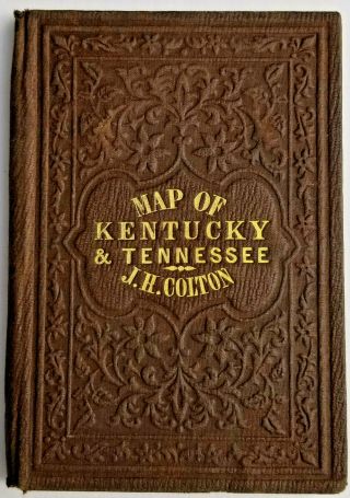
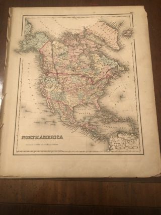
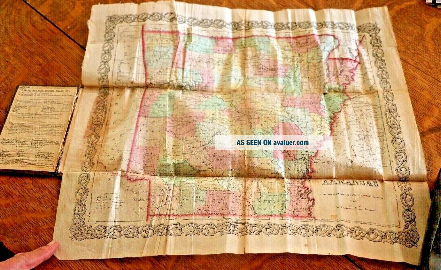
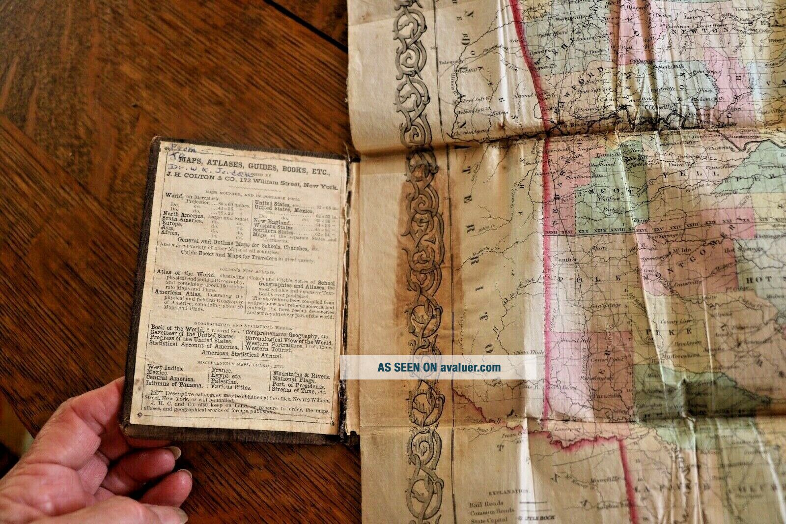
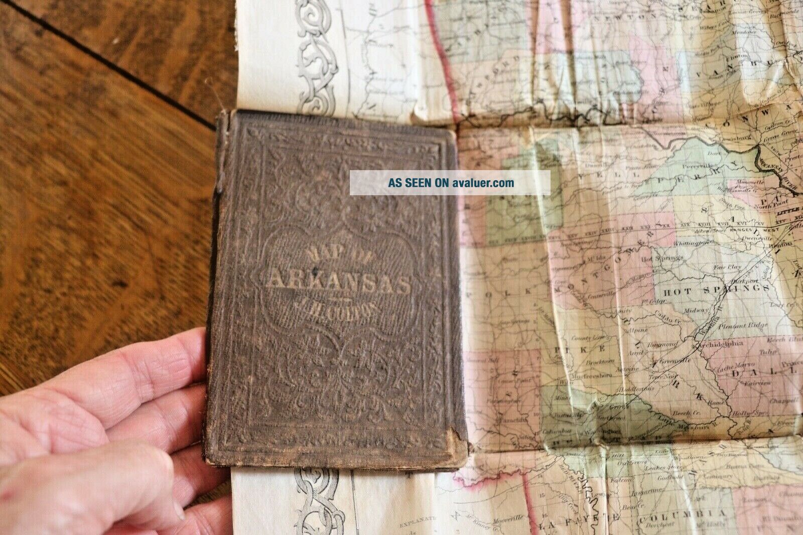
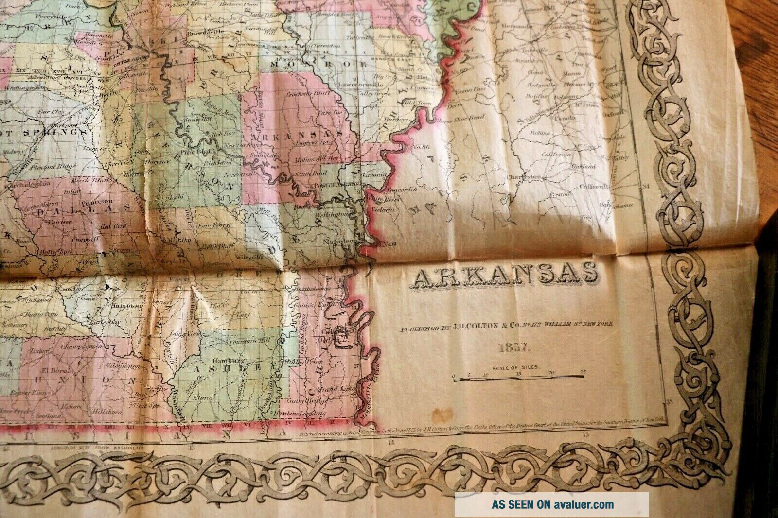
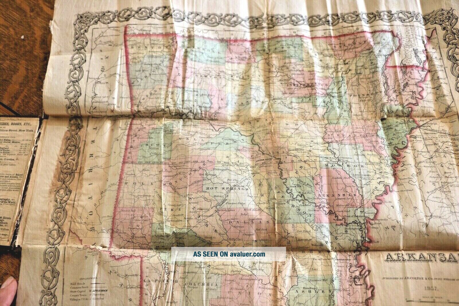
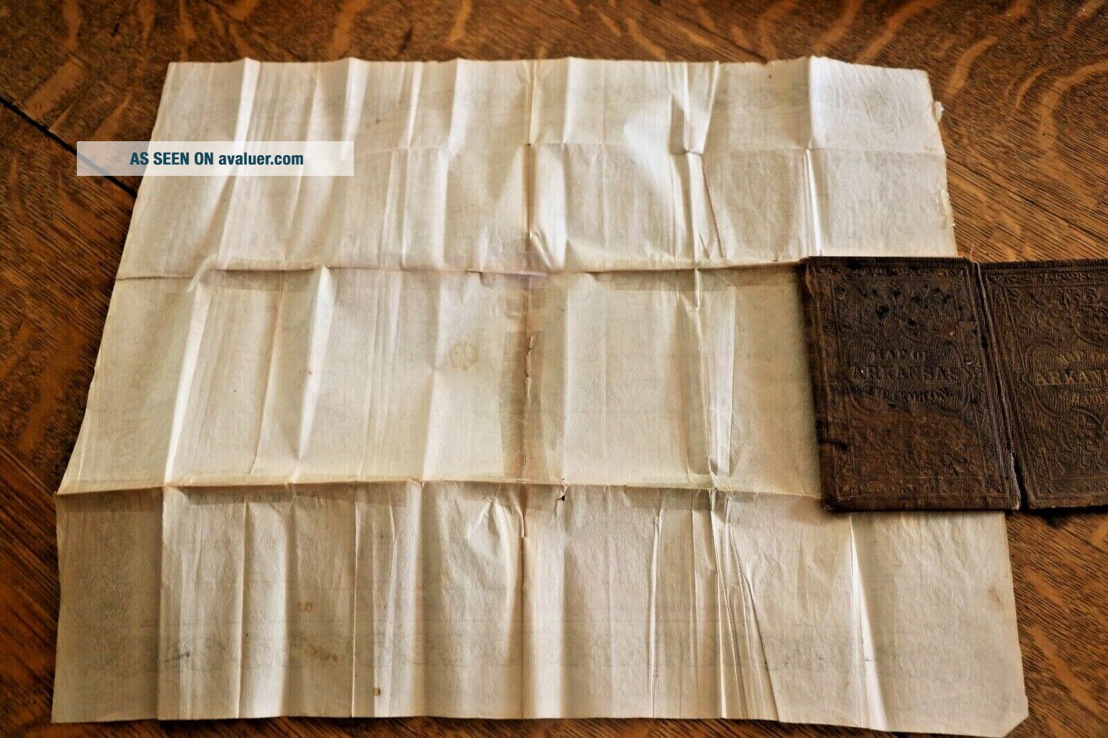
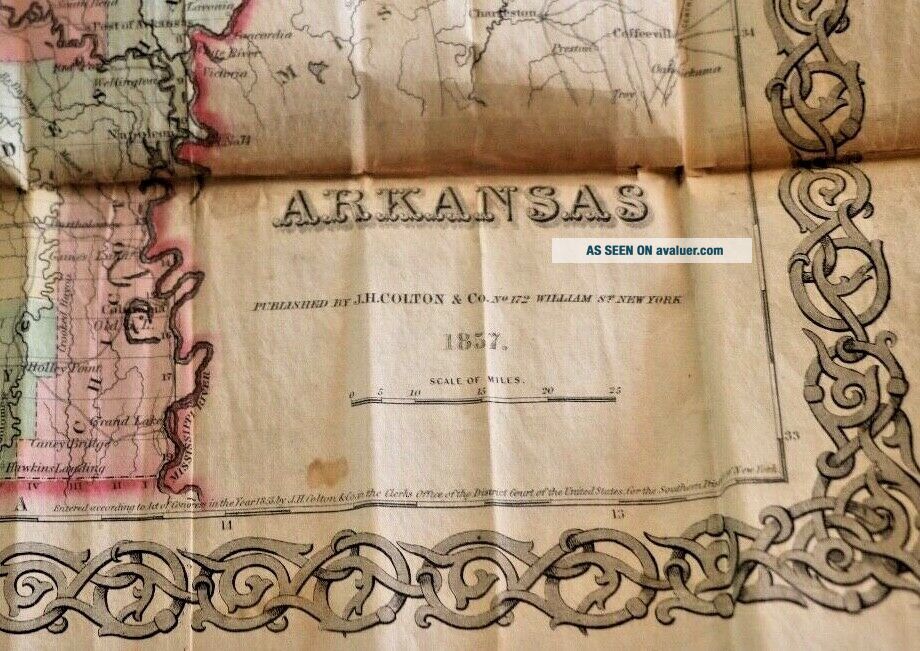
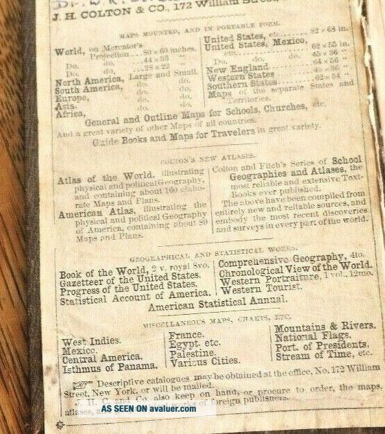
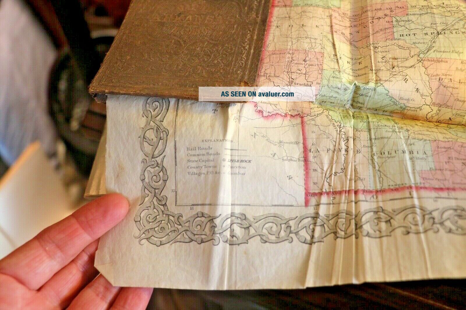
Up for your consideration is a wonderful, rare, handheld leather book containing a J. H. Colton parchment 1857 Pre-Civil War Map of Arkansas. You can find many maps of other states but you don't see many in this good condition of Arkansas. This map was obtained at an old estate in the 1980's in Pine Bluff, Arkansas. It was owned by a gentleman who lived in the old area of town in a home that was historically listed and even contained a cannonball from the Battle of Pine Bluff located i...n one of the walls.The home was also said to be very instrumental in the Undergound Railroad as a tunnel was located in the basement of the home and connected to the Arkansas River before the river changed its course.  Not sure if this map was ever used to show directions to the North, but it is a wonderful, neat piece of Arkansas history. The old, historical home burned in the late 1990's and is no longer there. The parchment color map folds and fits inside a leather bound 5" by 3 1/2" booklet and is stamped on the front in gold "Map of Arkansas J.H. Colton". The actual map unfolded is 16x14 inches.The inside cover says to: the man who owned the book from the person who gave it. (names not listed). Please use your zoom to look closely at all pictures for details and small print. The bottom left hand corner gives Explanations and the bottom right hand corners the publisher and date 1857! The map is very fragile and has some old tape on the back but is not torn apart; just slight fading and tape stains.The fold and binding in the center is intact but very fragile. Again, use your zoom to look at pictures!!! This original, vintage map has been locked inside a safe for many years and not displayed or handled. Not only is this map a rare one, but the history of the map adds to the lore of it. Authentic estate auction papers will be sent with the map. I will ship priority mail as soon as you pay with PayPal. If you have any questions, please email me BEFORE you bid and I will do my best to answer. Thank you for looking!!!!!


    Similar items


  • Extremely Rare J.  H.  Colton 1856 Folded Pocket Map Kentucky Tennessee Not Atlas

    Extremely Rare J. H. Colton 1856 Folded Pocket Map Kentucky Tennessee Not Atlas

  • Ex Rare J.  H.  Owen Cobalt Blue Glaze Nc Earthenware Vase Pre Jugtown Transitional

    Ex Rare J. H. Owen Cobalt Blue Glaze Nc Earthenware Vase Pre Jugtown Transitional

  • 1855 Hand Colored Map Of North America From J.  H.  Colton

    1855 Hand Colored Map Of North America From J. H. Colton ' S 1857 General Atlas

  • 1857 Township Map Of The State Of York J.  H.  Colton

    1857 Township Map Of The State Of York J. H. Colton

  • Rare J.  H.  Scotford Stereoview Lansing Mi Mich Michigan Bridge

    Rare J. H. Scotford Stereoview Lansing Mi Mich Michigan Bridge

  • North America 1857 J.  H.  Colton Large Unusual Antique Map

    North America 1857 J. H. Colton Large Unusual Antique Map

  • Map Of Iowa 1857 By J.  H.  Colton

    Map Of Iowa 1857 By J. H. Colton

  • Antiquevintage Rare J.  H.  Nicholas Pharmacist Cincinnati Oh Dose Cup/shot Glass

    Antiquevintage Rare J. H. Nicholas Pharmacist Cincinnati Oh Dose Cup/shot Glass


    • You might also like


    • 1860 Mitchell Hand Colored Map Colorado,  Nebraska & Kansas - Civil War Era

      1860 Mitchell Hand Colored Map Colorado, Nebraska & Kansas - Civil War Era

    • 18th Century French Map Of North America

      18th Century French Map Of North America

    • Las Vegas Nevada Vintage 1967 Us Geological Survey Quadrangle Map 4 Panels

      Las Vegas Nevada Vintage 1967 Us Geological Survey Quadrangle Map 4 Panels

    • Rare Antique 1845 Maps United States Exploring Expedition Book Antartica Hawaii

      Rare Antique 1845 Maps United States Exploring Expedition Book Antartica Hawaii

    • Vintage 1926 Map Hollywood From The Best Surveys Of The Time

      Vintage 1926 Map Hollywood From The Best Surveys Of The Time

    • American Continent (western Hemisphere) 1747 Bowen Antique Copper Engraved Map

      American Continent (western Hemisphere) 1747 Bowen Antique Copper Engraved Map

    • Gulf Coast Florida Texas United States 1705 De Fer Unusual Antique Engraved Map

      Gulf Coast Florida Texas United States 1705 De Fer Unusual Antique Engraved Map

    • California As Island United States 1700 De Fer Unusual First Edition Antique Map

      California As Island United States 1700 De Fer Unusual First Edition Antique Map

Avaluer          About Us          Privacy Policy          Contact Us          UP
© 2022, avaluer.net, Inc. or its affiliates