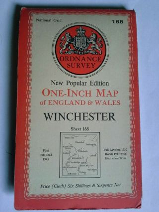
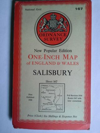
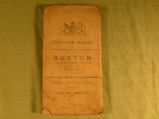
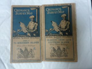
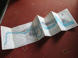
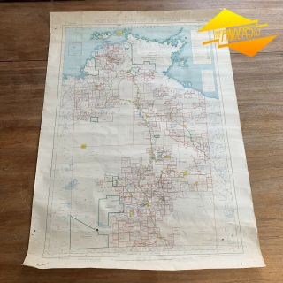
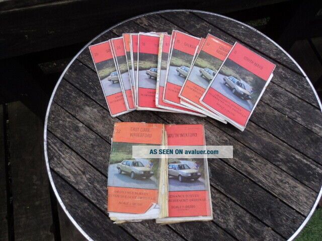
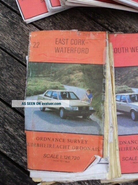
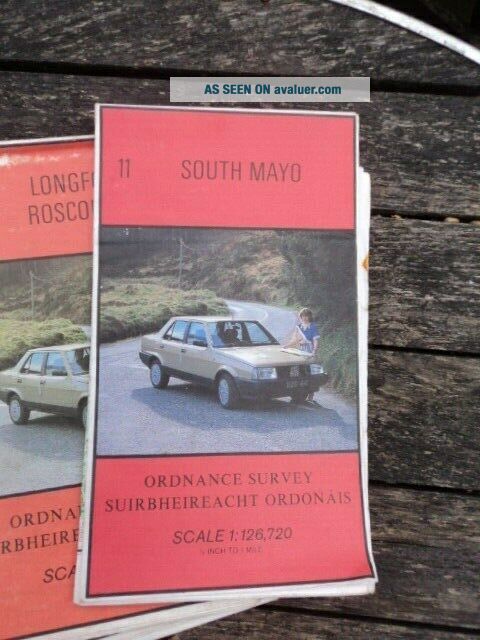
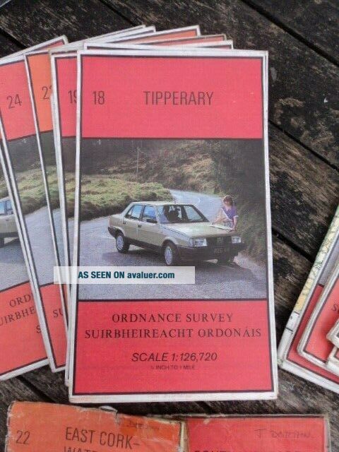
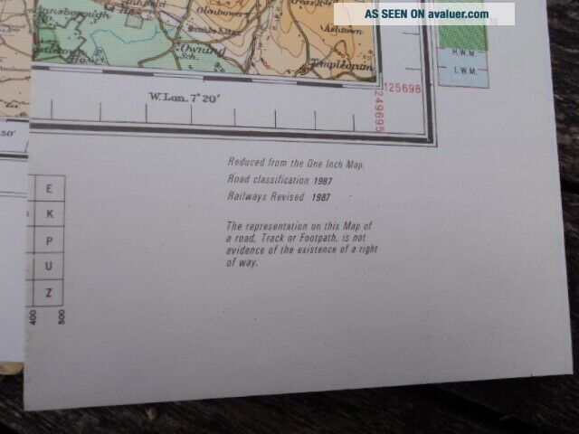
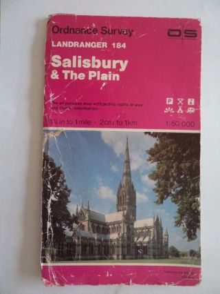
EIGHTEEN, ORDNANCE SURVEY, IRELAND, 1/2 INCH TO 1 MILE, VINTAGE MAPS, C. 1970 ' S.


Item History & Price

Information:
Reference Number: Avaluer:8005914
Original Description:
YOU WILL BE BIDDING ON A JOB LOT OF EIGHTEEN, ORDNANCE SURVEY OF IRELAND, 1/2 TO 1 MILE, VINTAGE MAPS, c. 1980's. SIXTEEN IN REASONABLE USED CONDITION WITH MINOR ROUTE MARKING AND A FEW TEARS AT SOME FOLDS, TWO IN POOR, SELLOTAPE REPAIRED CONDITION. FORMER PROPERTY OF JANE DOCHIN, WHO TRAVELLED  & WALKED ALL OVER THE BRITISH ISLES WITH ONLY A PACKHORSE WITH ALL HER GEAR & SUPPLIES ON. SHE HAS WRITTEN SEVERAL BOOKS OF HER ADVENTURES, IF YOU ARE INTERESTED TO DO SOME RESEARC...H.PART OF THE ESTATE DISPERSAL OF THE LORD OF GLENCOE & LOCHABER THAT I AM CURRENTLY DISPOSING OF.PLEASE VIEW THE OTHER ECLECTIC AND TRIBAL ITEMS THAT I WILL BE LISTING SHORTLY.COMBINATION OF PURCHASES WELCOME, IN ORDER TO GET BEST POSTAGE.


    Similar items


  • 2 Ordnance Survey 10 " :1 Mile Uk Route Planning Maps - England,  Scotland,  Wales 1967

    2 Ordnance Survey 10 " :1 Mile Uk Route Planning Maps - England, Scotland, Wales 1967

  • Ordnance Survey Map 1;50,  000 Salisbury 1983 Inc Stonehenge Bulford Boscombe Down

    Ordnance Survey Map 1;50, 000 Salisbury 1983 Inc Stonehenge Bulford Boscombe Down

  • Ordnance Survey Map 1 " To 1 Mile 1960 Barnstaple Map 163

    Ordnance Survey Map 1 " To 1 Mile 1960 Barnstaple Map 163

  • Ordnance Survey Map Cloth 2.  5map 51[tq]35 Caterham 1947 Oxted Coulsdon Godstone

    Ordnance Survey Map Cloth 2. 5map 51[tq]35 Caterham 1947 Oxted Coulsdon Godstone

  • 1947 Winchester Ordnance Survey Map 1 " Scale Vgc 70cm X 81cm Frameable

    1947 Winchester Ordnance Survey Map 1 " Scale Vgc 70cm X 81cm Frameable

  • 1947 Salisbury Ordnance Survey Map 1 " Scale Vgc 70cm X 81cm Frameable

    1947 Salisbury Ordnance Survey Map 1 " Scale Vgc 70cm X 81cm Frameable

  • Antique Ordnance Survey Map 1 Inch To Mile Buxton Sheet 45

    Antique Ordnance Survey Map 1 Inch To Mile Buxton Sheet 45

  • Cloth Ordnance Survey Maps X 2.  Scotland Southern Islands.

    Cloth Ordnance Survey Maps X 2. Scotland Southern Islands.


    • You might also like


    • Twelve (12 " X 18 ") Linen Backed Vintage Maps - Yorkshire Lancashire Westmorland

      Twelve (12 " X 18 ") Linen Backed Vintage Maps - Yorkshire Lancashire Westmorland

    • Rare Vtg/antq 1930 Hardcover Book: Atlas Of Buffalo And Pepin Counties Wisconsin

      Rare Vtg/antq 1930 Hardcover Book: Atlas Of Buffalo And Pepin Counties Wisconsin

    • Vintage Philips Authentic Imperial Maps Canada Ontario Quebec 1942 And Rare

      Vintage Philips Authentic Imperial Maps Canada Ontario Quebec 1942 And Rare

    • Rare Vtg/antq 1873 Hardcover Book: Clinton County Michigan Atlas Plus Rr Maps

      Rare Vtg/antq 1873 Hardcover Book: Clinton County Michigan Atlas Plus Rr Maps

    • Port Of London Authority (pla) - Vintage Map Of Docks I.  E.  Before Redevelopment

      Port Of London Authority (pla) - Vintage Map Of Docks I. E. Before Redevelopment

    • 1953 Vintage Pastoral Map Of Northern Territory A.  R.  Miller Surveryor General

      1953 Vintage Pastoral Map Of Northern Territory A. R. Miller Surveryor General

Avaluer          About Us          Privacy Policy          Contact Us          UP
© 2022, avaluer.net, Inc. or its affiliates