Antique 1871 Eldridge ' S ' MONTAUK To ST AUGUSTINE W York Bay ' NAUTICAL Map

Item History & Price
| Reference Number: Avaluer:6860520 | Type: Nautical Map |
| Year: 1871 |
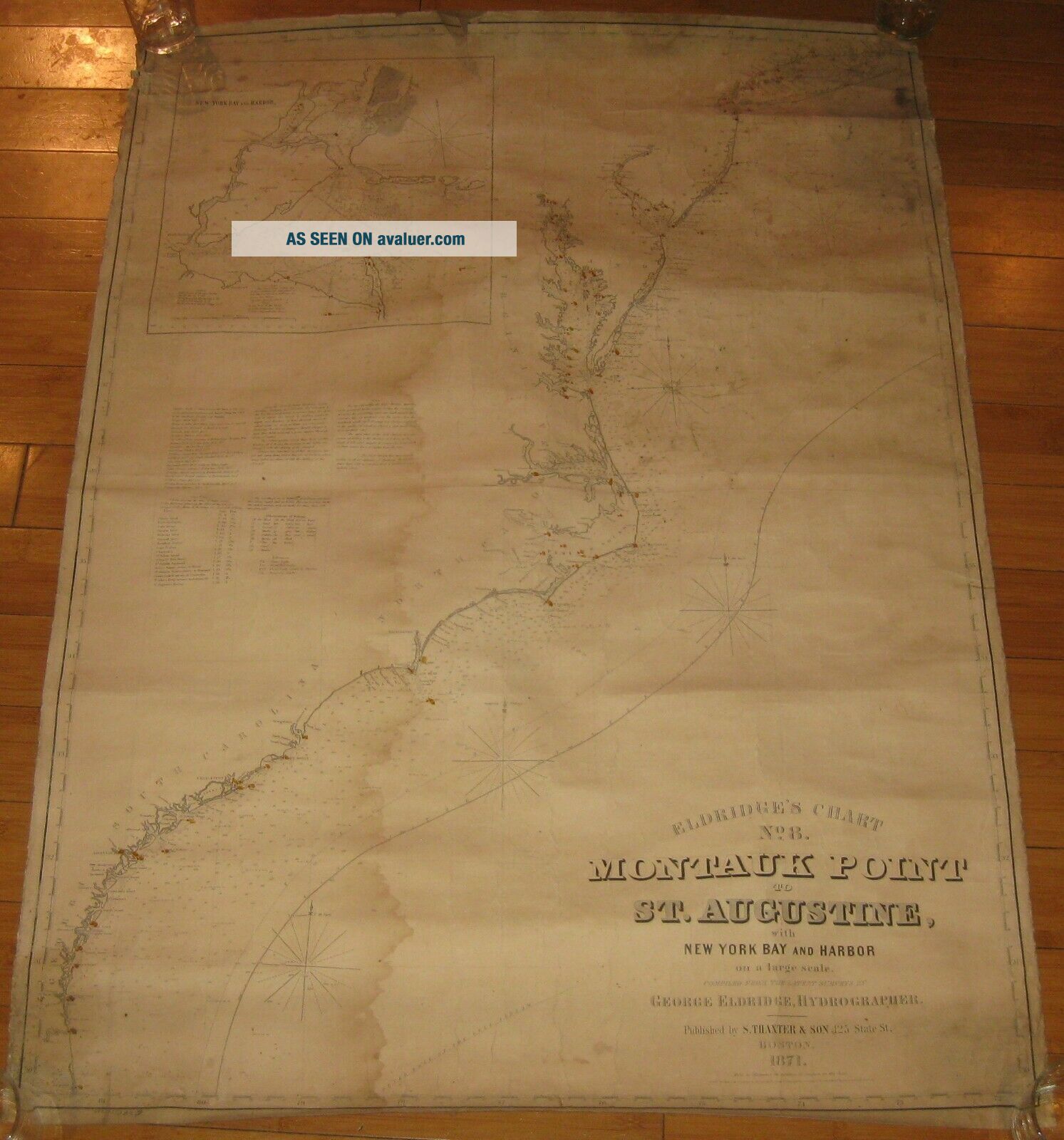
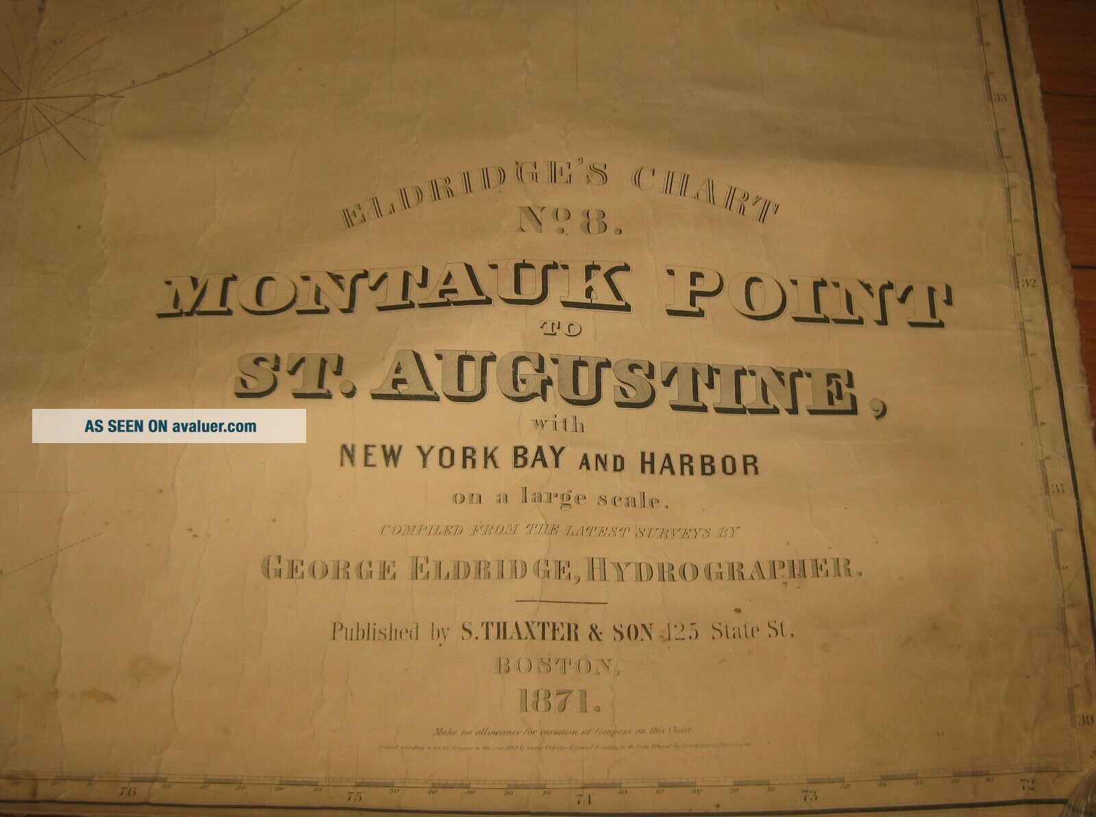
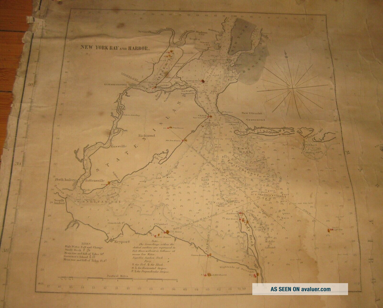
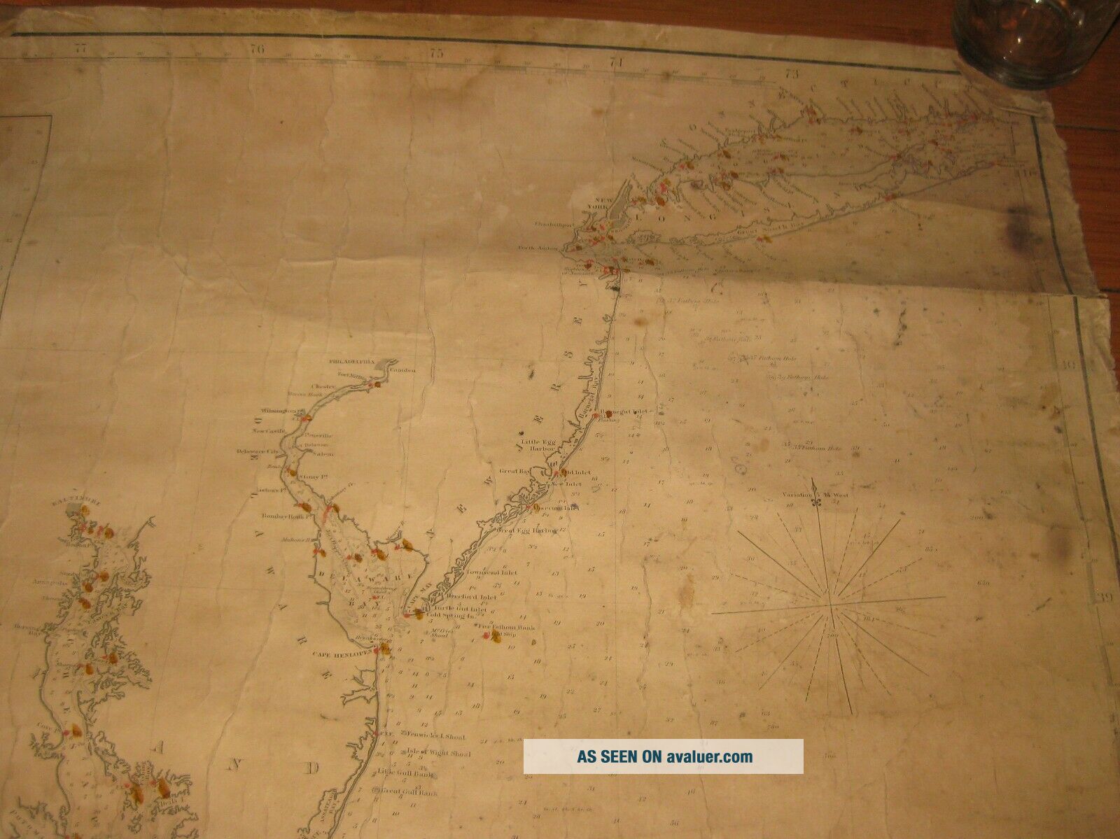
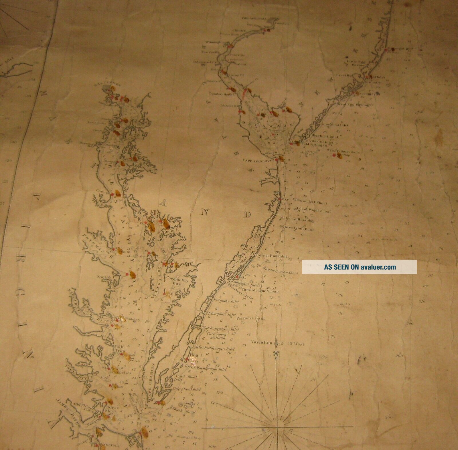
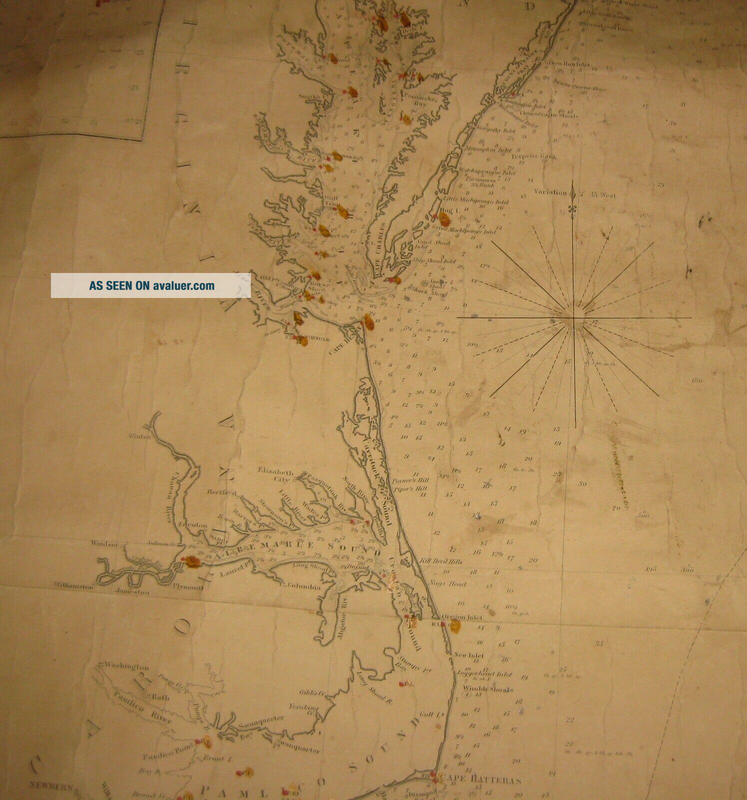
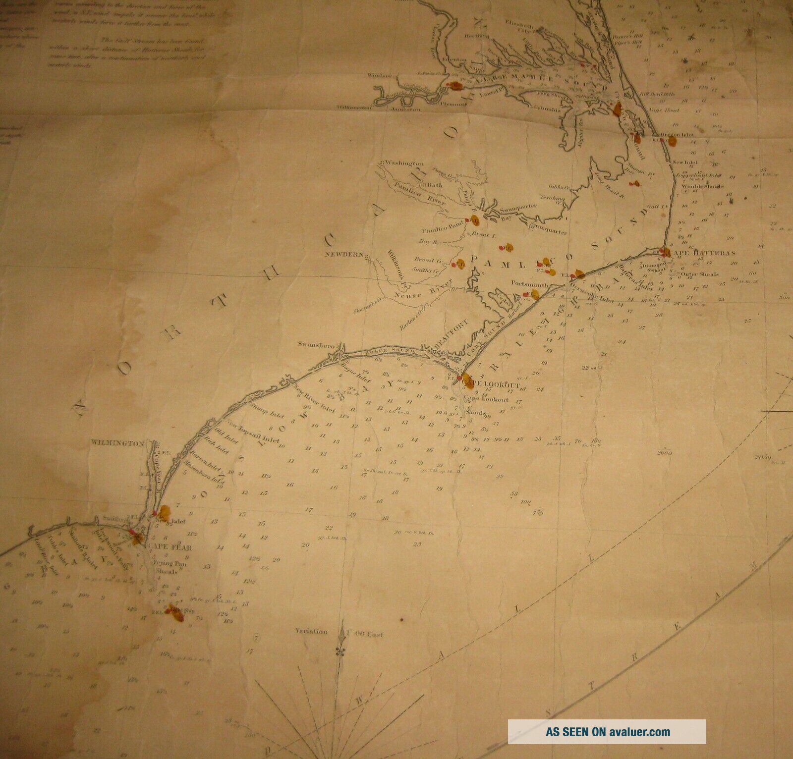
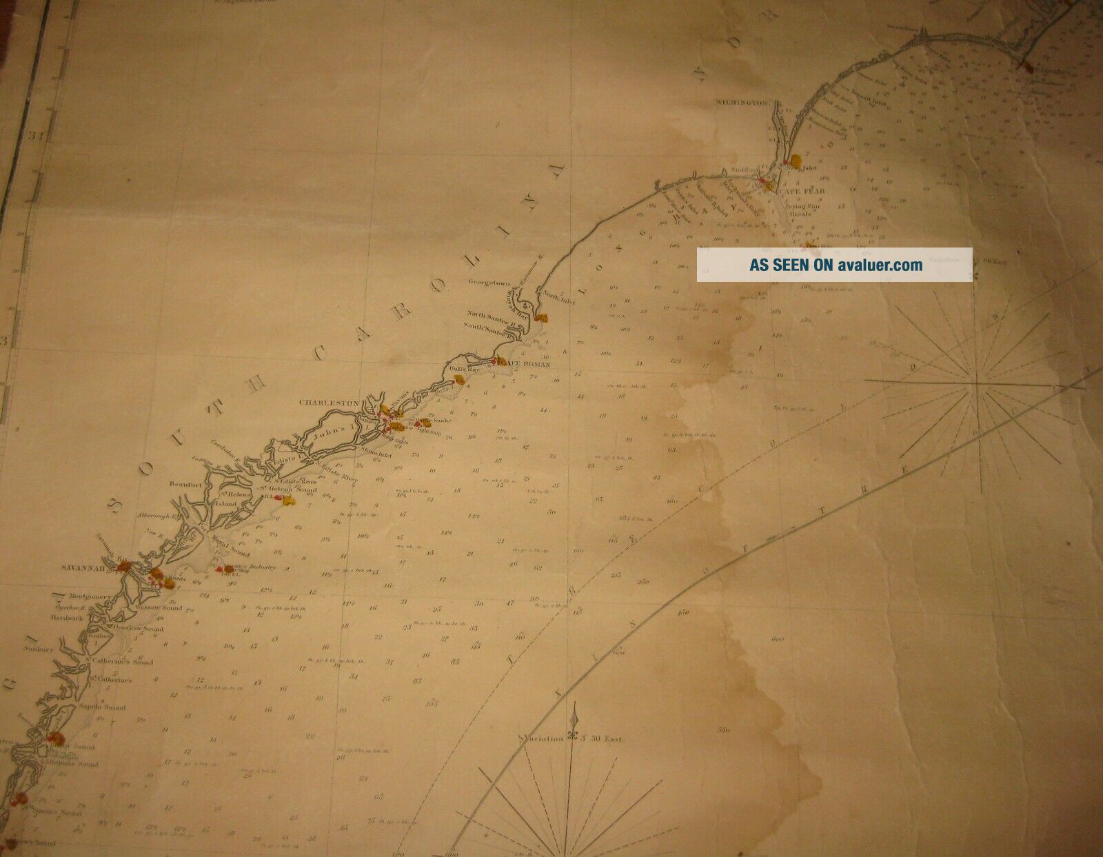
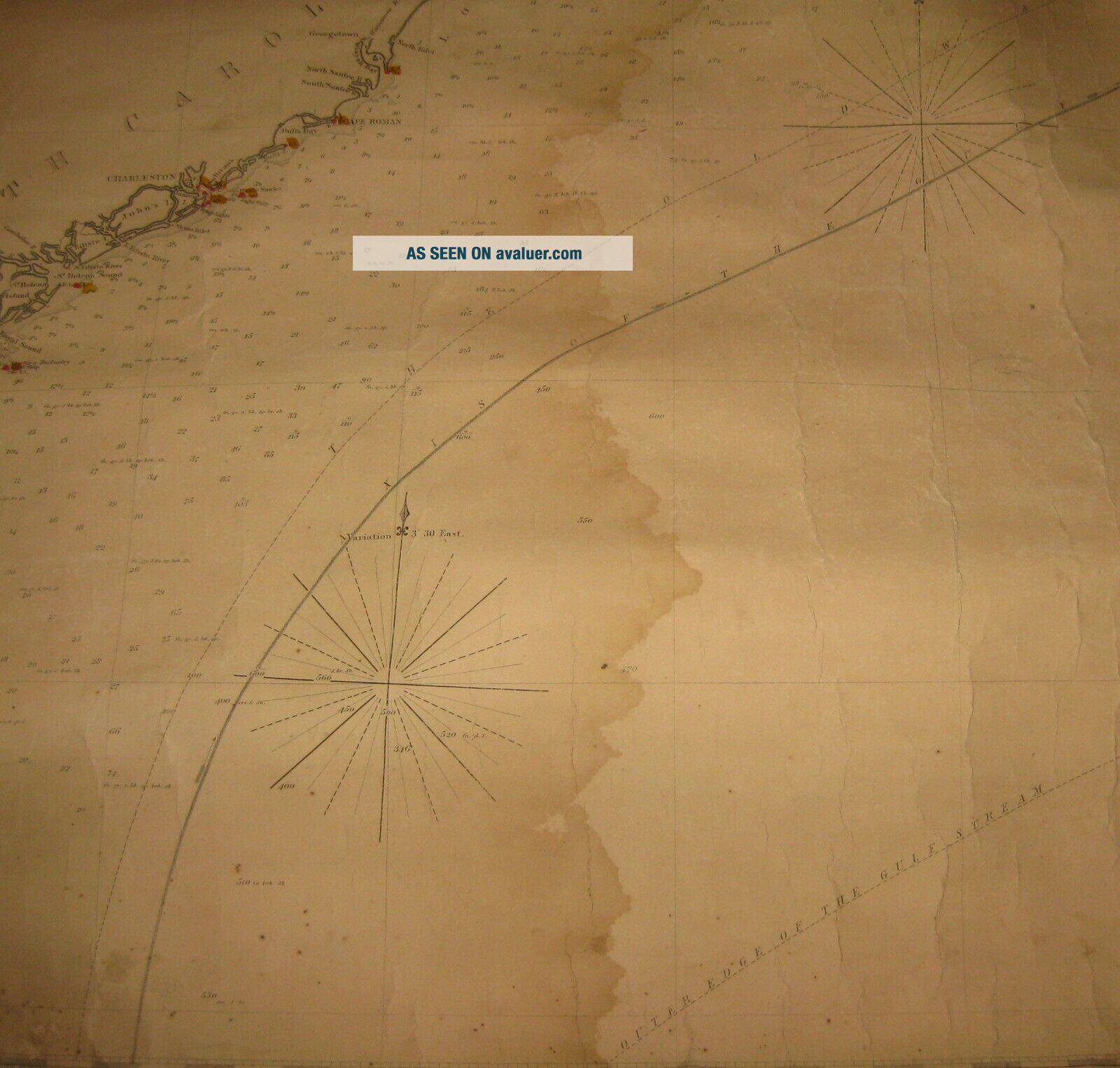
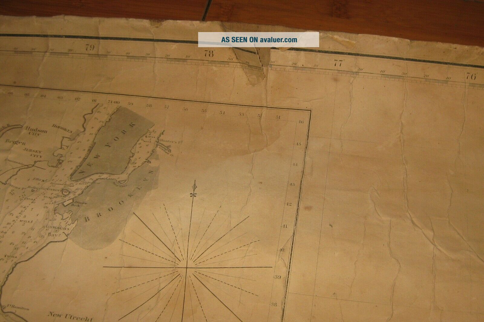
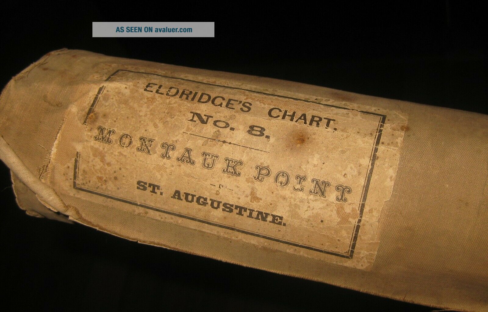
ORIGINAL 'ELDRIDGE'S CHART No8 MONTAUK POINT TO ST AUGUSTINE WITH NEW YORK BAY AND HARBOR ON A LARGE SCALE - PUBLISHED BY S THAXTER & SON BOSTON 1871' NAUTICAL MAP
This is just a great original piece. Eldridge's charts have become more and more rare lately. Back about a decade ago, I was able to buy a few every year. Lately, I rarely see them and when I do, they are priced way to high. Fortunately, I was able to buy a pair of early nautical maps from a lo...cal estate sale for inexpensive and so I am offering them out for a great deal. Actually, there is another later example of this map for sale published after this edition, priced at more than double I am asking. This is a wonderful original first edition of this large nautical map dating to 1871. Map measures 49 1/2 x 36 inches and is in good condition. On its original linen it has the 2 original labels on the backside. The map shows a slight water stain along the left side of the map but nothing too bad. There are the usual edge chips and small tears that are typical of these used charts from the 19th Century. Some wrinkles within as well but nothing really that bad. One of my favorite parts of this map is that it has hand colored dots within the map that are notations within the harbors. Really a good example of this scarce map. CHECK THE PICTURES ON THIS GREAT PIECE. DONT MISS THIS OPPORTUNITY.
Shipping and handling can be calculated based on the ebay shipping calculator. If you have any questions regarding the work, please dont hesitate to ask. Pictures are an excellent indication of condition. Though the shipping says it will take 5 days of handling, usually items are shipped much faster and if you pay right away, the item most likely will go out in the next day or two. If there is any problems with the item please dont hesitate to email me. I guarantee and stand 100% behind everything I sell. No reason to open up any sort of cases. Just simply contact me and I will handle any and all problems. Out of the nearly 500 items I ship around the world every year, a very few of them occasionally get lost or broken. I insure every item and will handle all insurance claims and make sure you are reimbursed 100%. Check my feedback. After nearly 15 years of selling on ebay, my reputation speaks for itself. If you are not happy with your purchase, I will work to make sure you are. Thanks again for your interest and bidding.
00036