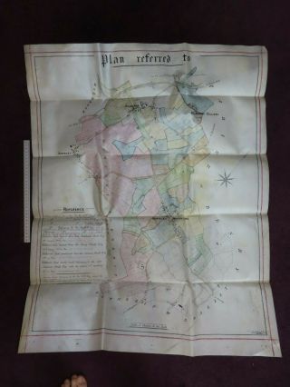
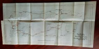
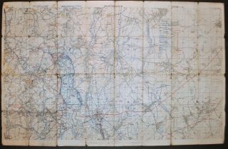
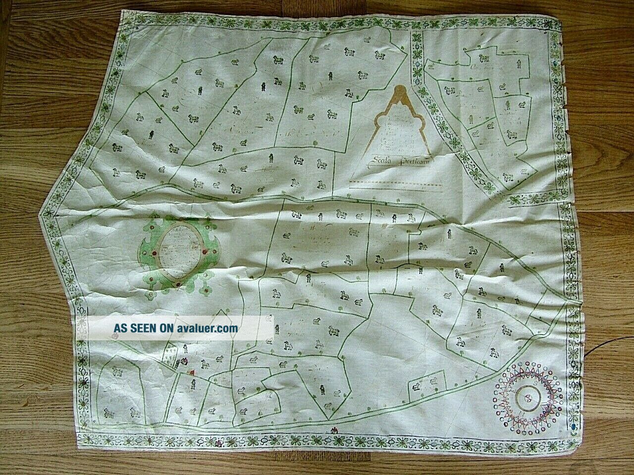
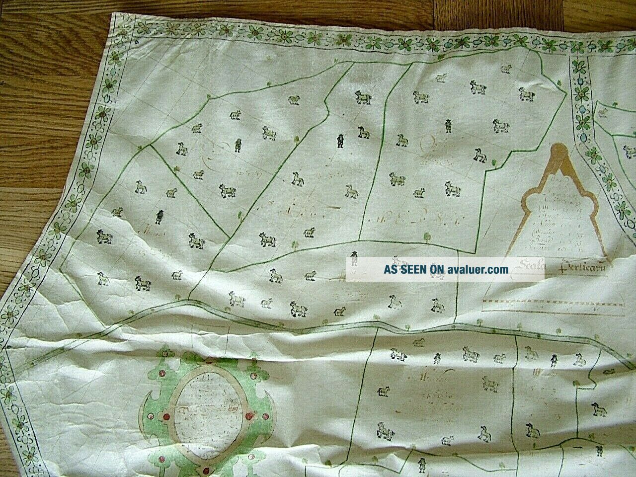
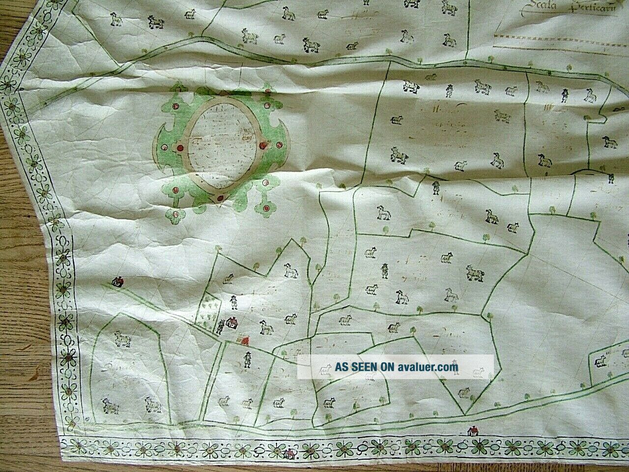
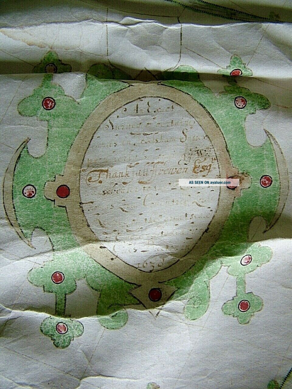
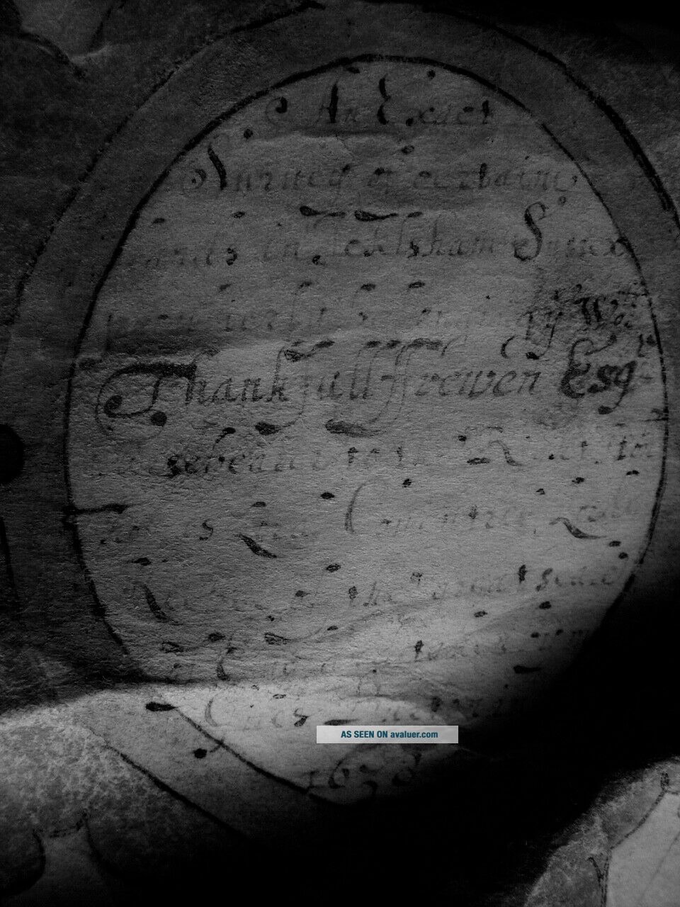
DATED 1638 VELLUM MAP OF ICKLESHAM SUSSEX SHOWING LAND USES OWNERS ETC
Item History & Price
| Reference Number: Avaluer:6680 | County: Sussex |
| Type: VELLUM MAP | Printing Technique: Woodcut |
| Year: 1638 | Original/Reproduction: Antique Original |
| Era: 1600s |
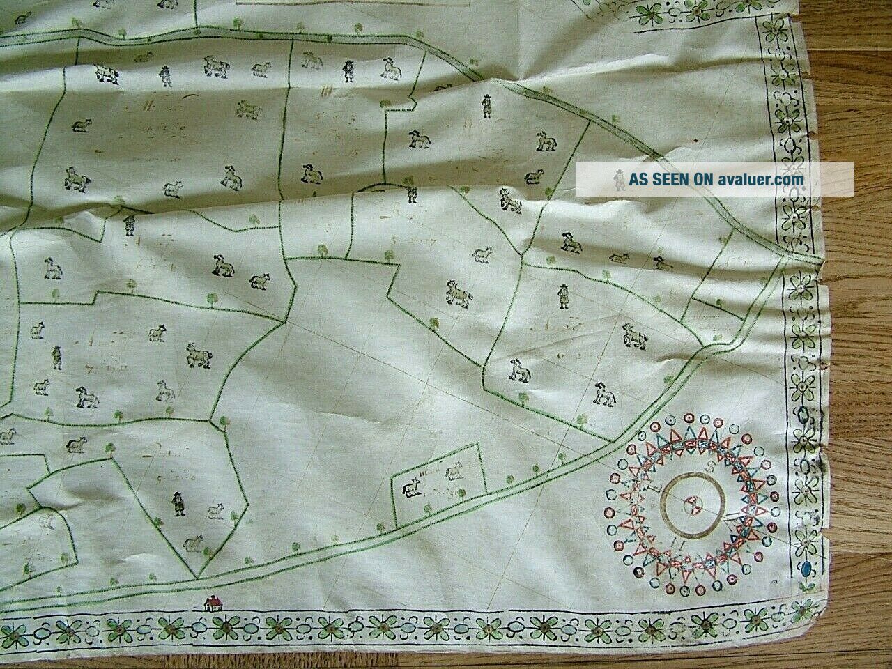
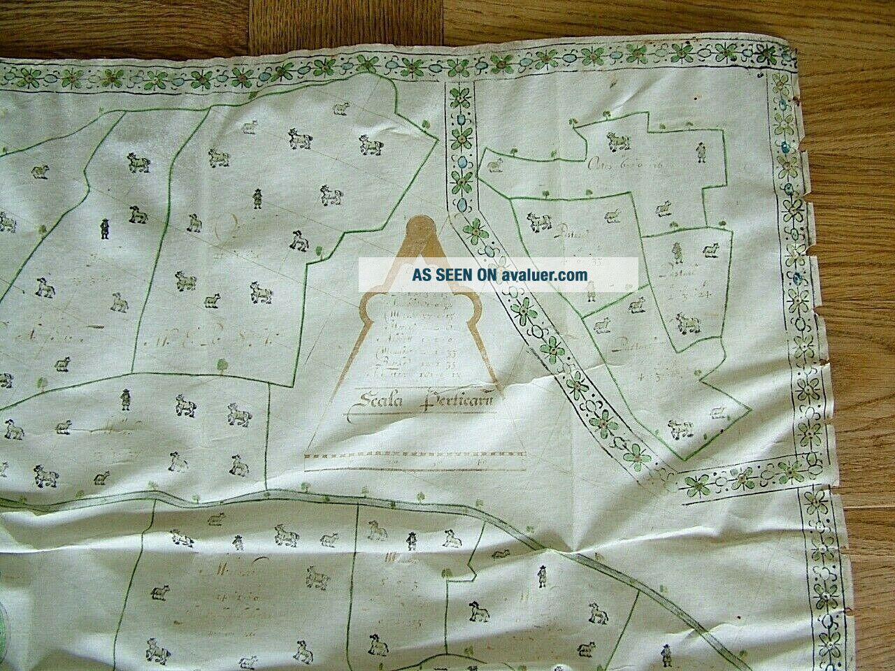
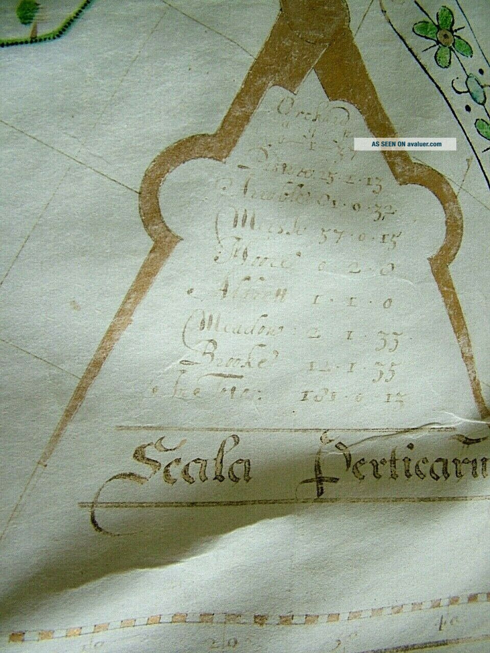
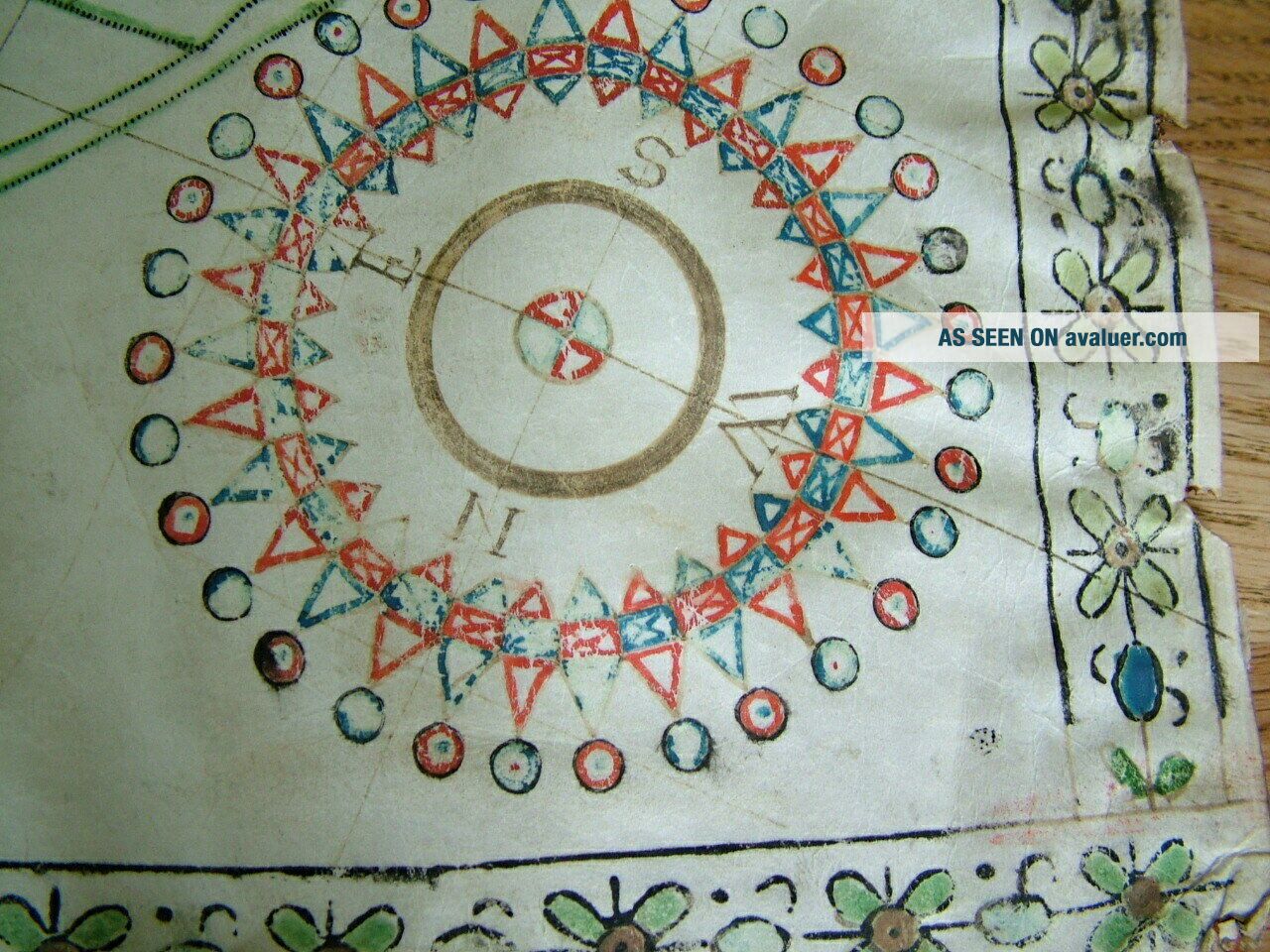
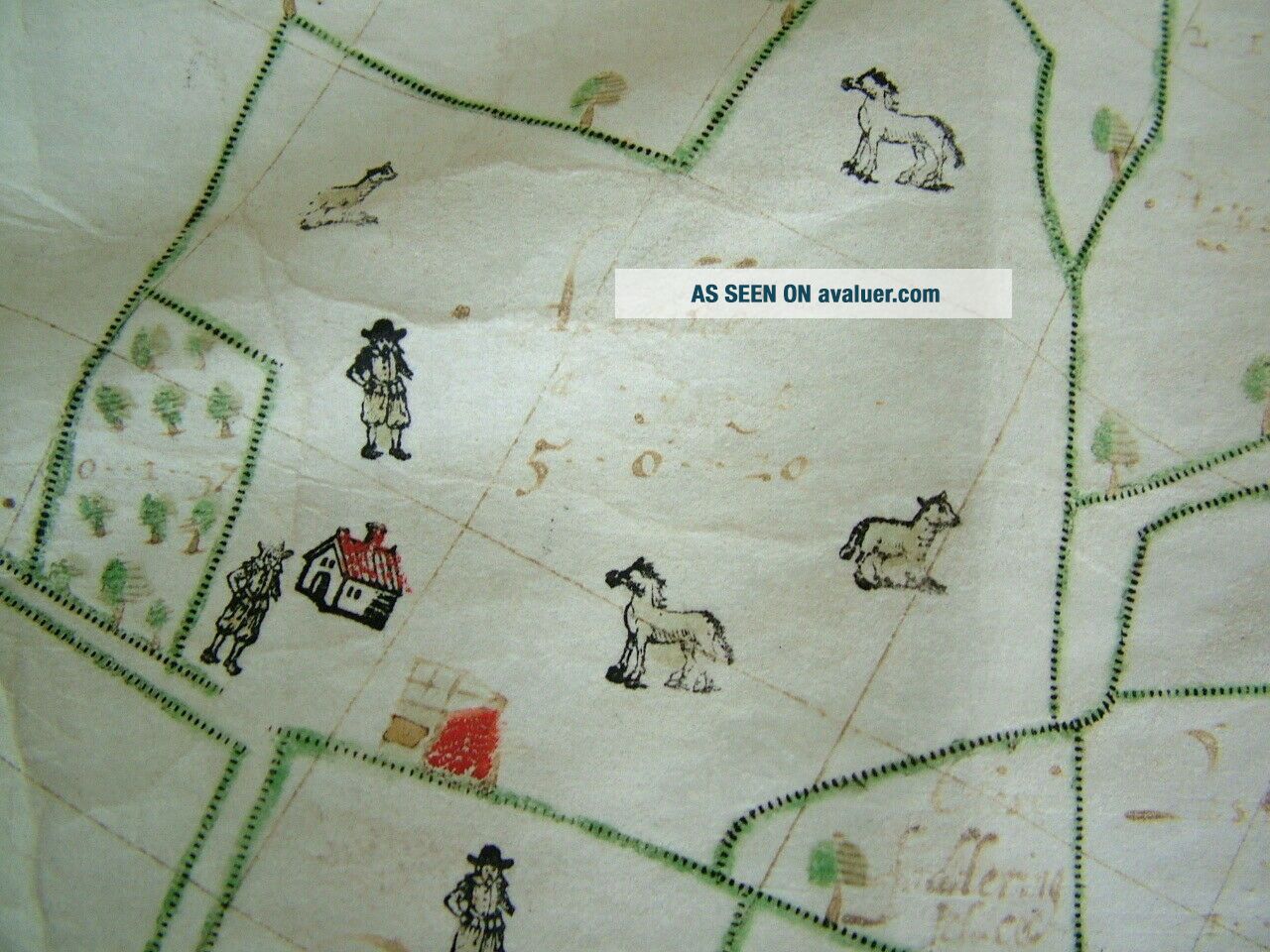
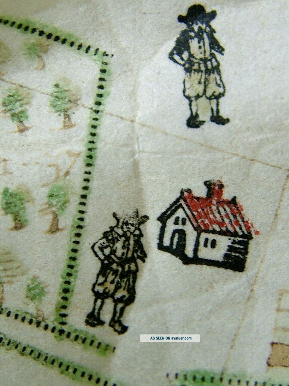
This rare vellum survey map measures 600mm (23.5") x 730mm (28.75") and is hand made and it looks like block printed for the figures and animals. I have managed to read a little of the title and I think it says " An Exact Survey of ? Land in Icklesham Sussex ??? Thankfull Ffreiven Esq ?????1638 " I am sure with a better eye and more skill it would be possible to determine the rest, I have tried basic filters with not much success (photo8) with the scale legend listing land uses like Or...chard Marsh Meadow etc with their areas. It is not an area I know anything about so please look at the photos and ask me any questions. It is in honest antique condition with creases and marks as per the photos and I am sure a little research would reveal a fascinating history. A fresh to the market very early map sold with no reserve.
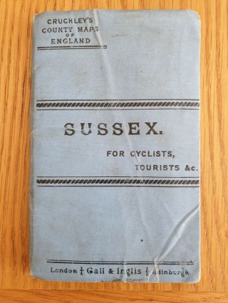
This is one of two maps I am selling this week so please look at my other listings..
I try and list at least 20 market fresh no reserve auction a week so please add me to your favourite sellers list.
International buyers are always welcome to this NO RESERVE auction. Due to the recent large increase in UK postage rates I am happy for domestic buyers to collect in person. Most international postage rates are listed as NOT signed for and NOT insured so if you require either please let me know and I will add it to your invoice. Sadly due to the sometimes unreliable postage systems in Italy, Russia, Australia & parts of China I will always add £5.15 to the postage charge for signed for to ensure it reaches the customer. If the item is listed as " Signed for " on the postage then obviously it is already included.If you have any questions please do contact me.All our items are extremely well packed to save them from damage in transit.If you are not happy with this article based on the information I have provided I will always happily refund minus the cost of any postage. All purchases must be paid for within 2 days of the end of the auction and will automatically open a case unless contact is made and agreed otherwise. Thanks very much for bidding on my items I really do appreciate the continued custom.