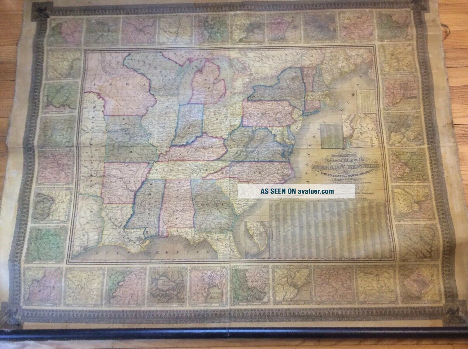
ANTIQUE 1844 MITCHELL’S NATIONAL MAP OF THE AMERICAN REPUBLIC UNITED STATES


Item History & Price

Information:
Reference Number: Avaluer:46111Year: 1844
Original/Reproduction: Antique OriginalFormat: Wall Map
Date Range: 1800-1899Cartographer/Publisher: Samuel Augustus Mitchell
Printing Technique: LithographyType: Rolled Instructional Map
Country/Region: United States of AmericaTopic: Maps
Original Description:
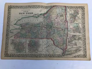
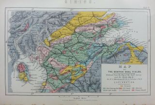
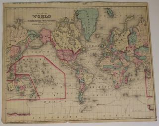
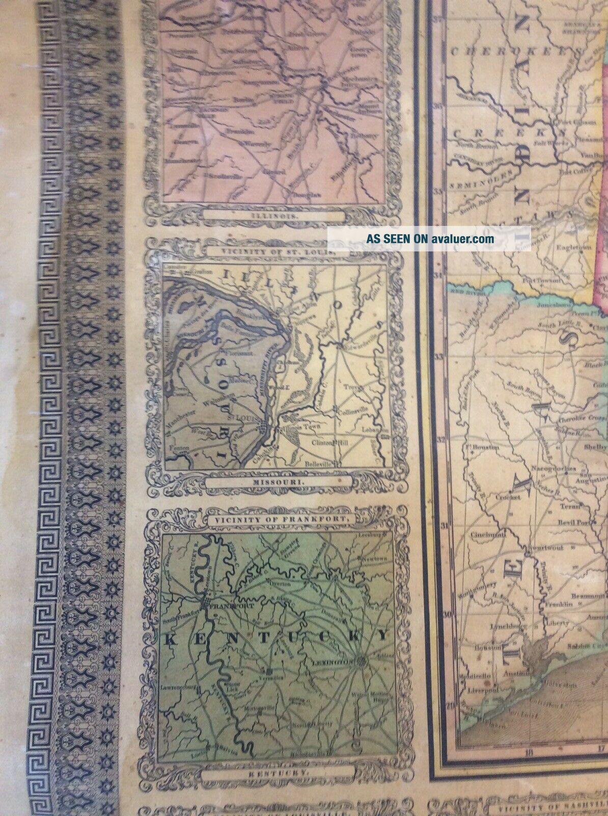
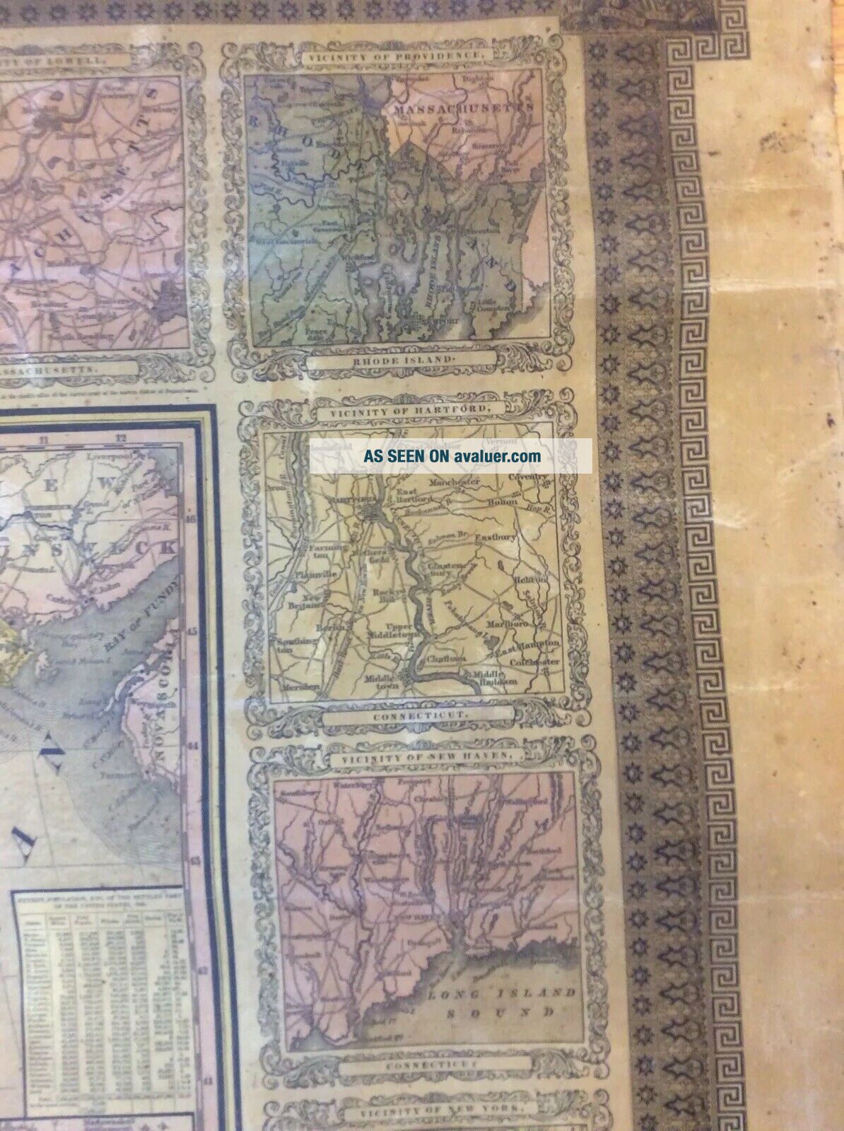
YOU ARE BIDDING ON THIS ANTIQUE 1844 MITCHELL’S NATIONAL MAP OF THE AMERICAN REPUBLIC THE UNITED STATES of NORTH AMERICA TOGETHER WITH MAPS OF 32 PRINCIPAL CITIES & TOWNS. EDITION NOT MARKED NOT SURE IF THAT MAKES THIS 1ST EDITION. NOTICE THE AREA MARKED INDIAN TERRITORY . I BELIEVE THIS MAY HAVE BEEN AN OLD SCHOOL MAP. MAP/FABRIC MEASURES APPROX 49” X 39”. AS YOU CAN SEE THERE ARE A FEW ISSUES (SEE PICS). PLEASE USE PICS AS PART OF DESCRIPTION. I HAVEN’T TRIED TO CLEAN. INTERN...ATIONAL WINNERS MUST USE THE GLOBAL SHIPPING PROGRAM. THANKS FOR LOOKING.


    Similar items


  • Antique Augustus Mitchell 1871 County Map Of The State Of York

    Antique Augustus Mitchell 1871 County Map Of The State Of York

  • Antique Print C1870

    Antique Print C1870 ' S Mining Map Of The Scotch Coal Fields Engraving Scotland

  • Old Rare Antique 1844 Nicol

    Old Rare Antique 1844 Nicol ' S Introductory Book Of The Sciences James Nicol Hb

  • Hand - Colored 1877 Mitchell

    Hand - Colored 1877 Mitchell ' S Mercator Map Of The World, United States

  • Antique Print C1870

    Antique Print C1870 ' S Mining Map Of The Coal Field Of Great Britain Geological

  • 1835 Tourist

    1835 Tourist ' S Pocket Map Of The State Of Indiana J Augustus Mitchell Framed

  • G W & C B Colton & Co. ,  Colton

    G W & C B Colton & Co. , Colton ' S Township Map Of The State Of York, 1868

  • Antique 1877 Edition Johnson’s 1866 Map Of The State Of Texas

    Antique 1877 Edition Johnson’s 1866 Map Of The State Of Texas


    • You might also like


    • 1860 Mitchell Hand Colored Map Colorado,  Nebraska & Kansas - Civil War Era

      1860 Mitchell Hand Colored Map Colorado, Nebraska & Kansas - Civil War Era

    • 18th Century French Map Of North America

      18th Century French Map Of North America

    • Las Vegas Nevada Vintage 1967 Us Geological Survey Quadrangle Map 4 Panels

      Las Vegas Nevada Vintage 1967 Us Geological Survey Quadrangle Map 4 Panels

    • Rare Antique 1845 Maps United States Exploring Expedition Book Antartica Hawaii

      Rare Antique 1845 Maps United States Exploring Expedition Book Antartica Hawaii

    • Vintage 1926 Map Hollywood From The Best Surveys Of The Time

      Vintage 1926 Map Hollywood From The Best Surveys Of The Time

    • American Continent (western Hemisphere) 1747 Bowen Antique Copper Engraved Map

      American Continent (western Hemisphere) 1747 Bowen Antique Copper Engraved Map

    • Gulf Coast Florida Texas United States 1705 De Fer Unusual Antique Engraved Map

      Gulf Coast Florida Texas United States 1705 De Fer Unusual Antique Engraved Map

    • California As Island United States 1700 De Fer Unusual First Edition Antique Map

      California As Island United States 1700 De Fer Unusual First Edition Antique Map

Avaluer          About Us          Privacy Policy          Contact Us          UP
© 2022, avaluer.net, Inc. or its affiliates