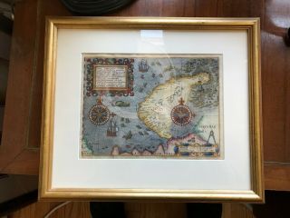
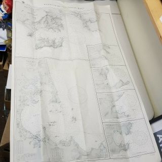
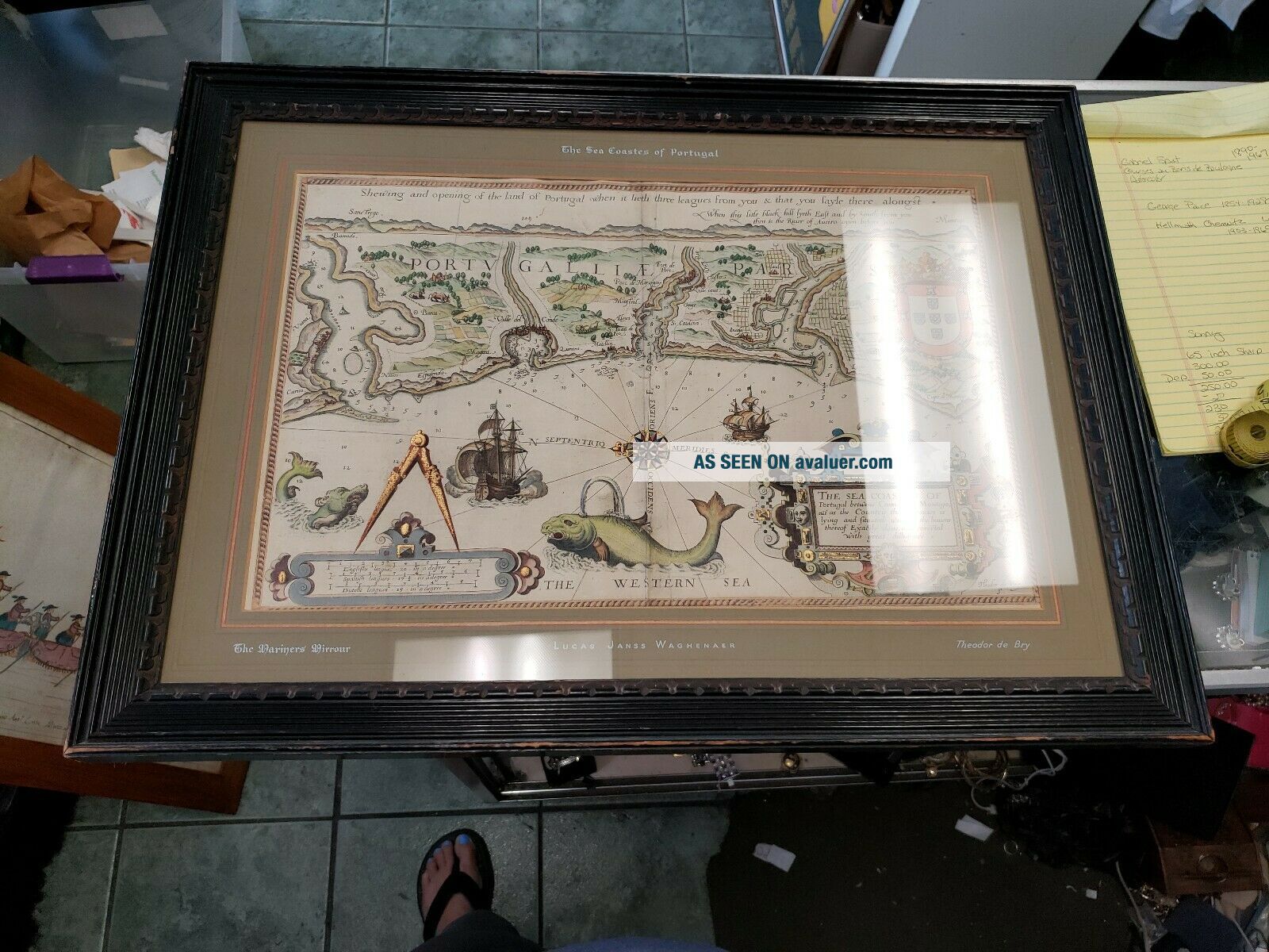
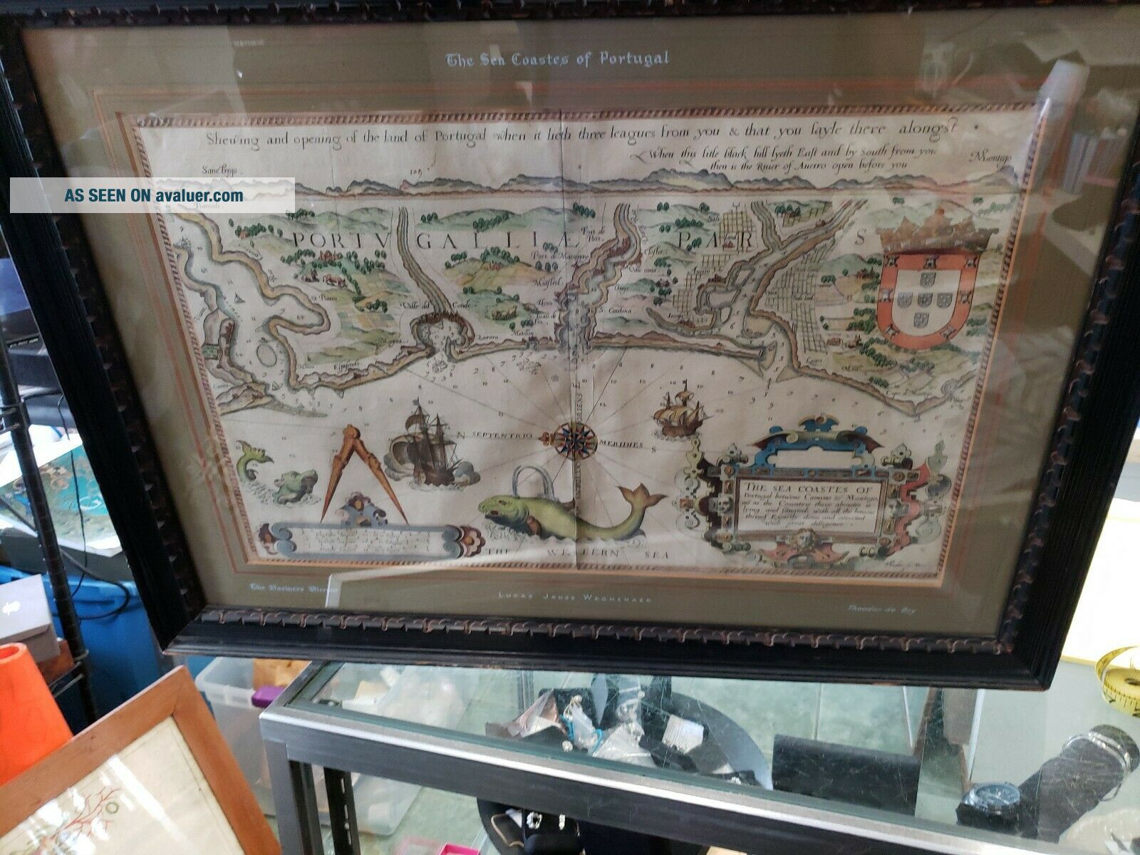
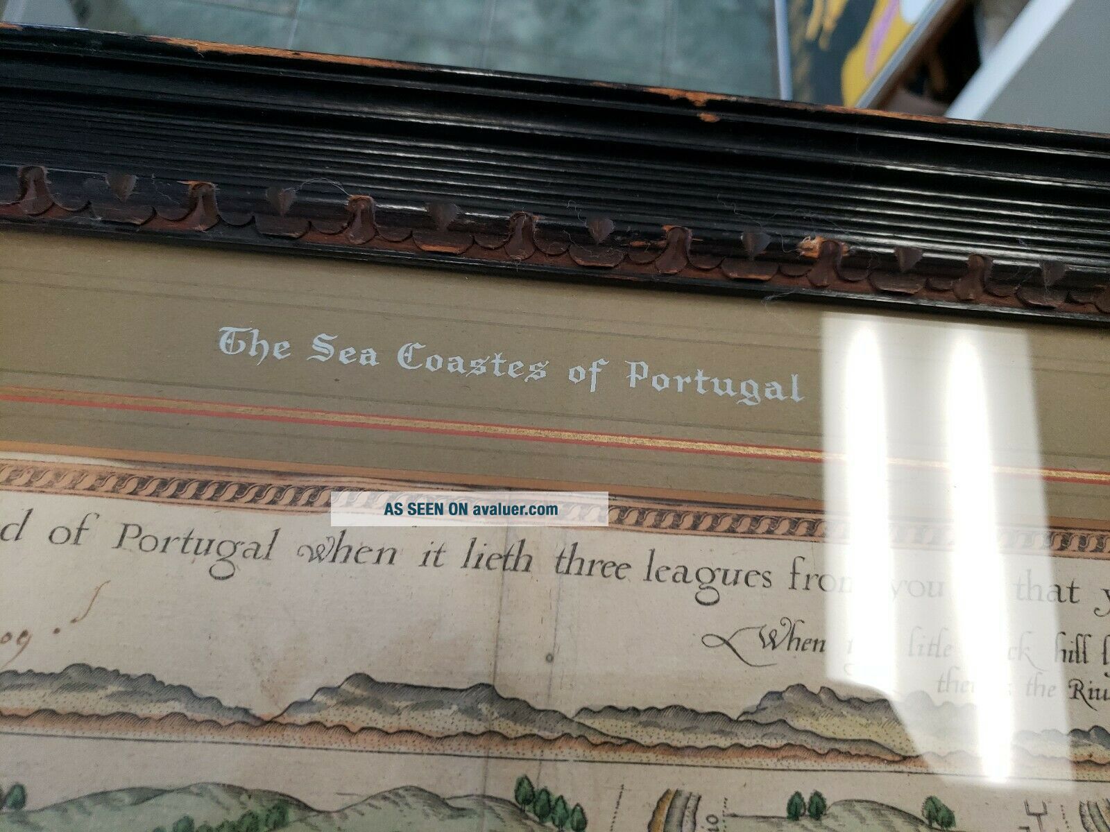
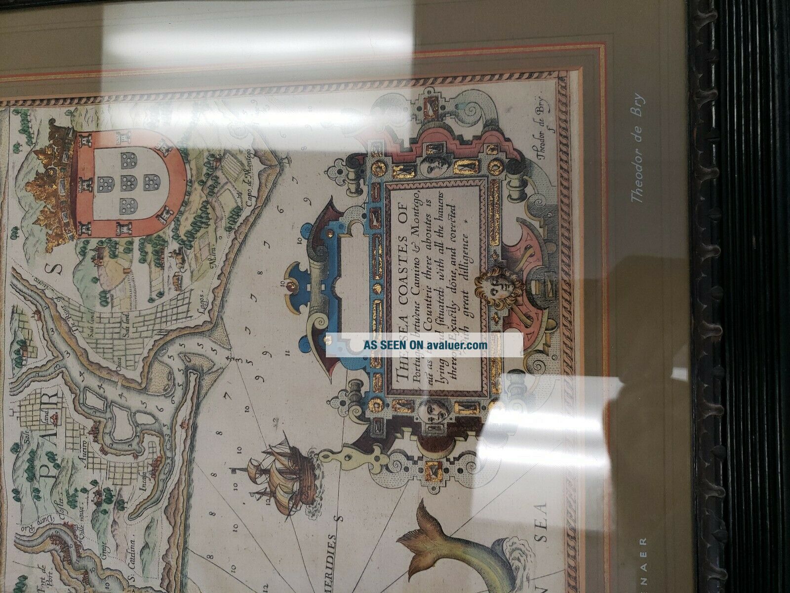
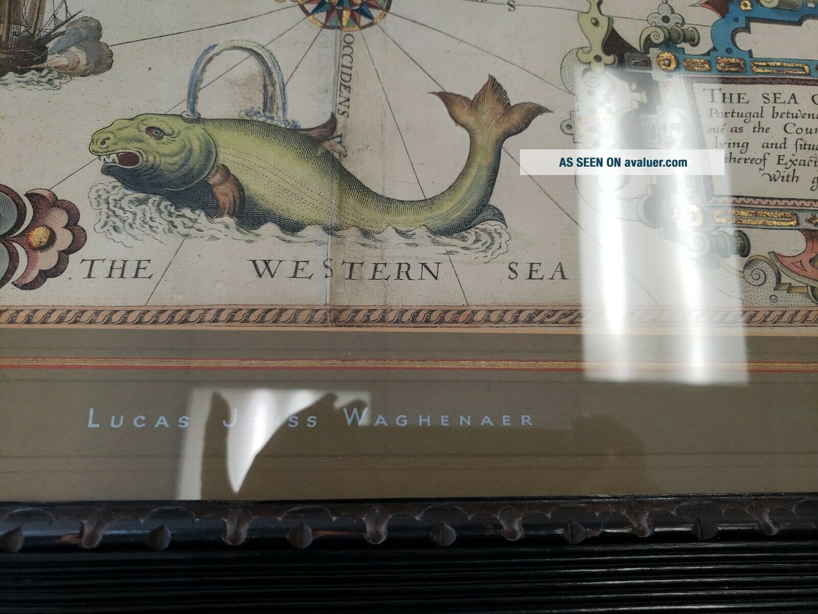
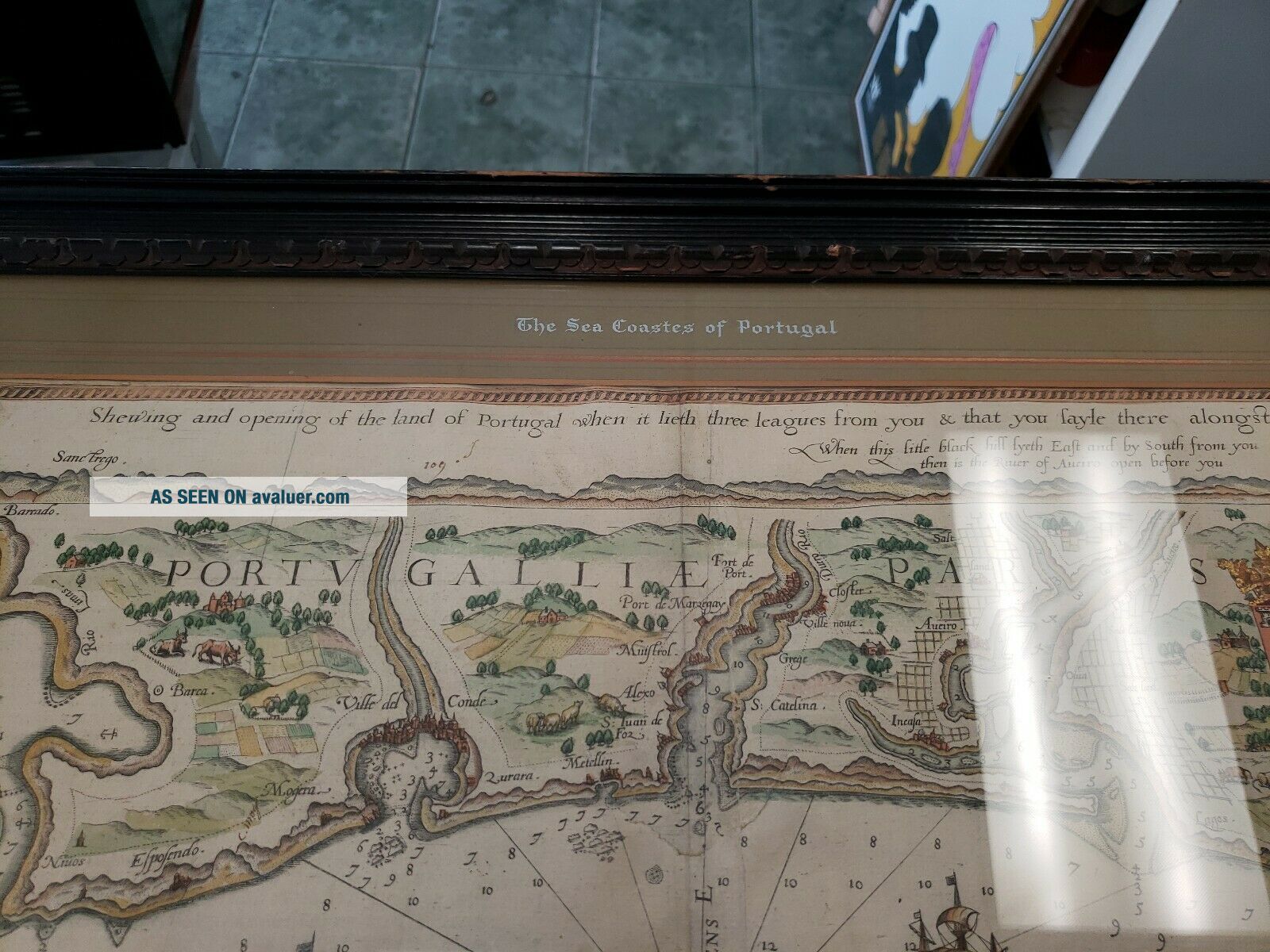
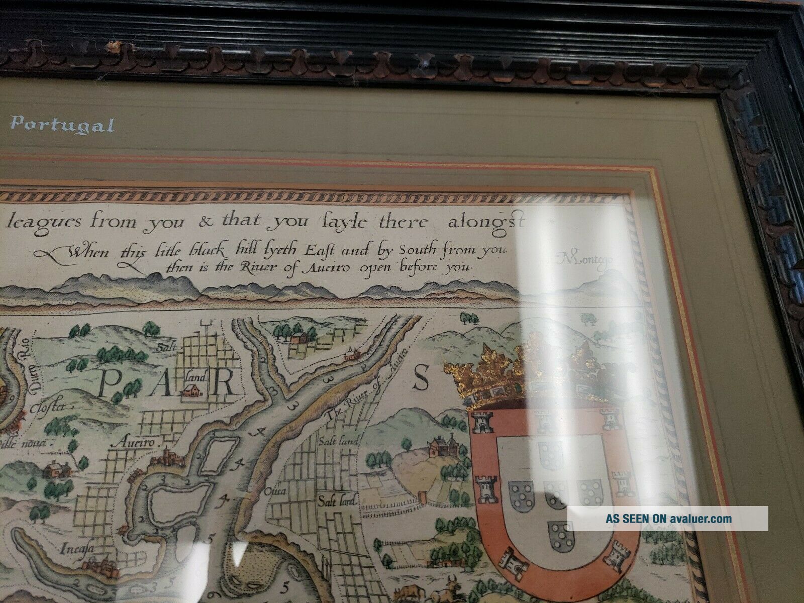
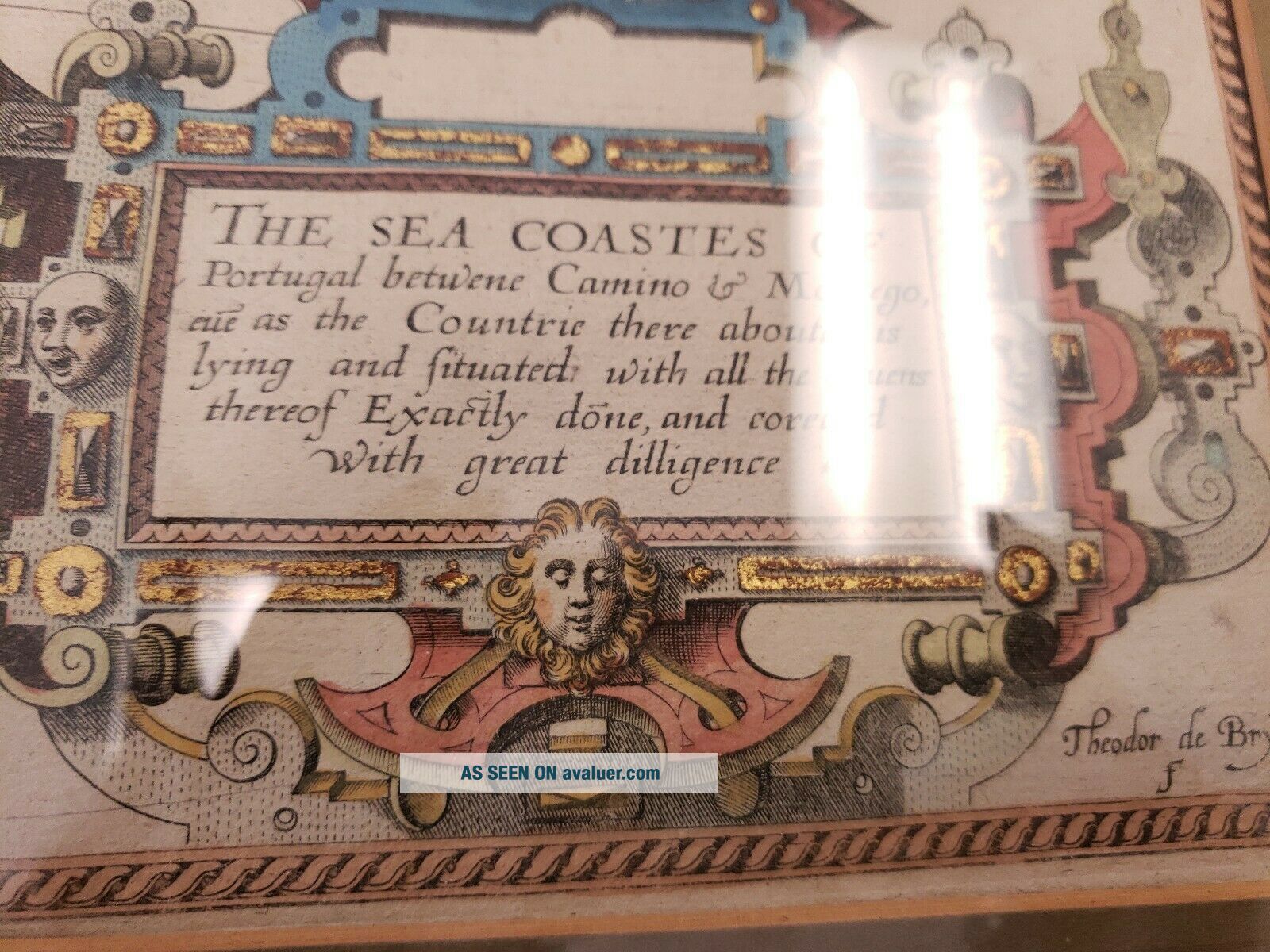
Theodor De Bry " The Sea Coastes Of Portugal " The Mariners ' Mirrour


Item History & Price

Information:
Reference Number: Avaluer:44549Width (Inches): 19.75
Listed By: Dealer or ResellerCartographer/Publisher: Theodor de Bry
Features: Framed, MattedType: Nautical Map
Country/Region: PortugalStyle: Vintage
Color: Multi-ColorHeight (Inches): 12.75
Size: Medium (up to 36in.)Originality: Original
Original Description:
Theodor de Bry map from The Mariners' Mirrour. "The Sea Coastes of Portugal." Looks like it was at one point folded. Does have fold marks in middle. Framed and matted. Also has the name Lucas Janss Waghenaer on bottom middle of matting. Map size 13x19.75. Frame size 19.5x26.5. Frame has some scratches. See pics.
This is a combined sale of 8 pictures/painting/prints. Including this one.
Shipped with USPS Priority Mail.


    Similar items


  • A Rare And Of The 1601 Theodore De Bry Map Of Nova Zembla.

    A Rare And Of The 1601 Theodore De Bry Map Of Nova Zembla.

  • Vintage Marine Chart Sheet Map Of The Sea Coast From Chichester To Christchurch

    Vintage Marine Chart Sheet Map Of The Sea Coast From Chichester To Christchurch

  • The Rivers,  Mountains & Sea - Coast Of Yorkshire - John Phillips 1855 H/b Illust.

    The Rivers, Mountains & Sea - Coast Of Yorkshire - John Phillips 1855 H/b Illust.

  • Coat Of Arms Of Ad Maximilian Iii From Part 1 Grand Voyages Theodor De Bry 1590

    Coat Of Arms Of Ad Maximilian Iii From Part 1 Grand Voyages Theodor De Bry 1590

  • The River Mountains And Sea Coast Of Yorkshire

    The River Mountains And Sea Coast Of Yorkshire

  • Mr.  Elmer Keene And His Art: A Painter Of The Sea - Coast.  An Article Fro

    Mr. Elmer Keene And His Art: A Painter Of The Sea - Coast. An Article Fro

  • Admiralty Sea Chart.  Plans On The South Coast Of Cornwall.  No.  147.  1962.

    Admiralty Sea Chart. Plans On The South Coast Of Cornwall. No. 147. 1962.

  • 1936 Harbors On The East Coast Of Chosen (korea) Map

    1936 Harbors On The East Coast Of Chosen (korea) Map


    • You might also like


    • Hungary & Romania 1579 (1584) Ortelius Unusual Antique Copper Engraved Map

      Hungary & Romania 1579 (1584) Ortelius Unusual Antique Copper Engraved Map

    • Brussels Bruxelles Belfium 1777 De Ferraris & Dupuis Large Antique Map Sheet Xxi

      Brussels Bruxelles Belfium 1777 De Ferraris & Dupuis Large Antique Map Sheet Xxi

    • 1616 Atlas Map Of Iceland.

      1616 Atlas Map Of Iceland.

    • Kazan Russia 1767 Le Clerc/lespinasse Antique Copper Engraved City View

      Kazan Russia 1767 Le Clerc/lespinasse Antique Copper Engraved City View

    • 1899 Stanford,  Folding Map Of Norwich,  Norfolk,  Arthur Collins,  Jarrold & Sons,

      1899 Stanford, Folding Map Of Norwich, Norfolk, Arthur Collins, Jarrold & Sons,

    • 1948 Vintage Linen Colour Map Geological Survey Ten Mile Of Great Britain

      1948 Vintage Linen Colour Map Geological Survey Ten Mile Of Great Britain

    • 1944 Map Flying Bombs Sussex Ww2 Newspaper Military Kent Courier German V1 V2

      1944 Map Flying Bombs Sussex Ww2 Newspaper Military Kent Courier German V1 V2

    • John Speed Map C1627 Invasions England & Ireland Engraved Armada Civil Wars

      John Speed Map C1627 Invasions England & Ireland Engraved Armada Civil Wars

Avaluer          About Us          Privacy Policy          Contact Us          UP
© 2022, avaluer.net, Inc. or its affiliates