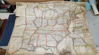
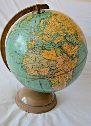
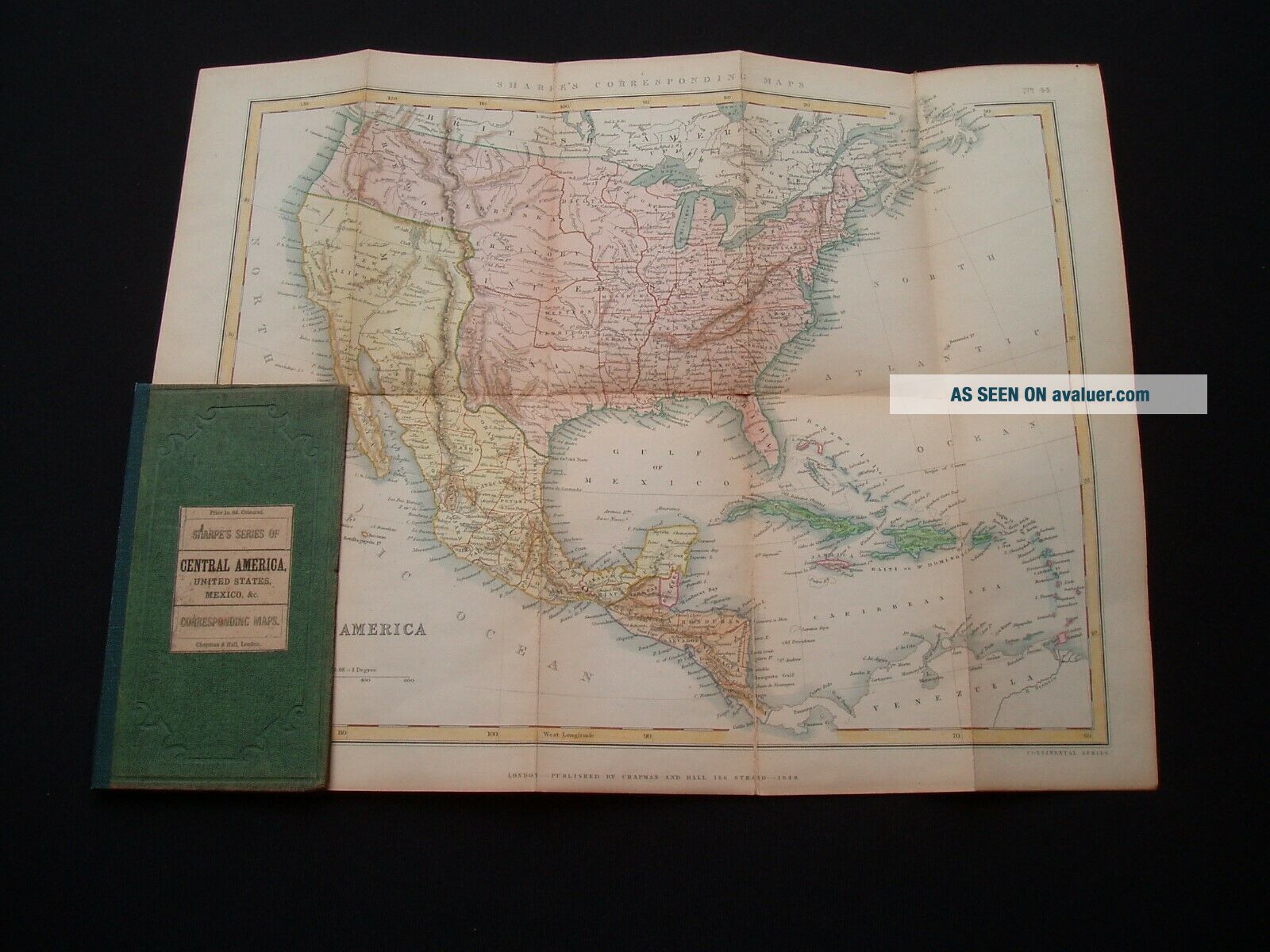
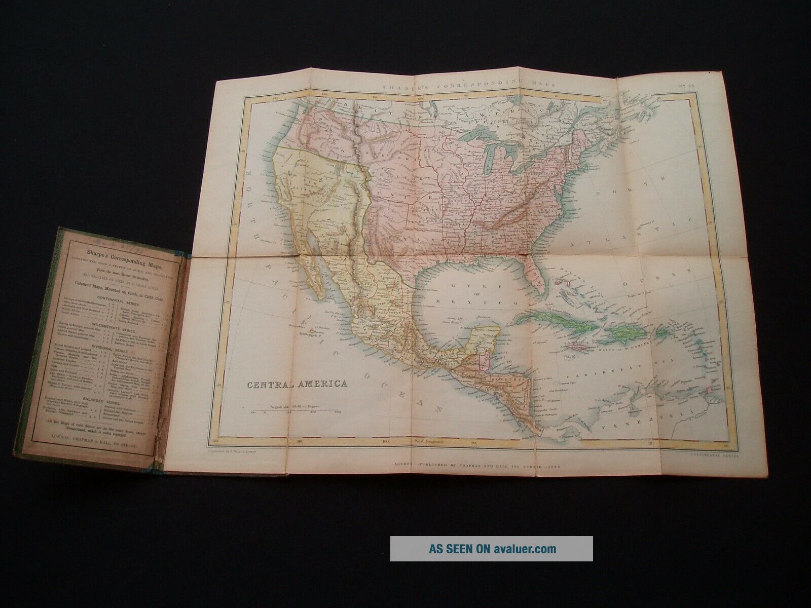
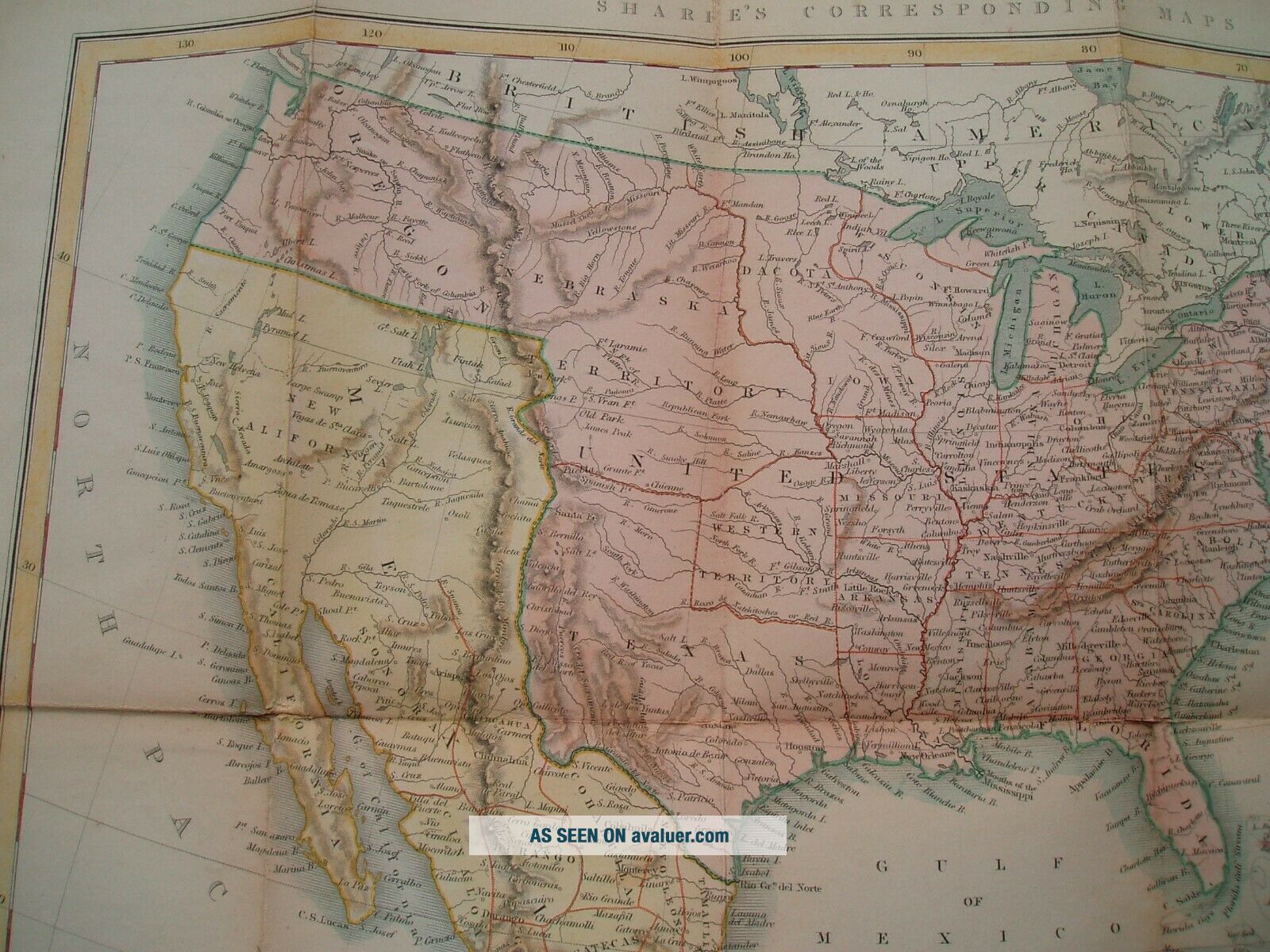
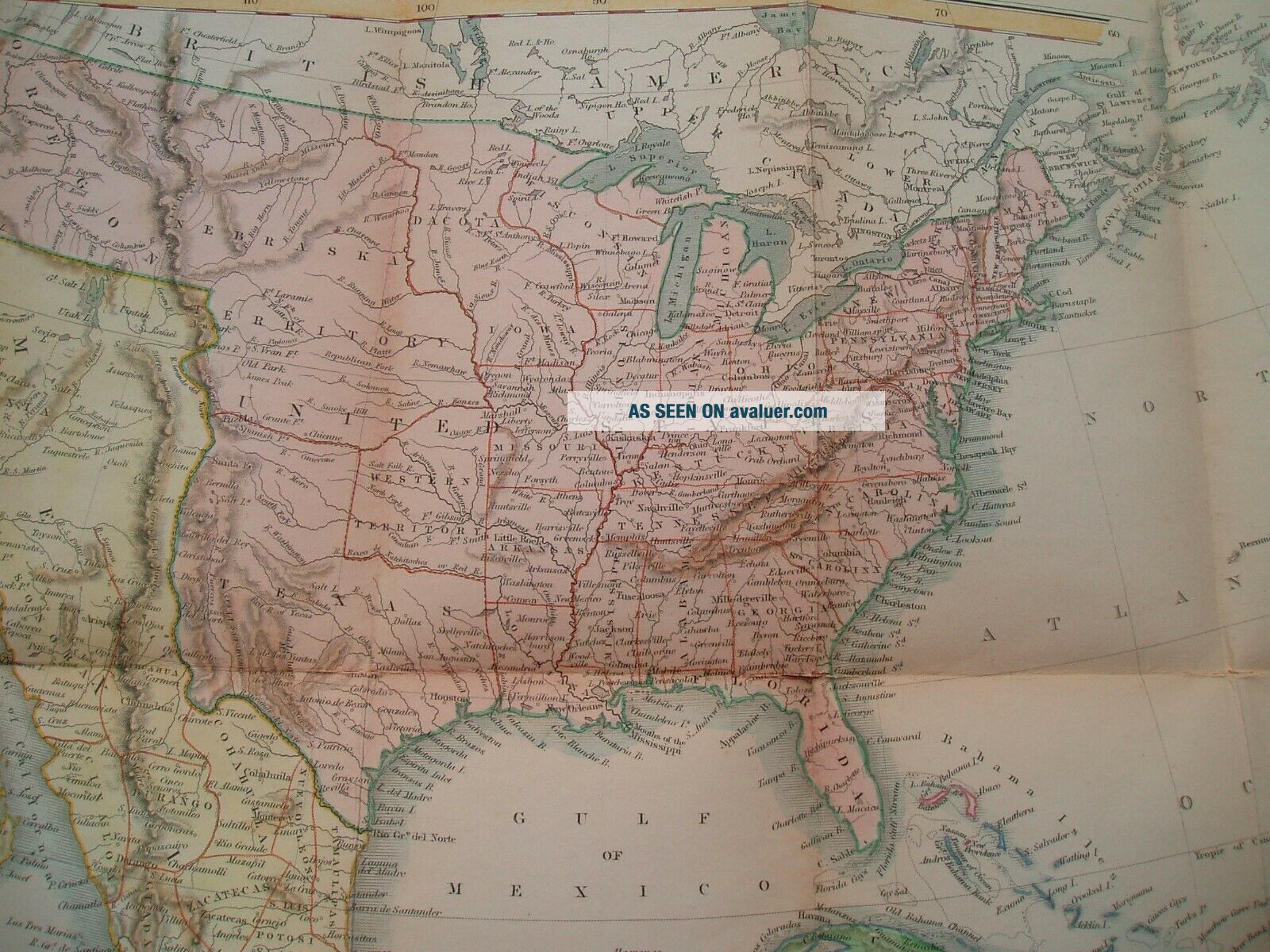
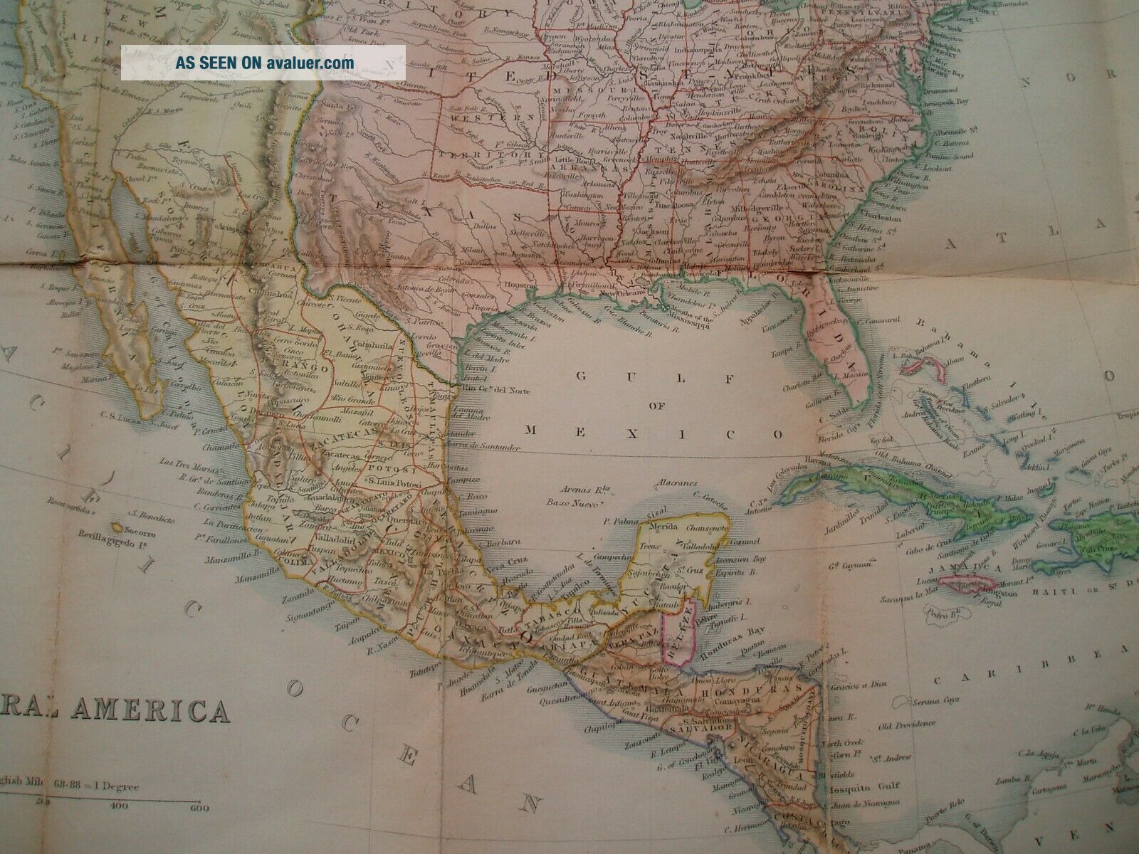
1848 Hall Map Stovepipe Texas United States Oregon Nebraska Iowa Wisconsin Terr

Item History & Price
| Reference Number: Avaluer:44339 | Original/Reproduction: Original |
| Type: Map |
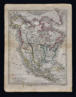
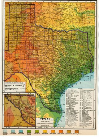
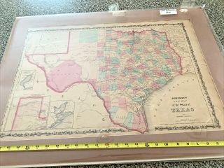
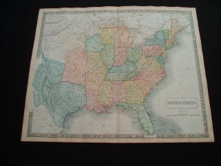
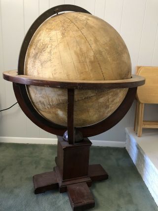
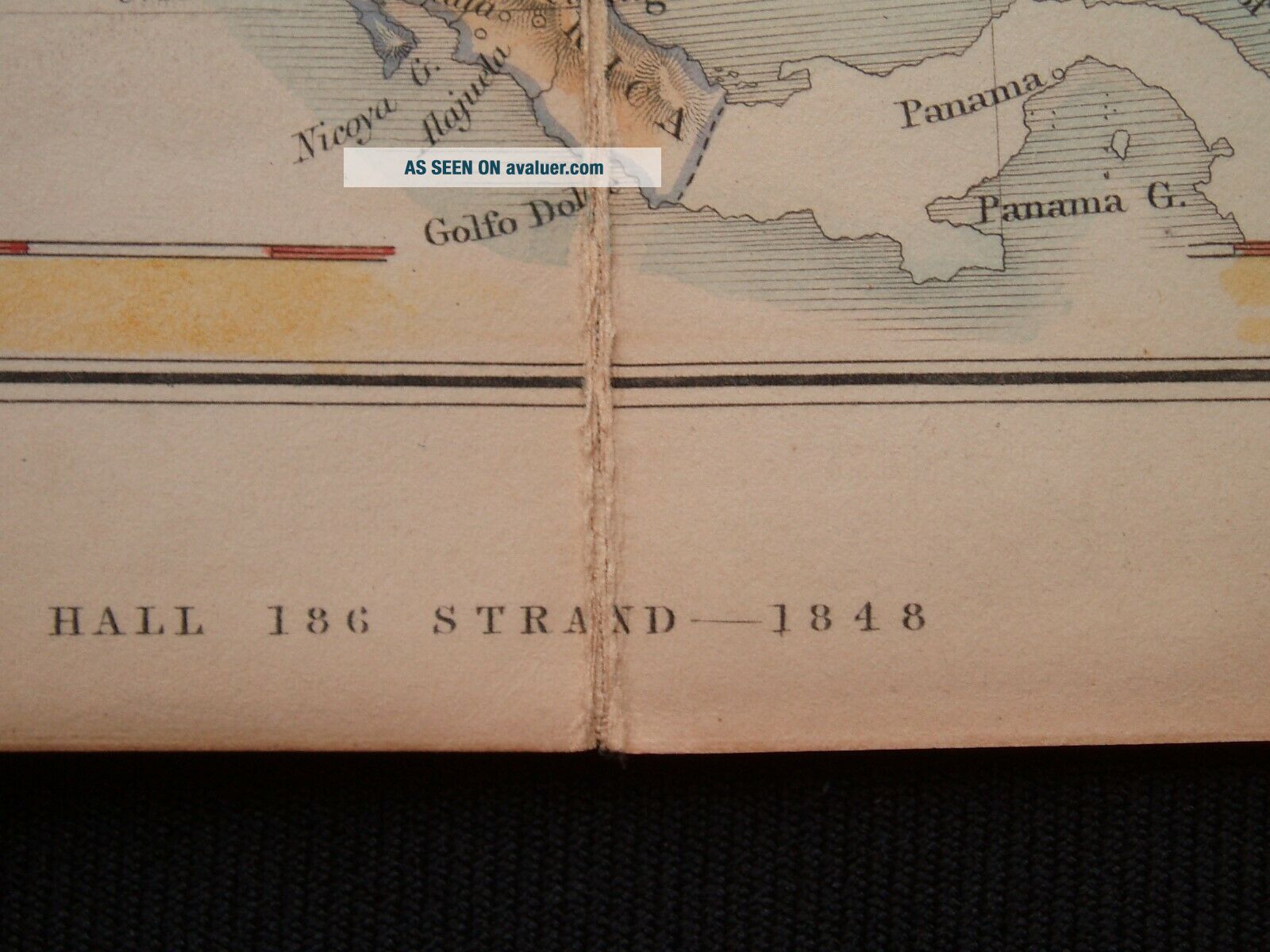
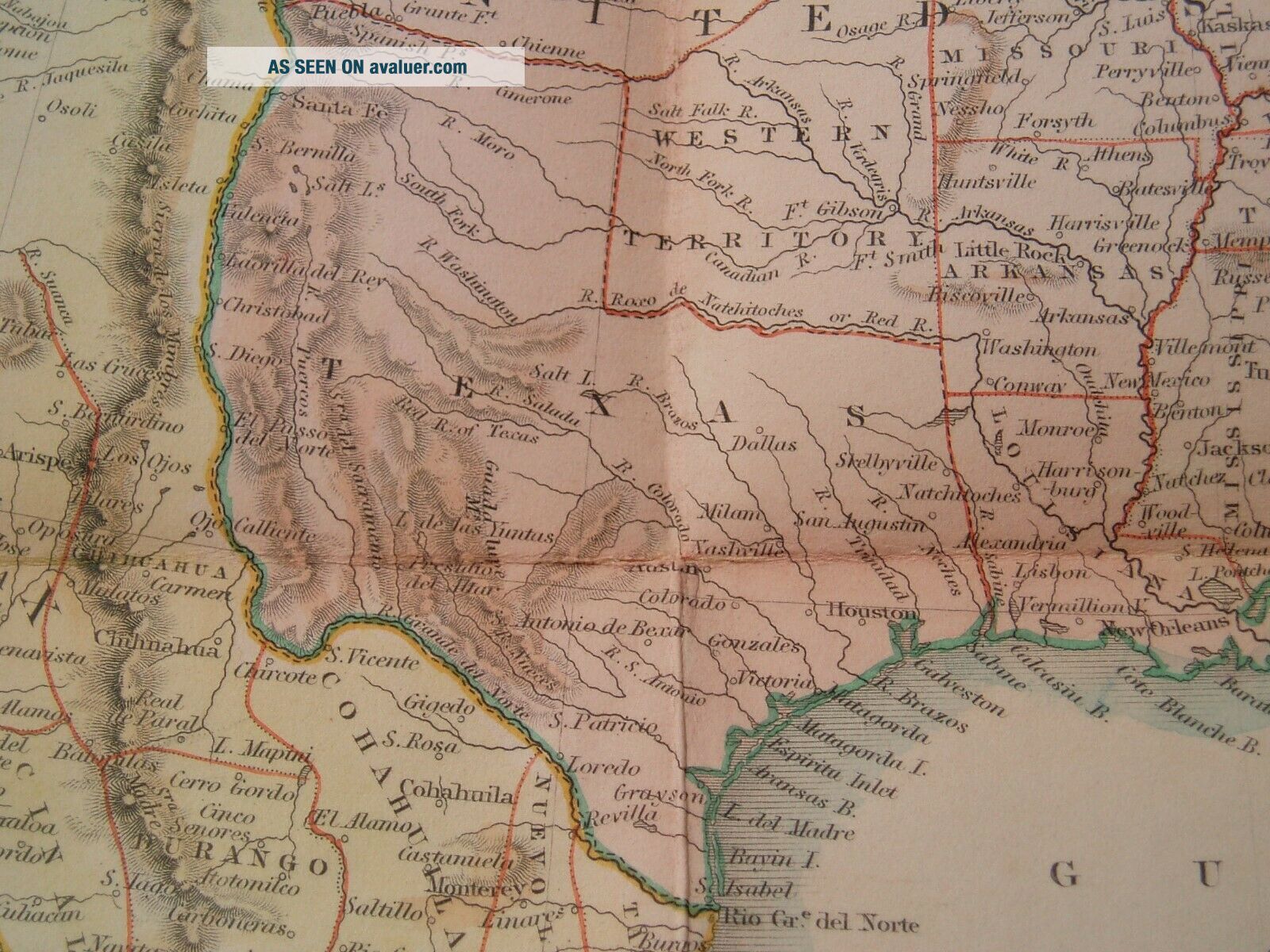
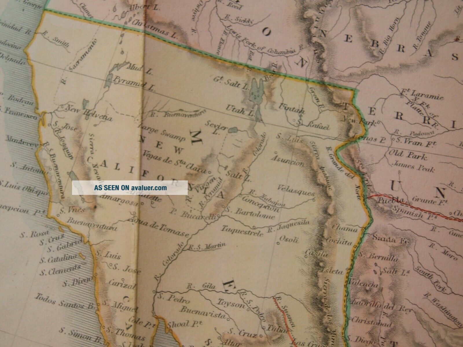
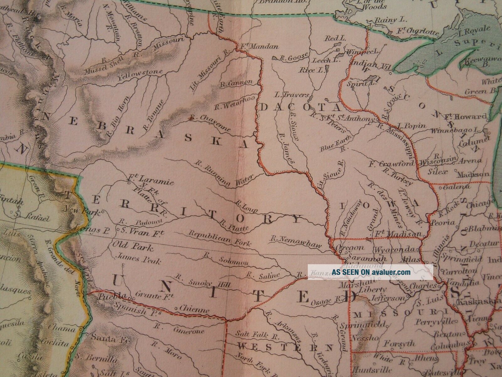
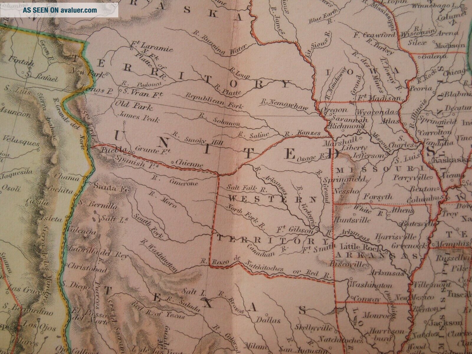
This auction is for the extremely rare and 100% original and authentic antique map of the above region, cartographer and year. This auction is only for the map that is pictured in this listing. This is a 100% genuine original antique map. I DO NOT sell copies, posters, reproductions or fakes so you can buy with total confidence that you are buying the real thing. I have sold my collection to thousands of dealers, galleries, and map co...llectors from all around the world. If you like this map, then please message me with an offer for me to consider. I cannot stress enough how beautiful this map is up close compared to the photos that you see. Note that the photos do not do the map justice. This is truly an incredible map to behold!! This is your chance to own a map that can be the centerpiece of your collection. Map Details: Gorgeous, extremely rare and beautifully engraved pocket map covers the entire United States and extends south to include Mexico and Central America. The new state of Texas is shown in its large stovepipe configuration, while Mexico is still in control of California and the Southwest. Present-day Oklahoma is named Western Territory and a huge Nebraska Territory occupies the region between the Rockies and the Missouri River. An undivided Dacota Iowa Territory takes up the region between the Missouri and Mississippi rivers. The map shows good detail of forts, settlements, rivers and topography. The map has been backed with linen and folds into green cloth boards (4.0 x 7.2") with paper label on front cover. There are no other past auctions or dealer listings for the pocket version of this map. The folds are as issued in the map and please note that the folds are way less prominent once the map is laid flat and that they folds are only showing up is due to the lighting when I told the photos so you see a lot of the shadowing from the fold line due to this lighting. You can remove the map from the book and then display the map and book together in a framed piece. The map shows good detail of forts, settlements, rivers and topography.Please note the detail in that every sub region is individually and meticulously hand colored. The map shows incredible and detailed geographical information as well. My price is based on the rare condition and scarcity of this map. This map is from my personal collection. I will entertain offers as well.
General Description: 1. Strikingly interesting and highly detailed map. The map depicts in great detail all of the geographical information known at the time the map was published. Note that many geographical details have changed since the map was published and were not accurate compared to today's modern maps because things were fully discovered and accurately mapped yet. Map symbols and details include individual towns, rivers, lakes, bays, harbors, islands, mountains, forests, roads and other important places as shown on the map in this listing. 2. The map is in excellent condition considering the age and rarity of the map. The overall size of the map sheet is approximately 16 inches by 13 inches. 3. The map is a 100% original and genuine antique map. All of my maps are investment grade and collectible quality. The value of this original will only increase over time. Many people are now starting to offer cheap reproductions/copies. Why spend the money for something like that when you can have an original for a few dollars more that will only increase in value over time.Please e-mail me with any offers that you would like to make.** I DO NOT SELL REPRODUCTIONS, FAKES OR COPIES!!! ** Please also view all of my other maps for sale at very reasonable prices** Please review all of my positive feeback of satisfied winners from past auctions.Payment Terms:US bidders:Terms: PayPal is accepted. Payment is expected within 3 days of the end of the auction. I ship a couple of times per week. All sales are final so bid carefully and ask any questions prior to the end of the auction. I ship these rolled and in strong reinforced heavy tubes. Buyer will pay shipping and handling charges of $10.00 for the US. I will combine the shipping charges if you win more than one item.International bidders:Terms: PayPal is accepted for payments. Payment is expected within 3 days of the end of the auction. All sales are final so bid carefully and ask any questions prior to the end of the auction. I ship these rolled and in strong reinforced heavy tubes. Buyer will pay shipping and handling charges of $15.00. If you want these shipped via Registered mail, then you need to add another $15.00 for a total shipping charge of $30.00. I will combine the shipping charges if you win more than one item.All Bidders:Bidding on items is your acceptance of these terms and conditions. No exceptions!! I will be selling off my entire collection over the next few months, so please see my other auctions for similar quality maps now and in the future under Divel3. May God Bless you and your family !!!
00006