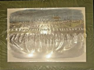
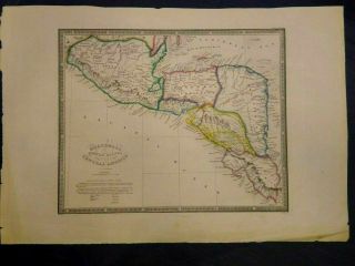
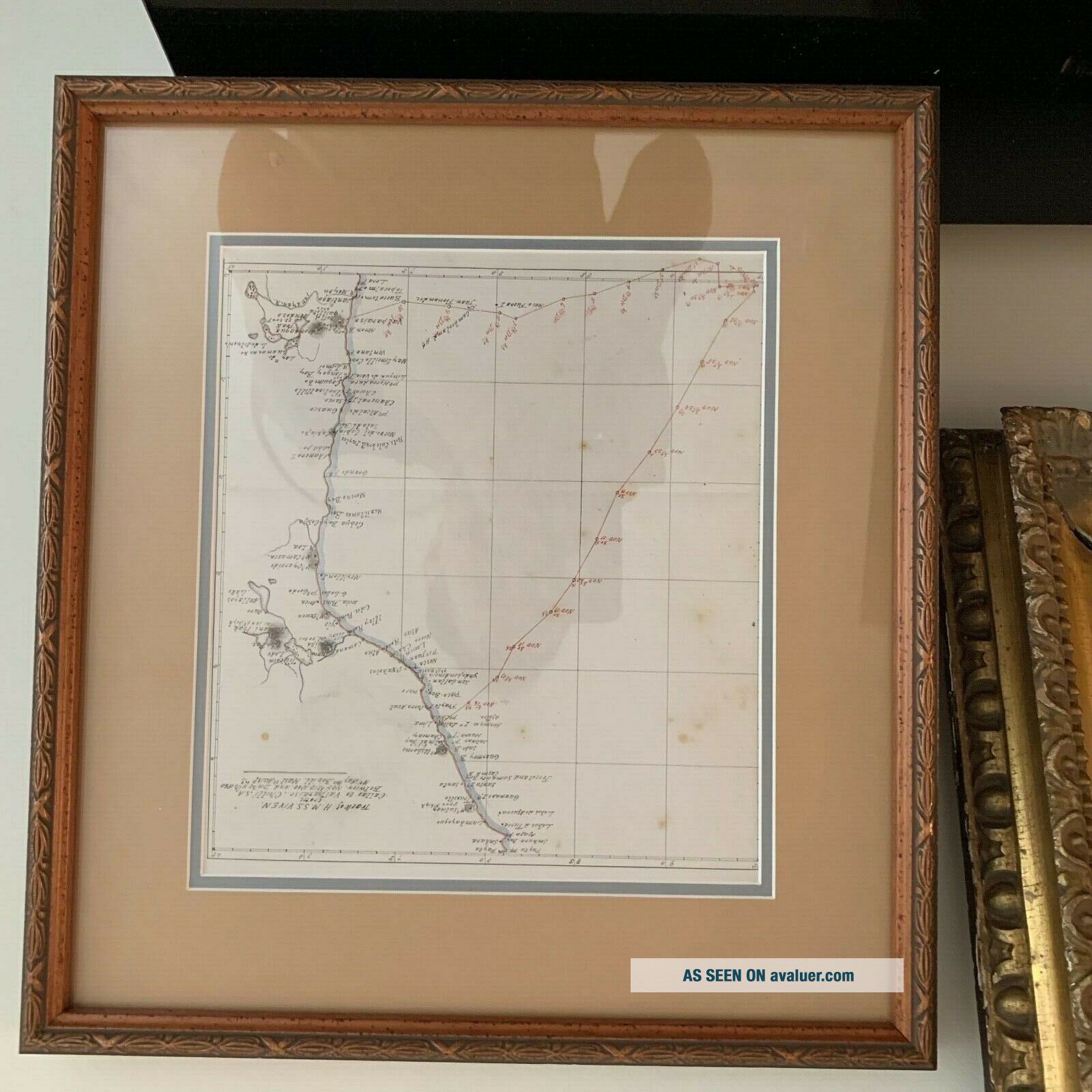
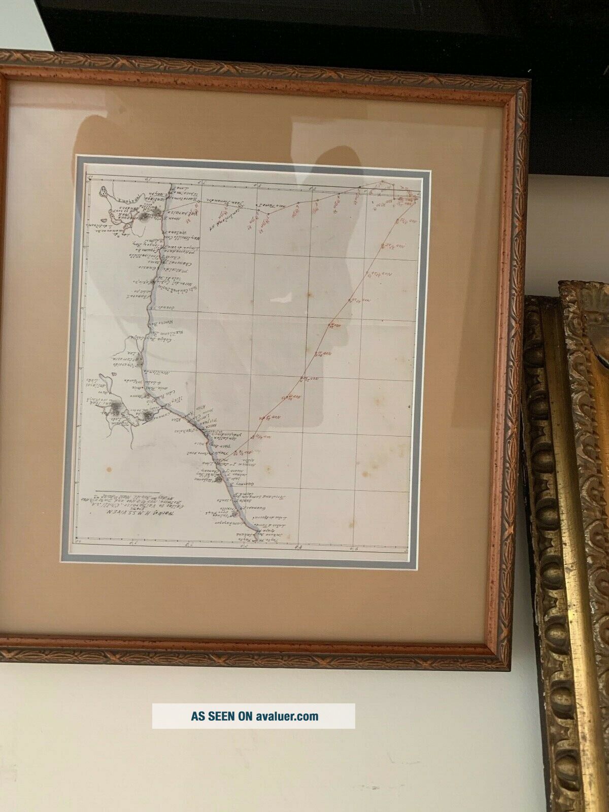
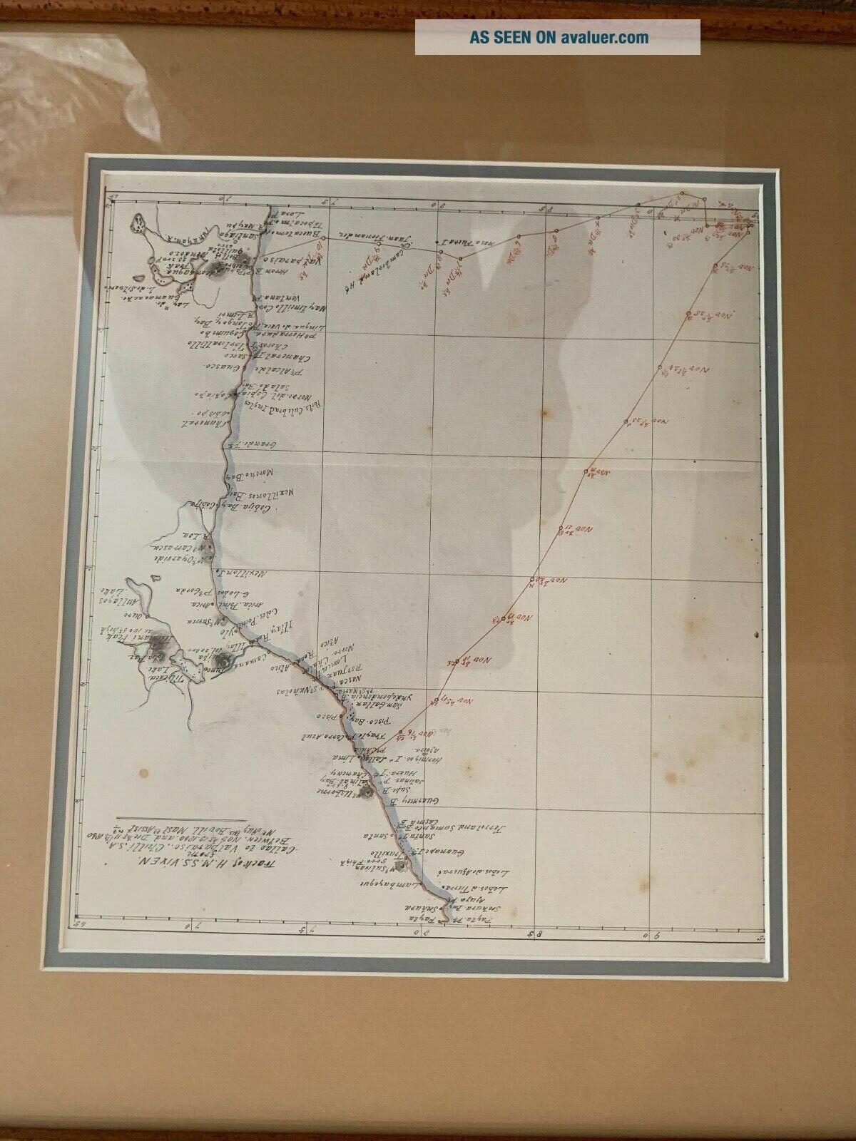
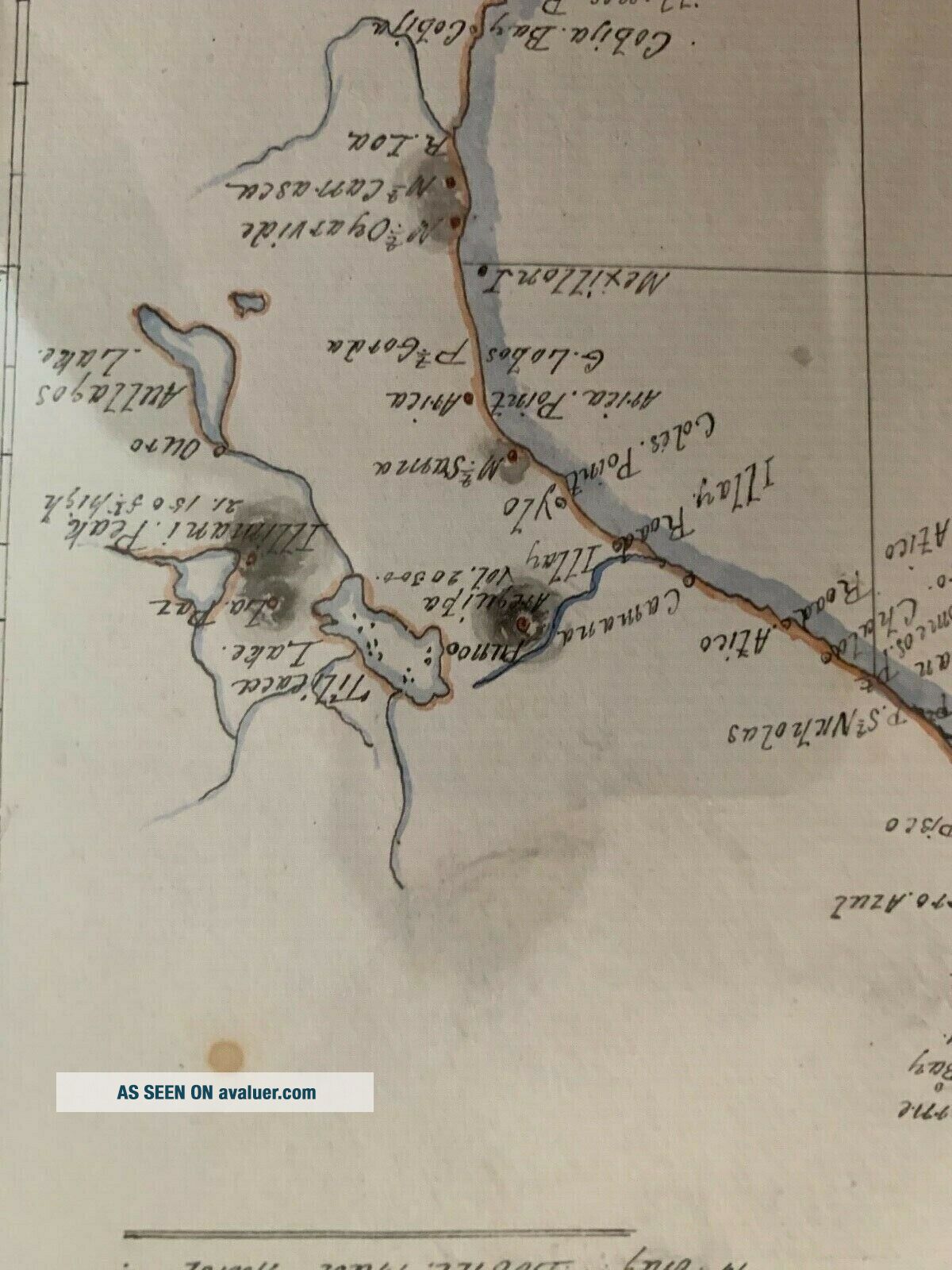
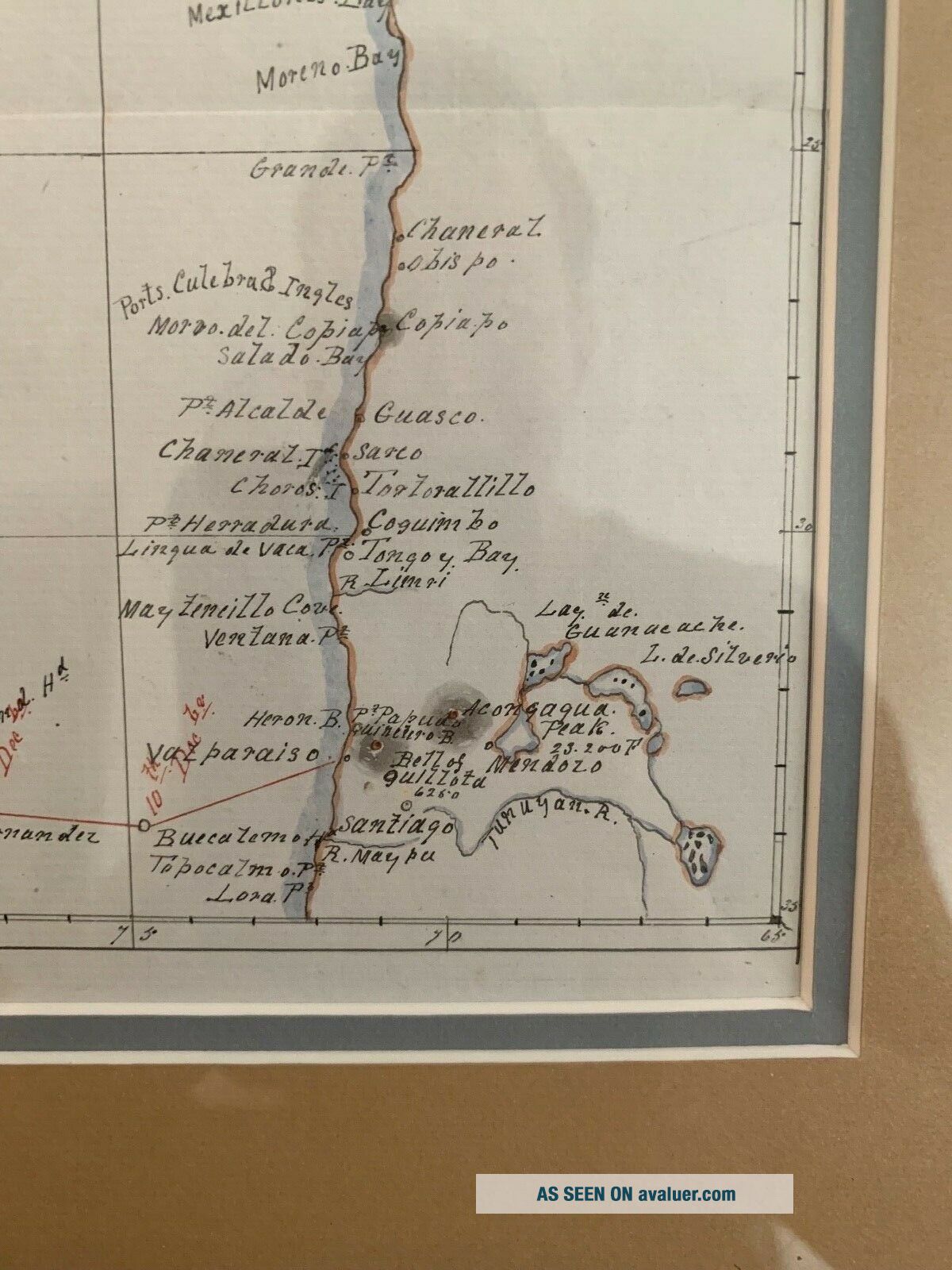
1860: MANUSCRIPT MAP OF HMS VIXEN CHILE / PERU


Item History & Price

Information:
Reference Number: Avaluer:44281Year Printed: 1860
Special Attributes: ManuscriptOriginal/Facsimile: Original
Original Description:

1860: ORIGINAL MANUSCRIPT MAP OF HMS VIXEN  
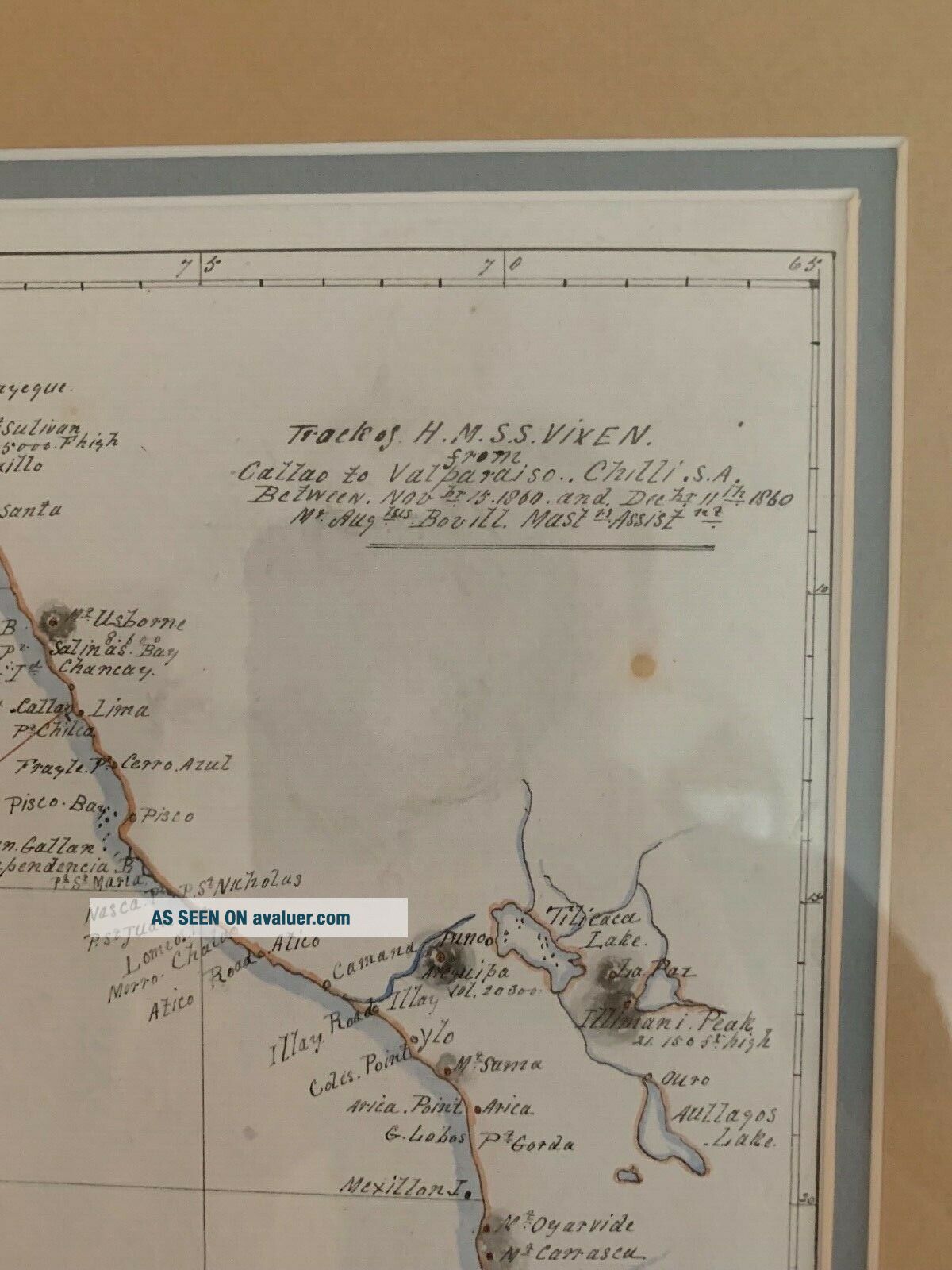
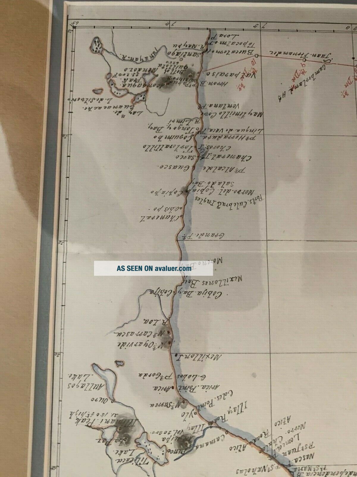
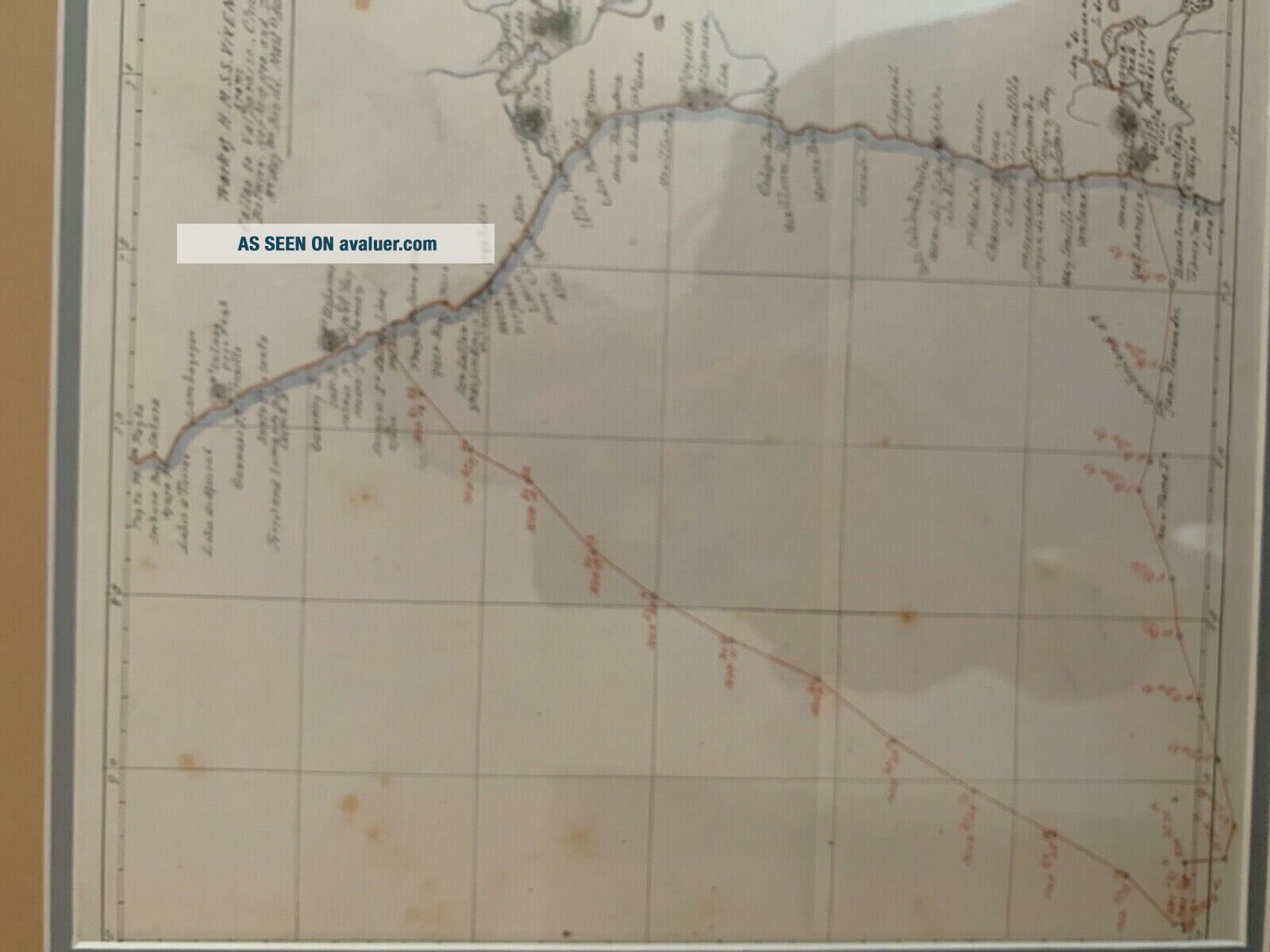
[MANUSCRIPT MAP]  Track of H.M.S.  Vixen from Callao, Peru  to Valparais,   Chile Dec 11, 1860. 23 x 26 cm  (39 x 36 in frame) by  Augustus Bovill, master's assistant. Some light foxing. 
...-color: rgb(255, 255, 255);">

Incidentally, the Mariners' Museum Library has the original logbook kept by Augustus Bovill, master's assistant Date:1857-1861
See R Morriss, Guide to British Naval Papers in North America (1994)


    Similar items


  • 1860 Johnson Map Of California,  Nevada,  Utah,  Mexico And Arizona

    1860 Johnson Map Of California, Nevada, Utah, Mexico And Arizona

  • 1860 Mitchell Map Of Boston,  Massachusetts

    1860 Mitchell Map Of Boston, Massachusetts

  • Antique 1860 County Map Of The State Of Texas

    Antique 1860 County Map Of The State Of Texas

  • Vintage 1860

    Vintage 1860 ' S Map Of Hampshire & Vermont

  • 1860s “township Map Of The State Of Ohio” Vintage Style Us Map - 16x20

    1860s “township Map Of The State Of Ohio” Vintage Style Us Map - 16x20

  • 1853 Map Of Republic Argentina & Chile Publiser: Gaspar Y Roig

    1853 Map Of Republic Argentina & Chile Publiser: Gaspar Y Roig

  • 1789 Bonne - Rare Map Of South America,  Chile,  Argentina,  Brazil,  Peru,  Colombia

    1789 Bonne - Rare Map Of South America, Chile, Argentina, Brazil, Peru, Colombia

  • Antique 1860 Italian Map Of United States - Estate Find - Rare

    Antique 1860 Italian Map Of United States - Estate Find - Rare


    • You might also like


    • Extremely Rare Photo Of Hong Kong,  Showing Central Victoria Township 1857

      Extremely Rare Photo Of Hong Kong, Showing Central Victoria Township 1857

    • Rare Antique G.  W.  Bromley & Co 1891 City Of South Boston Mass Atlas 33 Plates

      Rare Antique G. W. Bromley & Co 1891 City Of South Boston Mass Atlas 33 Plates

    • 1893 Atlas Map Plat Turner County South Dakota Rowley & Peterson Antique Vtg.

      1893 Atlas Map Plat Turner County South Dakota Rowley & Peterson Antique Vtg.

    • Antique Map Of Guatemala Or United States Of Central America

      Antique Map Of Guatemala Or United States Of Central America

    • U.  S Geological Survey Authentic Rubber Stamp 1986 South Pole

      U. S Geological Survey Authentic Rubber Stamp 1986 South Pole

    • South America; Brazil,  Santa Catarina Island - Bellin - 1751 - 1760

      South America; Brazil, Santa Catarina Island - Bellin - 1751 - 1760

    • Map; Mexico & Central America - Map Of West Indies 1887

      Map; Mexico & Central America - Map Of West Indies 1887

Avaluer          About Us          Privacy Policy          Contact Us          UP
© 2022, avaluer.net, Inc. or its affiliates