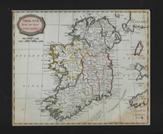
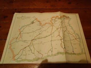
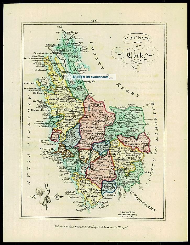
1776 IRELAND - Engraved Antique Map Of COUNTY OF CORK With Colour
Item History & Price
| Reference Number: Avaluer:43694 |
1776 IRELAND - Engraved Antique Map of COUNTY OF CORK with original colour 1776 IRELAND - Engraved Antique Map of COUNTY OF CORK with original colour Click image to enlarge Description 1776
A fine original antique map by Bermard Scale titled
" COUNTY OF CORK "
.../>
A fine and rare engraved map taken from " AN HIBERNIAN ATLAS or GENERAL DESCRIPTION OF THE KINGDOM OF IRELAND Divided into Provinces with its sub-divisions of Counties, Baronies etc... " and published in london by Robert Sayer & John Bennet. With original wash colour and outline to the map area. This map also comes with its Title descriptive page & text.
Surveyor and cartographer, Peter Bernard Scale (1738 - 1826) was a son of Peter Scale, a Huguenot resident in England. He was a pupil of John Rocque and came to Dublin to assist Rocque in the surveys for his map of Dublin. He then went to Ireland about the age of sixteen and by the autumn of 1758 had married Rocque's sister and established himself as a Surveyor and Cartographer.
Overall size including margins 18cm x 23cm. Perfect for mounting & framing. Condition is excellet with very light offsetting.All our items are original Antiques and as described.We provide a No Quibble Money Back Guarantee Payment We prefer payment via PAYPAL. In some circumstances, we are able to accept a Cheque from UK Buyers, drawn on a UK Bank. Buyers will need to wait for 7 working days for the cheque to clear before any items are sent out. We can also accept Cash Payment in UK Pounds Stirling, Euros or US Dollars, but payment by cash methods are sent at the risk of the buyer. If you want to pay in any way apart from PAYPAL, please contact us PRIOR to making any bid or outright purchase. Shipping We always try to ship items within 3 working days of any order. We are very happy to combine many items for a single postal charge. All our items are sent in either Board Backed envelopes or Art Tubes and are in the case of sending to tropical areas of the world, additionally provded with sealed plastic envelopes.
We ship to almost anywhere in the world but there are just a few territories we are unable to ship to.
About Us Antique Paper Company are established dealers in Antique Maps, Prints, Stamps, Postal History, Antiquarian Books and in fact all forms of Antique Paper also including Post Cards, Old Posters, Archives, Manuscripts, Ephemera etc.
We are keen buyers and are prepared to travel throughout the UK, Europe and most of the world in search of opportunites to buy. Cash funds of up to £250, 000 are available immediately for the right opportunities. We work closely with Libraries & Solicitors/probate situations where they are looking for disposal options and seek better single items to large quantities and also Specialised Collections of almost any genre.
Please do not hesitate to contact us with details of any items you might have for sale. Contact Us Tel: (+44) (0)1233 720703
Email: [email protected]
Pictures sell!
Auctiva offers Free Image Hosting and Editing.250+ Listing Templates!
Auctiva gets you noticed!
The complete eBay Selling Solution.
Track Page Views With
Auctiva's FREE Counter