AFRICA CA 1550 WOODCUT ANTIQUE MAP AFRICA CONTINENT SEBASTIAN MUNSTER
Item History & Price
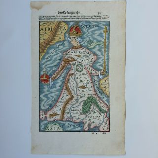
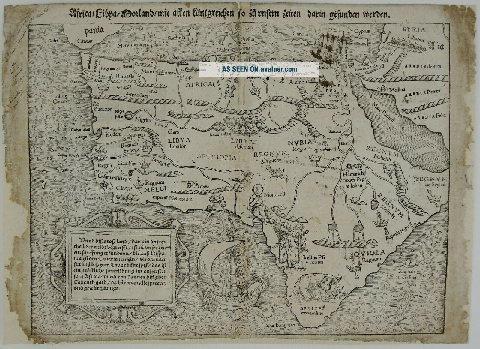
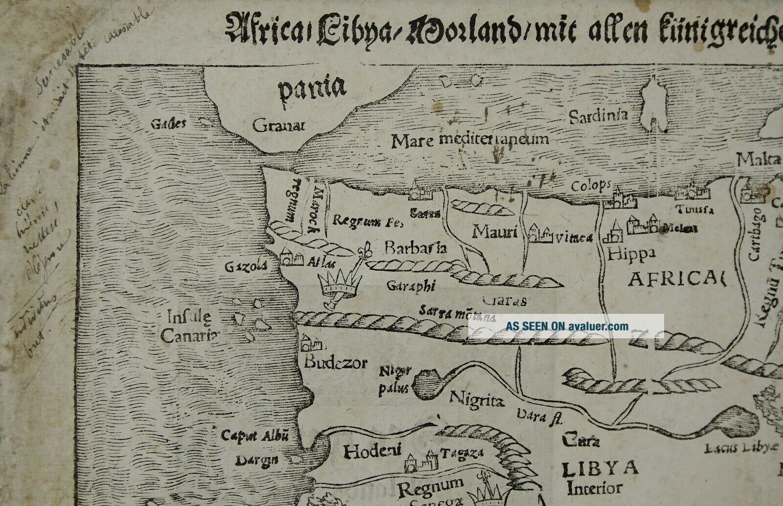
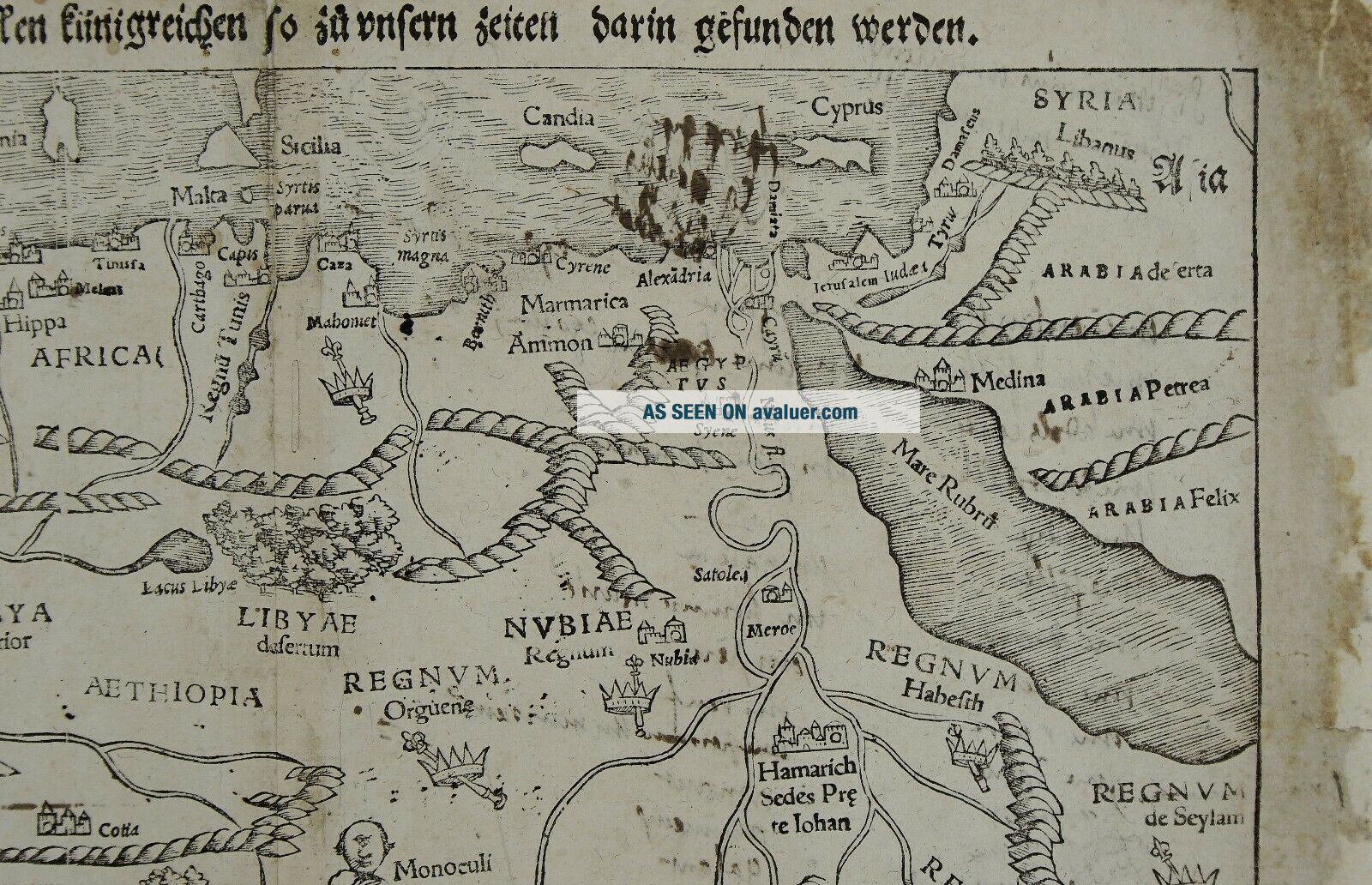
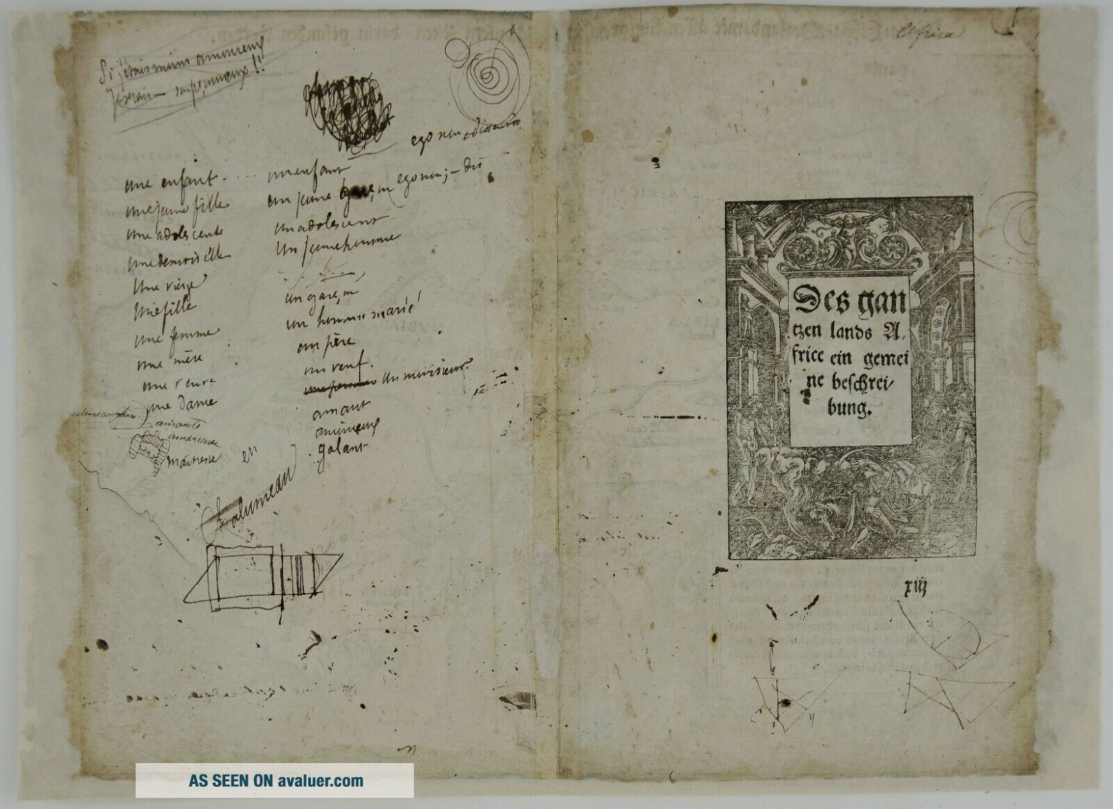
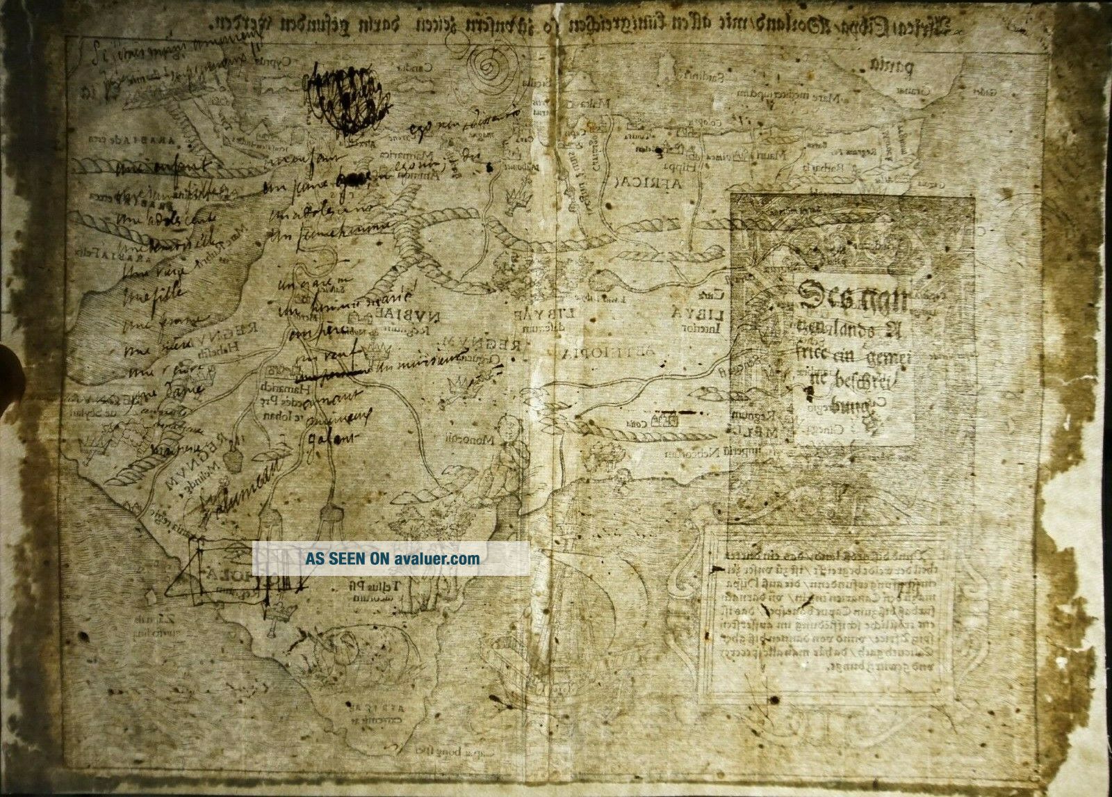
Title: “Africa / Libya / Mörenlandt / mit allen Königreichen / so zu unsern zeiten darin gefunden werden.”
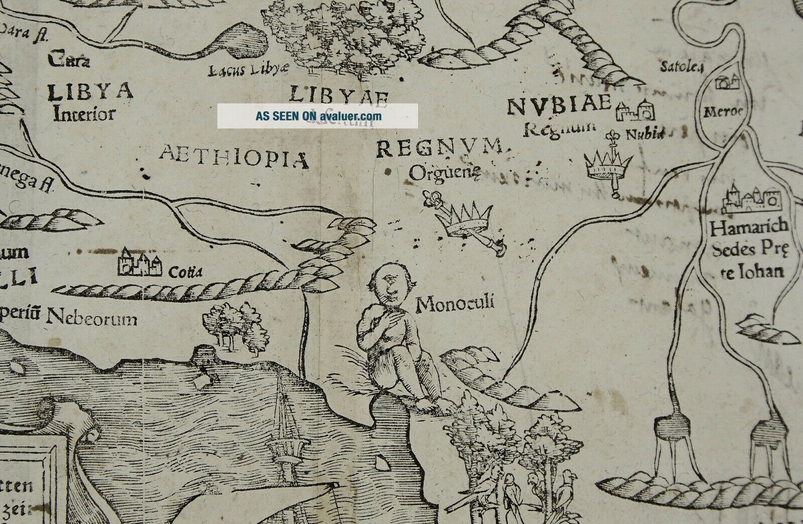
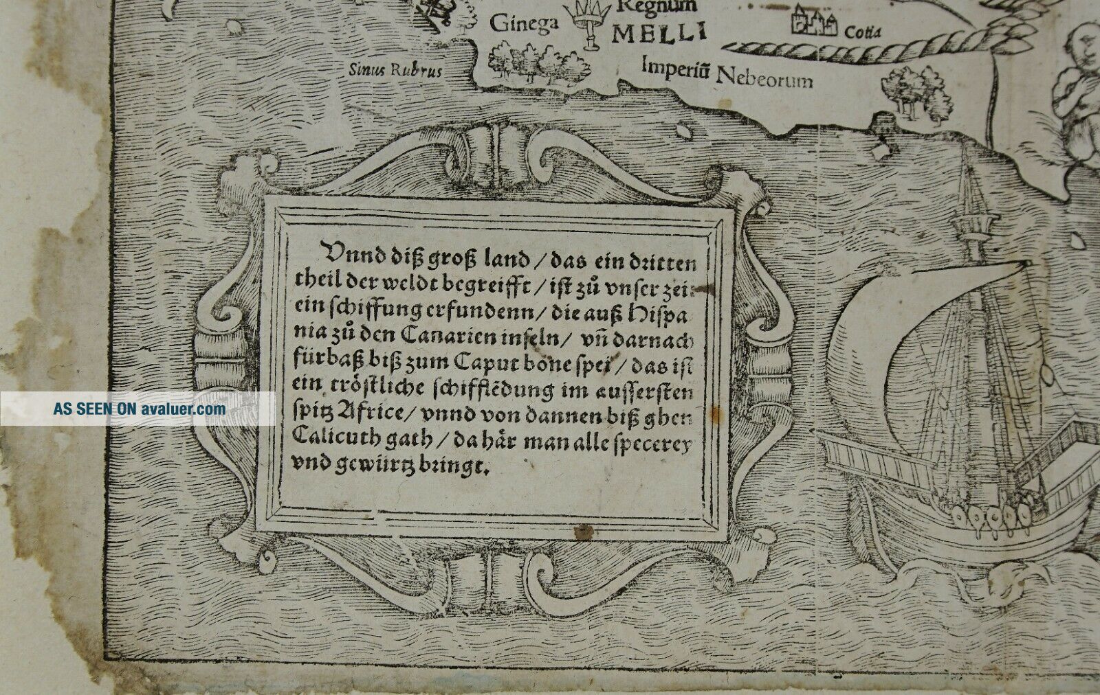
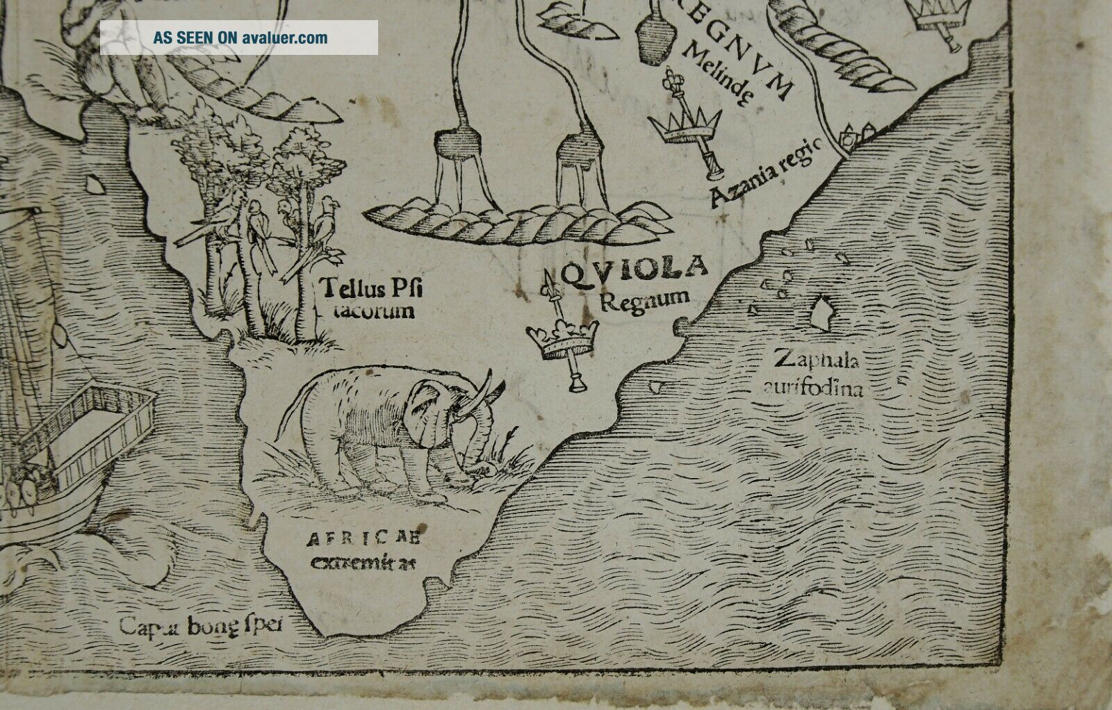
Description:A decorative Munster’s map of Africa, the first map of the African Continent. The map features a galleon, mountains, rivers, assorted kings crowns, denoting various kingdoms, an elephant, and a one eyed giant that is said to represent the mythical tribe of the “Monoculi”.The large box of text contains a guide to... sailing from Cadiz in Spain to Calicut in India. This is one of the first modern maps of the whole continent. Its geography, with large rivers and convoluted mountains, is taken from Portuguese and Arabic sources.Map comes from the German edition of Sebastian Münster’s Cosmography, titled “Cosmographey oder beschreibung aller Länder”, published ca. 1550 by Heinrich Petri in Basel. The woodblock of this map was used first in Münster's Geographia Universalis in 1540.
Cartographer: Sebastian Munster (1488 – 1552)Sheet size: 38, 5 x 28, 0 cmYear: ca 1550Technique: woodcut Condition:Reasonable condition. Few small centerfold reinforced repairs. Recto and verso with contemporary handwritten annotations. Margins extended.This is an original antique mappublished in ca 1550 and NOT a modern copy or reprint! Due to the ageof this map some imperfections to be expected! Do not hesitate to ask for moreinformation! Combine shippingis possible!Algeria Angola Benin Botswana Burkina Faso Burundi Cabo Verde Cameroon Central African Republic Chad Comoros Democratic Republic of the Congo Republic of the Congo Cote d'Ivoire Djibouti Egypt Equatorial Guinea Eritrea Ethiopia Gabon Gambia Ghana Guinea Guinea-Bissau Kenya Lesotho Liberia Libya Madagascar Malawi Mali Mauritania Mauritius Morocco Mozambique Namibia Niger Nigeria Rwanda Sao Tome and Principe Senegal Seychelles Sierra Leone Somalia South Africa South Sudan Swaziland Tanzania Togo Tunisia Uganda Zambia Zimbabwe