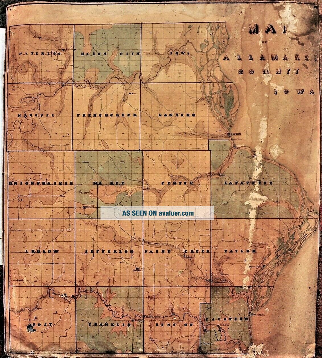
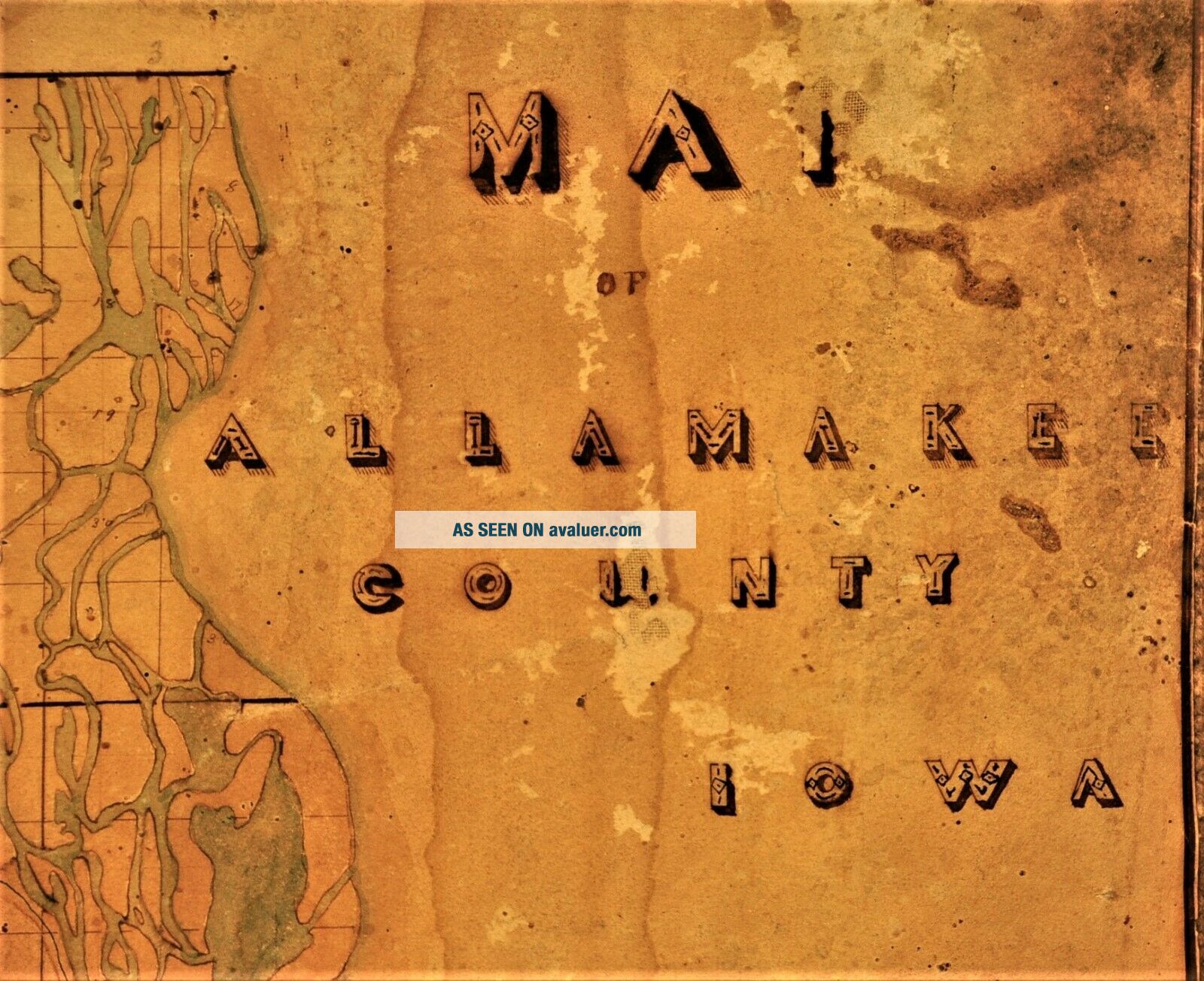
1850 ' S Hand Made Linen Map Of Allamakee County Iowa; 21x24


Item History & Price

Information:
Reference Number: Avaluer:37860Year: 1860
Date Range: 1800-1899Format: Wall Map
US State: IowaType: County Map
Printing Technique: Manuscript/Hand drawnOriginal/Reproduction: Antique Original
Original Description:
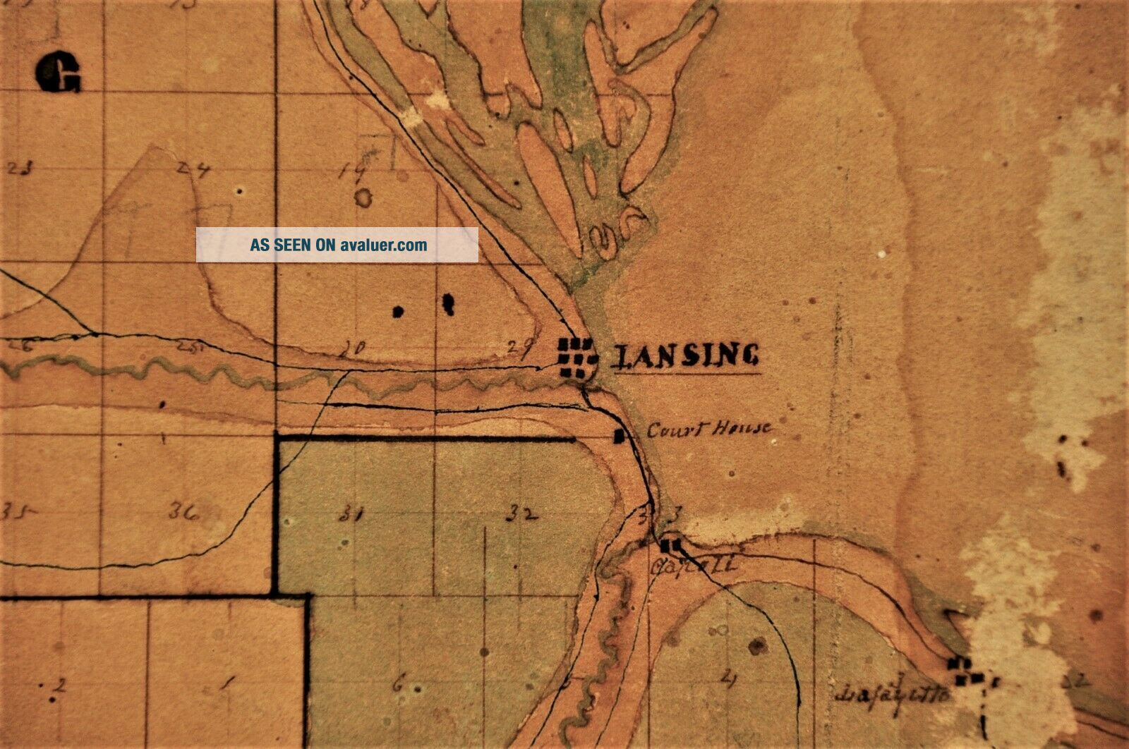
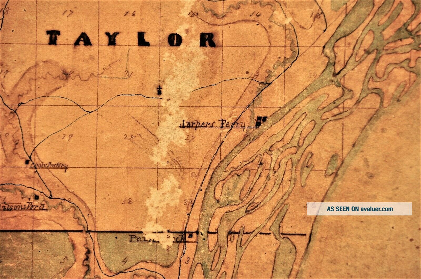
1850's Hand Made Linen Map of Allamakee County Iowa; 21x24. This map is unique in that it is hand drawn with great detail.Some details of interest are country schools, creeks and the various saw mills and grist mills of the day.It can be dated to pre 1861 because the county courthouse is shown below Lansing on the Mississippi River. In 1861 the county seat was moved and the courthouse was constructed permanently in Waukon.The colors are well preserved as this map has been stored a...way in the Garnavillo Iowa museum for many years. It would like a new home now with someone to care for it and ooh and aah over it.Proceeds from the sale will go to continued improvements in the museum.See the photos for overall condition of the map.Thanks for looking.


    Similar items


  • Vintage C1950

    Vintage C1950 ' S - 1960 ' S Hand Made Pine ' Chest Of Drawers ' Jewellery/trinket Box

  • Hand Made Stone Map Of Afghanistan

    Hand Made Stone Map Of Afghanistan

  • 1950

    1950 ' S Hand - Made Wooden Model Of Pt Fighting Boat Of Ww2 One Of A Kind

  • Hand Made Stone Map Of Afghanistan - Soapstone?

    Hand Made Stone Map Of Afghanistan - Soapstone?

  • Rare Vtg Hanging Frame Map Of The West Hand Made Linen Embroidery Needlepoint

    Rare Vtg Hanging Frame Map Of The West Hand Made Linen Embroidery Needlepoint

  • Antique 1850

    Antique 1850 ' S Hand Woven Paisley Coverlet 67 " X 130 " Wool Kashmir Blend

  • Antique Lace - Circa 1860

    Antique Lace - Circa 1860 ' S, Hand Made Chantilly Lace Bertha Collar

  • My Grandmother

    My Grandmother ' S Hand - Made Quilt


    • You might also like


    • 1860 Mitchell Hand Colored Map Colorado,  Nebraska & Kansas - Civil War Era

      1860 Mitchell Hand Colored Map Colorado, Nebraska & Kansas - Civil War Era

    • 18th Century French Map Of North America

      18th Century French Map Of North America

    • Las Vegas Nevada Vintage 1967 Us Geological Survey Quadrangle Map 4 Panels

      Las Vegas Nevada Vintage 1967 Us Geological Survey Quadrangle Map 4 Panels

    • Rare Antique 1845 Maps United States Exploring Expedition Book Antartica Hawaii

      Rare Antique 1845 Maps United States Exploring Expedition Book Antartica Hawaii

    • Vintage 1926 Map Hollywood From The Best Surveys Of The Time

      Vintage 1926 Map Hollywood From The Best Surveys Of The Time

    • American Continent (western Hemisphere) 1747 Bowen Antique Copper Engraved Map

      American Continent (western Hemisphere) 1747 Bowen Antique Copper Engraved Map

    • Gulf Coast Florida Texas United States 1705 De Fer Unusual Antique Engraved Map

      Gulf Coast Florida Texas United States 1705 De Fer Unusual Antique Engraved Map

    • California As Island United States 1700 De Fer Unusual First Edition Antique Map

      California As Island United States 1700 De Fer Unusual First Edition Antique Map

Avaluer          About Us          Privacy Policy          Contact Us          UP
© 2022, avaluer.net, Inc. or its affiliates