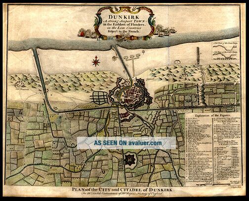
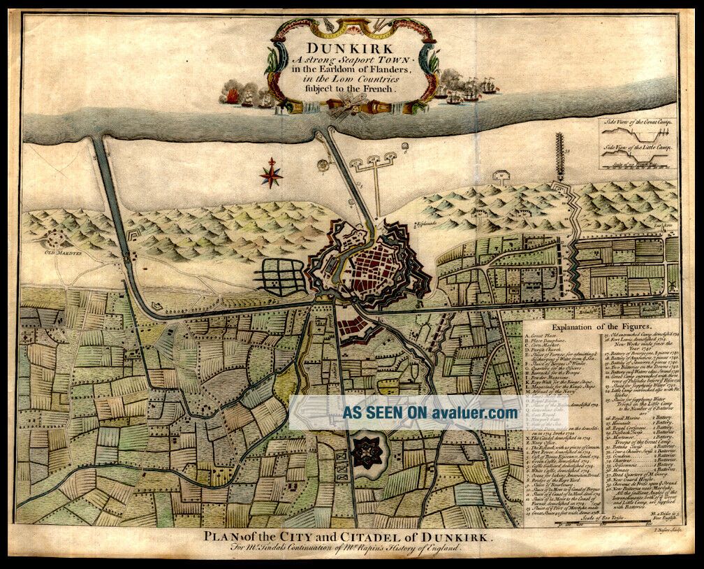
1732 Rapin De Thoyras Engraved Hand Colored Map Seaport Of Dunkirk World War II
Item History & Price
Click on the image
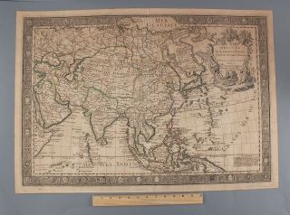
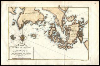
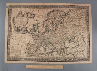
for a detailed view. An 18th Century, hand-colored map from Paul de Rapin's, The History of England by Nicholas Tindall. Douai France Old antique Plan of The City of Dunkirk. Paul de Rapin (25 March 1661 - 25 April 1725), sieur of Thoyras (and therefore styled Thoyras de Rapin), was a French historian writing under English patronage. Date: 1732, London Full Title: Plan of the City and Citadel of Dunkirk. Dunkirk, a strong seaport town in the Earldom of Fland...ers, in the Low Countries subject to the French. (18th Century Map) Size of Map: approximately 20.25in x 15.50 in.) Description: A copper engraved hand-colored map of Plan of the City and Citadel of Dunkirk. Dunkirk, a strong seaport town in the Earldom of Flanders, in the Low Countries subject to the French. Dunkirk is a small town on the coast of France that was the scene of a massive military campaign during World War II. From May 26 to June 4, 1940, some 338, 000 British Expeditionary Force (BEF) and other Allied troops were evacuated from Dunkirk to England as German forces closed in on them. The Little Ships of Dunkirk were about 850 private boats that sailed from Ramsgate in England to Dunkirk in northern France between 26 May and 4 June 1940 as part of Operation Dynamo, helping to rescue more than 336, 000 British, French, and other Allied soldiers who were trapped on the beaches at Dunkirk References: Tooley’s Dictionary of Mapmakers Revised Edition Vol. (K-P) p. 358 and Vol. (Q-Z) p. 77 A Great Gift For Any Manuscript Collector We Now Accept PayPal! We Ship Worldwide. Please Contact Us For a Free Shipping Quote!