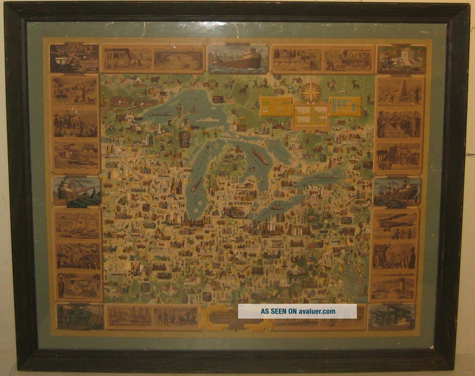
' 100 Years In Region Of GREAT LAKES ' Oglebay Norton Ships PICTORIAL MAP
Item History & Price
| Reference Number: Avaluer:31767 | Printing Technique: Lithography |
| Year: 1954 | Original/Reproduction: Vintage Original |
| Country/Region: United States of America | Type: Pictorial/Bird's Eye |
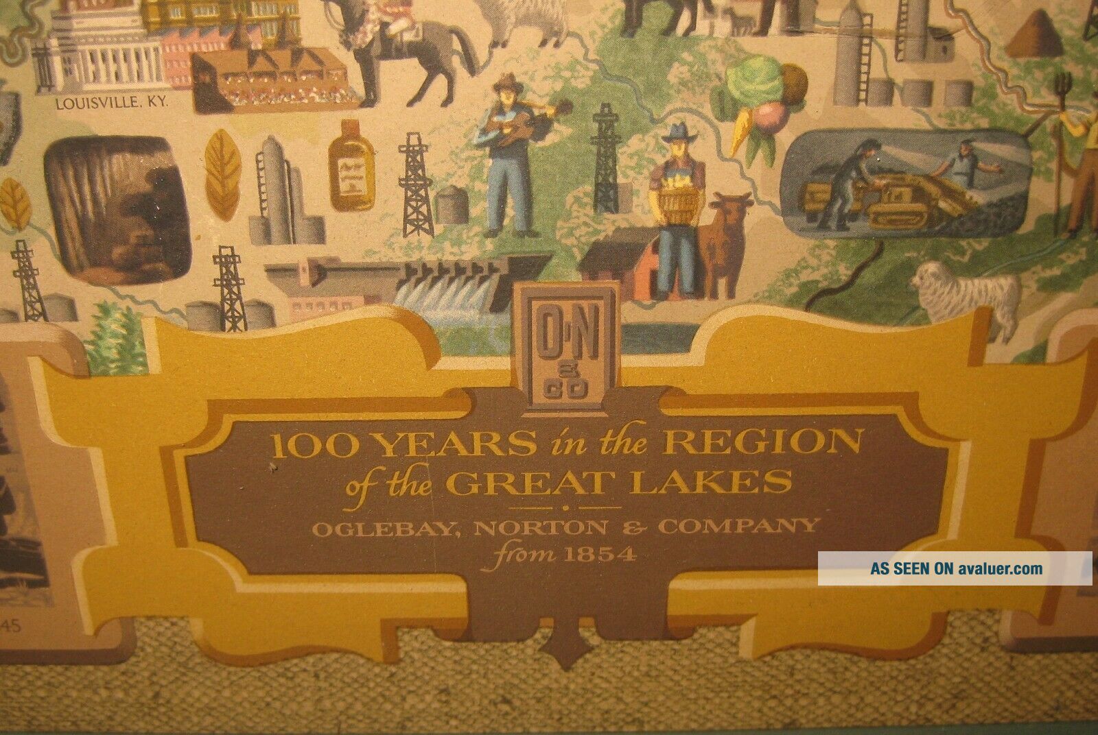
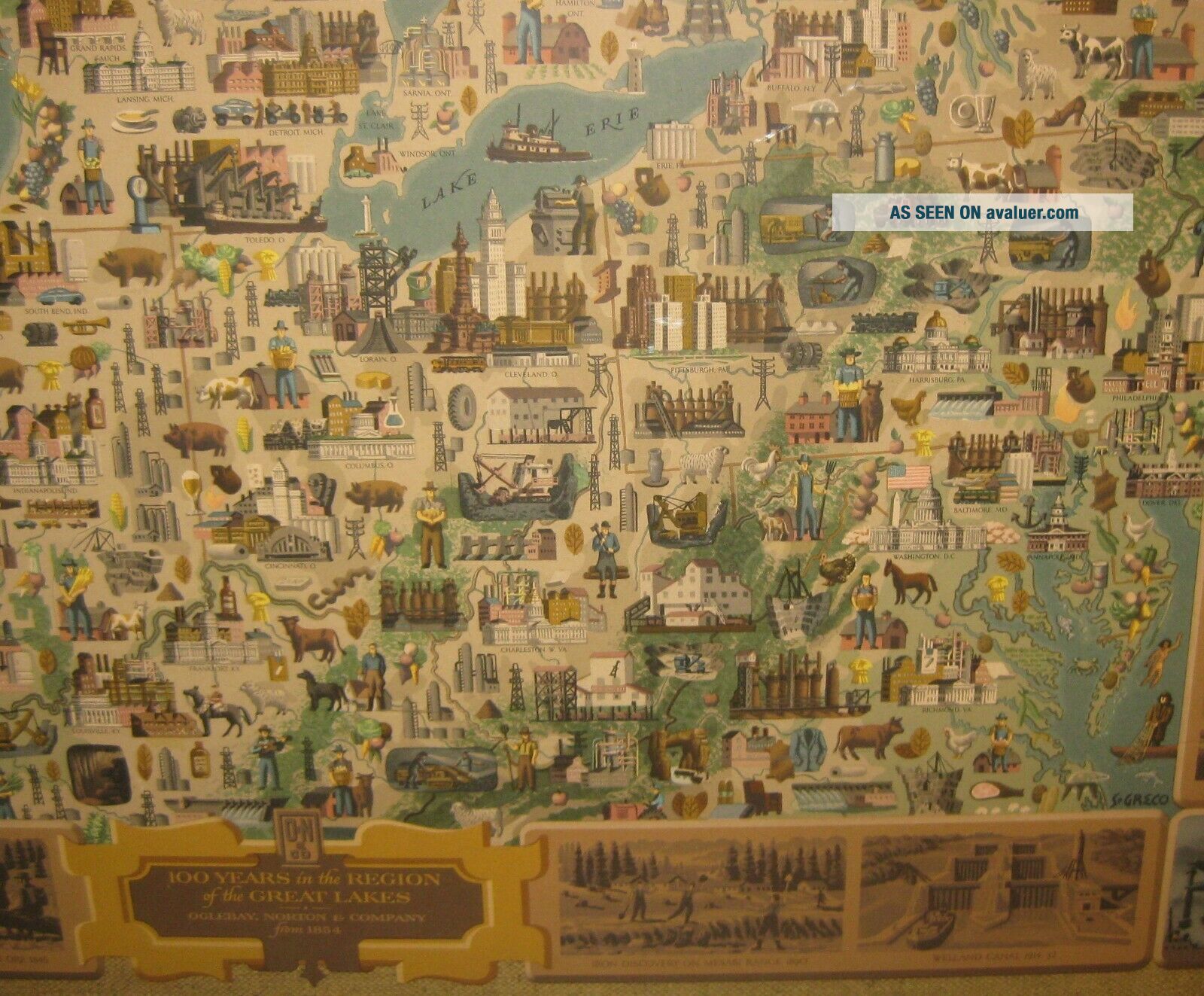
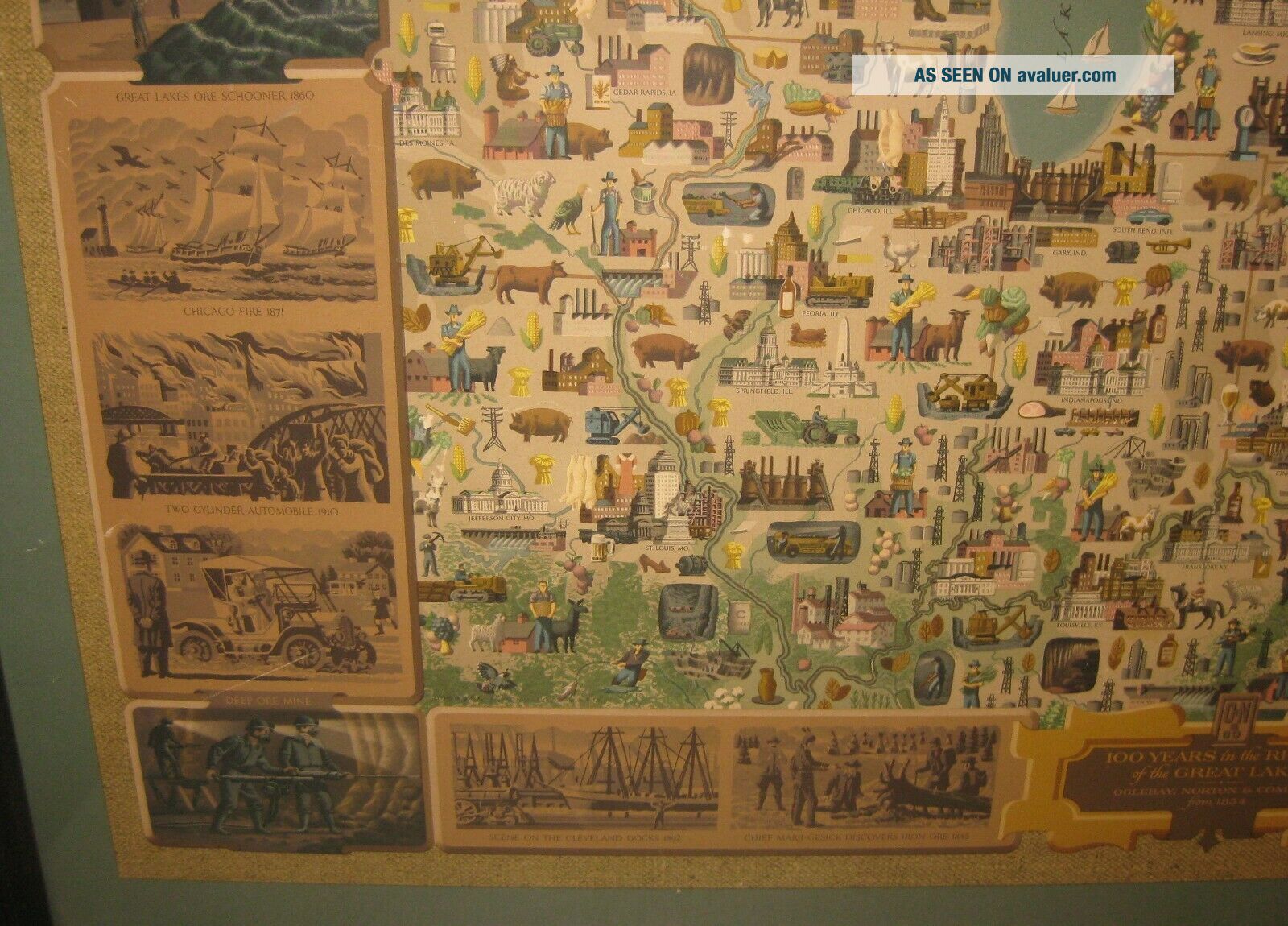
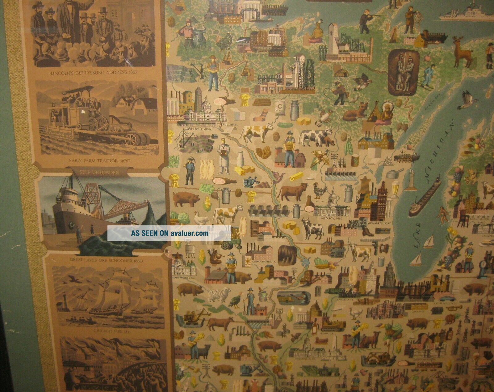
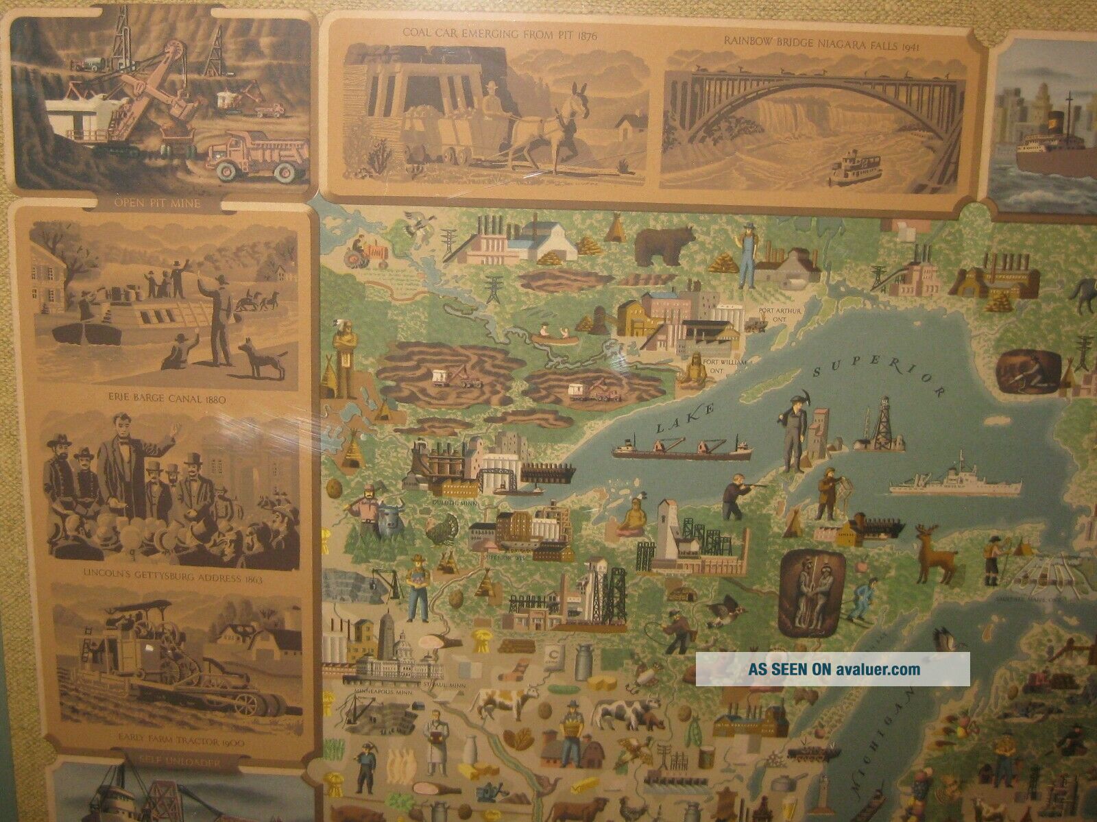
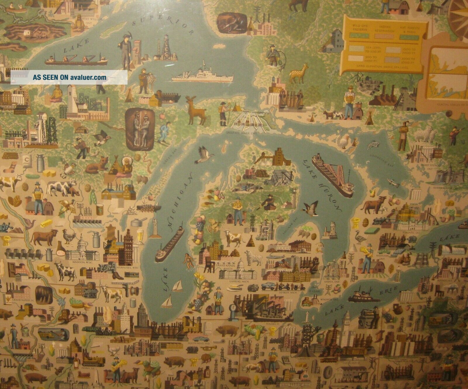
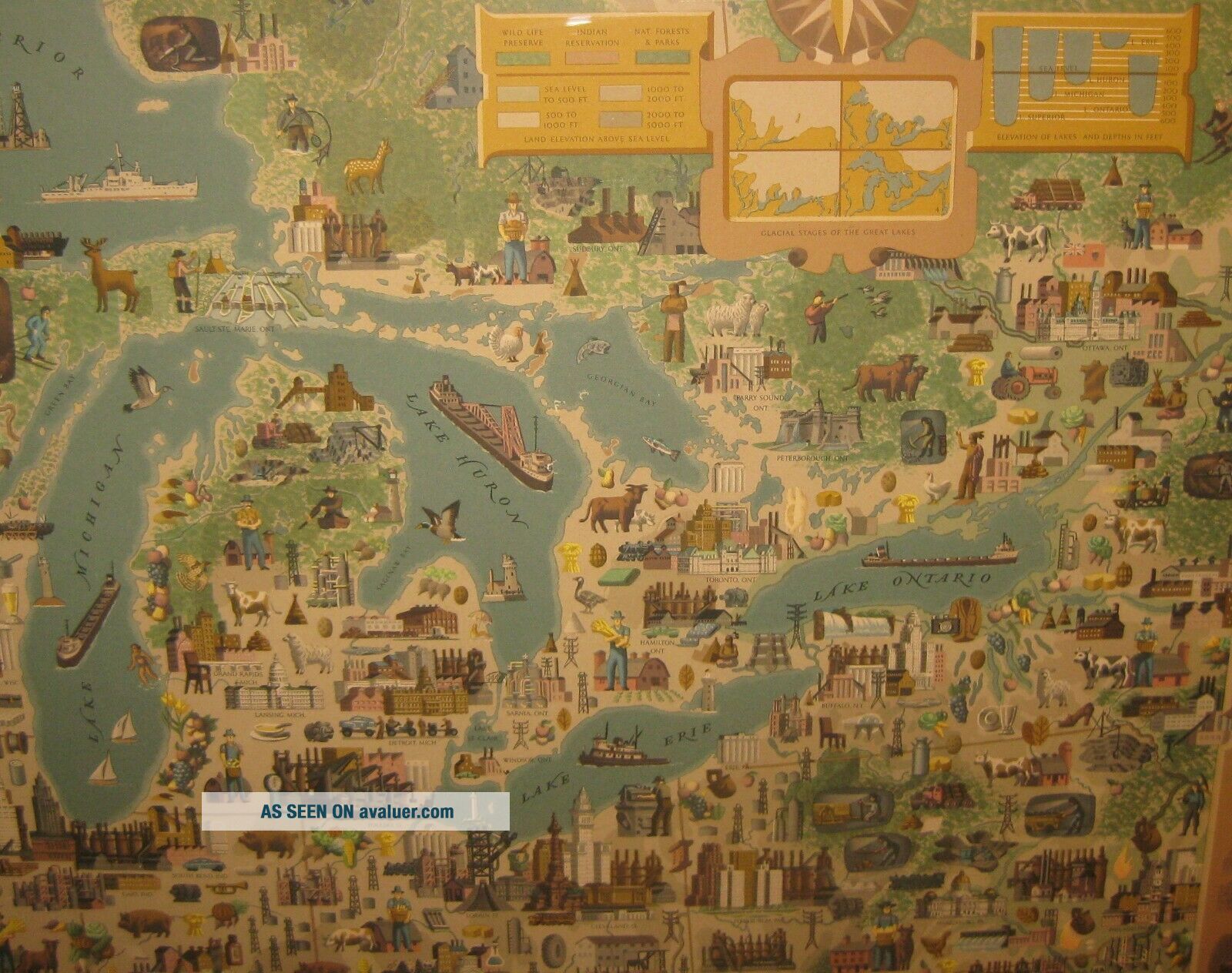
ORIGINAL '100 YEARS IN THE REGION OF THE GREAT LAKES, OGLEBAY NORTON & COMPANY FROM 1854' S GRECO PICTORIAL MAP
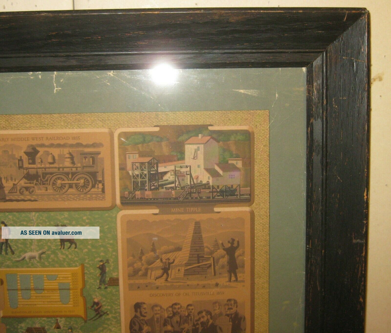
This is a great piece. For anyone that has been following my store for the last couple of years, I have been buying and selling a lot of these pictorial maps recently. They have been quite popular with both collectors and institutions and seem to be rather rare as when they were usually produced in the middle 20th Century, they were often vi...ewed as disposable and not many were kept for the long term. This is a special one as it actually crosses over from the map world also into the advertising world. This wonderful pictorial map was created by the Oglebay Norton Company which was the largest shipping company on the Great Lakes for the better part of the last 150 years. This one seems particularly rare. According to Worldcat, there are about 15 or so in institutions and historical societies but I have not been able to find another example anywhere on the market. The best description of the map comes from the company's website. I have included that below. The map itself measures about 30 x 37 inches. It is in good condition. You can see some tears in the borders of the map that show in the green as well as some minor scuffs in the map but really it displays beautifully. Wonderful crisp and clean image. Map was archival framed back in 2000 which makes for a really great presentation. Frame measures 33 x 39 1/2 inches.
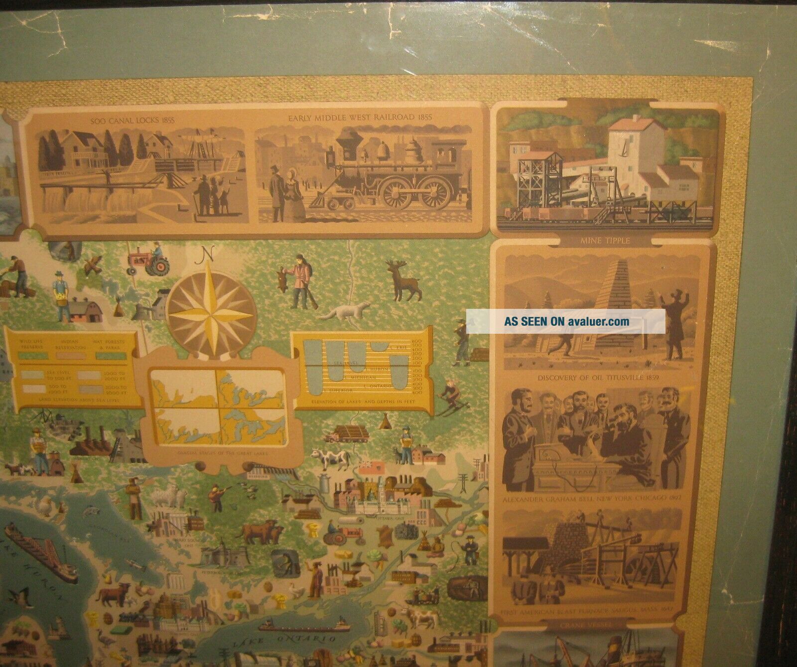
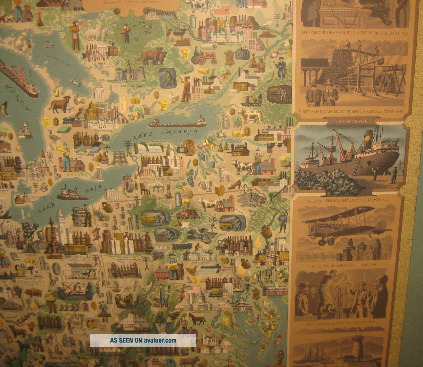
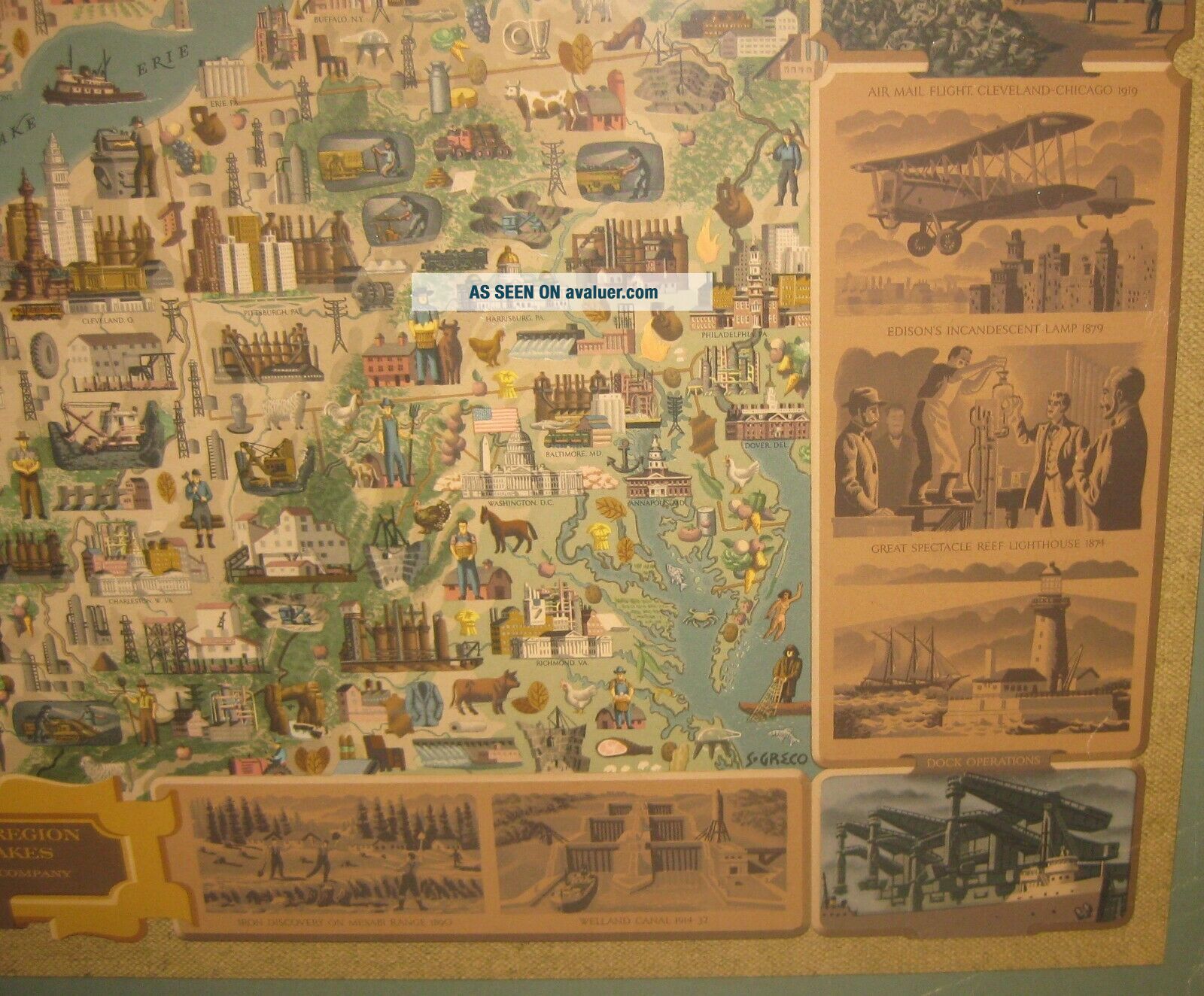
The description of this map from the company's website reads: "This pictorial map, "100 Years in the Region of the Great Lakes" was created to commemorate the 100th anniversary of Oglebay, Norton & Company. The artist, Simon Greco, wove a wealth of information into a decorative tapestry which is both an absorbing study and an attractive wall hanging. The collecting and organizing of the data for the map was supervised by Fredman-Chaite Studios of New York who employed a staff to sift the information supplied by trade associations, state governments and universities, chambers of commerce, libraries, historical societies and the Dominion of Canada. This research work required eleven months for completion. The map covers an area of approximately 1, 300, 000 square miles from 37 degrees to 49 degrees north latitude and from 73 degrees to 94 degrees west longitude. The projection is Lambert conformal. Hundreds of drawings were made to organize the elements for the map. Two preliminary paintings of the map preceded the final rendering in casein. Artist Greco carefully selected his palette of colors to preserve a uniform color balance throughout the map.
The final painting began with underlying colors to show differences in elevation of the terrain. This was followed by the forests and parks, the rivers and lakes. These topographic features are distinguished by the legend. The major task was the painting of the pictorial symbols to represent cultural features, important industries, products, agricultural centers, and natural resources. For the lettering of place names and other lettering, a special alphabet was designed. The scenes which frame the map depict some historical events which have had a lasting effect on commerce and industry within the region. Interspersed with these are seven panels in color representing the principal activities of Oglebay Norton Company and associated companies."
CHECK THE PICTURES ON THIS GREAT PIECE. DONT MISS THIS OPPORTUNITY.Shipping and handling can be calculated based on the ebay shipping calculator. If you have any questions regarding the work, please dont hesitate to ask. Pictures are an excellent indication of condition. Though the shipping says it will take 5 days of handling, usually items are shipped much faster and if you pay right away, the item most likely will go out in the next day or two. If there is any problems with the item please dont hesitate to email me. I guarantee and stand 100% behind everything I sell. No reason to open up any sort of cases. Just simply contact me and I will handle any and all problems. Out of the nearly 500 items I ship around the world every year, a very few of them occasionally get lost or broken. I insure every item and will handle all insurance claims and make sure you are reimbursed 100%. Check my feedback. After nearly 15 years of selling on ebay, my reputation speaks for itself. If you are not happy with your purchase, I will work to make sure you are. Thanks again for your interest and bidding.
00062
This is a great piece. For anyone that has been following my store for the last couple of years, I have been buying and selling a lot of these pictorial maps recently. They have been quite popular with both collectors and institutions and seem to be rather rare as when they were usually produced in the middle 20th Century, they were often vi...ewed as disposable and not many were kept for the long term. This is a special one as it actually crosses over from the map world also into the advertising world. This wonderful pictorial map was created by the Oglebay Norton Company which was the largest shipping company on the Great Lakes for the better part of the last 150 years. This one seems particularly rare. According to Worldcat, there are about 15 or so in institutions and historical societies but I have not been able to find another example anywhere on the market. The best description of the map comes from the company's website. I have included that below. The map itself measures about 30 x 37 inches. It is in good condition. You can see some tears in the borders of the map that show in the green as well as some minor scuffs in the map but really it displays beautifully. Wonderful crisp and clean image. Map was archival framed back in 2000 which makes for a really great presentation. Frame measures 33 x 39 1/2 inches.
The description of this map from the company's website reads: "This pictorial map, "100 Years in the Region of the Great Lakes" was created to commemorate the 100th anniversary of Oglebay, Norton & Company. The artist, Simon Greco, wove a wealth of information into a decorative tapestry which is both an absorbing study and an attractive wall hanging. The collecting and organizing of the data for the map was supervised by Fredman-Chaite Studios of New York who employed a staff to sift the information supplied by trade associations, state governments and universities, chambers of commerce, libraries, historical societies and the Dominion of Canada. This research work required eleven months for completion. The map covers an area of approximately 1, 300, 000 square miles from 37 degrees to 49 degrees north latitude and from 73 degrees to 94 degrees west longitude. The projection is Lambert conformal. Hundreds of drawings were made to organize the elements for the map. Two preliminary paintings of the map preceded the final rendering in casein. Artist Greco carefully selected his palette of colors to preserve a uniform color balance throughout the map.
The final painting began with underlying colors to show differences in elevation of the terrain. This was followed by the forests and parks, the rivers and lakes. These topographic features are distinguished by the legend. The major task was the painting of the pictorial symbols to represent cultural features, important industries, products, agricultural centers, and natural resources. For the lettering of place names and other lettering, a special alphabet was designed. The scenes which frame the map depict some historical events which have had a lasting effect on commerce and industry within the region. Interspersed with these are seven panels in color representing the principal activities of Oglebay Norton Company and associated companies."
CHECK THE PICTURES ON THIS GREAT PIECE. DONT MISS THIS OPPORTUNITY.Shipping and handling can be calculated based on the ebay shipping calculator. If you have any questions regarding the work, please dont hesitate to ask. Pictures are an excellent indication of condition. Though the shipping says it will take 5 days of handling, usually items are shipped much faster and if you pay right away, the item most likely will go out in the next day or two. If there is any problems with the item please dont hesitate to email me. I guarantee and stand 100% behind everything I sell. No reason to open up any sort of cases. Just simply contact me and I will handle any and all problems. Out of the nearly 500 items I ship around the world every year, a very few of them occasionally get lost or broken. I insure every item and will handle all insurance claims and make sure you are reimbursed 100%. Check my feedback. After nearly 15 years of selling on ebay, my reputation speaks for itself. If you are not happy with your purchase, I will work to make sure you are. Thanks again for your interest and bidding.
00062