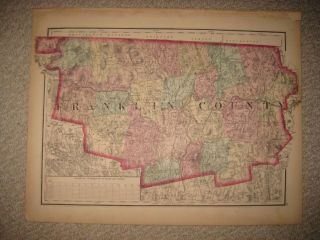
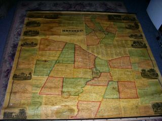
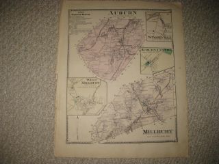
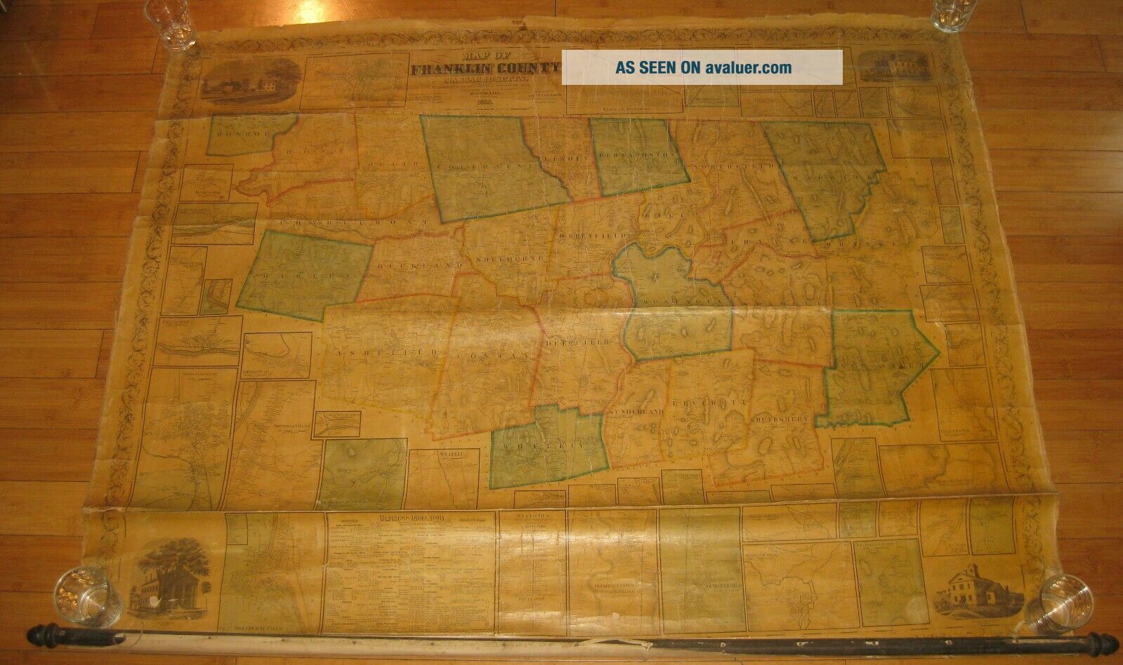
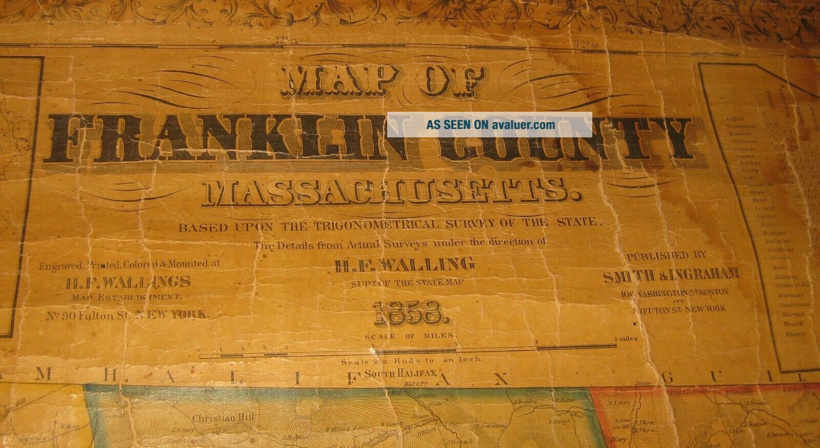
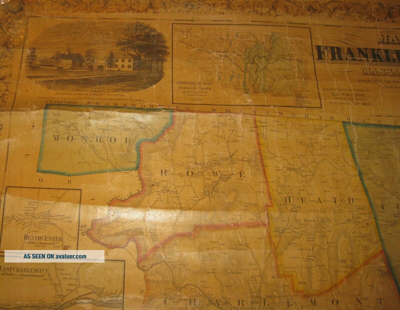
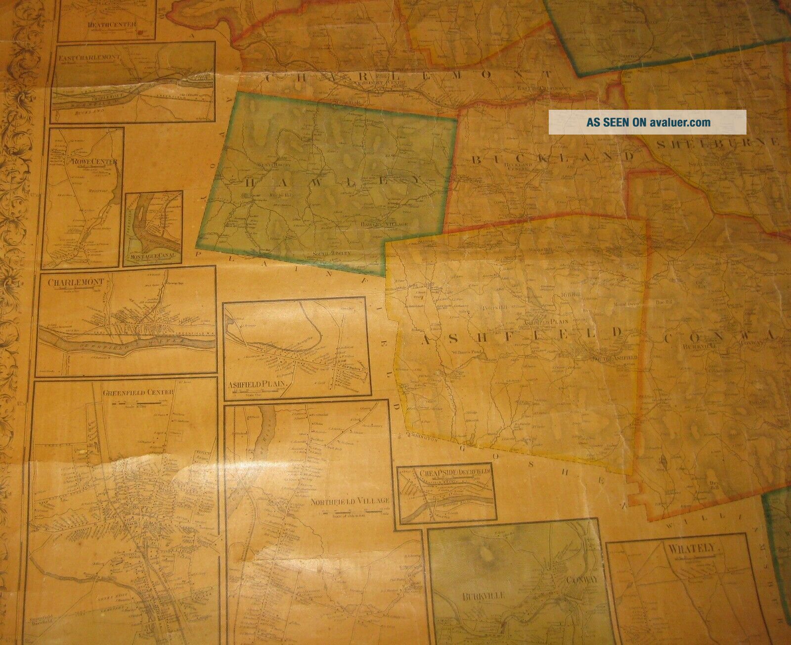
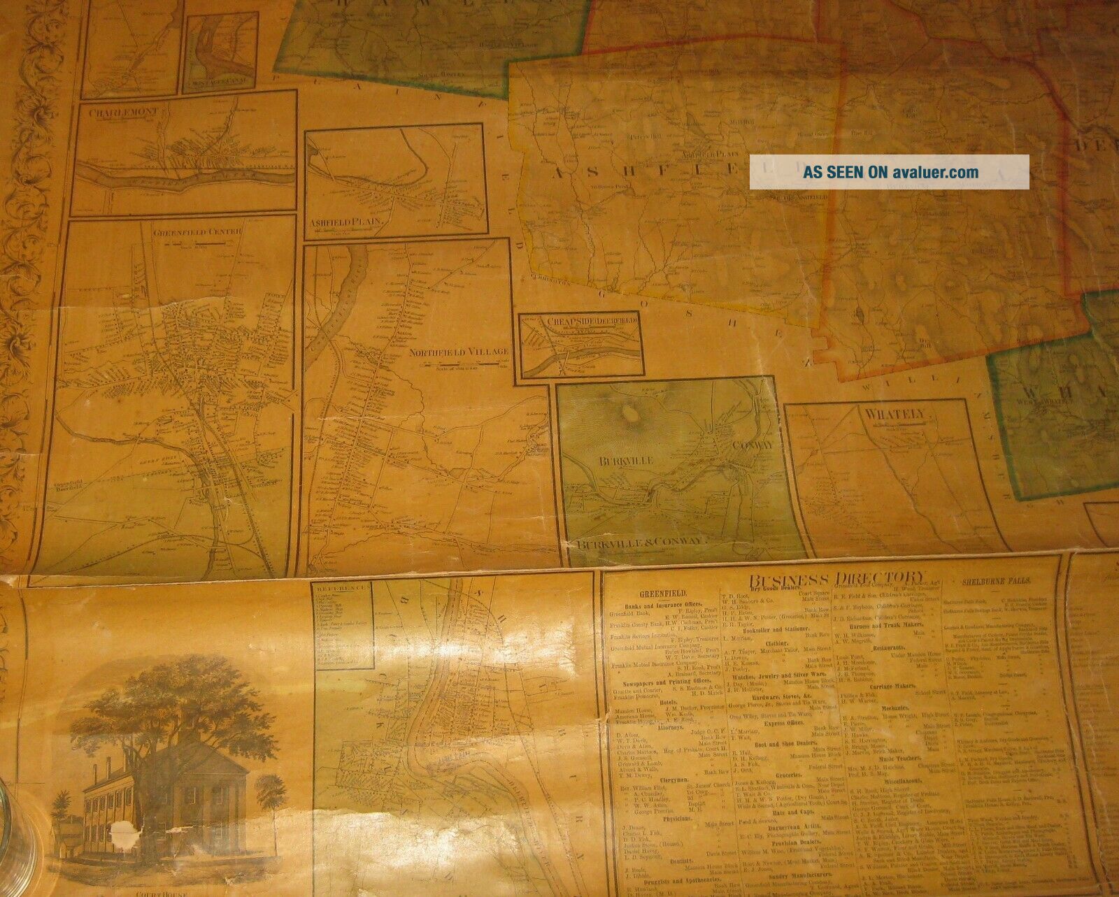
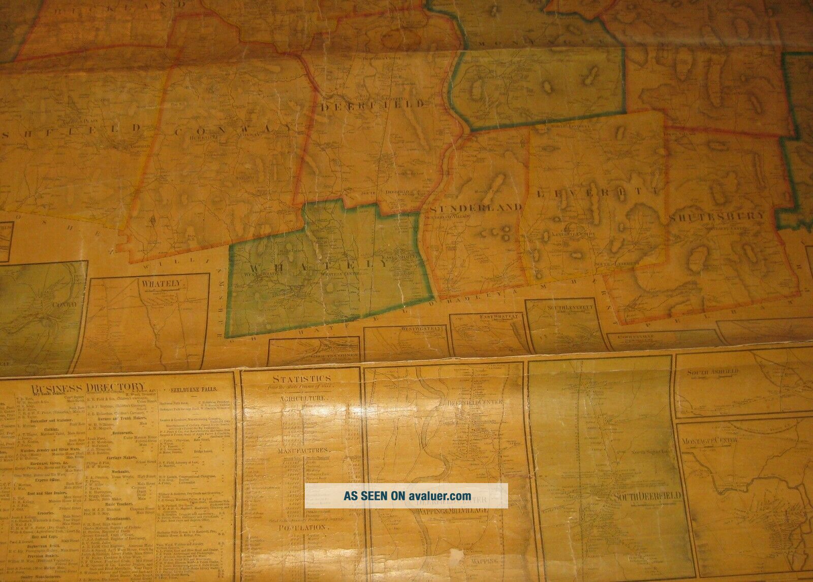
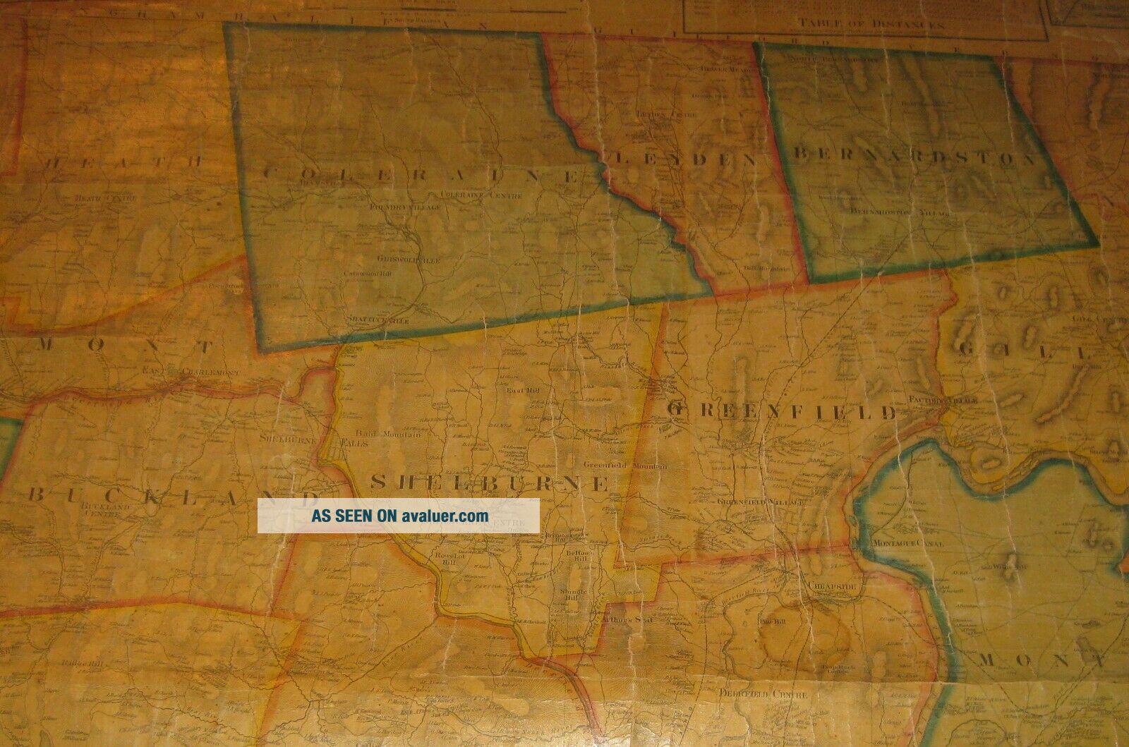
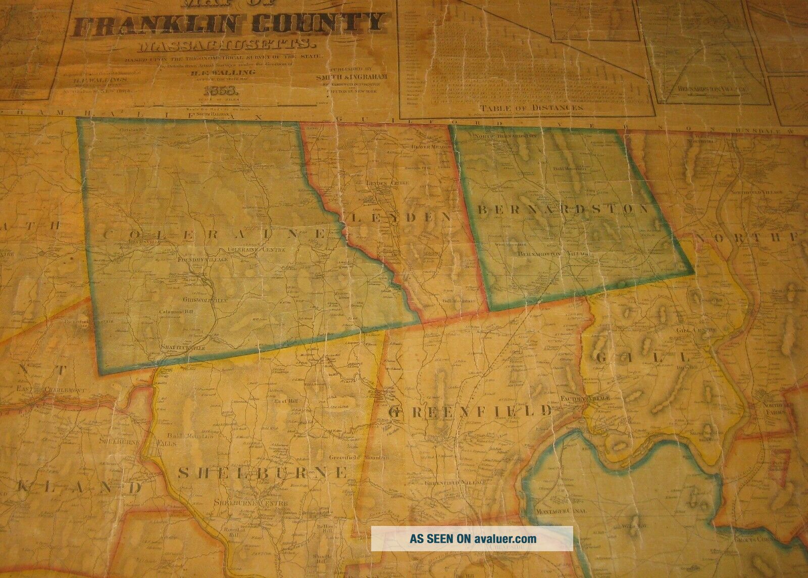
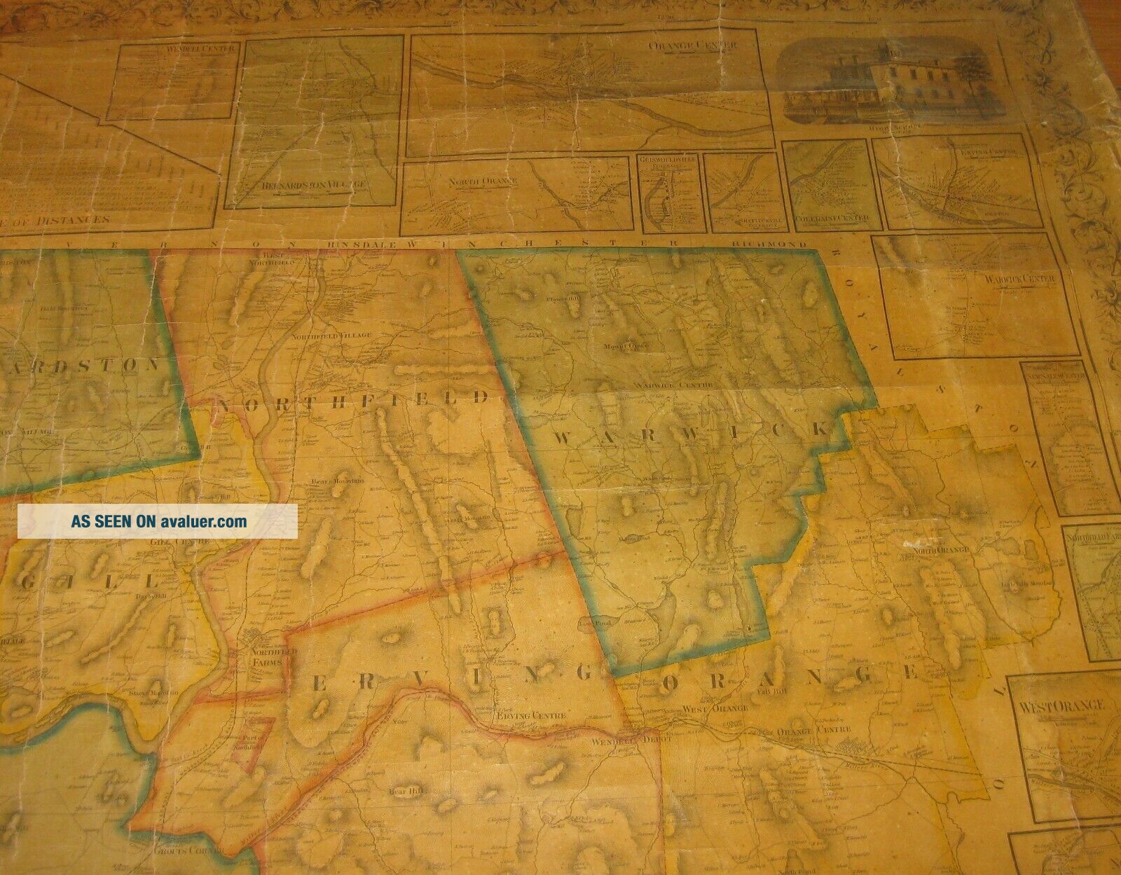
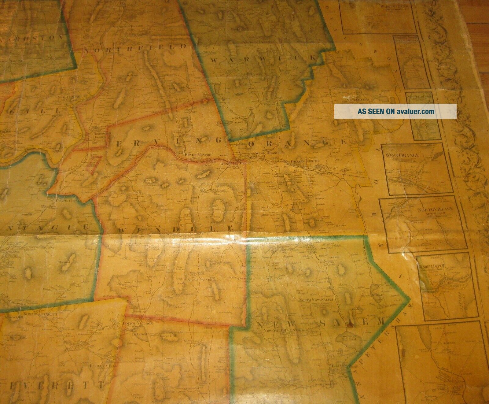
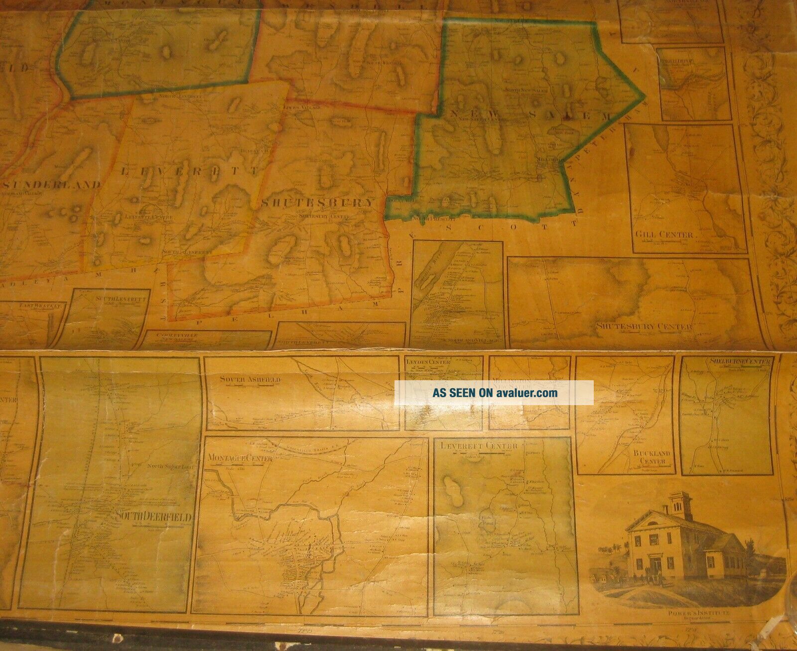
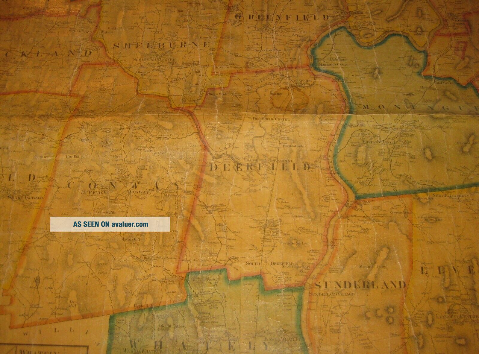
RARE Antique 1858 Henry Walling FRANKLIN COUNTY MASSACHUSETTS Wall MAP
Item History & Price
| Reference Number: Avaluer:29436 | Cartographer/Publisher: Henry Walling |
| Year: 1852 | Original/Reproduction: Antique Original |
| US State: Massachusetts | Format: Wall Map |
| Date Range: 1858 | Type: City Map |
| Topic: Maps |
ORIGINAL 1858 HENRY WALLING 'FRANKLIN COUNTY MASSACHUSETTS' WALL MAP
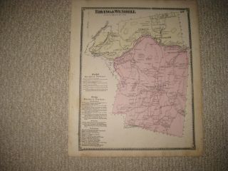
This is just a great original piece. This is a wonderful scarce map. I have been buying these Walling wall maps for quite a few years as they are getting more and more scarce. Especially the good ones. With all the ones I have seen around Massachusetts this is actually the first I have seen of Franklin County. Being the least populated County in Massachusetts, I am getting the impr...ession that this was one of the least printed of all the county maps. There are ones in institutions that I can find but none on the market and I cant find any historical sales records. Overall, this one is in excellent condition. The map measures 51 x 63 inches. Missing the top rail. The bottom original wood rail is still partially connected. As you can see in the pictures, the map is in very good condition. It has toned consistently with still strong original color outlines of the towns. There is a small water stain center top margin but it is faint and barely extends into the map. There is some minor creasing in some areas with only one really strong crease that goes from side to side along the bottom quarter of the map. There is some minor losses at the very edges as well as some selvage loss and tearing but still all in all very good. Really a good example of this scarce county map. Pictures are an excellent indication of condition. If you collect Walling maps or other antique 19th Century wall maps, check my store for the many I am offering. Happy to work with you if you are interested in buying more than one.
CHECK THE PICTURES ON THIS GREAT PIECE. DONT MISS THIS OPPORTUNITY. Shipping and handling can be calculated based on the ebay shipping calculator. If you have any questions regarding the work, please dont hesitate to ask. Pictures are an excellent indication of condition. Though the shipping says it will take 5 days of handling, usually items are shipped much faster and if you pay right away, the item most likely will go out in the next day or two. If there is any problems with the item please dont hesitate to email me. I guarantee and stand 100% behind everything I sell. No reason to open up any sort of cases. Just simply contact me and I will handle any and all problems. Out of the nearly 500 items I ship around the world every year, a very few of them occasionally get lost or broken. I insure every item and will handle all insurance claims and make sure you are reimbursed 100%. Check my feedback. After nearly 15 years of selling on ebay, my reputation speaks for itself. If you are not happy with your purchase, I will work to make sure you are. Thanks again for your interest and bidding.
00032