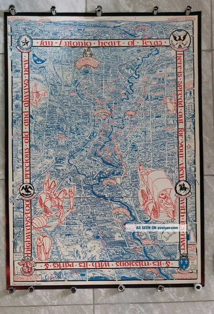
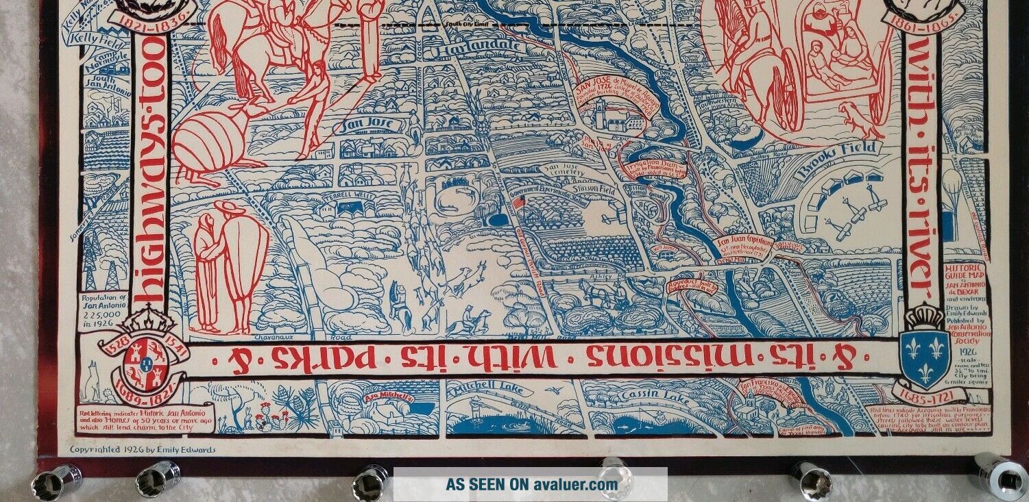
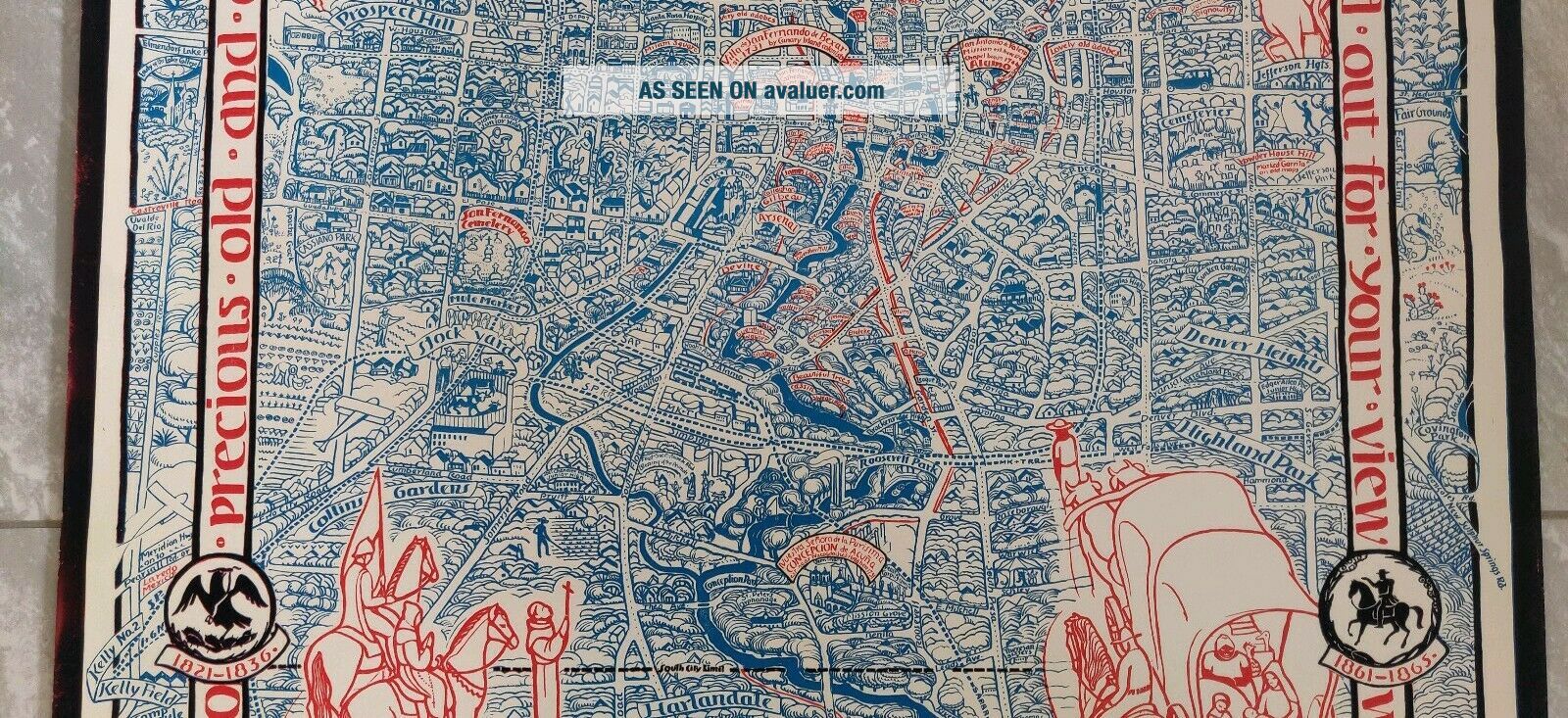
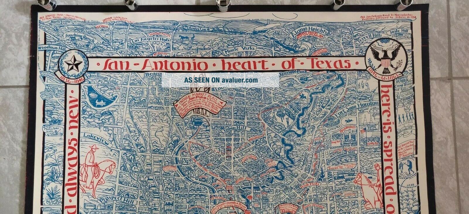
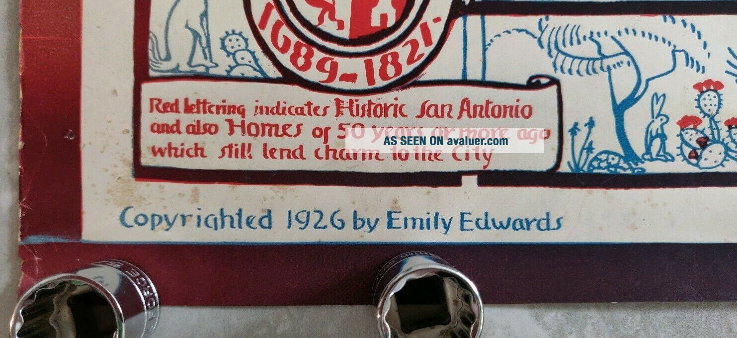
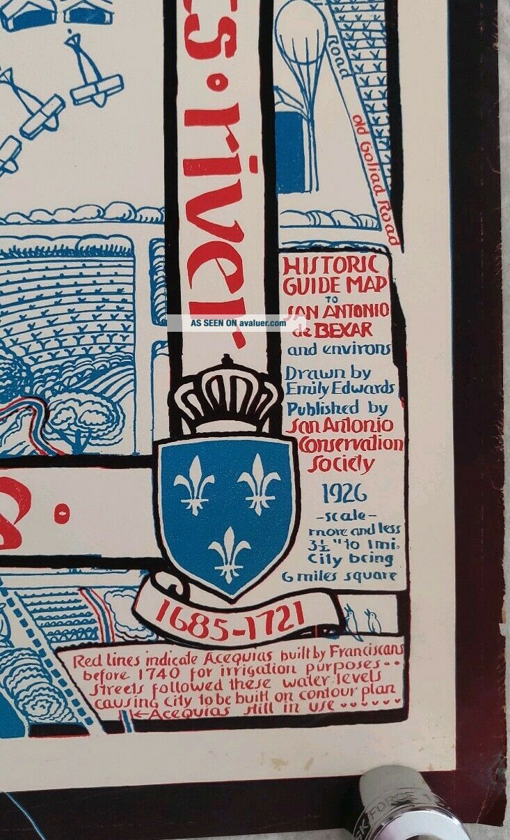
Emily Edwards 1929 Pictorial Map Historic Guide Map San Antonio De Bexar Texas
Item History & Price
| Reference Number: Avaluer:28501 | Year: 1929 |
| US State: TX | Cartographer/Publisher: Emily Edwards |
| City: San Antonio | Type: City Map |
| Country/Region: North America |
Emily Edwards 1929 Pictorial Map Historic Guide Map to San Antonio de Bexar
1926 Map of San Antonio created to benefit the San Antonio Conservation Society. The Artist, Emily Edwards (1888-1980) was an important figure both in San Antonio and elsewhere, a lifelong friend and student of Diego Rivera and a director of Hull House in Chicago. The map measures about 28" by 39". Has been stored rolled and will be shipped in a tube. Rare example.
Rest assured that your item will be... packaged well and with care.Texas residents will pay an 8.25% sales tax. Please note that Ebay is also collecting sales tax from some state residents.As always, please don't hesitate to message me with any questions that you may have about the piece. It is my goal to make sure all bidders feel comfortable with their purchase. Thank you for looking and happy bidding!