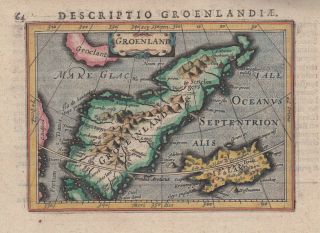
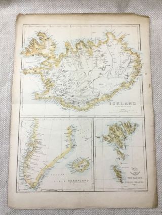
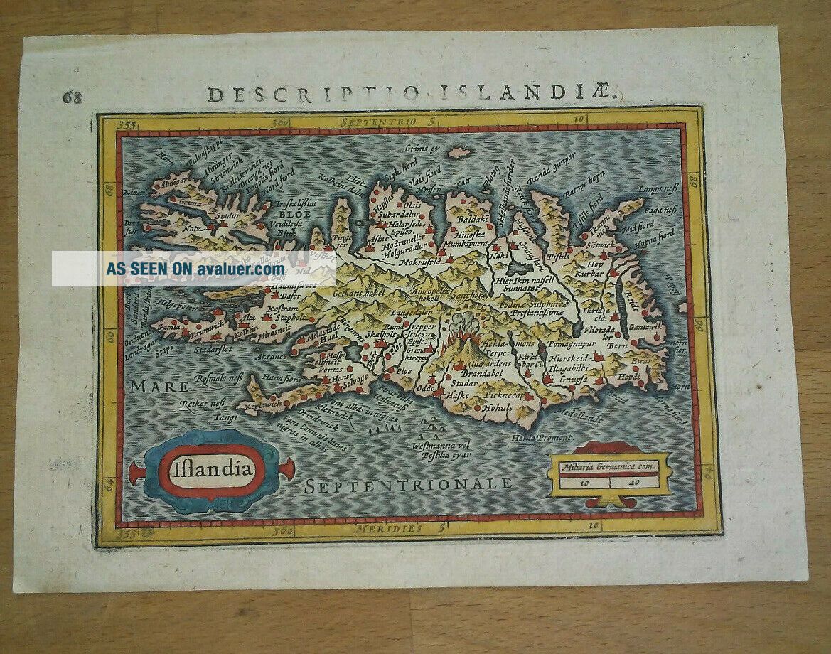
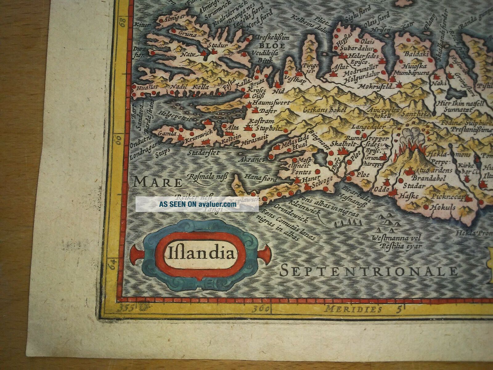
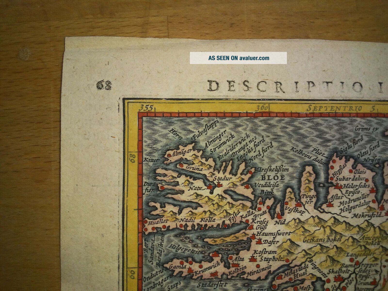
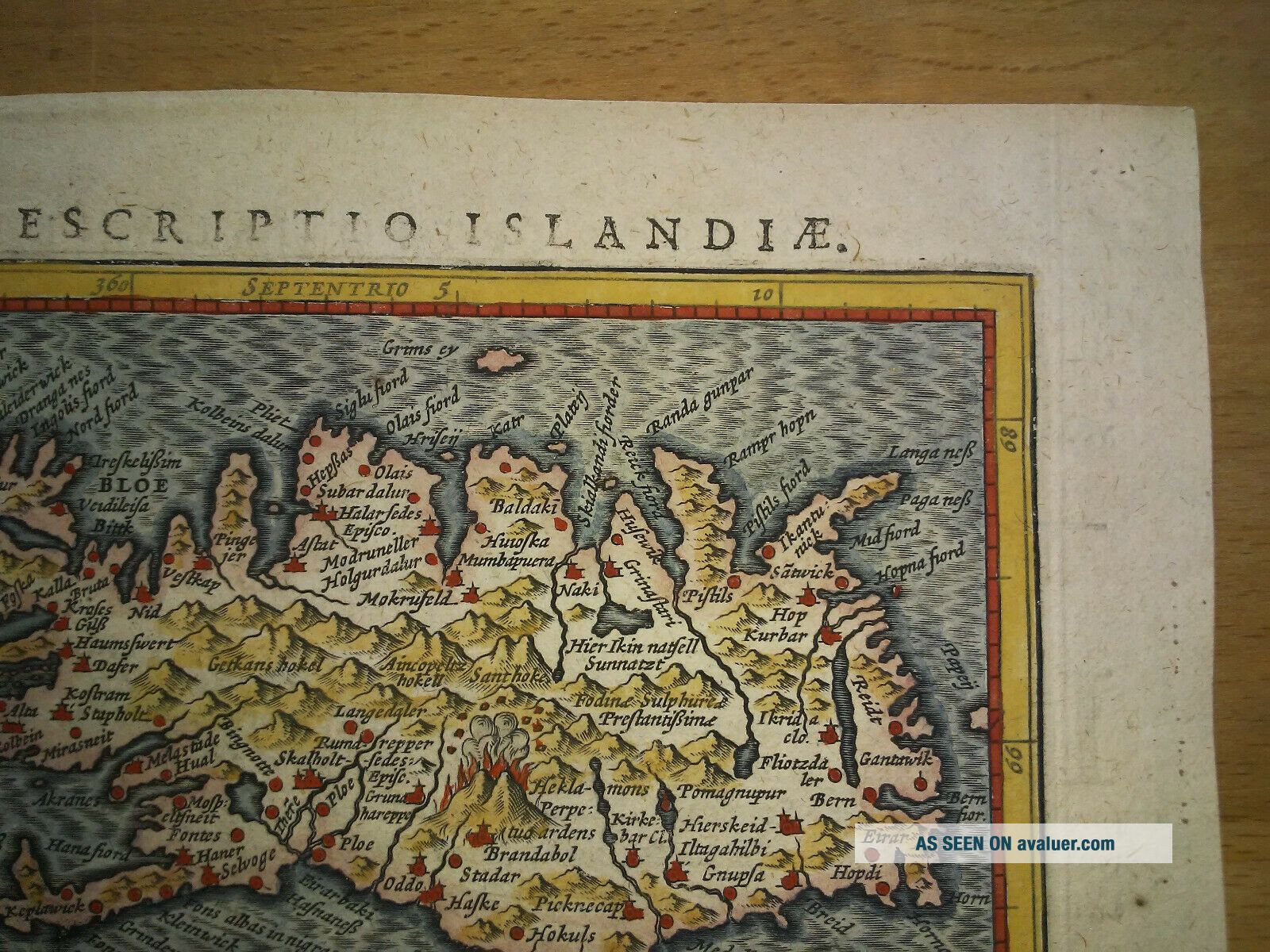
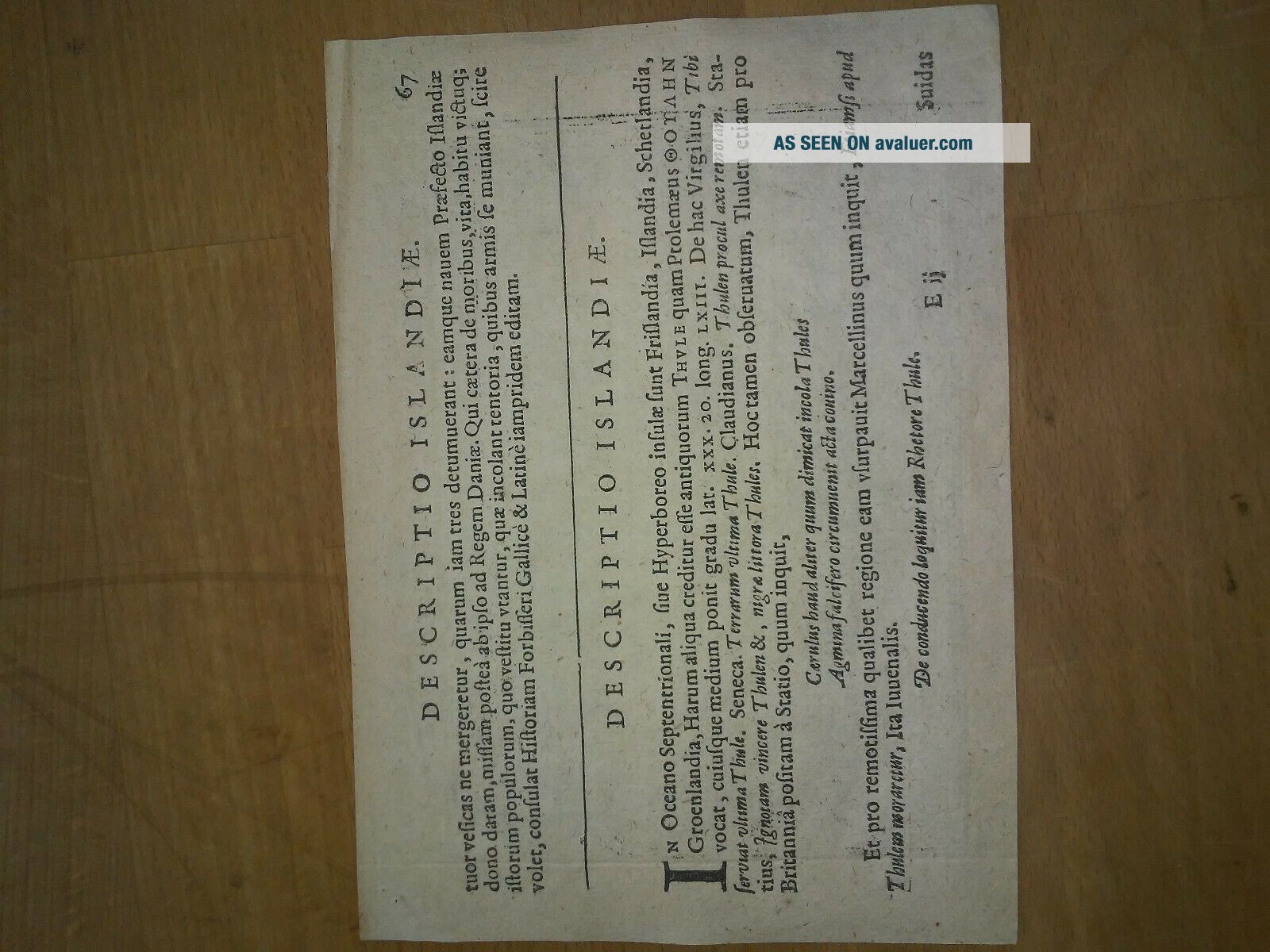
1616 Atlas Map Of Iceland.


Item History & Price

Information:
Reference Number: Avaluer:15891Type: County Map
Country/Region: Iceland
Original Description:
This is an original map of Iceland.  1616 atlas entitled 'Tabularum geographicarum contractarum' by Petrus Bertius.. Condition is clearly visible in the photos.  The paper measures 11.9 cm by 16.4 cm.


    Similar items


  • 1616 Lovely Bertius Map Of Iceland & Greenland

    1616 Lovely Bertius Map Of Iceland & Greenland

  • Vintage Hagstrom Atlas Map Of Hunterdon County Nj 1996 Paperback

    Vintage Hagstrom Atlas Map Of Hunterdon County Nj 1996 Paperback

  • Vintage Hagstrom Atlas Map Of Somerset Hunterdon Mercer Counties Nj 2004

    Vintage Hagstrom Atlas Map Of Somerset Hunterdon Mercer Counties Nj 2004

  • Edward Stanford 1:5274720 Linen Backed London Atlas Map Of Br.  Columbia - C.  1910

    Edward Stanford 1:5274720 Linen Backed London Atlas Map Of Br. Columbia - C. 1910

  • Antique Colton

    Antique Colton ' S Atlas Map Of Hawaii Sandwich Islands South Pacifc Tribal

  • 1863 Rare Antique Mitchell Atlas Map Of York City - Handcolored

    1863 Rare Antique Mitchell Atlas Map Of York City - Handcolored

  • 1863 Rare Antique Mitchell Atlas Map Of Texas - Handcolored

    1863 Rare Antique Mitchell Atlas Map Of Texas - Handcolored

  • Antique Map Of Iceland Greenland Faeroe Islands 19th Century Old Hand Coloured

    Antique Map Of Iceland Greenland Faeroe Islands 19th Century Old Hand Coloured


    • You might also like


    • Hungary & Romania 1579 (1584) Ortelius Unusual Antique Copper Engraved Map

      Hungary & Romania 1579 (1584) Ortelius Unusual Antique Copper Engraved Map

    • Brussels Bruxelles Belfium 1777 De Ferraris & Dupuis Large Antique Map Sheet Xxi

      Brussels Bruxelles Belfium 1777 De Ferraris & Dupuis Large Antique Map Sheet Xxi

    • Kazan Russia 1767 Le Clerc/lespinasse Antique Copper Engraved City View

      Kazan Russia 1767 Le Clerc/lespinasse Antique Copper Engraved City View

    • 1899 Stanford,  Folding Map Of Norwich,  Norfolk,  Arthur Collins,  Jarrold & Sons,

      1899 Stanford, Folding Map Of Norwich, Norfolk, Arthur Collins, Jarrold & Sons,

    • 1948 Vintage Linen Colour Map Geological Survey Ten Mile Of Great Britain

      1948 Vintage Linen Colour Map Geological Survey Ten Mile Of Great Britain

    • 1944 Map Flying Bombs Sussex Ww2 Newspaper Military Kent Courier German V1 V2

      1944 Map Flying Bombs Sussex Ww2 Newspaper Military Kent Courier German V1 V2

    • Singapore 1964 Ordnace Survey Map

      Singapore 1964 Ordnace Survey Map

Avaluer          About Us          Privacy Policy          Contact Us          UP
© 2022, avaluer.net, Inc. or its affiliates