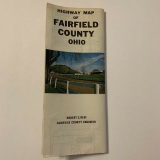
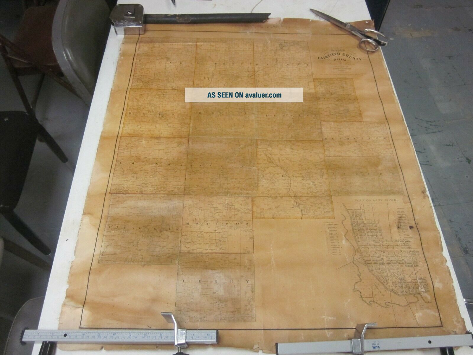
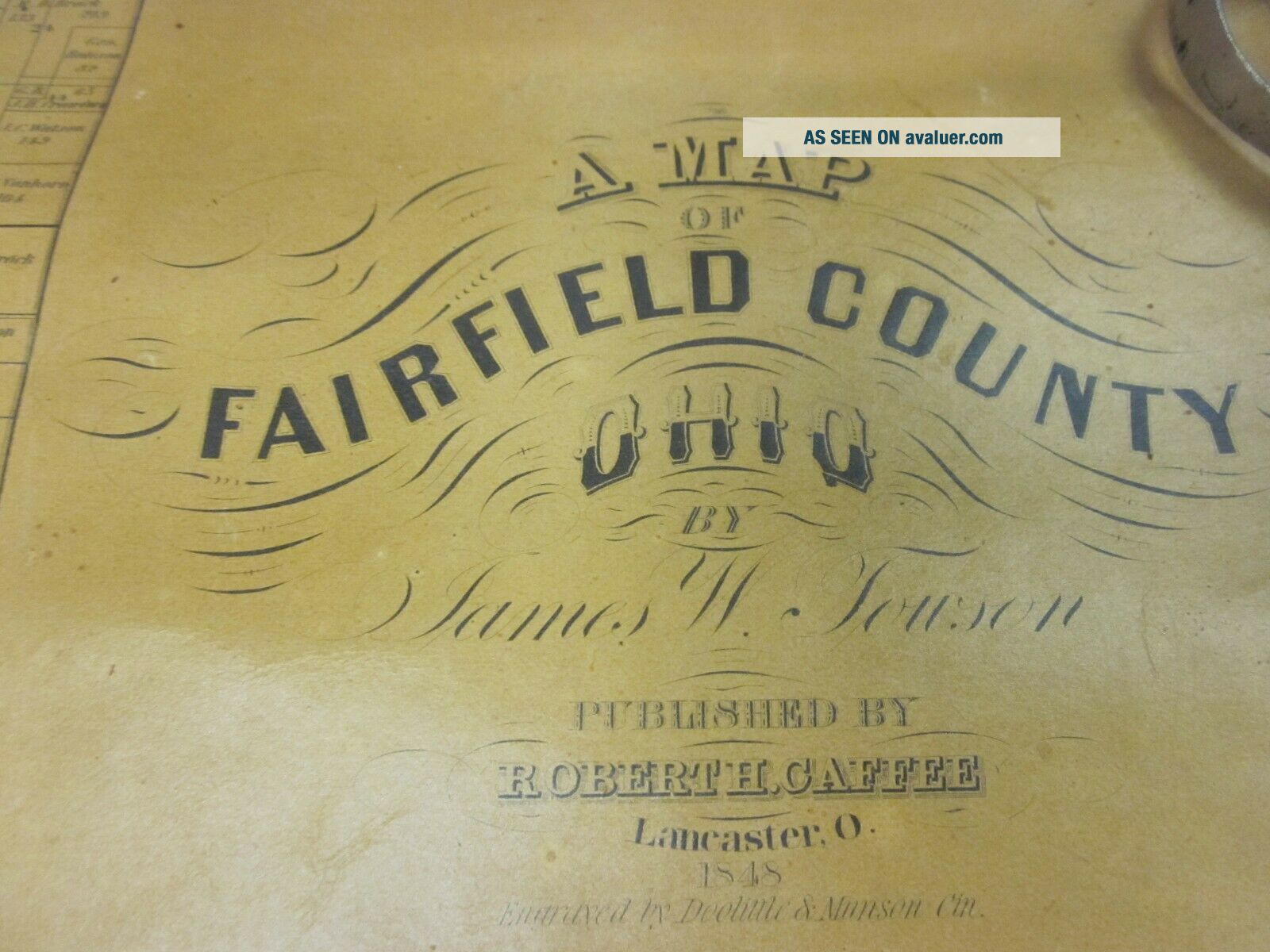
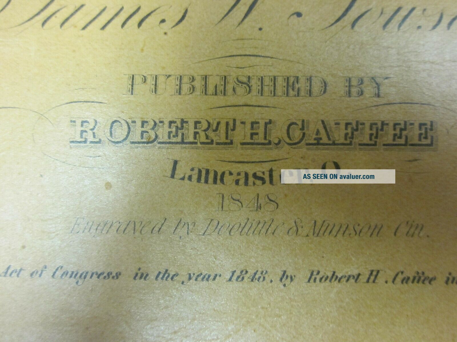
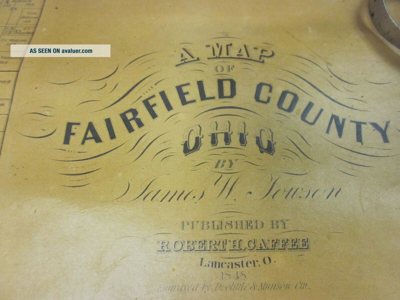
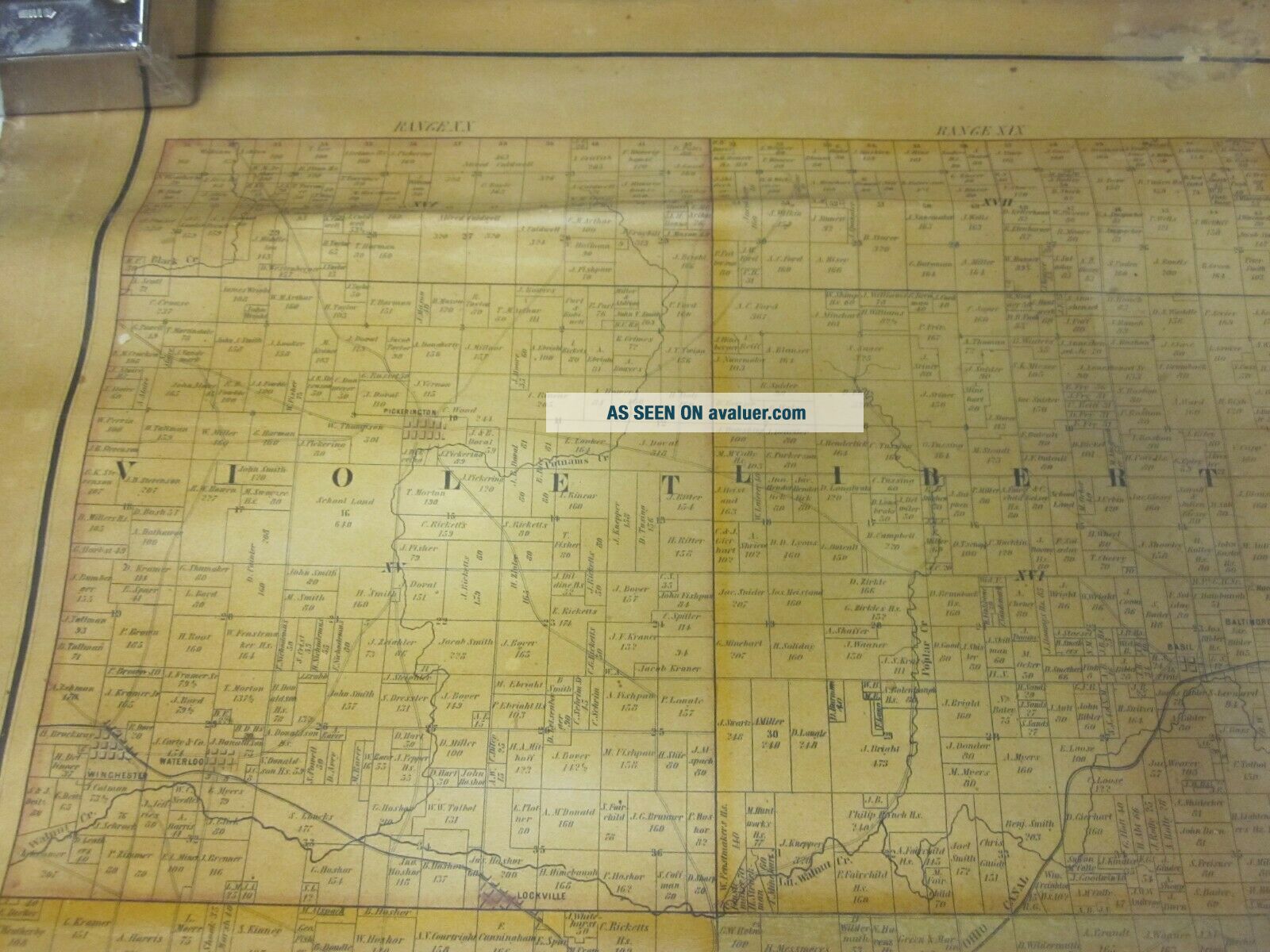
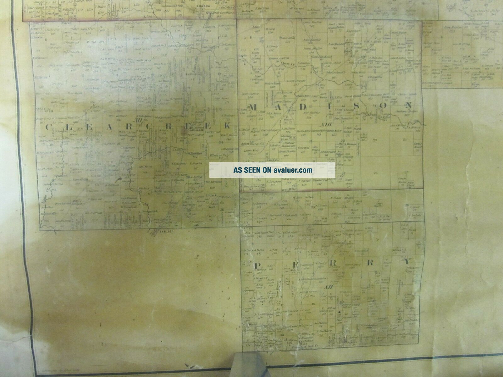
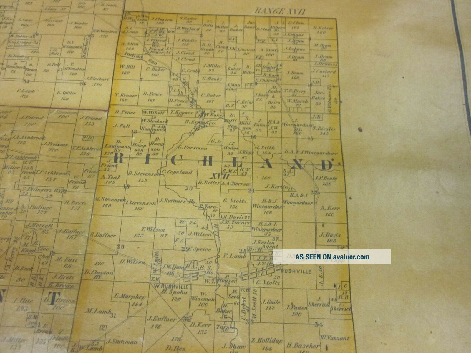
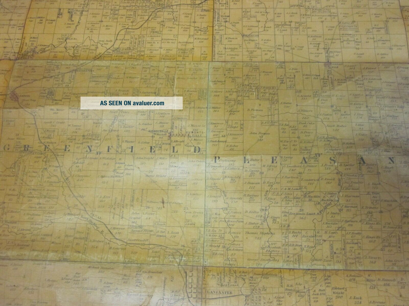
1848 FAIRFIELD COUNTY OHIO STATE ANTIQUE MAP LANCASTER 35 " X 28 "


Item History & Price

Information:
Reference Number: Avaluer:15670Cartographer/Publisher: US GOV
Year: 1848Printing Technique: Lithography
US State: OHIOOriginal/Reproduction: Antique Original
Date Range: 1800-1899Format: Sheet Map
City: LANCASTER OHIOType: MAP
Country/Region: United States of America
Original Description:
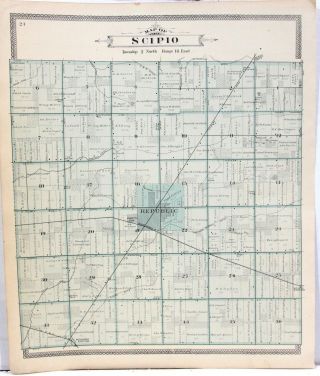
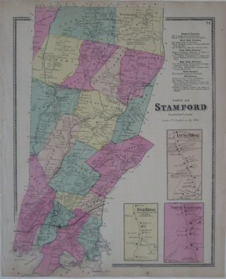
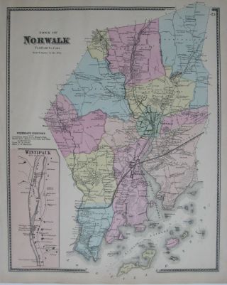
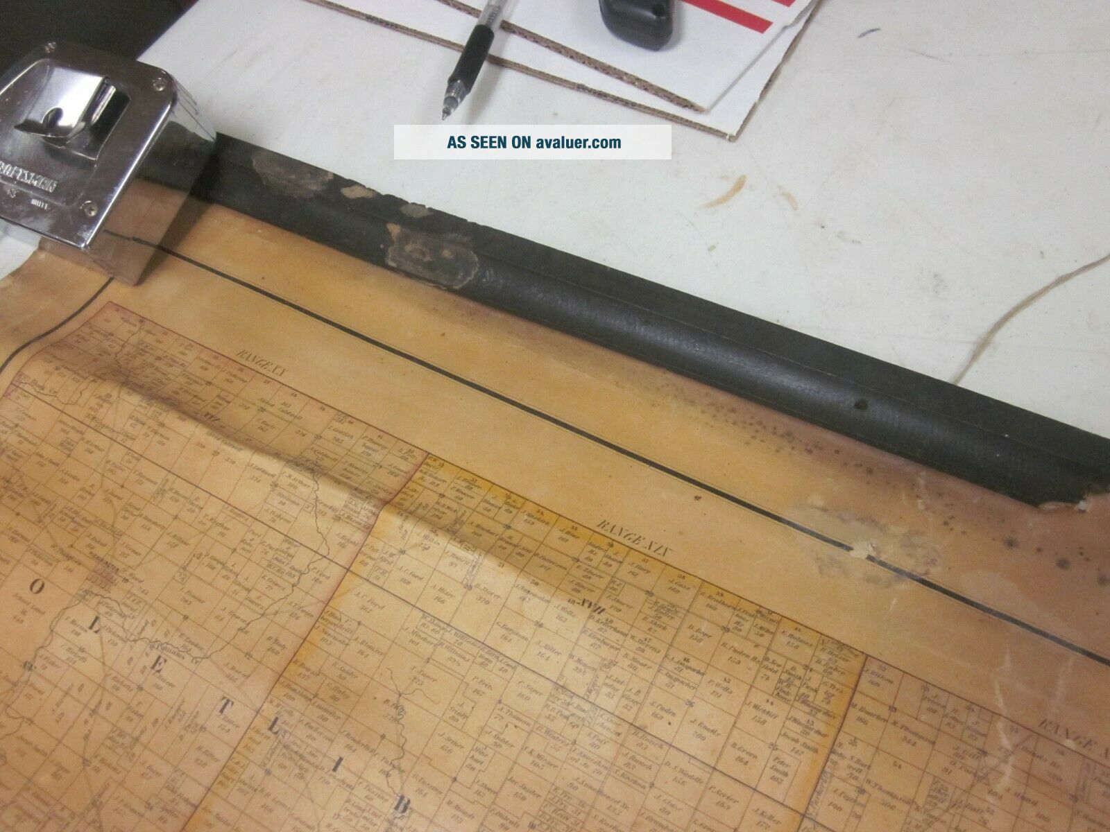
HELLO, FOR AUCTION I'M OFFERING AN ANTIQUE PLAN MAP OF FAIRFIELD COUNTY OHIO WITH THE CITY OF LANCASTER SHOWN.ON THE MAP EACH PARCEL OF LAND IN EACH TOWNSHIP HAS THE LAND OWNERS NAME AND THE ACREAGE.THE MAP WOULD HAVE HUNG ON A WALL OR OFFICE/BANK AND HAS HALF OF THE WOODEN FRAME THAT THE MAP HANGS FROM WITH TACKS.VERY OLD BUT STILL VERY LEGIBLE AND A NICE COLLECTOR PIECE.CHECK MY PHOTOS FOR DETAILS AS THEY ARE PART OF MY DESCRIPTION.LOW PRICE THANKS FOR LOOKING.SHIPS AT 3-4 POUND RATE... IN A SECURE USPS PRIORITY MAILING TUBE.


    Similar items


  • 8 Large Hand Colored Township Maps From Seneca County Ohio C1896

    8 Large Hand Colored Township Maps From Seneca County Ohio C1896

  • 1867 Hand Colored Map Stamford Fairfield County Connecticut Shippan

    1867 Hand Colored Map Stamford Fairfield County Connecticut Shippan

  • 1867 Hand Colored Map Norwalk Fairfield County Connecticut Winnipauk

    1867 Hand Colored Map Norwalk Fairfield County Connecticut Winnipauk

  • Historical Map Adirondack Preserve Counties York State

    Historical Map Adirondack Preserve Counties York State

  • Vintage 1988 Fairfield County Ohio Highway Road Map Robert C Reef County Engin

    Vintage 1988 Fairfield County Ohio Highway Road Map Robert C Reef County Engin

  • Vintage Historical Atlas - Carroll County Ohio 1874

    Vintage Historical Atlas - Carroll County Ohio 1874

  • Atlas Of Clark County,  Ohio 1875

    Atlas Of Clark County, Ohio 1875

  • Atlas Of Allen County,  Ohio 1880

    Atlas Of Allen County, Ohio 1880


    • You might also like


    • 1860 Mitchell Hand Colored Map Colorado,  Nebraska & Kansas - Civil War Era

      1860 Mitchell Hand Colored Map Colorado, Nebraska & Kansas - Civil War Era

    • 18th Century French Map Of North America

      18th Century French Map Of North America

    • Las Vegas Nevada Vintage 1967 Us Geological Survey Quadrangle Map 4 Panels

      Las Vegas Nevada Vintage 1967 Us Geological Survey Quadrangle Map 4 Panels

    • Rare Antique 1845 Maps United States Exploring Expedition Book Antartica Hawaii

      Rare Antique 1845 Maps United States Exploring Expedition Book Antartica Hawaii

    • Vintage 1926 Map Hollywood From The Best Surveys Of The Time

      Vintage 1926 Map Hollywood From The Best Surveys Of The Time

    • American Continent (western Hemisphere) 1747 Bowen Antique Copper Engraved Map

      American Continent (western Hemisphere) 1747 Bowen Antique Copper Engraved Map

    • Gulf Coast Florida Texas United States 1705 De Fer Unusual Antique Engraved Map

      Gulf Coast Florida Texas United States 1705 De Fer Unusual Antique Engraved Map

    • California As Island United States 1700 De Fer Unusual First Edition Antique Map

      California As Island United States 1700 De Fer Unusual First Edition Antique Map

Avaluer          About Us          Privacy Policy          Contact Us          UP
© 2022, avaluer.net, Inc. or its affiliates