2 1860 Maps York Central Park, Olmstead & Vaux 3rd Report Commissio

Item History & Price
| Reference Number: Avaluer:1231607 | Original/Reproduction: Antique Original |
| Year: 1860 | Type: City Map |
| US State: New York |
Ebay has changed the Sale Tax in certain states. I am not in control of this. You will need to check to see if your state requires sales tax. There is not a way to add a tax exemption number to an invoice.
This will be sent via Insured Priority Mail. Photos are a part of the description. Returns accepted with in three days of receiving the item. Must contact us to return item. Buyer pays return shipping. Please contact me if you have any... questions. Thanks.There was one of these maps (First Type I have pictured) from 1871 that sold for $1800 at Christies. I have seen the first map on line for between $2300 to $2500.
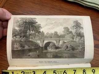
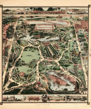
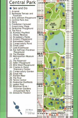
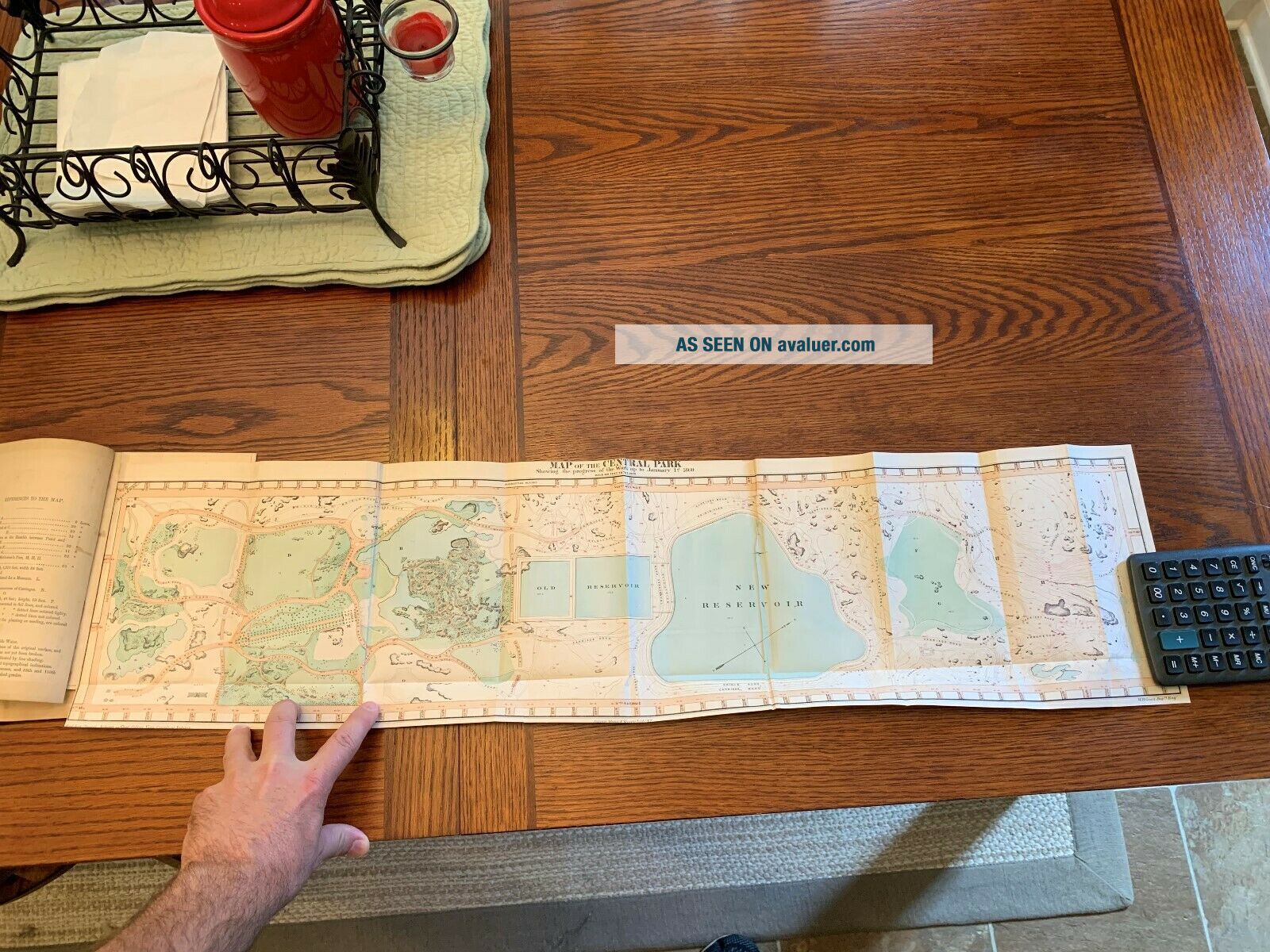
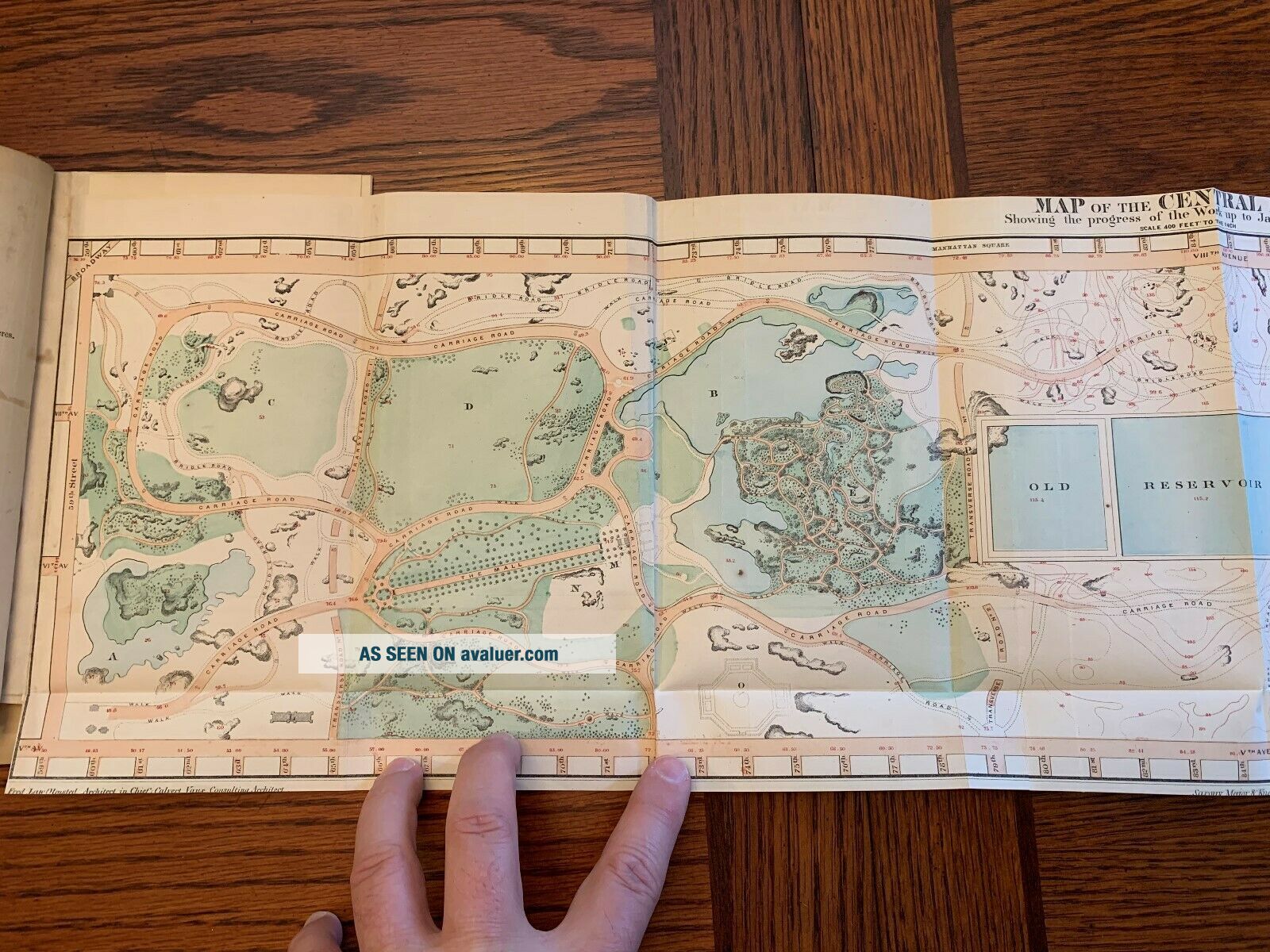
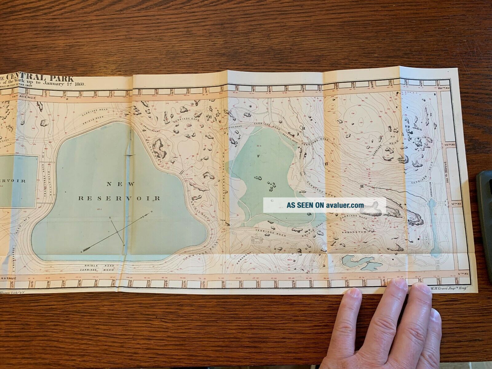
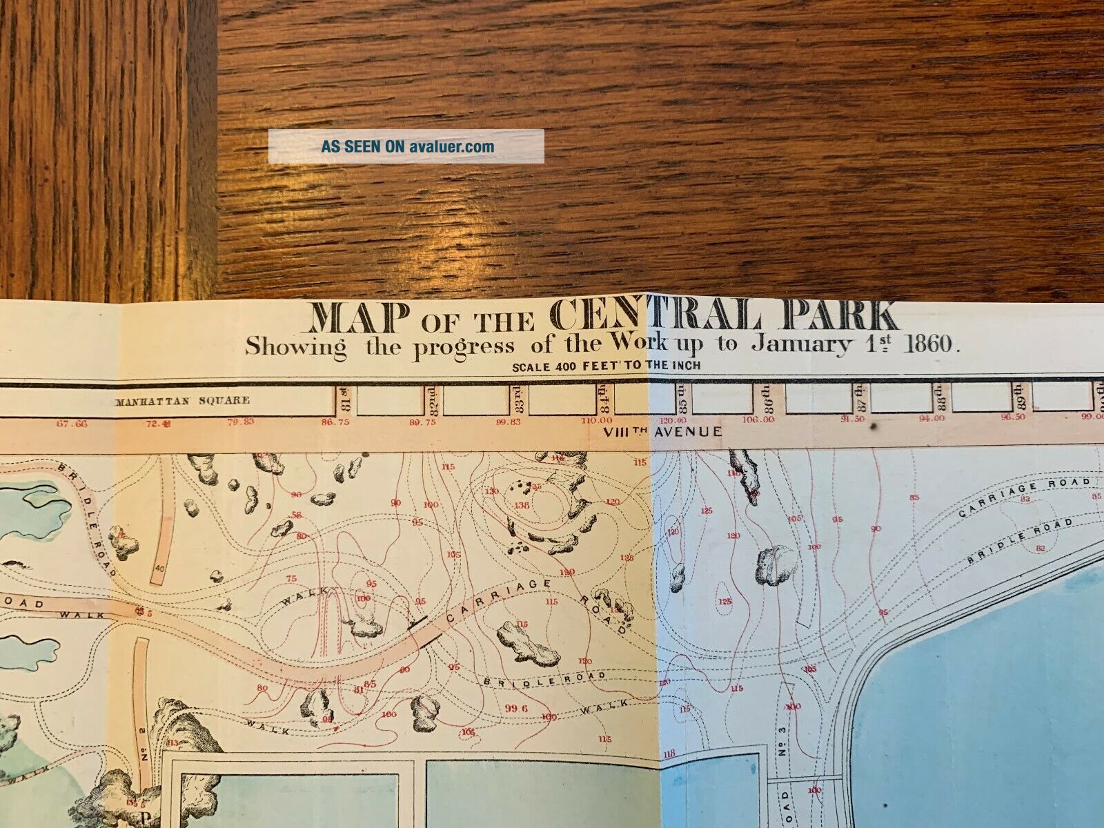
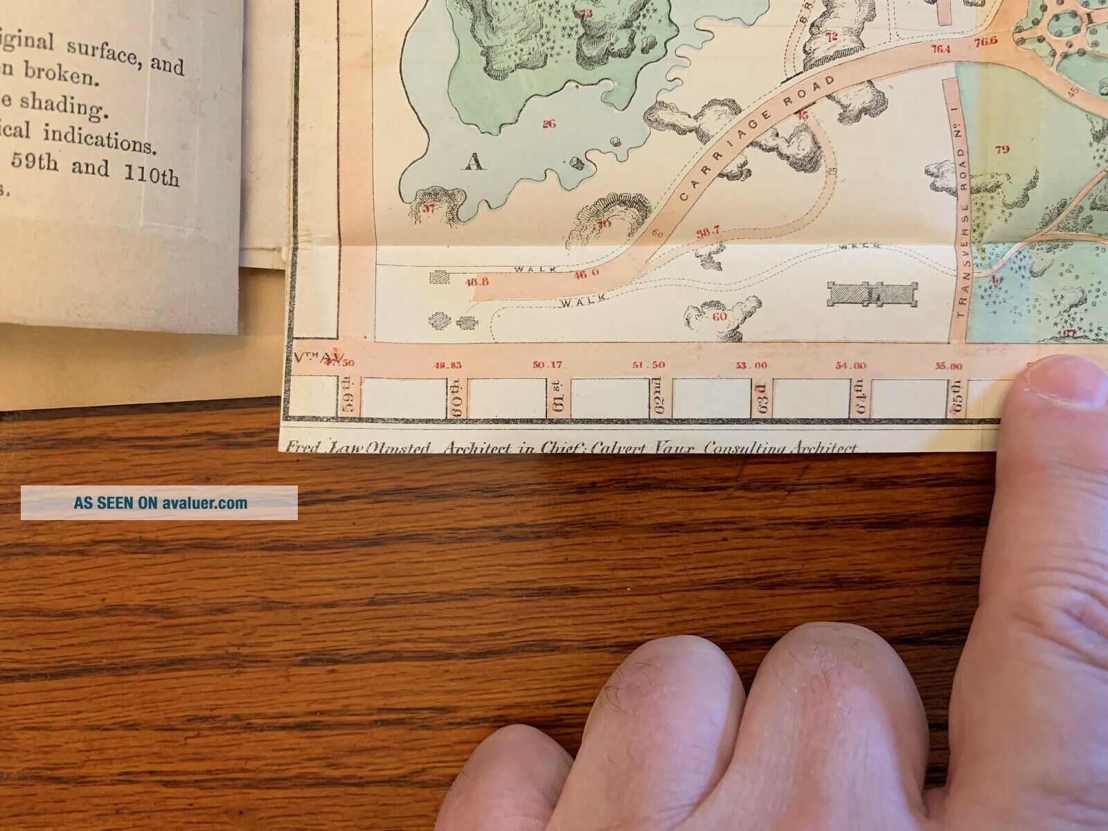
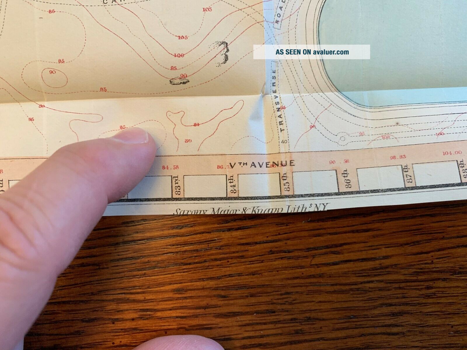
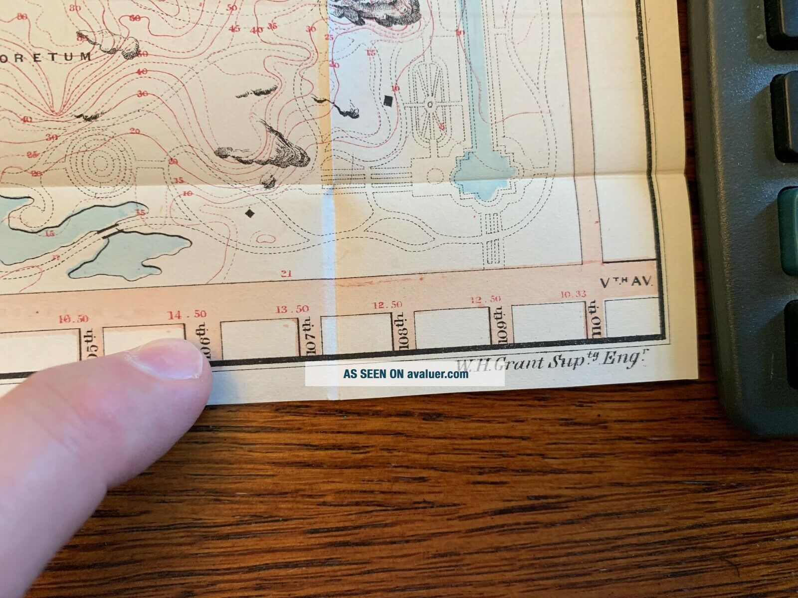
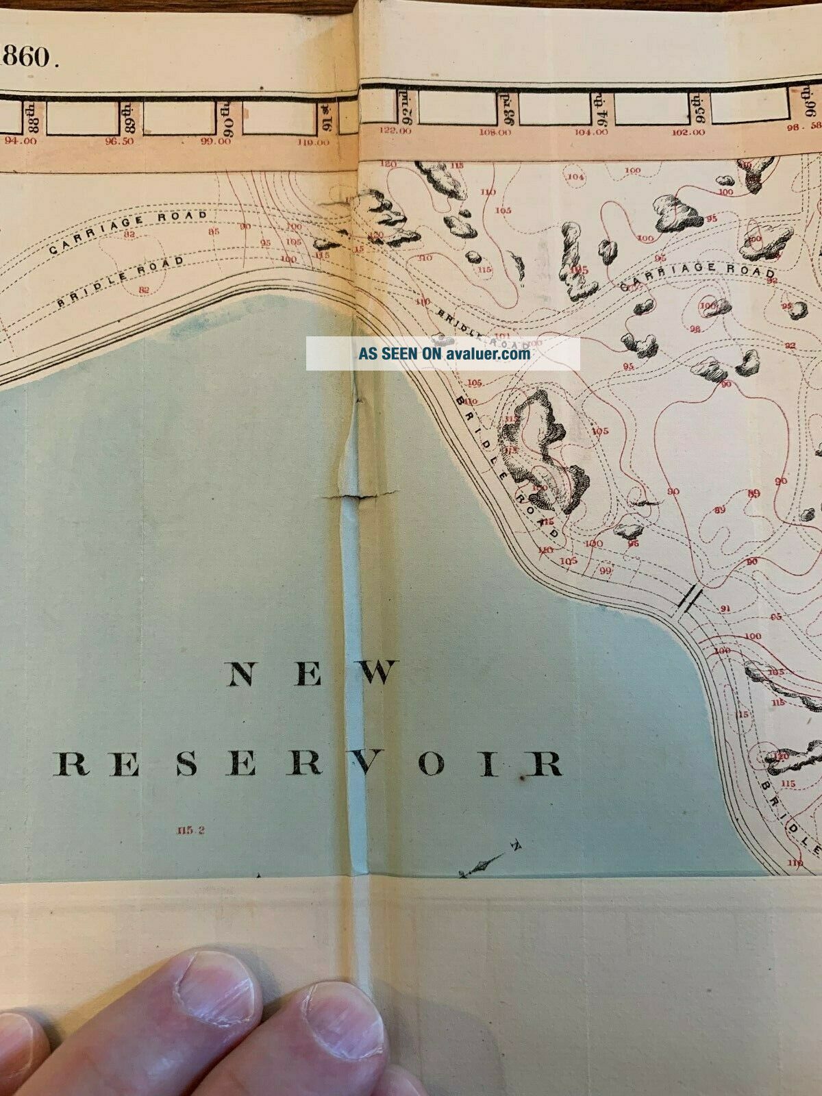
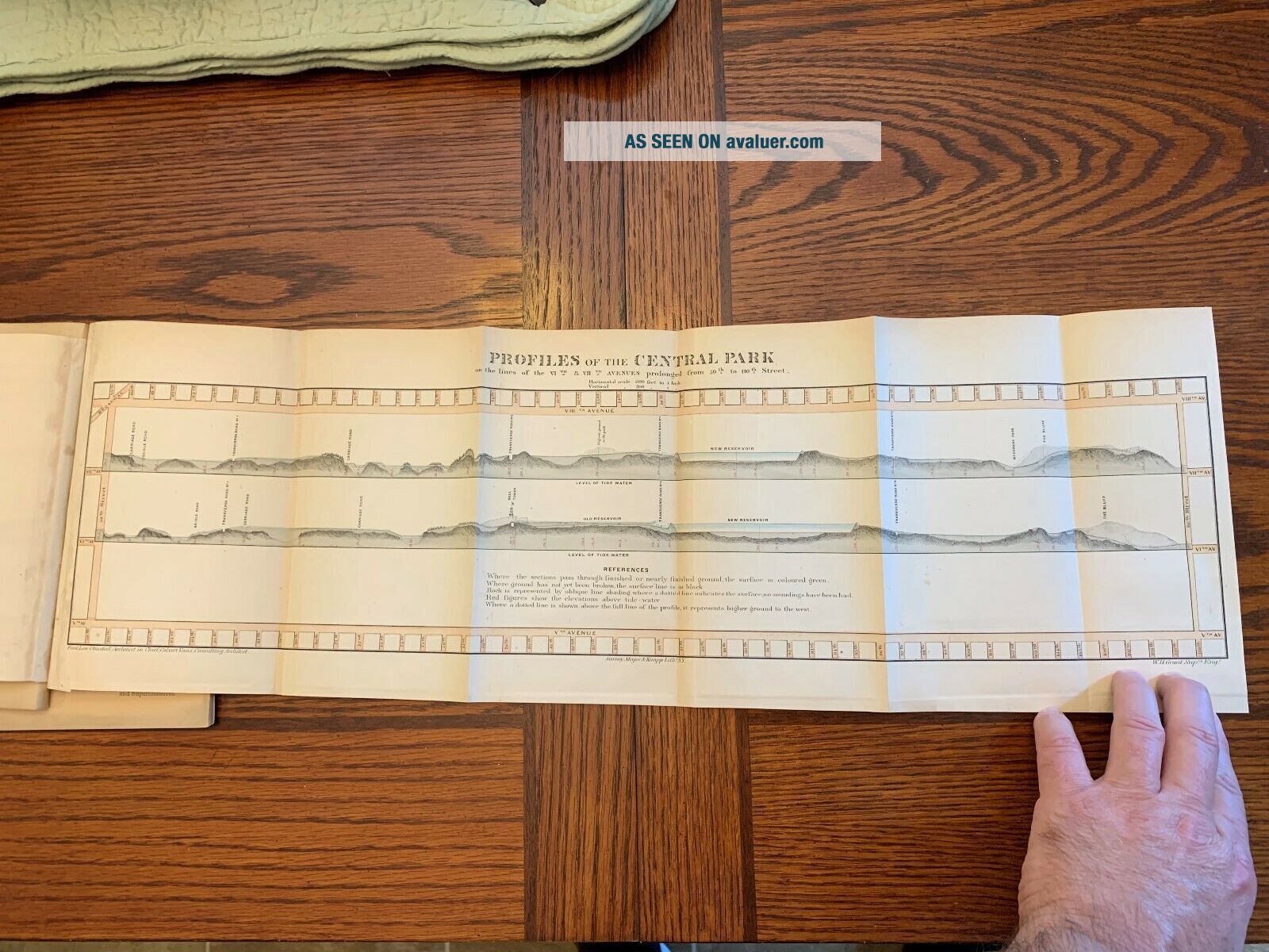
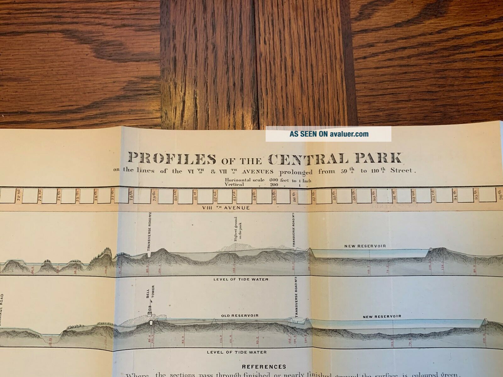
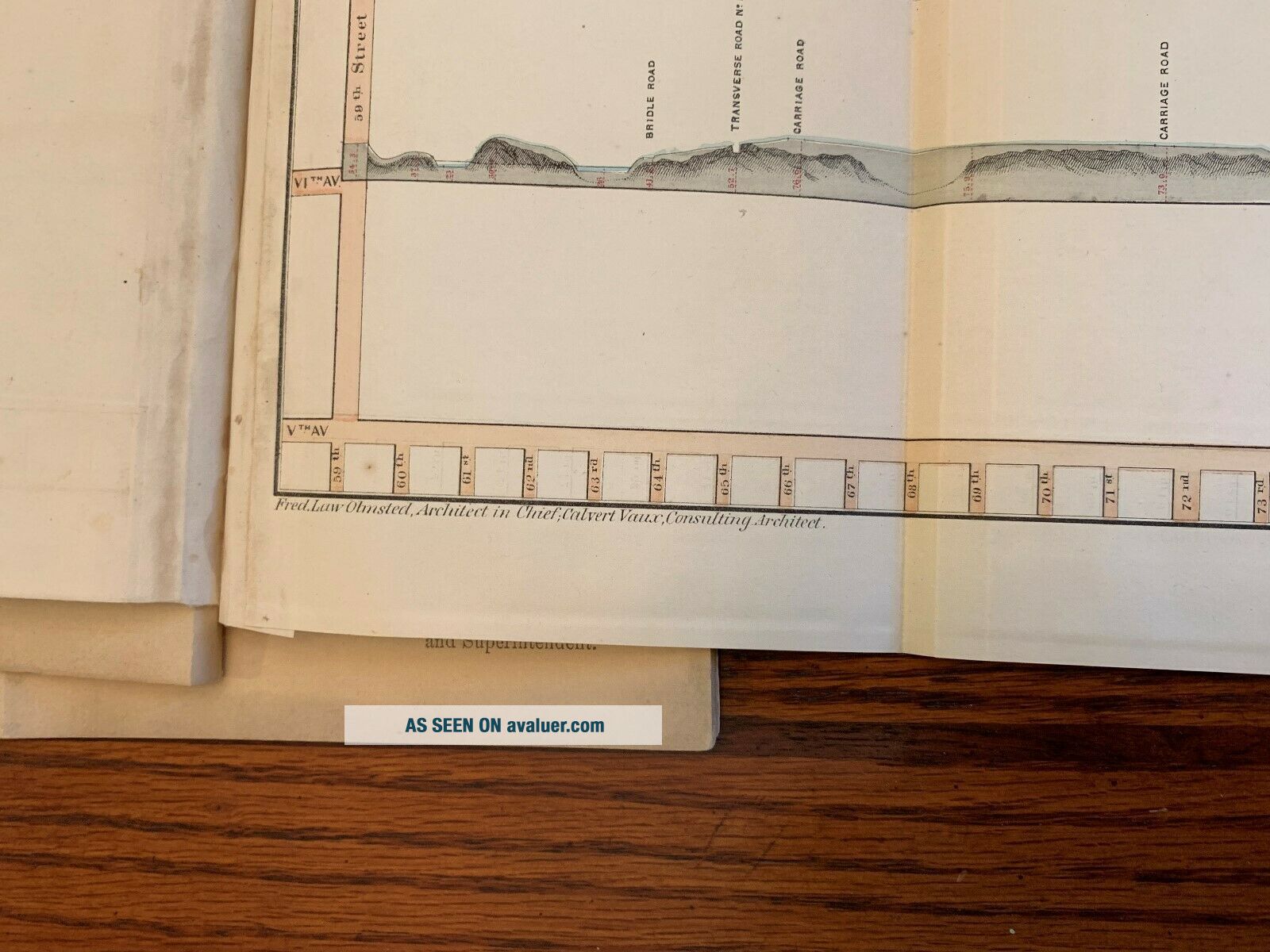
Pictured is a fairly nice Original 1860 Map of The Progress of New York's Central Park and a map of the profiles of the Central Park. Both maps have Fred Law Olmstead Architect in Chief & Calvert Vaux consulting Architect on the lower left, Sarony, Major, & Knapp Lith. NY in the center and W. H. Grant Supty Engr on the lower right. Both of these maps are attached to page 43-44 of the Third Annual Report of the Board of Commissioners of the Central Park, January, 1860. (I will be listing the Lithographs from the book in a separate auction as the book was not salvageable). The first map of Central park measures approx. 34 1/2" by 8 1/2". It does have a small tear in the section with the New Reservoir (see photo), but would probably mat and frame okay. The other map of the Profiles of Central Park measures approx. 24" x 8". Both maps will be mailed folded as found in the book. Map, Rare Map, New York Central Park, 1860, Civil War, Frederick Law Olmstead, Calvert Vaux, Sarony, Major & Knapp Lithographers New York, W. H. Grant, Maps, Architect, New York Central Park.
From Orth Militaria. Payments Due in 3 Days of end ofAuction. Overseas bidders, all items be sent via Registered Mail, please refer to the USPS website at usps.com for shipping information. The USPostal Service has just increased their prices. Orth Militaria. Scroll down to see more photos of the item.Sorryabout the poor-quality photos.
00030
This will be sent via Insured Priority Mail. Photos are a part of the description. Returns accepted with in three days of receiving the item. Must contact us to return item. Buyer pays return shipping. Please contact me if you have any... questions. Thanks.There was one of these maps (First Type I have pictured) from 1871 that sold for $1800 at Christies. I have seen the first map on line for between $2300 to $2500.
Pictured is a fairly nice Original 1860 Map of The Progress of New York's Central Park and a map of the profiles of the Central Park. Both maps have Fred Law Olmstead Architect in Chief & Calvert Vaux consulting Architect on the lower left, Sarony, Major, & Knapp Lith. NY in the center and W. H. Grant Supty Engr on the lower right. Both of these maps are attached to page 43-44 of the Third Annual Report of the Board of Commissioners of the Central Park, January, 1860. (I will be listing the Lithographs from the book in a separate auction as the book was not salvageable). The first map of Central park measures approx. 34 1/2" by 8 1/2". It does have a small tear in the section with the New Reservoir (see photo), but would probably mat and frame okay. The other map of the Profiles of Central Park measures approx. 24" x 8". Both maps will be mailed folded as found in the book. Map, Rare Map, New York Central Park, 1860, Civil War, Frederick Law Olmstead, Calvert Vaux, Sarony, Major & Knapp Lithographers New York, W. H. Grant, Maps, Architect, New York Central Park.
From Orth Militaria. Payments Due in 3 Days of end ofAuction. Overseas bidders, all items be sent via Registered Mail, please refer to the USPS website at usps.com for shipping information. The USPostal Service has just increased their prices. Orth Militaria. Scroll down to see more photos of the item.Sorryabout the poor-quality photos.
00030