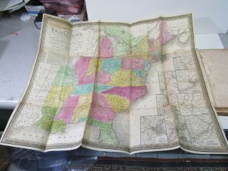
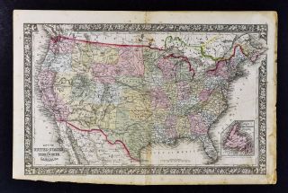
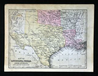
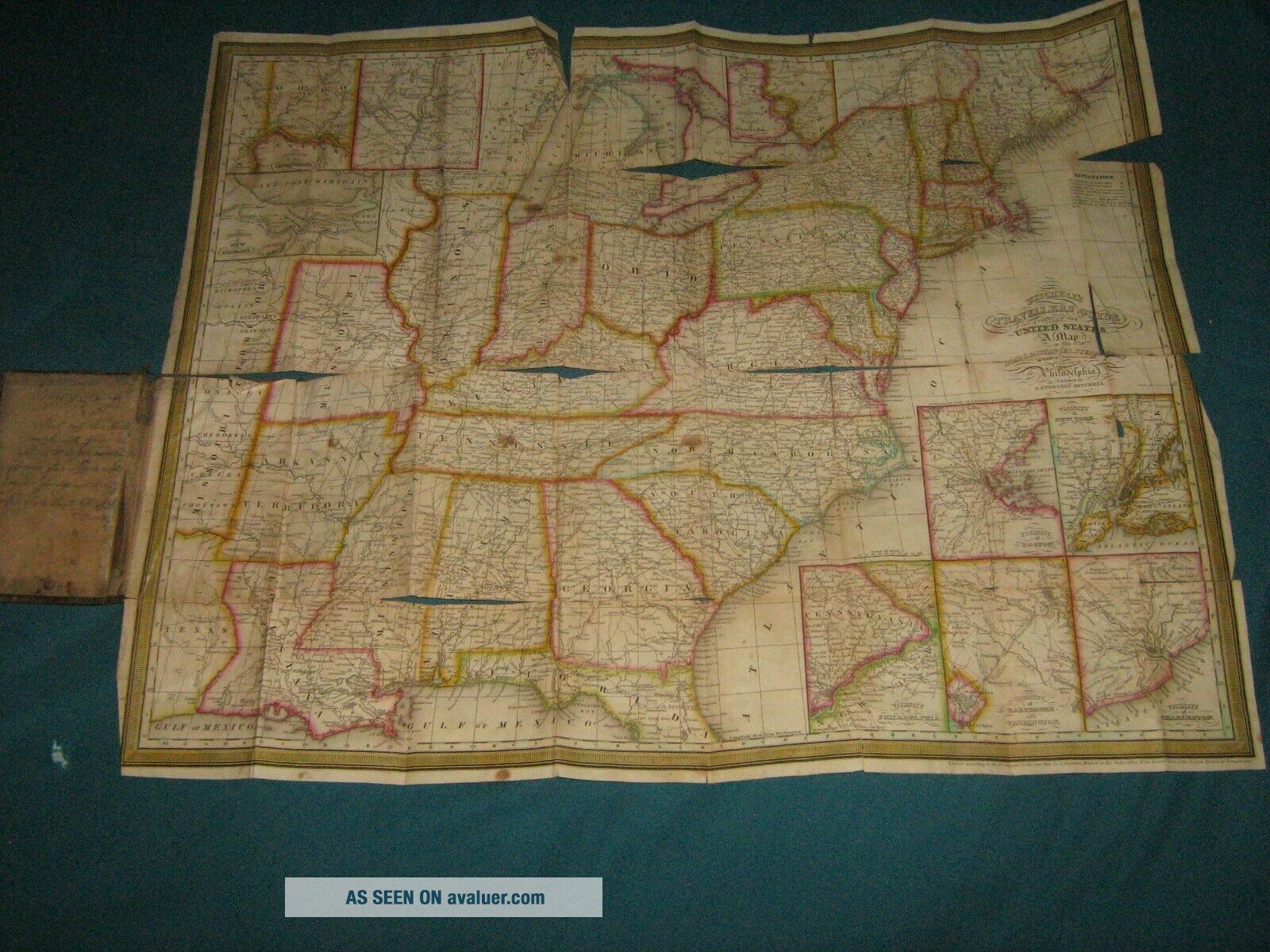
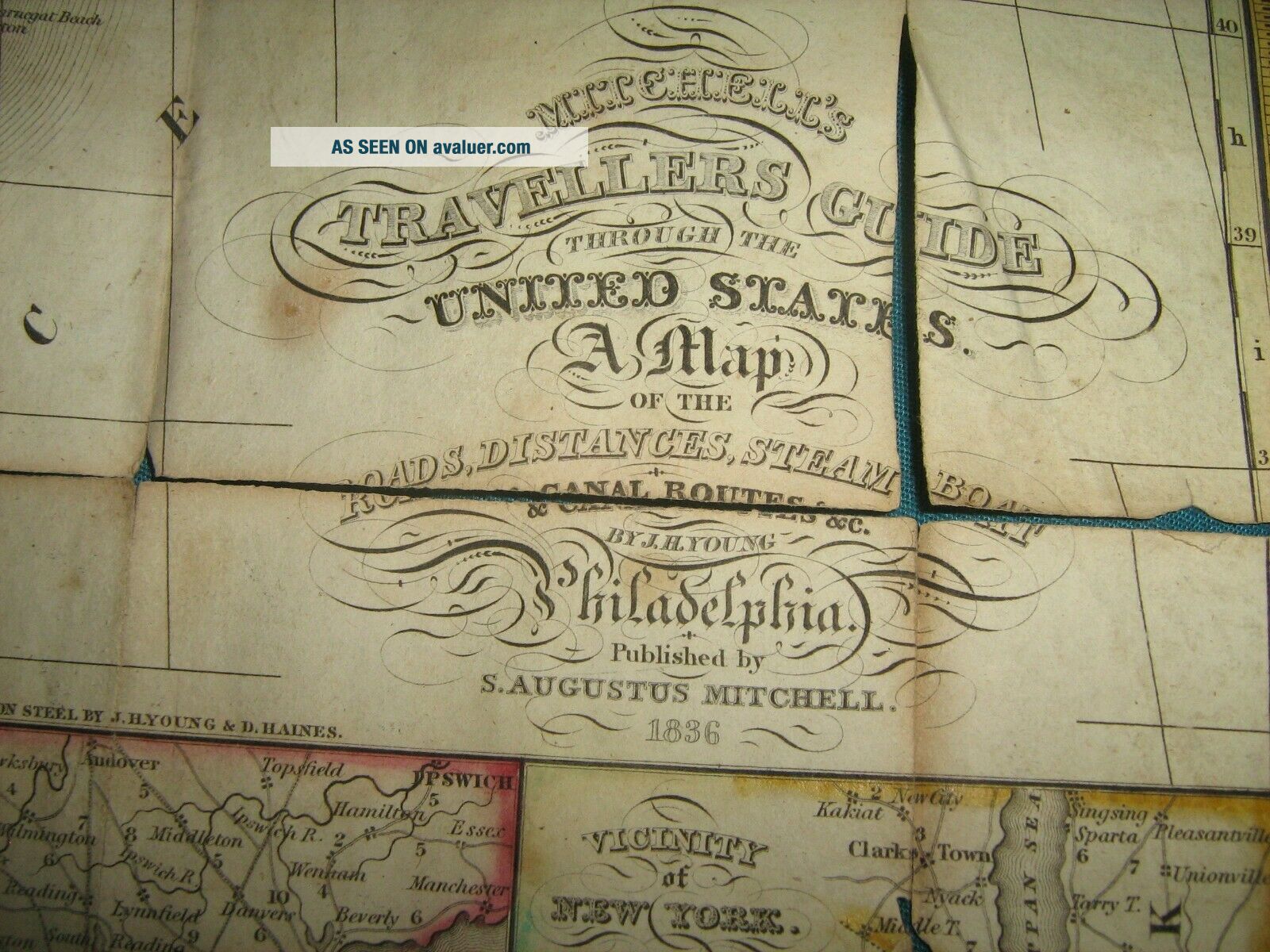
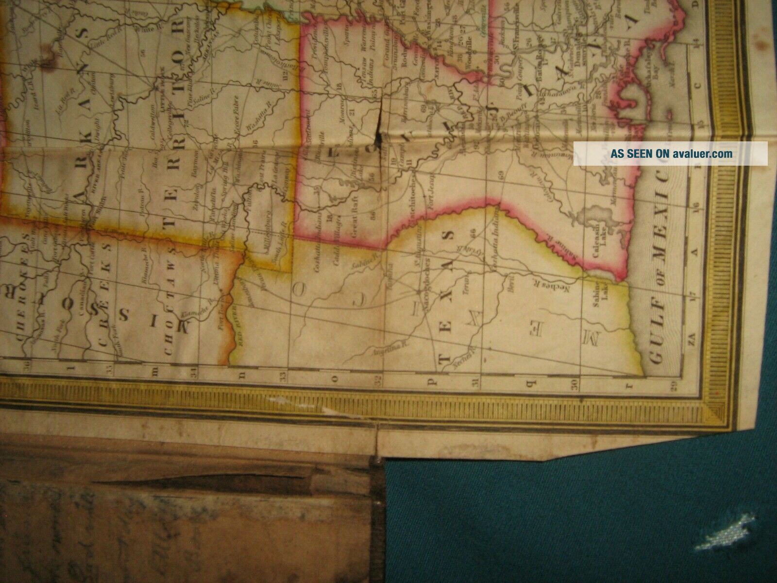
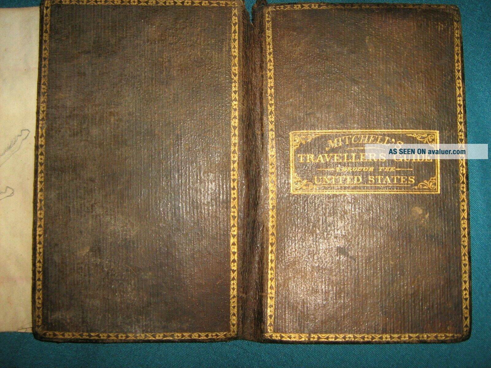
1836 MITCHELL FOLDING MAP UNITED STATES DRAWING SOLDIER TEXAS RANGERS MANUSCRIPT


Item History & Price

Information:
Reference Number: Avaluer:1231484Type: FOLDING POCKET
Date Range: 1834-1836Year: 1836
Country/Region: United States of AmericaUS State: Texas
Original Description:
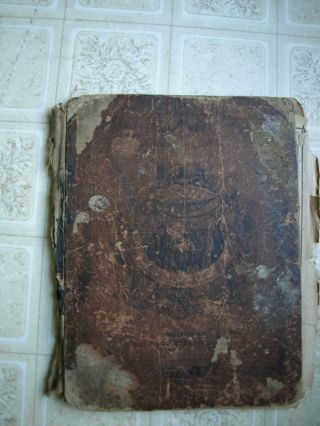
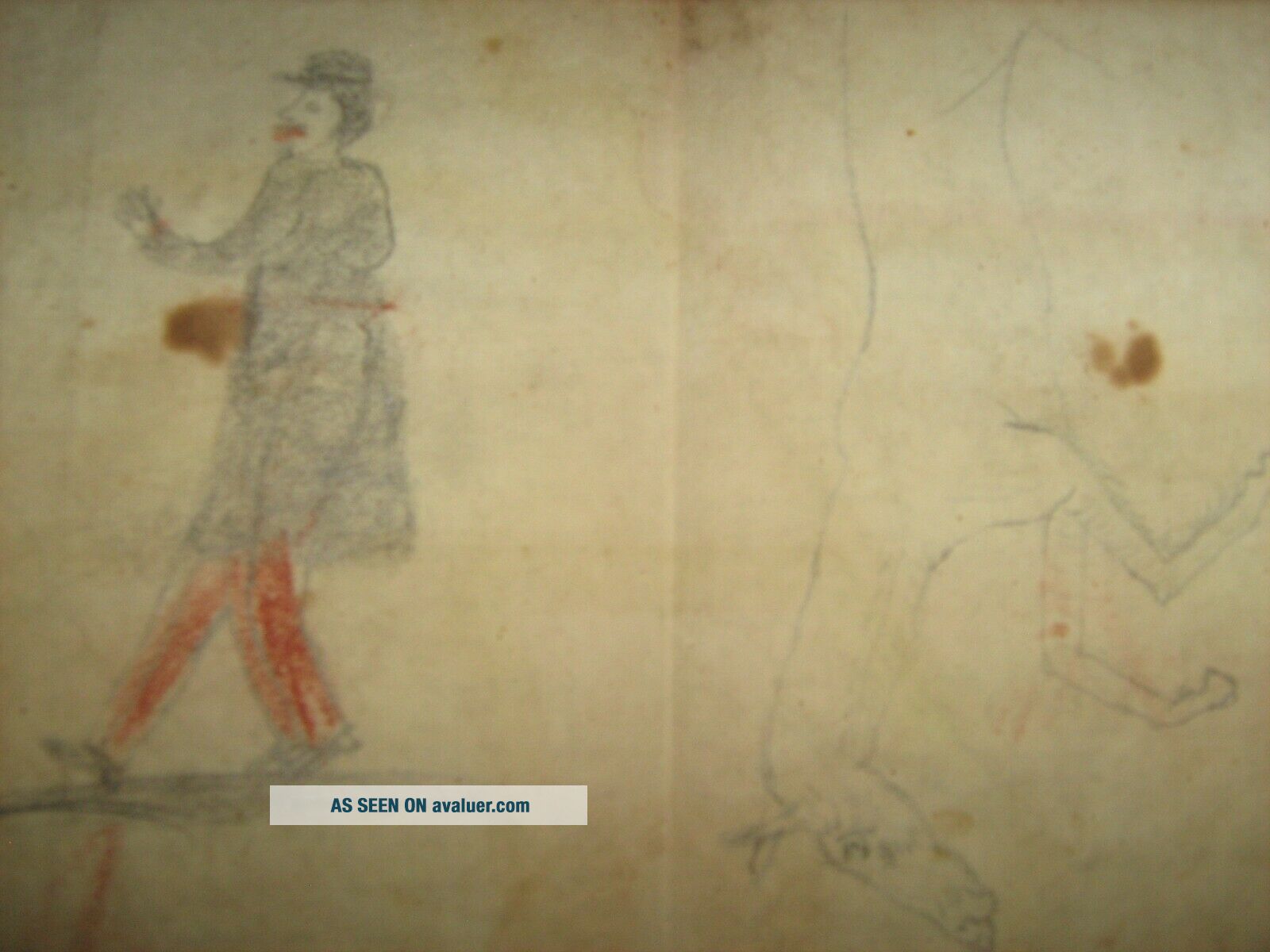
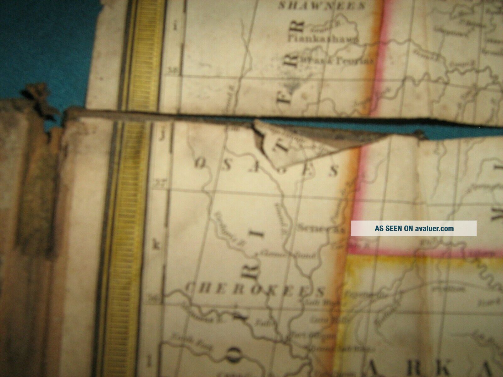
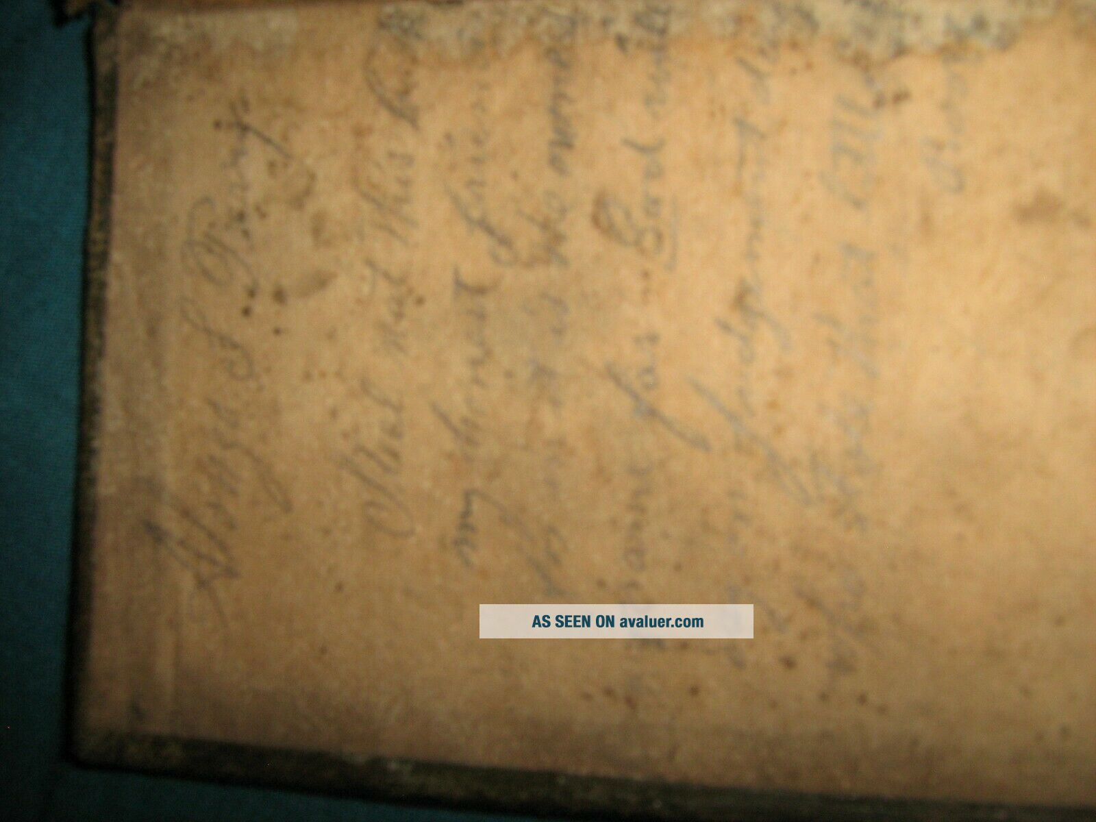
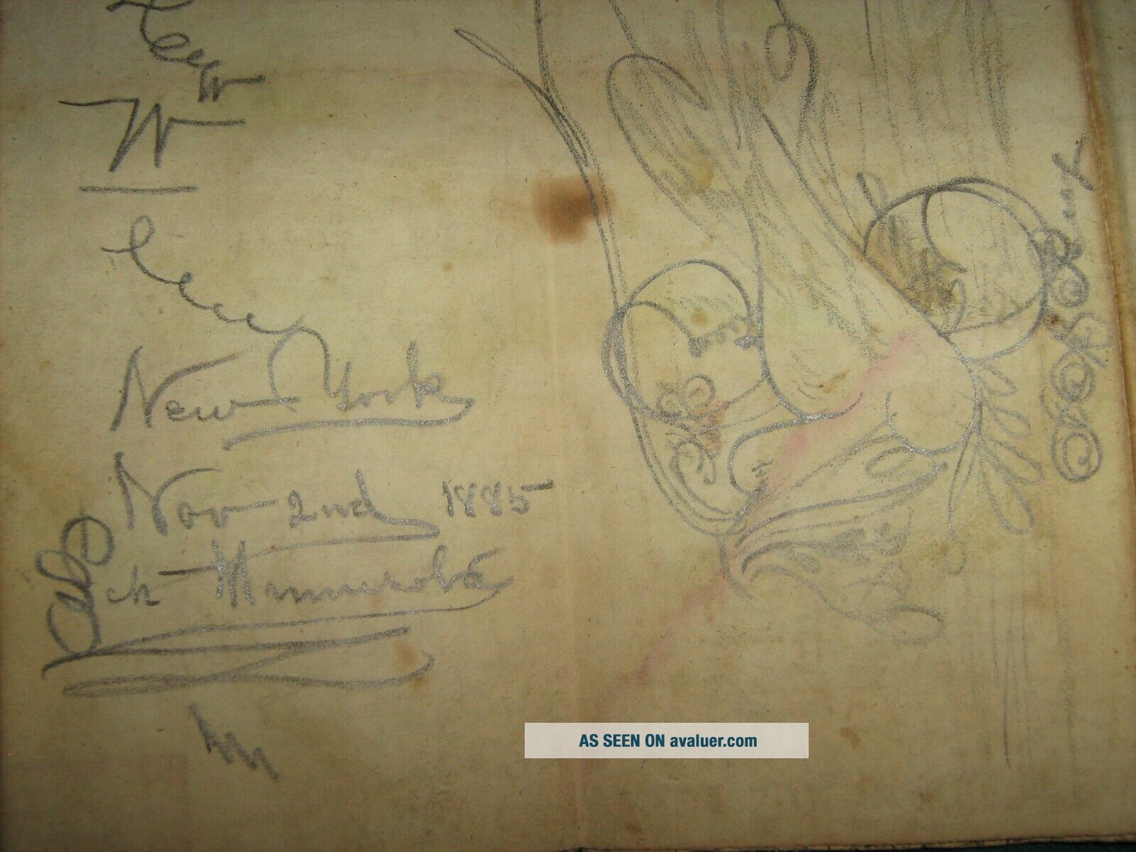
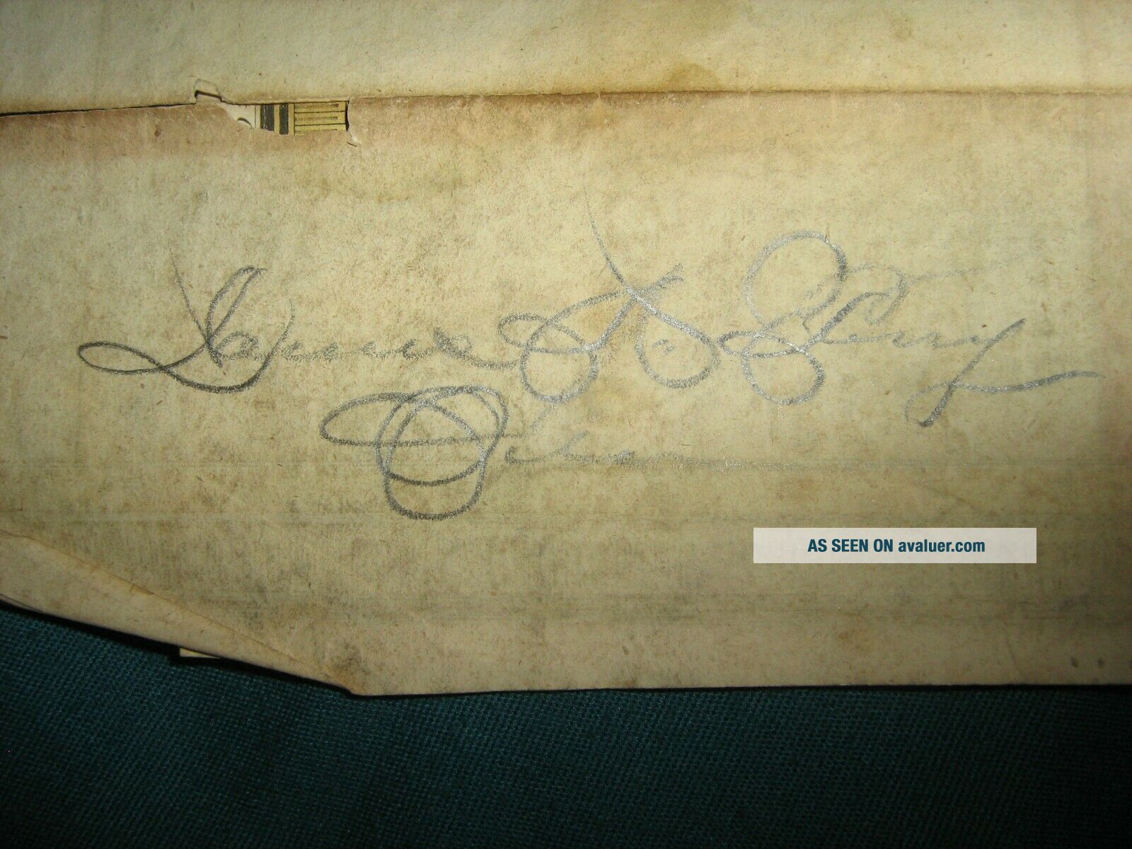
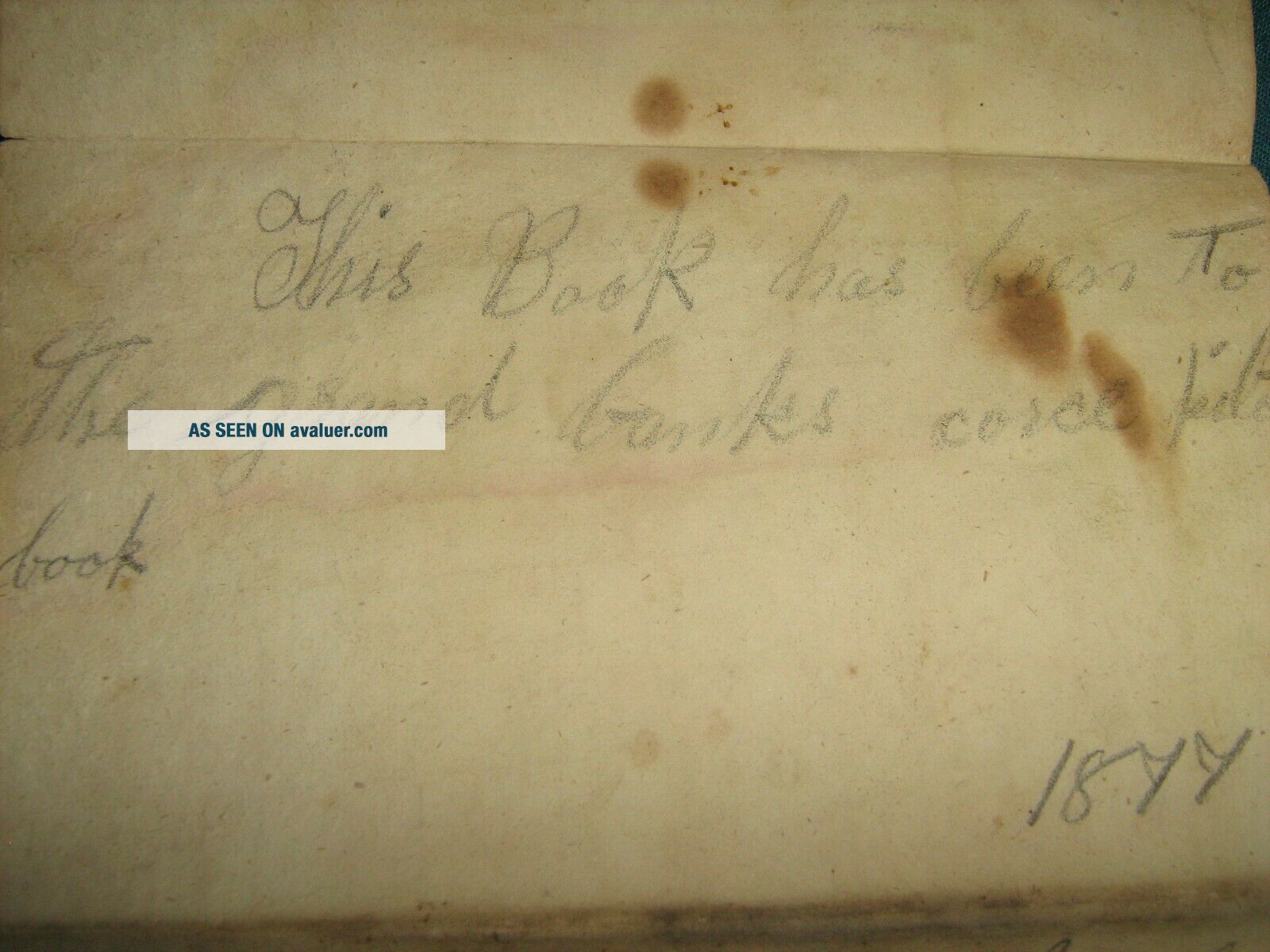
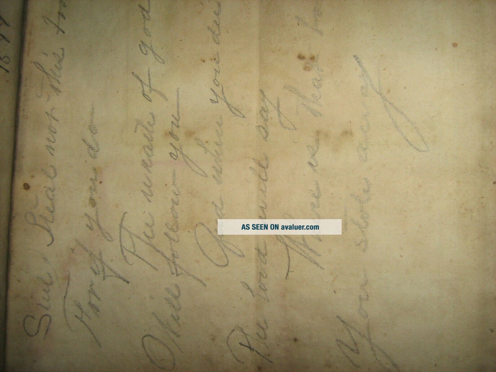
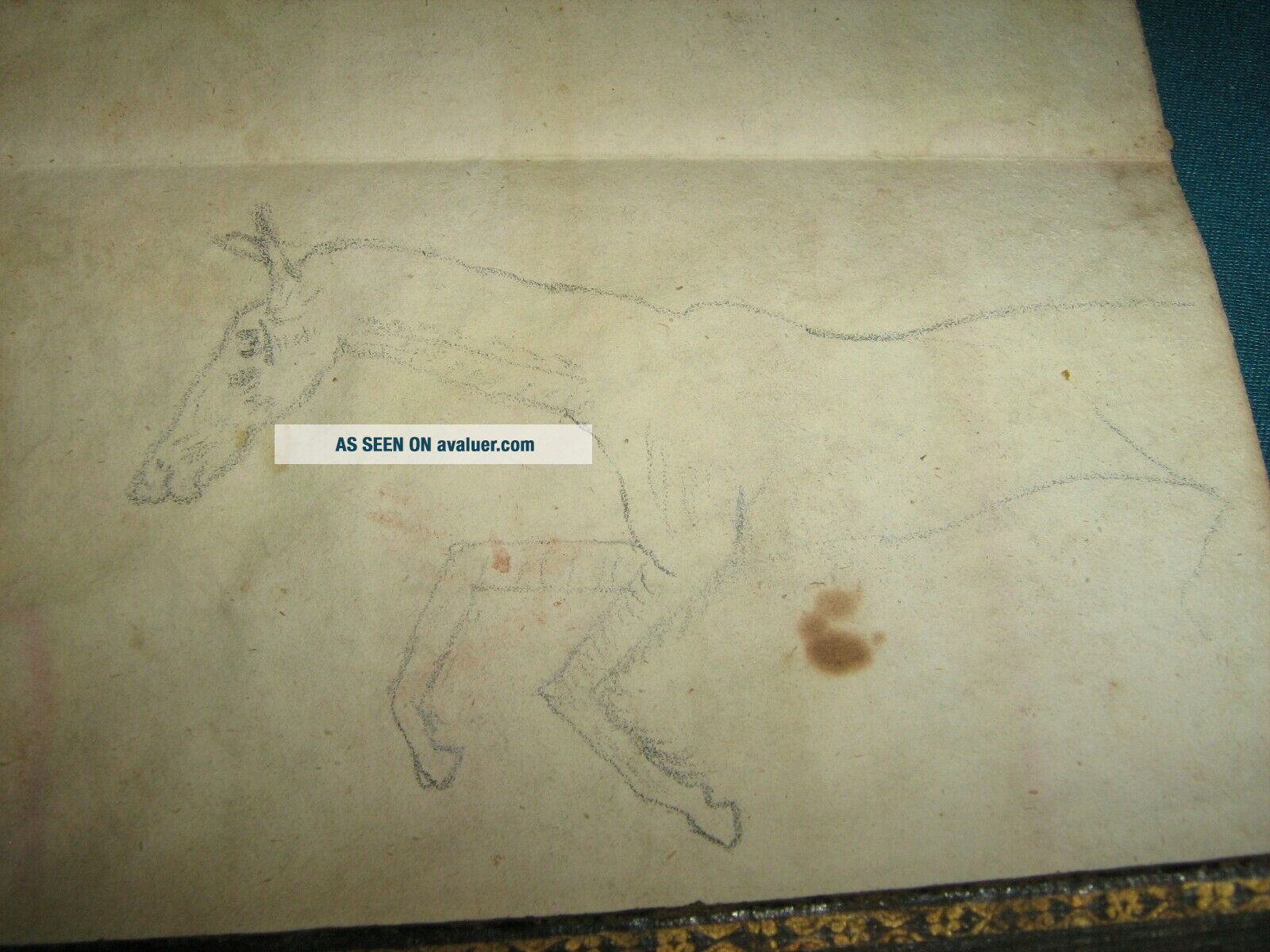
SOME INTERESTING NAMES AND DRAWINGS ON THE BACK SIDE OF THIS MAP.  A MID 19TH CENTURY DRAWING OF A SOLDIER AND A HORSE, 2 INSCRIPTIONS FROM 2 MEMBERS OF A PERRY FAMILY (ONE, AN ALONZO PERRY, WAS SOMEHOW ASSOCIATED WITH THE TEXAS RANGERS), AN INSCRIPTION "THIS BOOK HAS BEEN TO THE GRAND BANKS COARSE [COURSE] PILOT BOOK 1877", A BIT OF CALLIGRAPHY AND OTHER INSCRIPTIONS.   COPYRIGHT 1834, PRINTING DATE 1836.  MAP IS IN 2 PIECES, SOME TINY DOGEARS BUT NO LOSS, AND CLEA...N.  A RESTORER COULD CLEAN UP THE MULTIPLE SPLITS AT THE FOLDS VERY INEXPENSIVELY.


    Similar items


  • The West Census Of 1880 Folding Map United States Old West History Statistics

    The West Census Of 1880 Folding Map United States Old West History Statistics

  • Vintage Sinclair Folding Map United States Featuring National Parks And.

    Vintage Sinclair Folding Map United States Featuring National Parks And.

  • Rand Mcnally Folded Map: United States All Interstate And U.  S.  Highways

    Rand Mcnally Folded Map: United States All Interstate And U. S. Highways

  • 1836 Gazetteer Of The United States With Mitchel Folding Map

    1836 Gazetteer Of The United States With Mitchel Folding Map

  • 1864 Mitchell Map - United States Canada Indian Dakota Wyoming Indian Territory

    1864 Mitchell Map - United States Canada Indian Dakota Wyoming Indian Territory

  • 1847 Mitchells School Atlas Book,  Maps,  United States,  World,  California

    1847 Mitchells School Atlas Book, Maps, United States, World, California

  • 1888 Mitchell Map United States Texas Louisiana Indian Territory Oklahoma Austin

    1888 Mitchell Map United States Texas Louisiana Indian Territory Oklahoma Austin

  • Vintage 1950’s Liggett

    Vintage 1950’s Liggett ' S Rexall Drug Stores Fold Out United States Map


    • You might also like


    • 1860 Mitchell Hand Colored Map Colorado,  Nebraska & Kansas - Civil War Era

      1860 Mitchell Hand Colored Map Colorado, Nebraska & Kansas - Civil War Era

    • 18th Century French Map Of North America

      18th Century French Map Of North America

    • Las Vegas Nevada Vintage 1967 Us Geological Survey Quadrangle Map 4 Panels

      Las Vegas Nevada Vintage 1967 Us Geological Survey Quadrangle Map 4 Panels

    • Rare Antique 1845 Maps United States Exploring Expedition Book Antartica Hawaii

      Rare Antique 1845 Maps United States Exploring Expedition Book Antartica Hawaii

    • Vintage 1926 Map Hollywood From The Best Surveys Of The Time

      Vintage 1926 Map Hollywood From The Best Surveys Of The Time

    • American Continent (western Hemisphere) 1747 Bowen Antique Copper Engraved Map

      American Continent (western Hemisphere) 1747 Bowen Antique Copper Engraved Map

    • Gulf Coast Florida Texas United States 1705 De Fer Unusual Antique Engraved Map

      Gulf Coast Florida Texas United States 1705 De Fer Unusual Antique Engraved Map

    • California As Island United States 1700 De Fer Unusual First Edition Antique Map

      California As Island United States 1700 De Fer Unusual First Edition Antique Map

Avaluer          About Us          Privacy Policy          Contact Us          UP
© 2022, avaluer.net, Inc. or its affiliates