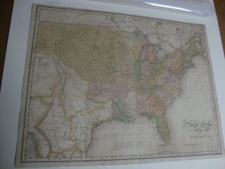
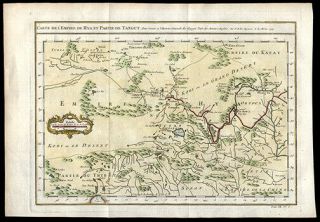
1784 Hand - Colored Map Of Shropshire & Staffordshire Coat Of Arms Cartouches
Item History & Price
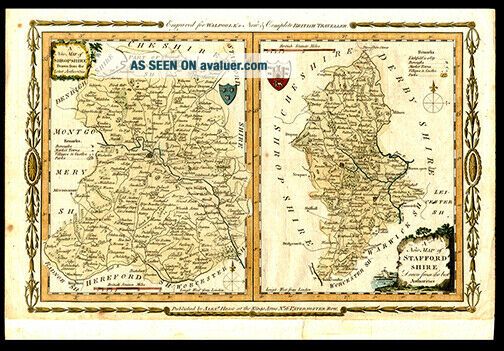
Click on the image
for a detailed view. Maker: Engraver: T. Conder, Publisher: Alex Hogg for George Augustus WalpoleDate: 1784, LondonShort Title: A New Map of Shropshire Drawn from the Latest Authorities and A New Map of Staffordshire Drawn from the best Authorities.Full Title: A New Map of Shropshire Drawn from the Latest Authorities and A New Map of Staffordshire Drawn from the best Authorities. TB: Engraved for Walpoole’s New & Complete British Traveller. LB: Publ...ished by Alex Hogg at the Kings Arms No 16 Peternoster Row . Source: Walpole’s New and Complete British TravellerSize of Map: 23.6 x 37.7 cm. approximately (9.29 x 14.84 in.)Description: A New Map of Shropshire Drawn from the Latest Authorities and A New Map of Staffordshire Drawn from the best Authorities are copper engraved, uncolored maps. Each has a coat of arms and a cartouche. The two maps as published on one sheet making is scarce since so many specimens have been divided into individual mapsReferences: Chubb, Thomas “The Printed Maps in the Atlases of Great Britain and Ireland A Bibliography 1579 – 1870” CCLX No. 2 pp. 204 – 206. Tooley’s Dictionary of Mapmakers Revised Edition Vol. (Q – Z) p.351.A Great Gift For Any Manuscript Collector We Now Accept PayPal! We Ship Worldwide. Please Contact Us For a Free Shipping Quote!