1607 Christopher Saxton Map Copper Plate Engraving Cheshire England Cartography
Item History & Price
Click on the image
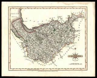
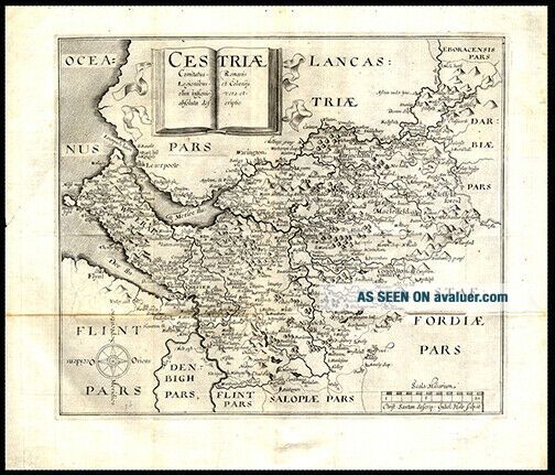
for a detailed view. Maker: Original Engraver Christopher Saxton (c.1543 – 1610/1611);Date: 1607, LondonShort Title: CestriaeFull Title: Cestriae Comitatus Romanis Legionibus et Colonijs olim insignis vera et absoluta descriptio Source: Camden's BritanniaSize of Map: 24.92 X 30 cm. approximately (9.81 x 11.81 in.)Description: A cooper engraved, uncolored map of Cheshire. The title page of the atlas gives Saxton credit. Includes parts of Lancashire,... Flints , Denbighshire, Shropshire and Staffordshire. No 33References: Chubb, Thomas The Printed Maps in the Atlases of Great Britain and Ireland XVIII; Tooley’s Dictionary of Mapmakers Revised Edition Vol. (Q-Z) p 111; Skelton, R. A. County Atlases of the British Isles 1579-1850 No 5 p.27 Shirley, Rodney Early Printed Maps of the British Isles 1477-1650 No 279 p 94A Great Gift For Any Manuscript Collector We Now Accept PayPal! We Ship Worldwide. Please Contact Us For a Free Shipping Quote!