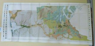
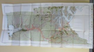
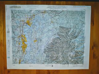
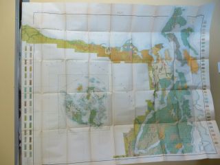
Rare Map PUGET SOUND & GRAYS HARBOR COUNTRY Lowman & Hanford 1891 Washington NW
Item History & Price
| Reference Number: Avaluer:10031 | Cartographer/Publisher: Lowman & Hanford |
| Year: 1891 | Original/Reproduction: Antique Original |
| US State: Washington | Format: Folding Map |
| Date Range: 1800-1899 | Type: Physical Map |
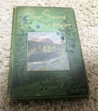
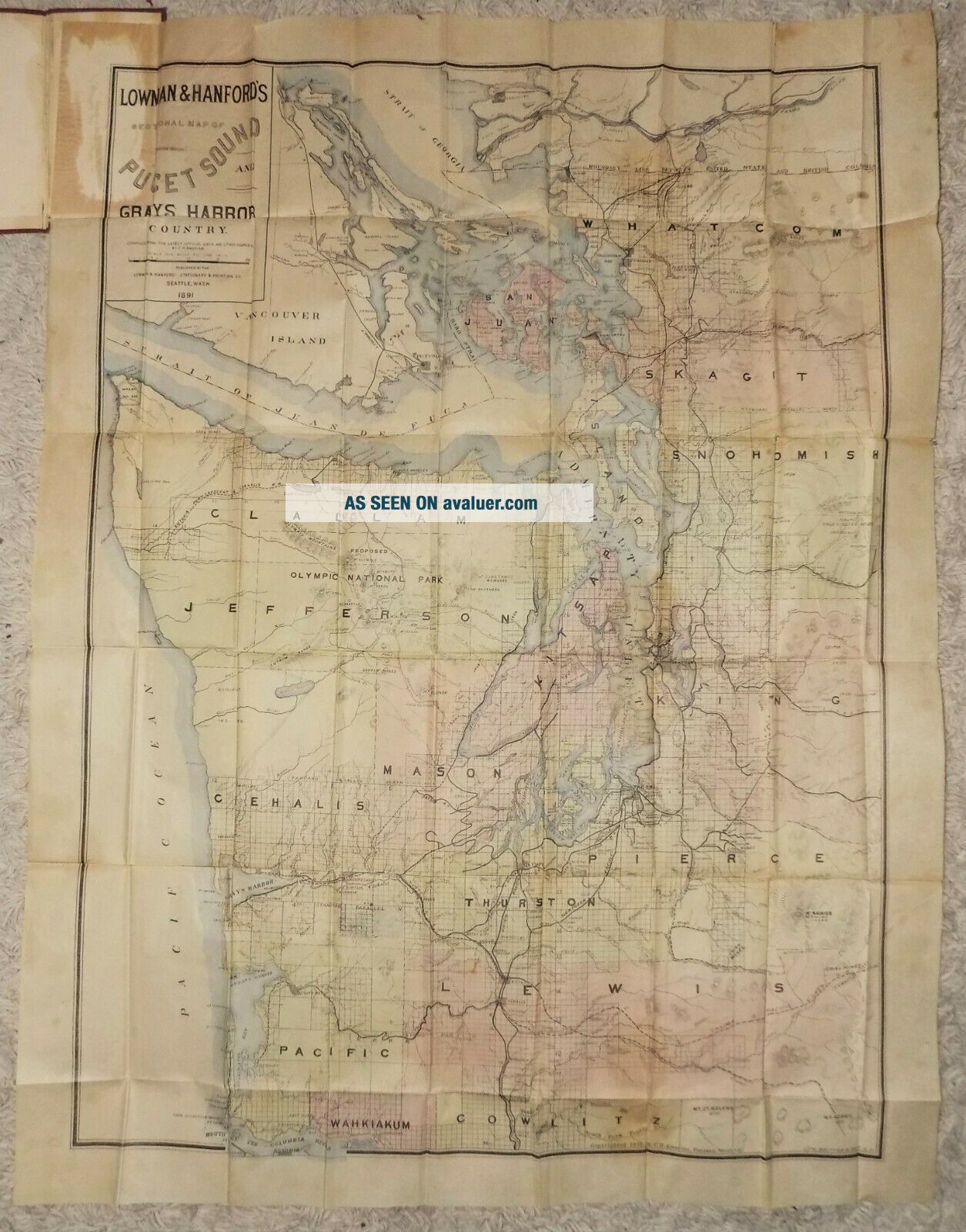
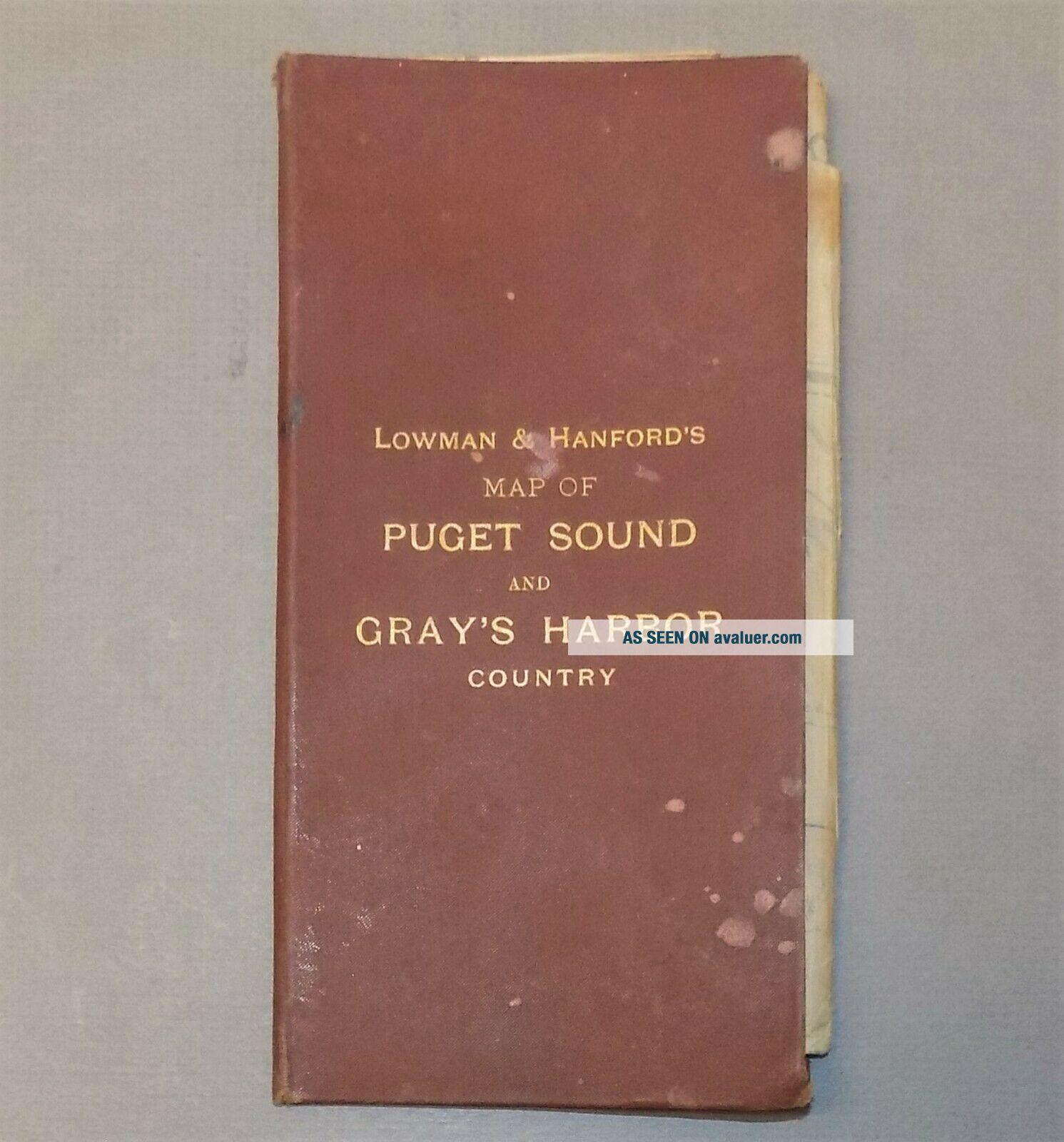
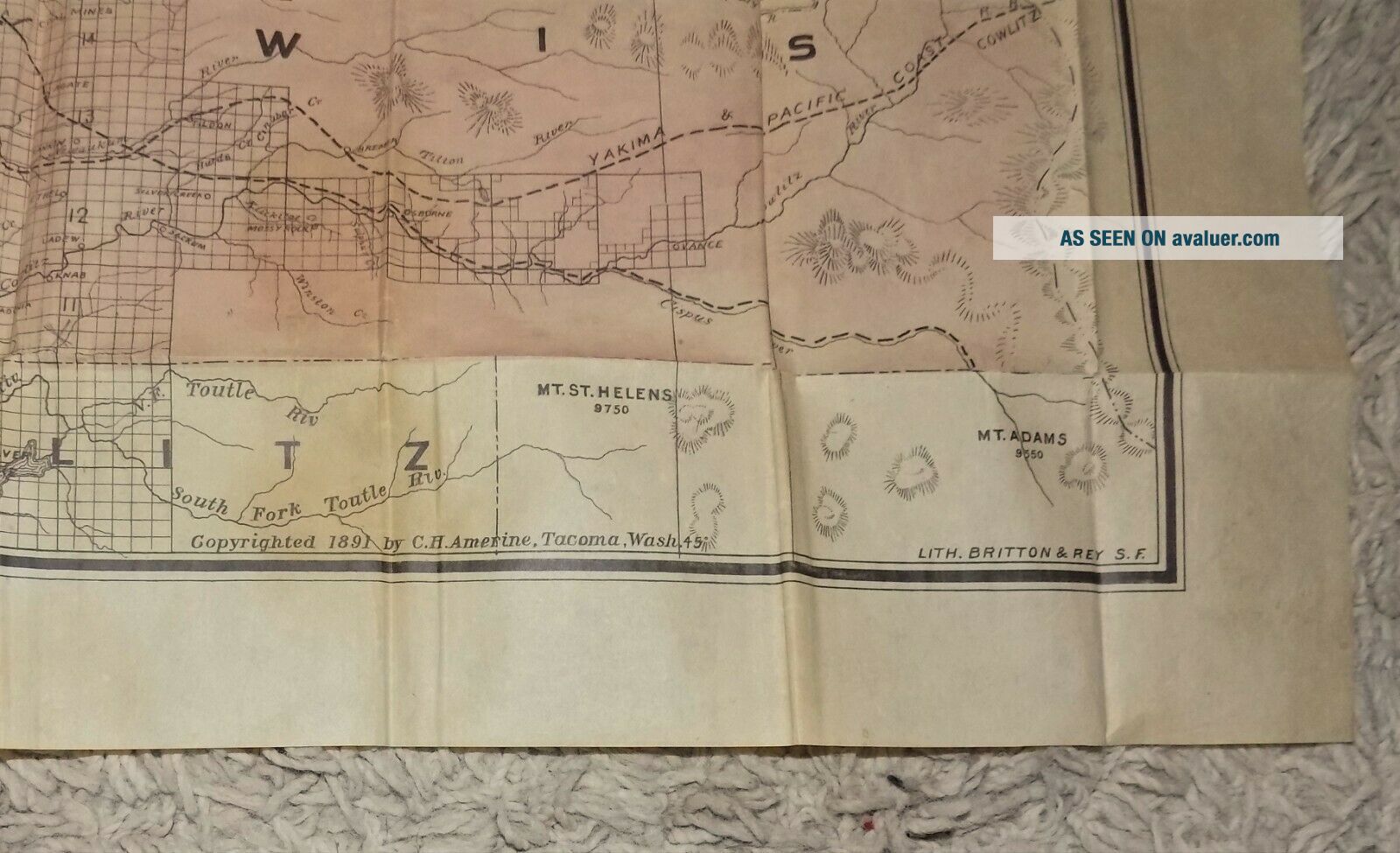
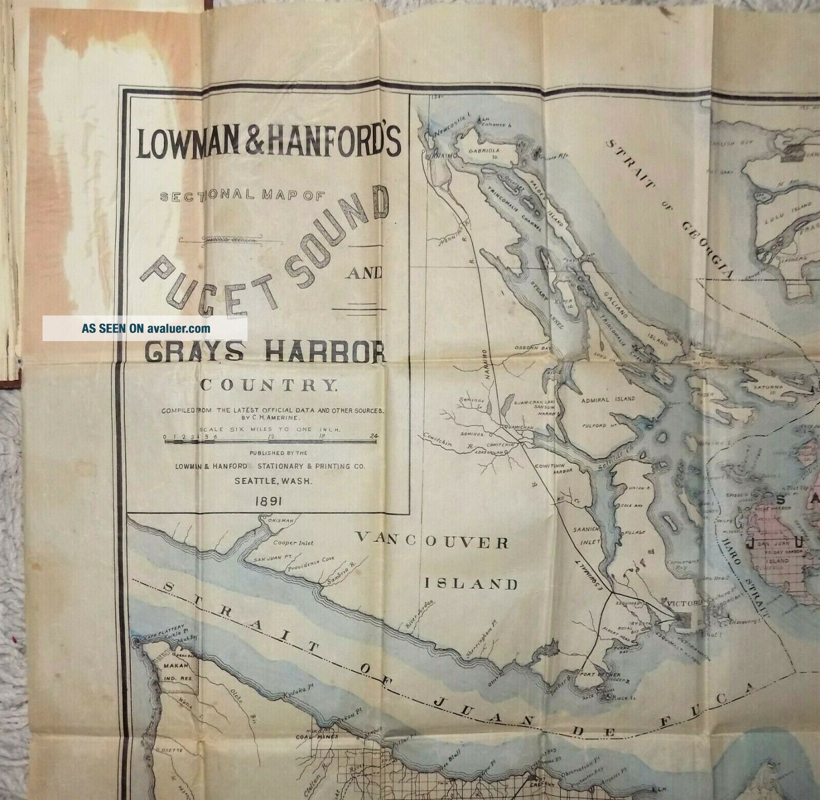
Rare antique map: LOWMAN & HANFORD'S MAP OF PUGET SOUND and GRAY'S HARBOR COUNTRY, copyright 1891 by C. H. Amarine - a large folding map, printed on thin, almost tissue-like paper, folded up inside stiff cloth covers; measures 36x27.5 inches when unfolded. In 1891, L&H had just moved to a new building after losing their first to the Great Seattle Fire; the new building wasn't completed until 1892; this may explain why this map appears to be so rare, being produced during this p...eriod of reconstruction. I can't find any others to compare this to, either currently available for sale, or listed on completed-auction websites. ... PLEASE NOTE - I've had several offers on this already, after less than a day, but I won't accept any (though appreciated); nor have I changed the price or added a reserve. Don't miss out!
Condition is VG+ (map is still pretty nice, with minor spotting, tanning, some tiny pinholes at some of the fold intersections and a few tiny tears at edges, minor wrinkles; cover has concave warp and some spotting).
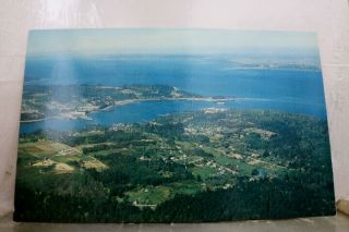
(Vintage & Antique, Paper, Ephemera, Map, Pocket Map, Folding Map, Atlas, Washington State, Washington Territory, Territorial, Pacific Northwest, Travel, History, Transportation, NW, WA, San Juan Islands, Vancouver Island, King County, Snohomish, Pierce, Chehalis, Olympic Peninsula, 1890's, Memorabilia, Collectible)
PLEASE READ BEFORE BIDDING: All items are very well-packed for shipment and always include tracking numbers.We are always happy to combine multiple items. Vinyl records are shipped with the vinyl out-of-sleeve to prevent seam splitting. Many of our media listings feature FREE SHIPPING IN THE U.S. - a savings of $3 to $5 on records, books and small paper collectibles.
INTERNATIONAL BIDDERS - WE SHIP WORLDWIDE - if the cost isn't set in the listing, pleasecontact me prior to bidding so I can determine Airmail shipping rates foryou. CANADA - your shipping costs are cheaper than most other countries - please contact me for rates.
WE NEVER USE STOCK PHOTOS - all images are of actual items. WE USUALLY USE MULTIPLE IMAGES. We grade all items conservatively, and when grading record albums we follow the Goldmine Record Guide. Pleasesee our other Ebay auctions for many used, odd, rare and collectiblebooks and records, paper & ephemera, and more. Thank you!
Condition is VG+ (map is still pretty nice, with minor spotting, tanning, some tiny pinholes at some of the fold intersections and a few tiny tears at edges, minor wrinkles; cover has concave warp and some spotting).
(Vintage & Antique, Paper, Ephemera, Map, Pocket Map, Folding Map, Atlas, Washington State, Washington Territory, Territorial, Pacific Northwest, Travel, History, Transportation, NW, WA, San Juan Islands, Vancouver Island, King County, Snohomish, Pierce, Chehalis, Olympic Peninsula, 1890's, Memorabilia, Collectible)
PLEASE READ BEFORE BIDDING: All items are very well-packed for shipment and always include tracking numbers.We are always happy to combine multiple items. Vinyl records are shipped with the vinyl out-of-sleeve to prevent seam splitting. Many of our media listings feature FREE SHIPPING IN THE U.S. - a savings of $3 to $5 on records, books and small paper collectibles.
INTERNATIONAL BIDDERS - WE SHIP WORLDWIDE - if the cost isn't set in the listing, pleasecontact me prior to bidding so I can determine Airmail shipping rates foryou. CANADA - your shipping costs are cheaper than most other countries - please contact me for rates.
WE NEVER USE STOCK PHOTOS - all images are of actual items. WE USUALLY USE MULTIPLE IMAGES. We grade all items conservatively, and when grading record albums we follow the Goldmine Record Guide. Pleasesee our other Ebay auctions for many used, odd, rare and collectiblebooks and records, paper & ephemera, and more. Thank you!