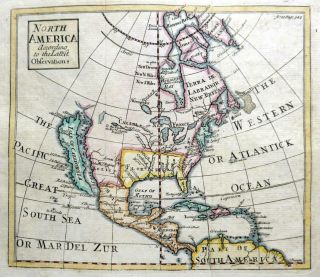
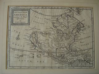
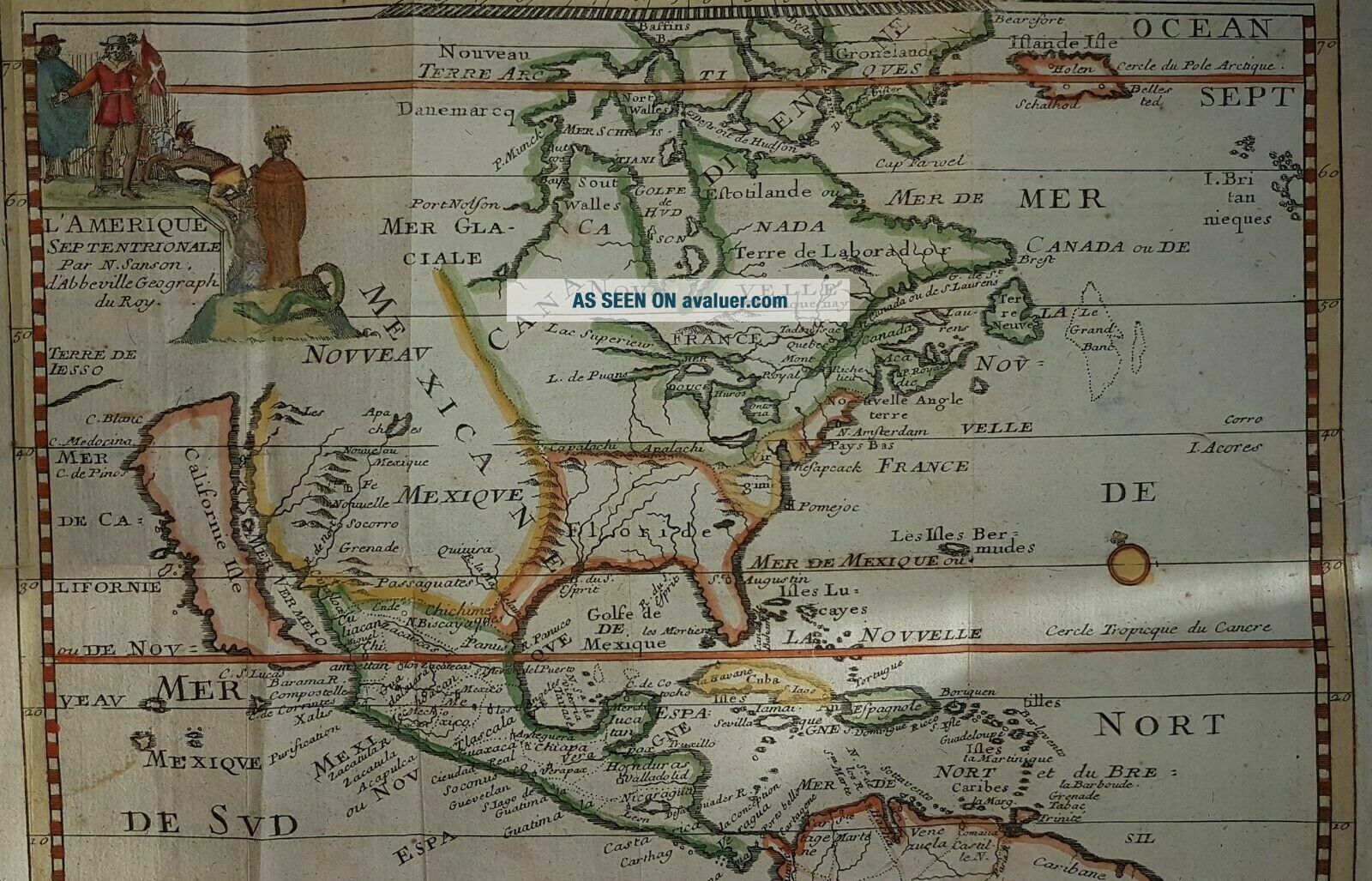
RARE Circa 1700 NORTH AMERICA CALIFORNIA AS ISLAND MAP BY N. SANSON


Item History & Price

Information:
Reference Number: Avaluer:43952Cartographer/Publisher: SANSON
Type: World AtlasPrinting Technique: Copper Plate
Year: 1700Original/Reproduction: Antique Original
US State: AL, FL, GA, MS, NC, SC, Alabama, AR, IA, KS, LA, MO, NE, Arizona, Arkansas, California, Colorado, OK, TXCanadian Province: British Columbia
Date Range: 1700-1799Format: Atlas Map
Country/Region: United States of America
Original Description:
Very rare Nicholas Sanson map showing California as an island This map is circa 1700...over 300 years old 
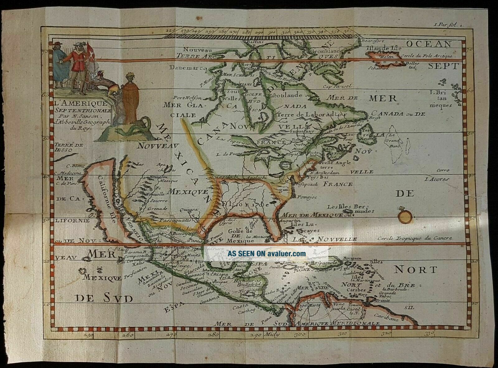
L'Amérique Septentrionale par N. Sanson...
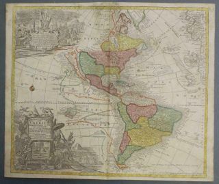
Nicolas Sanson (20 December 1600 – 7 July 1667) was a French cartographer, termed by some the creator of French geography, in which he's been called the "father of French cartography"
Rare and important Sanson's map of North America, published in Paris, ca. 1700
...-standard;">Size: 25X18 cm ( 9.8 inches X 7 inches)
Two old repaired tears, otherwise good condition.
Original copper engraved antique map - not a reproduction
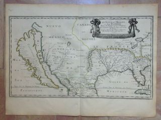


    Similar items


  • 1700s Map Of California As Island Mappe - Monde

    1700s Map Of California As Island Mappe - Monde

  • North America California As An Island By John Senex C1740 Antique Map

    North America California As An Island By John Senex C1740 Antique Map

  • California As Island United States 1700 De Fer Unusual First Edition Antique Map

    California As Island United States 1700 De Fer Unusual First Edition Antique Map

  • America California As An Island 1656 Nicolas Sanson Very Rare Large Antique Map

    America California As An Island 1656 Nicolas Sanson Very Rare Large Antique Map

  • Circa 1690 A Map Of All The Earth J Moxon,  King Charlesii & California As Island

    Circa 1690 A Map Of All The Earth J Moxon, King Charlesii & California As Island

  • Rare Circa 1700 A Map Of North America According To The Newest Observation

    Rare Circa 1700 A Map Of North America According To The Newest Observation

  • American Continent California As Island 1790 Seutter/probst Unusual Antique Map

    American Continent California As Island 1790 Seutter/probst Unusual Antique Map

  • 1697 Philip Cluver Map America California As An Island Coloring

    1697 Philip Cluver Map America California As An Island Coloring


    • You might also like


    • 1860 Mitchell Hand Colored Map Colorado,  Nebraska & Kansas - Civil War Era

      1860 Mitchell Hand Colored Map Colorado, Nebraska & Kansas - Civil War Era

    • 18th Century French Map Of North America

      18th Century French Map Of North America

    • Las Vegas Nevada Vintage 1967 Us Geological Survey Quadrangle Map 4 Panels

      Las Vegas Nevada Vintage 1967 Us Geological Survey Quadrangle Map 4 Panels

    • Rare Antique 1845 Maps United States Exploring Expedition Book Antartica Hawaii

      Rare Antique 1845 Maps United States Exploring Expedition Book Antartica Hawaii

    • Vintage 1926 Map Hollywood From The Best Surveys Of The Time

      Vintage 1926 Map Hollywood From The Best Surveys Of The Time

    • American Continent (western Hemisphere) 1747 Bowen Antique Copper Engraved Map

      American Continent (western Hemisphere) 1747 Bowen Antique Copper Engraved Map

    • Gulf Coast Florida Texas United States 1705 De Fer Unusual Antique Engraved Map

      Gulf Coast Florida Texas United States 1705 De Fer Unusual Antique Engraved Map

Avaluer          About Us          Privacy Policy          Contact Us          UP
© 2022, avaluer.net, Inc. or its affiliates