-
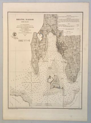
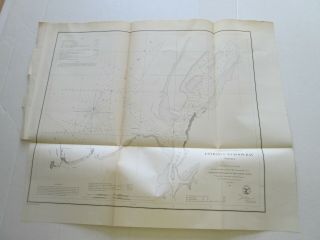
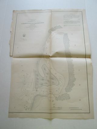
1864 Us Coast Survey Chart Map Bristol Harbor Rhode Island Ad Bache 20 X 14 1/2
-
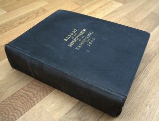
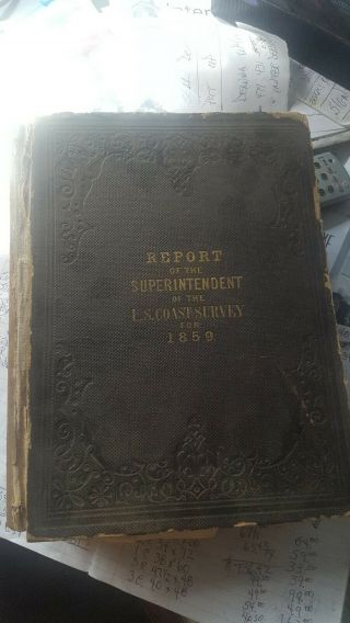
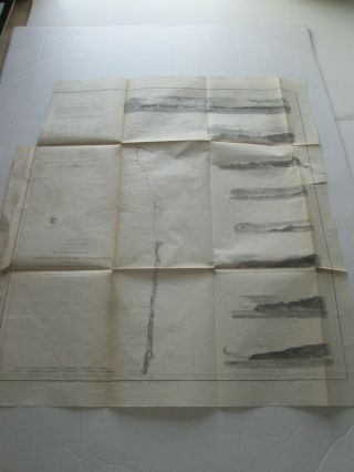
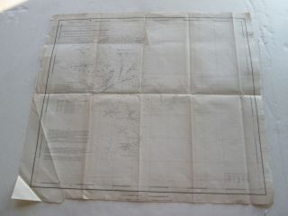
1856 Us Gift From Bache Rare Report Coast Survey Book With 60 Maps Sketches
-
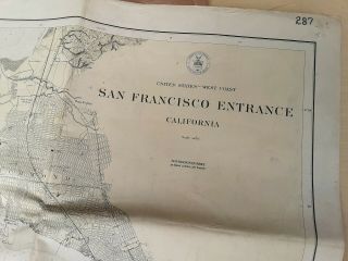
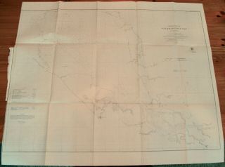
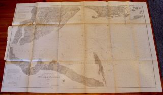
San Francisco Bay Entrance Map 1928 Chart By U S Coast Geodetic Survey
-
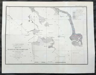
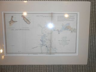
1855 Us Coast Survey & Bache Antique Map Golden Gate Entrance To San Francisco
-
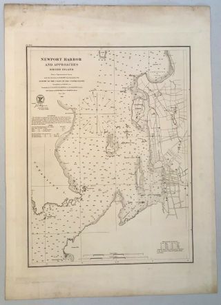
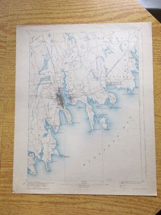
1864 Us Coast Survey Chart Map Newport Harbor Rhode Island Ad Bache 22 X 16
-
![1859 Us Coast Survey Book Ad Bache With 40 Maps Hempstead Portland]()
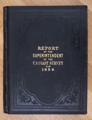
1859 Us Coast Survey Book Ad Bache With 40 Maps Hempstead Portland
-
![Rare 1856 & 1859 Us Coast Survey Books With 100, Charts, Maps & Sketches - Rare]()
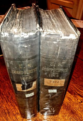
Rare 1856 & 1859 Us Coast Survey Books With 100, Charts, Maps & Sketches - Rare
-
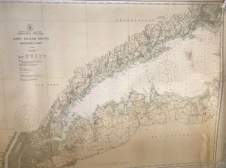
![Maps Charts Survey Of Usa Coast U. S. C. & G. Long Island Sound]()
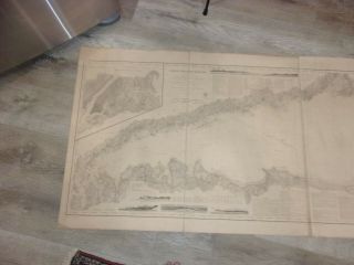
Maps Charts Survey Of Usa Coast U. S. C. & G. Long Island Sound
-
![Preliminary Chart Of Hudson River York Map Us Coast Survey 1861]()
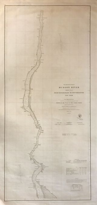
Preliminary Chart Of Hudson River York Map Us Coast Survey 1861
-
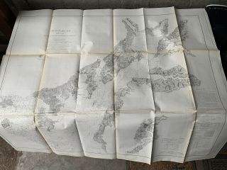
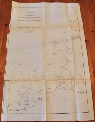
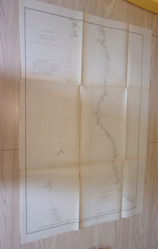
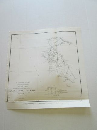
![Atlantic Gulf Of Mexico And Pacific Coasts 1863 Us Coast Survey Map Chart]()
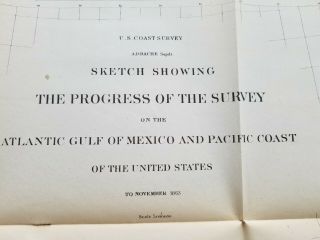
Atlantic Gulf Of Mexico And Pacific Coasts 1863 Us Coast Survey Map Chart
-
![(1) 1856 U. S. Coast Survey Chart: " Port Gamble, Washington Territory "]()
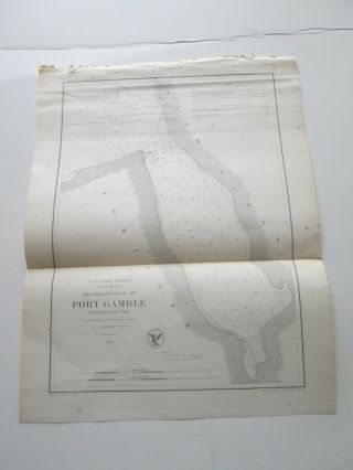
(1) 1856 U. S. Coast Survey Chart: " Port Gamble, Washington Territory "
-
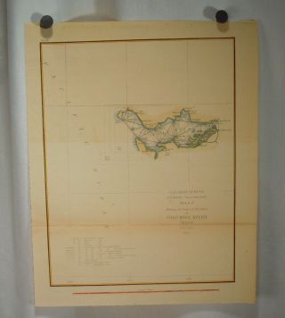
![(1) 1856 U. S. Coast Survey Chart: " San Pablo Bay, California "]()
(1) 1856 U. S. Coast Survey Chart: " San Pablo Bay, California "
-
![U S Coast Survey 1859 - 34 Maps]()
U S Coast Survey 1859 - 34 Maps
-
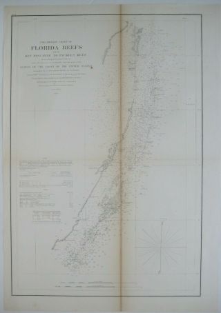
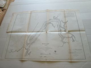
![1861 Coast Survey Map Florida Reefs Key West Miami River Dry Tortugas]()
1861 Coast Survey Map Florida Reefs Key West Miami River Dry Tortugas
-
![Washington Sound And Approaches Washington Territory 1863 Us Coast Survey Map]()
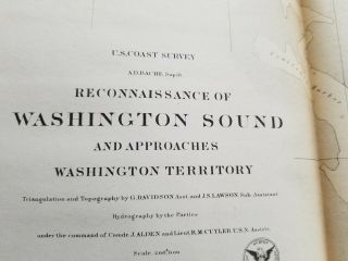
Washington Sound And Approaches Washington Territory 1863 Us Coast Survey Map
-
![U. S Coast Survey 1856 Nantucket To Maine]()
U. S Coast Survey 1856 Nantucket To Maine
-
![1866 Map Cape Cod - Belle Isle Us Coast Survey Chart Coastal Nautical Art Poster]()
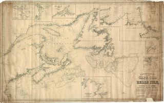
1866 Map Cape Cod - Belle Isle Us Coast Survey Chart Coastal Nautical Art Poster
-
![1855 Us Coast Survey Map Delaware & Chesapeake Bays Inlets Lighthouses]()
1855 Us Coast Survey Map Delaware & Chesapeake Bays Inlets Lighthouses
-
![(1) 1862 U. S. Coast Survey Chart: " Upper Part, San Francisco Bay, California "]()
(1) 1862 U. S. Coast Survey Chart: " Upper Part, San Francisco Bay, California "
-
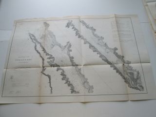
![1855 Us Coast Survey & Bache Antique Map Farallon Isles San Francisco California]()
1855 Us Coast Survey & Bache Antique Map Farallon Isles San Francisco California
-
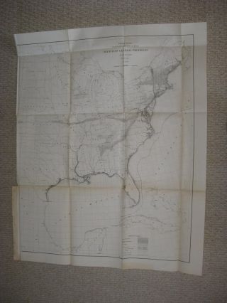
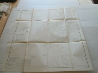
![(1) 1864 U. S. Coast Survey Chart: " Progress Of The Survey, All Of U. S. A. "]()
(1) 1864 U. S. Coast Survey Chart: " Progress Of The Survey, All Of U. S. A. "
-
![1862 Coast Survey Map Chart Chesapeake Delaware Bay Art Poster Print Wall Decor]()
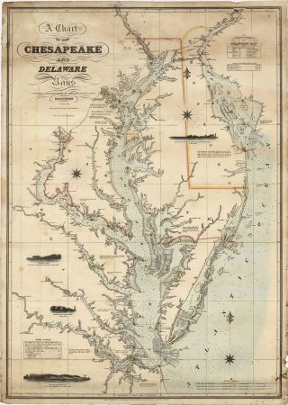
1862 Coast Survey Map Chart Chesapeake Delaware Bay Art Poster Print Wall Decor
-
![U. S. Coast Survey Report - 1857 - 65 Folding Maps & 6 Illus. - 1/2 Leather - Vg]()
U. S. Coast Survey Report - 1857 - 65 Folding Maps & 6 Illus. - 1/2 Leather - Vg
-
![Report Of The Superintendent Of The Coast Survey During 1854 Hc 1855 W/maps]()
Report Of The Superintendent Of The Coast Survey During 1854 Hc 1855 W/maps
-
![1857 U. S. Coast Survey Map Of Eastern Long Island (hamptons, Amagansett)]()
1857 U. S. Coast Survey Map Of Eastern Long Island (hamptons, Amagansett)
-
![House Documents Vol. 63, Coast & Geodetic Survey Report 1921 - 1922 Maps]()
House Documents Vol. 63, Coast & Geodetic Survey Report 1921 - 1922 Maps
-
![1919 Long Island Sound East Coast U. S. Geodetic Survey Chart Conn - N. Y.]()
1919 Long Island Sound East Coast U. S. Geodetic Survey Chart Conn - N. Y.
-
![1856 Coast Survey Map Florida Reefs Key Biscayne Lighthouses Beacons]()
1856 Coast Survey Map Florida Reefs Key Biscayne Lighthouses Beacons
-
![Antique 1856 U. S. Coast Survey California San Clemente Island Bache Ackerman Map]()
Antique 1856 U. S. Coast Survey California San Clemente Island Bache Ackerman Map
-
![1867 Report Of The Superintendent Of The United States Coast Survey During 1865]()
1867 Report Of The Superintendent Of The United States Coast Survey During 1865
-
![Antique 1851 U. S. Coast Survey California Monterey To Columbia River Map Bache]()
Antique 1851 U. S. Coast Survey California Monterey To Columbia River Map Bache
-
![1857 Large Map Of Chesapeake Bay, Survey Of The Coast Of United States,]()
1857 Large Map Of Chesapeake Bay, Survey Of The Coast Of United States,
-
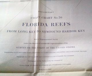
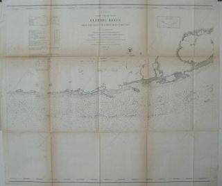
![1863 Us Coast Survey Florida Reefs - Long Key To Newfound Harbor Key Map Chart]()
1863 Us Coast Survey Florida Reefs - Long Key To Newfound Harbor Key Map Chart
-
![1863 Us Coast Survey Map Florida Reefs Key Largo Long Island Matecumbe]()
1863 Us Coast Survey Map Florida Reefs Key Largo Long Island Matecumbe
-
![1862 Us Coast Survey Map Of Upper Of Part San Francisco Bay, California]()
1862 Us Coast Survey Map Of Upper Of Part San Francisco Bay, California
-
![U. S. Coast Survey - City Of San Francisco And Its Vicinity]()
U. S. Coast Survey - City Of San Francisco And Its Vicinity
-
![1867 Us Coast Survey Map York Entrance Incl Staten Island]()
1867 Us Coast Survey Map York Entrance Incl Staten Island
-
![1868 Us Coast Survey Map Nantucket Arc Long Island Sound]()
1868 Us Coast Survey Map Nantucket Arc Long Island Sound
-
![U. S. Coast Survey San Francisco 1851 Originl Hand Colored]()
U. S. Coast Survey San Francisco 1851 Originl Hand Colored
-
![Antique Map " Us Coast Survey. Progress In York Bay & Hudson River "]()
Antique Map " Us Coast Survey. Progress In York Bay & Hudson River "
-
![Antique Map " U. S. Coast Survey. Chesapeake Bay From North East To Mouth Of Bay "]()
Antique Map " U. S. Coast Survey. Chesapeake Bay From North East To Mouth Of Bay "
-
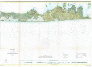
![Maps Charts Survey Of Usa Coast U. S. C. & G. Southern Coast Long Island Western]()
Maps Charts Survey Of Usa Coast U. S. C. & G. Southern Coast Long Island Western
-
![1857 U. S. Coast Survey Map Of Woods Hole, Massachusetts]()
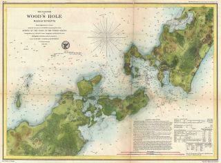
1857 U. S. Coast Survey Map Of Woods Hole, Massachusetts
-
![1863 Us Coast Survey Chesapeake Bay, Delaware Bay And The Delmarva Peninsula]()
1863 Us Coast Survey Chesapeake Bay, Delaware Bay And The Delmarva Peninsula
-
![Antique Survey Map Florida With Keys / United States Coast Survey 1848 - 1855]()
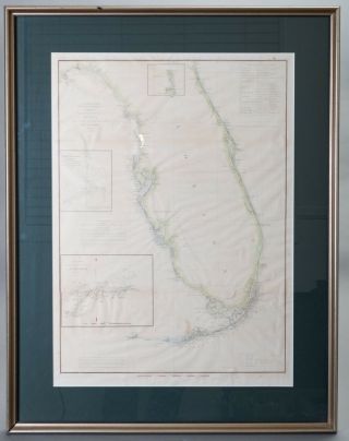
Antique Survey Map Florida With Keys / United States Coast Survey 1848 - 1855
-
![1926 U. S. Coast And Geodetic Survey Map Of Field Work In Hawaii]()
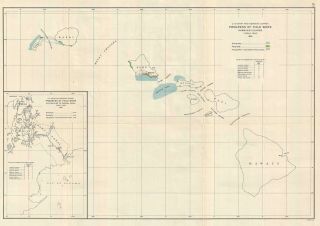
1926 U. S. Coast And Geodetic Survey Map Of Field Work In Hawaii
-
![1855 Us Coast Survey & Bache Antique Map Drakes Bay Puerto Los Reyes, California]()
1855 Us Coast Survey & Bache Antique Map Drakes Bay Puerto Los Reyes, California
-
![1856 Us Coast Survey Large Antique Map, Chart Charleston Harbor, South Carolina]()
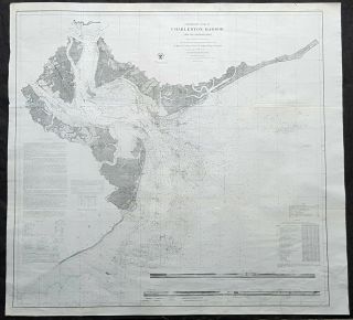
1856 Us Coast Survey Large Antique Map, Chart Charleston Harbor, South Carolina
-
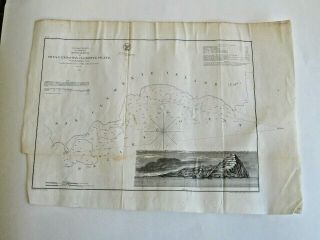
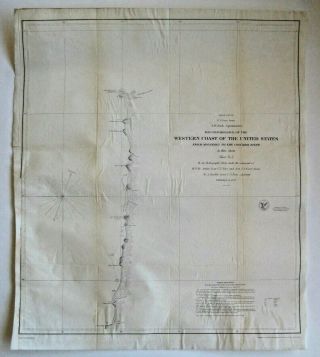
![(1) 1855 U. S. Coast Survey Chart: " Western Coastof The United States "]()
(1) 1855 U. S. Coast Survey Chart: " Western Coastof The United States "
-
![1857 U. S. Coast Survey Map Of The Chesapeake Bay (3 Parts)]()
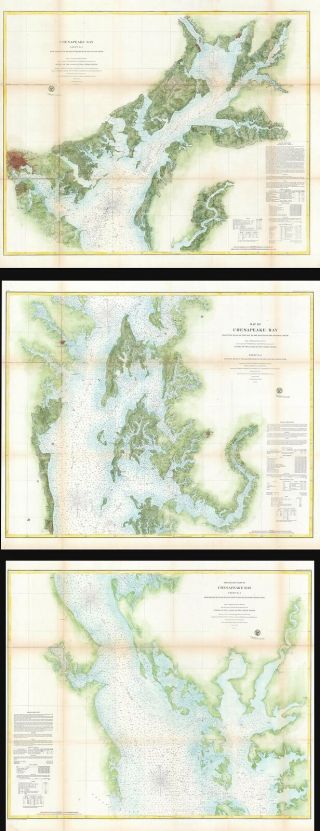
1857 U. S. Coast Survey Map Of The Chesapeake Bay (3 Parts)
-
![Antique 1889 United States Coast Survey Map Texas Florida Maine North Carolina]()
Antique 1889 United States Coast Survey Map Texas Florida Maine North Carolina
-
![(1) 1861 U. S. Coast Survey Chart: " Kennebec River, Entrance To Bath, Maine "]()
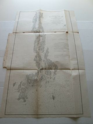
(1) 1861 U. S. Coast Survey Chart: " Kennebec River, Entrance To Bath, Maine "
-
![Antique 1887 Map Oregon Coast Geodetic Survey California To Tillamook Bay]()
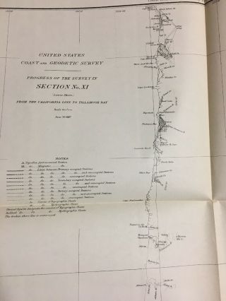
Antique 1887 Map Oregon Coast Geodetic Survey California To Tillamook Bay
-
![1851 U S Coast Survey Nautical Chart " Point Pinos, Bay Of Monterey "]()
1851 U S Coast Survey Nautical Chart " Point Pinos, Bay Of Monterey "
-
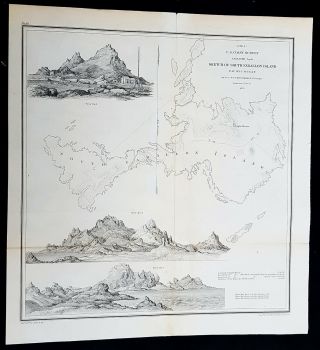
![(1) 1855 U. S. Coast Survey Chart: " South Farallon Island, Pacific Ocean "]()
(1) 1855 U. S. Coast Survey Chart: " South Farallon Island, Pacific Ocean "
-
![(1) 1857 U. S. Coast Survey Chart: " Monteray Bay, California "]()
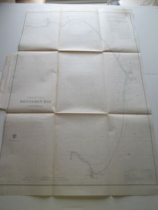
(1) 1857 U. S. Coast Survey Chart: " Monteray Bay, California "
-
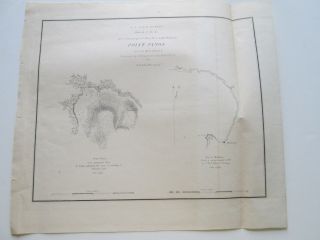
![Preliminary Chart Of Half Moon Bay California 1863 Us Coast Survey Map Chart]()

Preliminary Chart Of Half Moon Bay California 1863 Us Coast Survey Map Chart
-
![1862 U. S. Coast Survey Nautical Chart " Forts Jackson And St. Philip "]()
1862 U. S. Coast Survey Nautical Chart " Forts Jackson And St. Philip "
-
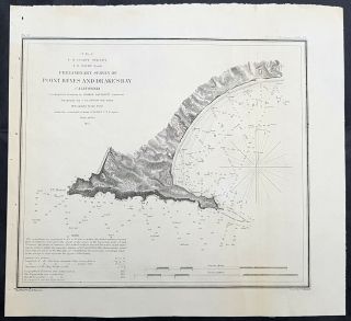
![1855 U. S. Coast Survey Nautical Chart " Point Reyes And Vicinity, California "]()
1855 U. S. Coast Survey Nautical Chart " Point Reyes And Vicinity, California "
-
![(1) 1857 U. S. Coast Survey Chart: " Measurement Of Epping Base, Maine "]()
(1) 1857 U. S. Coast Survey Chart: " Measurement Of Epping Base, Maine "
-
![Old Ordnance Survey Maps North Kent Coast Faversham Whitstable 1878 Sheet 273]()
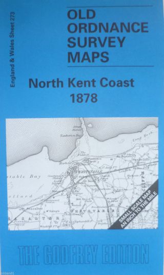
Old Ordnance Survey Maps North Kent Coast Faversham Whitstable 1878 Sheet 273
-
![1853 Columbia River U. S. Coast Survey Map Oregon 53257]()
1853 Columbia River U. S. Coast Survey Map Oregon 53257
-
![Rockland Harbor And Vicinity Maine Map 1863 Us Coast Survey Annual Report Map]()
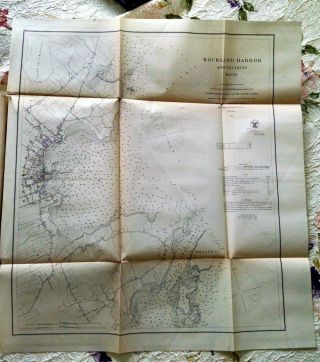
Rockland Harbor And Vicinity Maine Map 1863 Us Coast Survey Annual Report Map
-
![(1) 1853 U. S. Coast Survey Chart: " Sea Coast Of Virginia, Gargathy, Machipongo "]()
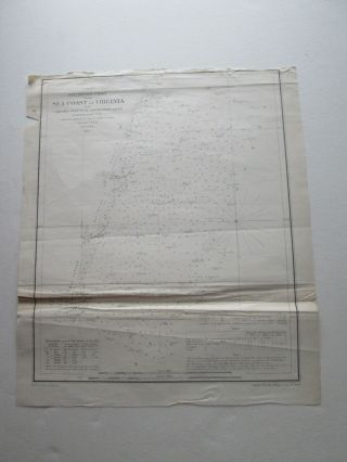
(1) 1853 U. S. Coast Survey Chart: " Sea Coast Of Virginia, Gargathy, Machipongo "
-
![San Pablo Bay California 1863 Us Coast Survey Map Chart]()
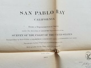
San Pablo Bay California 1863 Us Coast Survey Map Chart
-
![1840 Coast Survey Map Chart Chesapeake Delaware Bay Art Poster Print Wall Decor]()
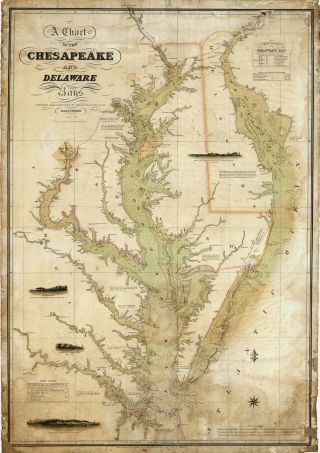
1840 Coast Survey Map Chart Chesapeake Delaware Bay Art Poster Print Wall Decor
-
![1857 Nautical Survey Chart Coast Map Decor St Mary]()
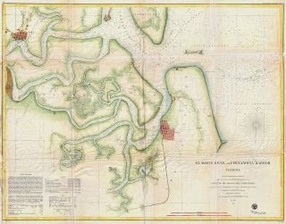
1857 Nautical Survey Chart Coast Map Decor St Mary ' S River Fernandina Harbor Fl
-
![(1) 1856 U. S. Coast Survey Chart: " Stillwater Bay, Washington "]()
(1) 1856 U. S. Coast Survey Chart: " Stillwater Bay, Washington "
-
![1914 Annual Report Us Coast Geodetic Survey Maps Of Hawaii Alaska Philippines Pr]()
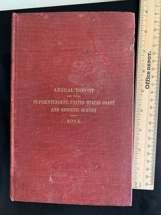
1914 Annual Report Us Coast Geodetic Survey Maps Of Hawaii Alaska Philippines Pr
-
![1863 Us Coast Survey Florida Reef - Elbow To Lower Matecumbe Key Map Chart]()
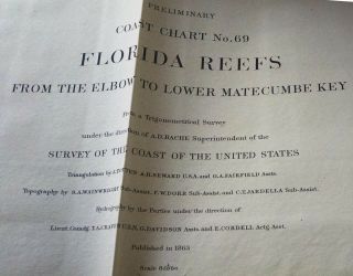
1863 Us Coast Survey Florida Reef - Elbow To Lower Matecumbe Key Map Chart
-
![Antique Map " U. S. Coast Survey Reconnaissance Of Pass Fourchon Louisiana " 1854]()
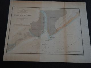
Antique Map " U. S. Coast Survey Reconnaissance Of Pass Fourchon Louisiana " 1854
-
![Antique Map " U. S. Coast Survey Showing Progress Of Deep Sea Soundings "]()
Antique Map " U. S. Coast Survey Showing Progress Of Deep Sea Soundings "
-
![1918 Us Coast Survey Map Alaska Montague Island Cape Cleare Prince William Sound]()
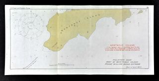
1918 Us Coast Survey Map Alaska Montague Island Cape Cleare Prince William Sound
-
![1849 U. S. Coast Survey Nautical Chart " Davis South Shoal & Dangers "]()
1849 U. S. Coast Survey Nautical Chart " Davis South Shoal & Dangers "
-
![1863 U S Coast Survey Nautical Chart " Preliminary Chart Tomales Bay, California "]()
1863 U S Coast Survey Nautical Chart " Preliminary Chart Tomales Bay, California "
-
![1853 U. S. Coast Survey Nautical Chart " Sow & Pigs Reef, Massachusetts "]()
1853 U. S. Coast Survey Nautical Chart " Sow & Pigs Reef, Massachusetts "
-
![1865 U. S. Coast Survey Instrument For Charts " Theodolite Magnetometer "]()
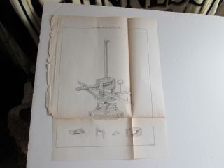
1865 U. S. Coast Survey Instrument For Charts " Theodolite Magnetometer "
-
![1852 U. S. Coast Survey Nautical Chart " Columbia River, Oregon "]()
1852 U. S. Coast Survey Nautical Chart " Columbia River, Oregon "
-
![1851 U. S. Coast Survey Chart Or Map Of Mosquito (ponce De Leon) Inlet, Florida]()
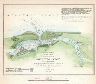
1851 U. S. Coast Survey Chart Or Map Of Mosquito (ponce De Leon) Inlet, Florida
-
![1894: Large Folding Maps U. S. Coast And Geodetic Survey Report]()
1894: Large Folding Maps U. S. Coast And Geodetic Survey Report
-
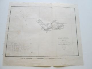
![Government Report 12/23/1844 Us Survey Of The Coast With Sketches Maps Ri Ny Nj]()
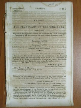
Government Report 12/23/1844 Us Survey Of The Coast With Sketches Maps Ri Ny Nj
-
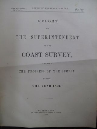
![1854 Us Coast Survey Tidal Currents Of Nantucket Shoals]()
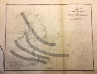
1854 Us Coast Survey Tidal Currents Of Nantucket Shoals
-
![1854 Us Coast Survey Golden Gate And Approaches]()
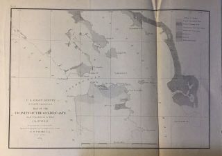
1854 Us Coast Survey Golden Gate And Approaches
-
![1889 U. S. Coast Survey Map Of Savannah, Sapelo Island, And Ossabaw Island]()
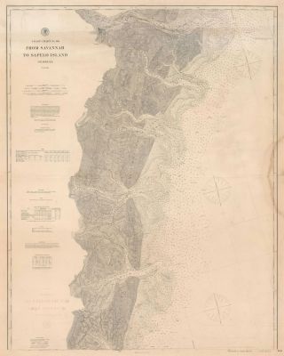
1889 U. S. Coast Survey Map Of Savannah, Sapelo Island, And Ossabaw Island
-
![1883 U. S. Coast Survey Chart Map West Point Military Academy Ny Coastal Wall Art]()
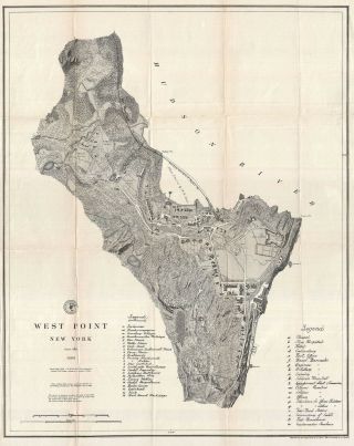
1883 U. S. Coast Survey Chart Map West Point Military Academy Ny Coastal Wall Art
-
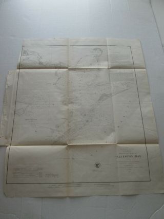
![(1) 1856 U. S. Coast Survey Chart: " Seacoast Of Texas In Vicinity Of Galveston "]()
(1) 1856 U. S. Coast Survey Chart: " Seacoast Of Texas In Vicinity Of Galveston "
-
![(1) 1856 U. S. Coast Survey Chart : " Galveston Entrance, Texas "]()
(1) 1856 U. S. Coast Survey Chart : " Galveston Entrance, Texas "
-
![(1) 1856 U. S. Coast Survey Chart: " St. John]()
(1) 1856 U. S. Coast Survey Chart: " St. John ' S River, Florida " Entrance - Brown ' S
-
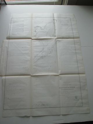
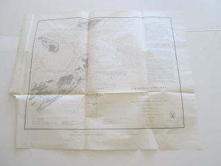
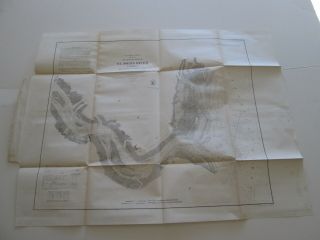
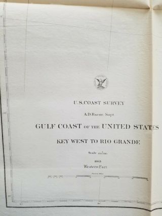
![Us Gulf Coast - Key West To The Rio Grande Western Part 1863 Us Coast Survey Map]()
Us Gulf Coast - Key West To The Rio Grande Western Part 1863 Us Coast Survey Map
-
![1881 Us Coast Survey Map Georgia South Carolina Islands Savannah Charleston Usgs]()
1881 Us Coast Survey Map Georgia South Carolina Islands Savannah Charleston Usgs
-
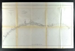
![1851 Map Superintendent Of Us Coast Survey Frying Pan Shoals Cape Fear]()
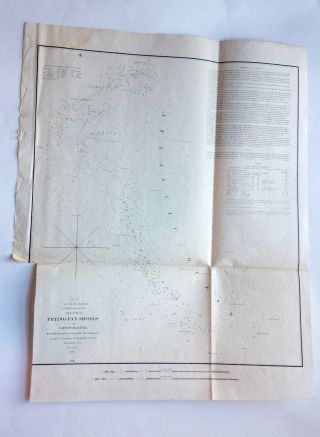
1851 Map Superintendent Of Us Coast Survey Frying Pan Shoals Cape Fear
-
![Coast Survey Map 1862 Nautical Chart Nantucket Cape Hatteras Atlantic]()
Coast Survey Map 1862 Nautical Chart Nantucket Cape Hatteras Atlantic
-
![2 Sheet Map Progress Us Coast And Geodetic Survey California Texas Ohio 1899]()
2 Sheet Map Progress Us Coast And Geodetic Survey California Texas Ohio 1899
-
![(1) 1855 U. S. Coast Survey Chart: " Galveston Bay, Texas "]()
(1) 1855 U. S. Coast Survey Chart: " Galveston Bay, Texas "
-
![1855 U. S. Coast Survey Nautical Chart " Triangulations, Washington Snd "]()
1855 U. S. Coast Survey Nautical Chart " Triangulations, Washington Snd "
-
![1857 Nautical Chart Us Coast Coastal Survey Map Decor Monterey Bay California]()
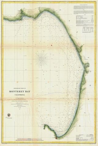
1857 Nautical Chart Us Coast Coastal Survey Map Decor Monterey Bay California
-
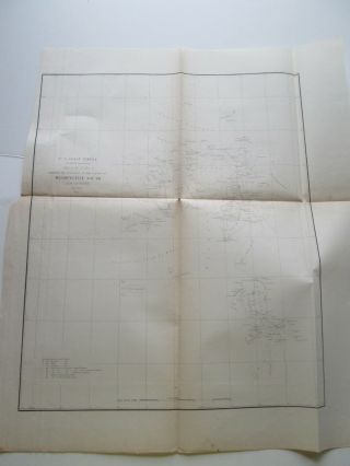
![(1) 1859 U. S. Coast Survey. Chart: " Patuxent River, Maryland "]()
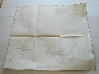
(1) 1859 U. S. Coast Survey. Chart: " Patuxent River, Maryland "
-
![Very Large San Diego Bay. 1887. California. U. S. Coast Survey.]()
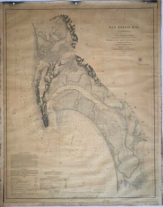
Very Large San Diego Bay. 1887. California. U. S. Coast Survey.
-
![Large Map. China S. Coast. Yang - Pu Wan. Survey 1939. 30 X 42 In]()
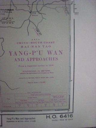
Large Map. China S. Coast. Yang - Pu Wan. Survey 1939. 30 X 42 In
-
![Large Map. China S. Coast. Niu - Ch]()
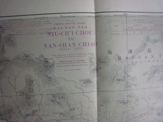
Large Map. China S. Coast. Niu - Ch ' I Chou. Survey 1939. 30 X 42 In
-
![Large Map. China S. Coast. Nan - Shan Chio. Survey 1940. 30 X 42 In]()
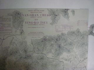
Large Map. China S. Coast. Nan - Shan Chio. Survey 1940. 30 X 42 In
-
![Large Map. China S. Coast. Fu - Jung Ch]()
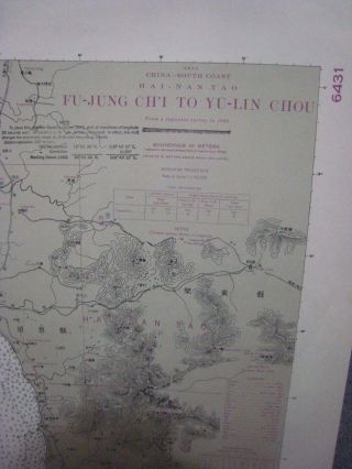
Large Map. China S. Coast. Fu - Jung Ch ' I. Survey 1940. 30 X 42 In
-
![Large Map. China S. Coast. Wan - Shan Ch]()
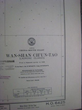
Large Map. China S. Coast. Wan - Shan Ch ' Un - Tao. Survey 1938. 30 X 42 In, Ladrone
-
![(1) 1862/1866 U. S. Coast Survey Chart: " Point Pinos To Bodega Head, California "]()
(1) 1862/1866 U. S. Coast Survey Chart: " Point Pinos To Bodega Head, California "
-
![1853 U. S. Coast Survey Nautical Chart " Entrance To Pascagoula River ",]()
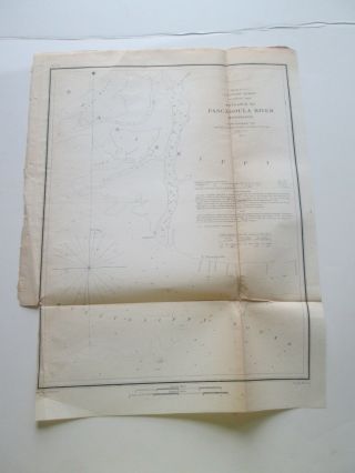
1853 U. S. Coast Survey Nautical Chart " Entrance To Pascagoula River ",
-
![1877 U. S. Coast Progress Survey Map From The California Tamoulas Bay To Oregon]()
1877 U. S. Coast Progress Survey Map From The California Tamoulas Bay To Oregon
-
![(1) 1862 U. S. Coast Survey. Chart: " Washington Sound, Washington Terr " As Seen]()
(1) 1862 U. S. Coast Survey. Chart: " Washington Sound, Washington Terr " As Seen
-
![(1) 1865 U. S. Coast Survey. Chart: " Koos Bay, Oregon ", Third One]()
(1) 1865 U. S. Coast Survey. Chart: " Koos Bay, Oregon ", Third One
-
![(1) 1850 - 52 U. S. Coast Survey Chart: Triangulation, San Francisco Bay, Second]()
(1) 1850 - 52 U. S. Coast Survey Chart: Triangulation, San Francisco Bay, Second
-
![(1) 1861 U. S. Coast Survey Chart: " Entrance To Koos Bay, Oregon " As Seen]()
(1) 1861 U. S. Coast Survey Chart: " Entrance To Koos Bay, Oregon " As Seen
-
![(1) 1862 U. S. Coast Survey. Chart: " Washington Sound, Washington Terr " 2]()
(1) 1862 U. S. Coast Survey. Chart: " Washington Sound, Washington Terr " 2
-
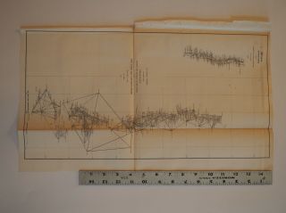
![(1) 1850 - 52 U. S. Coast Survey Chart: Triangulation, San Francisco Bay & Vincin]()

(1) 1850 - 52 U. S. Coast Survey Chart: Triangulation, San Francisco Bay & Vincin
-
![(1) 1854 U. S. Coast Survey Chart: " Winyah Bay & Cape Roman Shoals, S Carolina "]()
(1) 1854 U. S. Coast Survey Chart: " Winyah Bay & Cape Roman Shoals, S Carolina "
-
![(1) 1862 U. S. Coast Survey Chart: " Diurnal & Semi - Diurnal Tide Lines " Florida]()
(1) 1862 U. S. Coast Survey Chart: " Diurnal & Semi - Diurnal Tide Lines " Florida
-
![1930 U. S. Geological Survey Map Ma Coast Guard Buzzards Bay Bedford 20”x15”]()
1930 U. S. Geological Survey Map Ma Coast Guard Buzzards Bay Bedford 20”x15”
-
![(1) 1861 U. S. Coast Survey Chart: " Entrance. & Part Of Coquille River, Oregon "]()
(1) 1861 U. S. Coast Survey Chart: " Entrance. & Part Of Coquille River, Oregon "
-
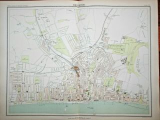
![Victorian Colour Map Of Brighton (c1896) Ordnance Survey - East Sussex, S Coast]()
Victorian Colour Map Of Brighton (c1896) Ordnance Survey - East Sussex, S Coast
-
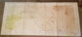
![Phoenix Aeronautical Flight Map (1946) U. S. Coast Guard & Geodetic Survey 48x23]()
Phoenix Aeronautical Flight Map (1946) U. S. Coast Guard & Geodetic Survey 48x23
-
![(1) 1851 United States Coast Survey Chart: " York Harbor Range Beacons "]()
(1) 1851 United States Coast Survey Chart: " York Harbor Range Beacons "
-
![Antique Map " U. S. Coast And Geodetic Survey Alaska And Adjoining Territory "]()
Antique Map " U. S. Coast And Geodetic Survey Alaska And Adjoining Territory "
© 2022, avaluer.net, Inc. or its affiliates