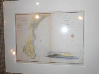
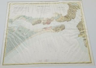
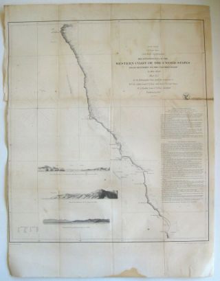
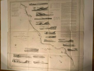
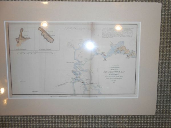
U. S. Coast Survey SAN FRANCISCO 1851 Originl Hand Colored


Item History & Price

Information:
Reference Number: Avaluer:59226416Year: 1851
City: San FranciscoUS State: California
Original Description:
U. S. Coast SurveySAN FRANCISCO BAY 1851 Hand colored ready to frame. Archivally mounted on acid free foam core and matted with acid free board and shrink wrapped for protection. 17.5 X 12 matted size


    Similar items


  • U.  S.  Coast Survey San Pedro Harbor California 1852 Originl Hand Colored

    U. S. Coast Survey San Pedro Harbor California 1852 Originl Hand Colored

  • (1) 1862 U.  S.  Coast Survey Chart: " Upper Part,  San Francisco Bay,  California "

    (1) 1862 U. S. Coast Survey Chart: " Upper Part, San Francisco Bay, California "

  • (1) 1850 - 52 U.  S.  Coast Survey Chart: Triangulation,  San Francisco Bay,  Second

    (1) 1850 - 52 U. S. Coast Survey Chart: Triangulation, San Francisco Bay, Second

  • (1) 1850 - 52 U.  S.  Coast Survey Chart: Triangulation,  San Francisco Bay & Vincin

    (1) 1850 - 52 U. S. Coast Survey Chart: Triangulation, San Francisco Bay & Vincin

  • 1857 U.  S.  Coast Survey Map Of Mare Island Strait,  San Francisco Bay,  California

    1857 U. S. Coast Survey Map Of Mare Island Strait, San Francisco Bay, California

  • Antique 1851 U.  S.  Coast Survey California Monterey Santa Cruz San Francisco Map

    Antique 1851 U. S. Coast Survey California Monterey Santa Cruz San Francisco Map

  • U.  S.  Coast Survey - Western Coast Of The United States,  San Francisco To San Diego

    U. S. Coast Survey - Western Coast Of The United States, San Francisco To San Diego

  • U.  S.  Coast Survey - City Of San Francisco And Its Vicinity

    U. S. Coast Survey - City Of San Francisco And Its Vicinity


    • You might also like


    • 1860 Mitchell Hand Colored Map Colorado,  Nebraska & Kansas - Civil War Era

      1860 Mitchell Hand Colored Map Colorado, Nebraska & Kansas - Civil War Era

    • 18th Century French Map Of North America

      18th Century French Map Of North America

    • Las Vegas Nevada Vintage 1967 Us Geological Survey Quadrangle Map 4 Panels

      Las Vegas Nevada Vintage 1967 Us Geological Survey Quadrangle Map 4 Panels

    • Rare Antique 1845 Maps United States Exploring Expedition Book Antartica Hawaii

      Rare Antique 1845 Maps United States Exploring Expedition Book Antartica Hawaii

    • Vintage 1926 Map Hollywood From The Best Surveys Of The Time

      Vintage 1926 Map Hollywood From The Best Surveys Of The Time

    • American Continent (western Hemisphere) 1747 Bowen Antique Copper Engraved Map

      American Continent (western Hemisphere) 1747 Bowen Antique Copper Engraved Map

    • Gulf Coast Florida Texas United States 1705 De Fer Unusual Antique Engraved Map

      Gulf Coast Florida Texas United States 1705 De Fer Unusual Antique Engraved Map

    • California As Island United States 1700 De Fer Unusual First Edition Antique Map

      California As Island United States 1700 De Fer Unusual First Edition Antique Map

Avaluer          About Us          Privacy Policy          Contact Us          UP
© 2022, avaluer.net, Inc. or its affiliates