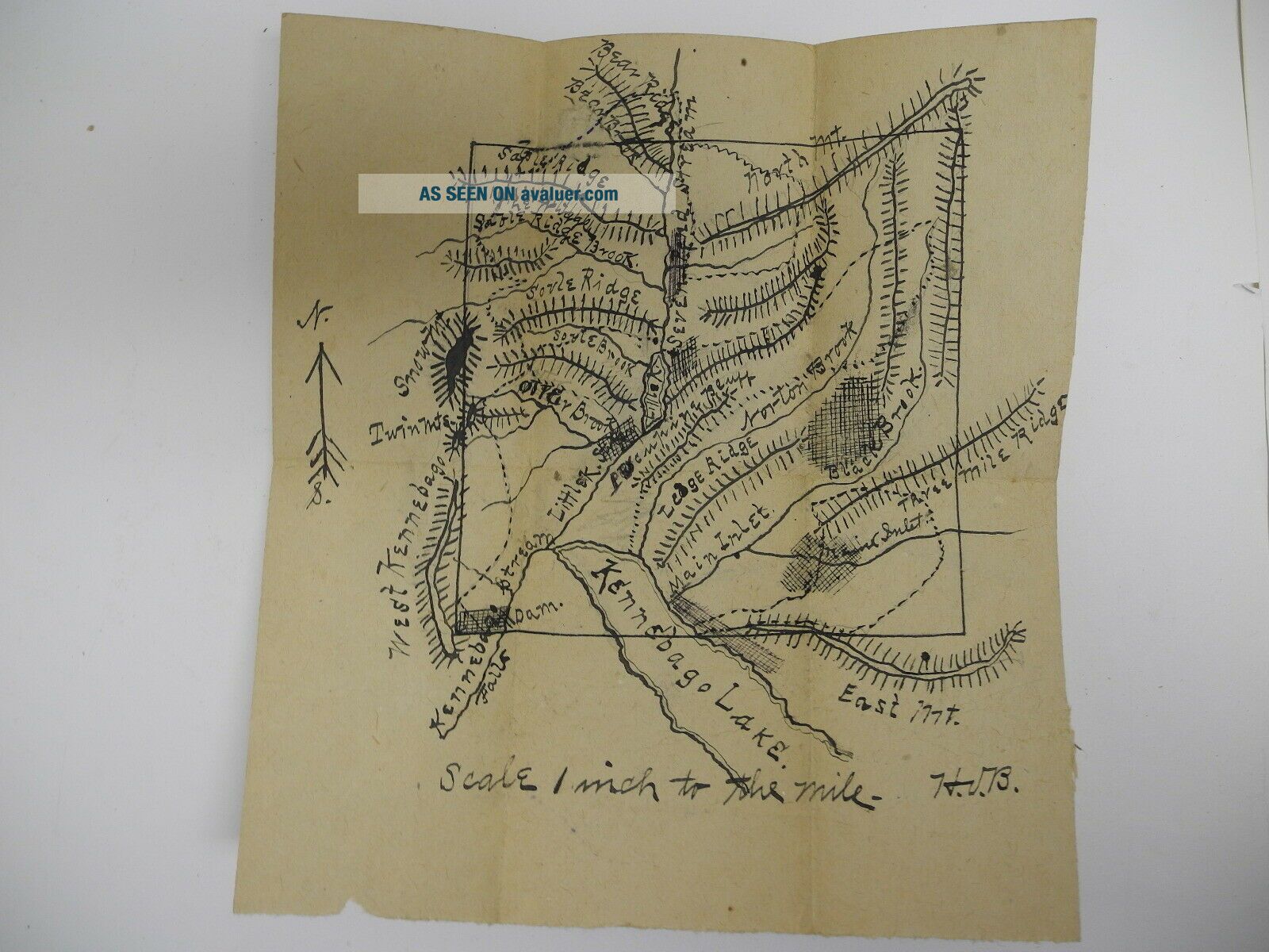
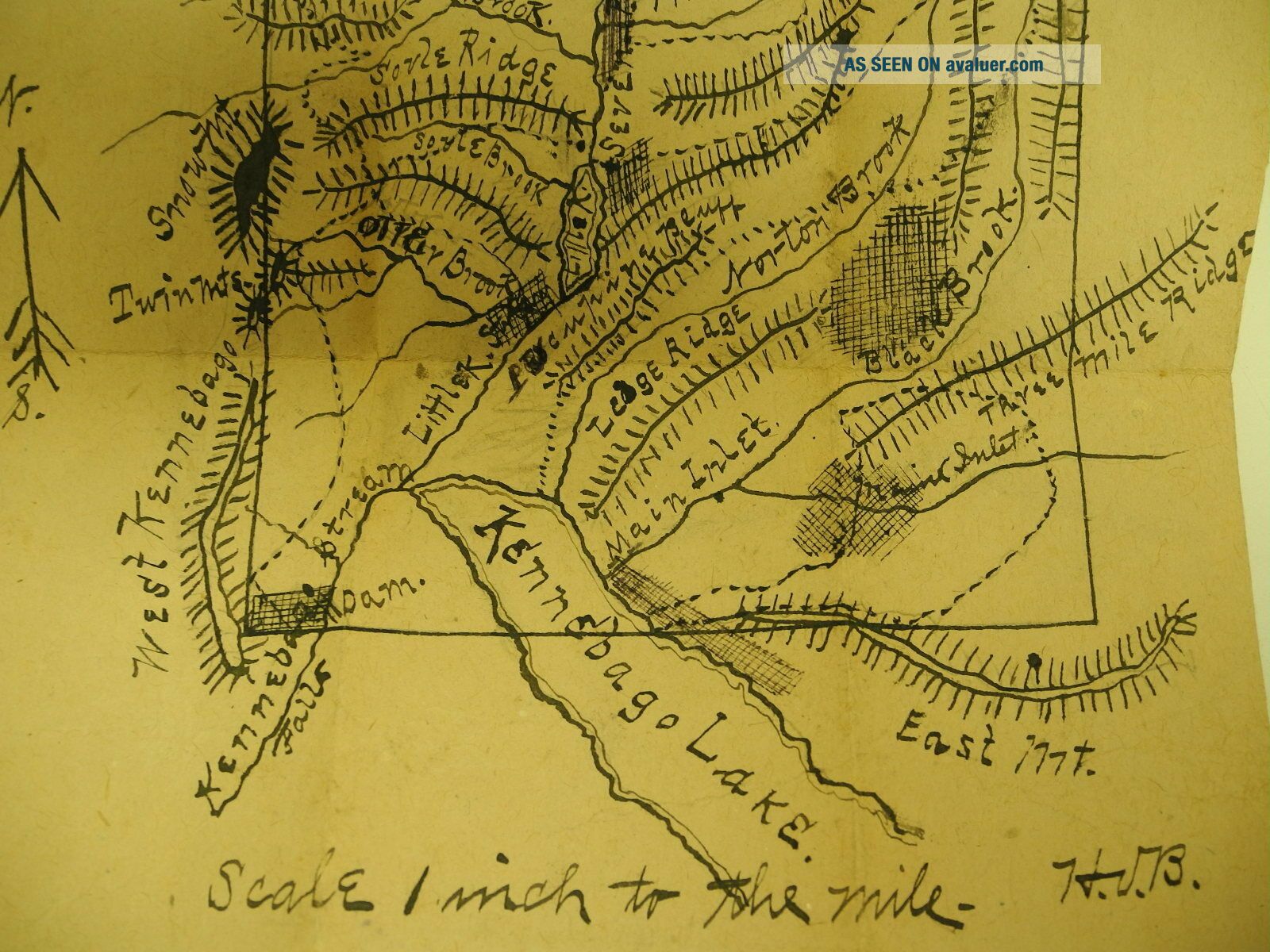
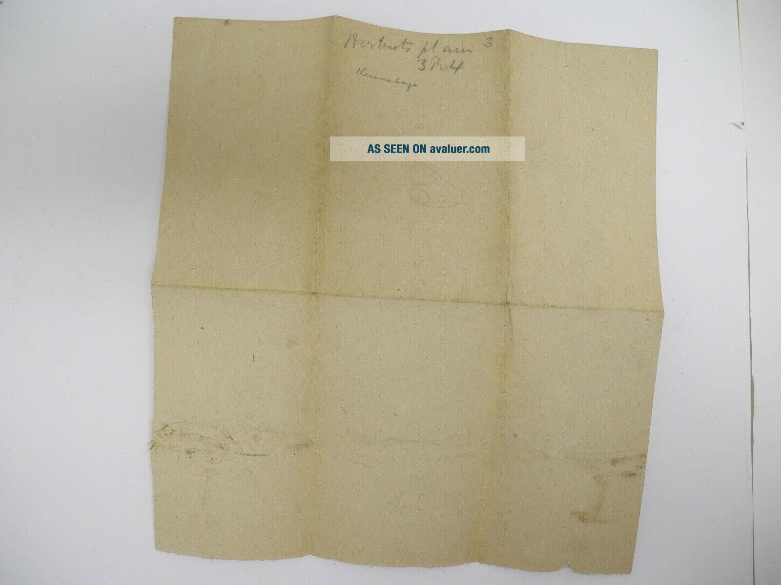
Antique 1800 ' S Hand - Drawn Topographic Map Kennebago Lake, North Franklin, Maine


Item History & Price

Information:
Reference Number: Avaluer:58934668US State: Maine
Type: Topographical MapDate Range: 1800-1899
Country/Region: United States of AmericaCity: North Franklin
Format: Sheet MapOriginal/Reproduction: Antique Original


    Similar items


  • Victorian Antique 1800s Lace Hand Drawn ? Silk Cloth Center? Valentine Card 245

    Victorian Antique 1800s Lace Hand Drawn ? Silk Cloth Center? Valentine Card 245

  • Large Antique 1800

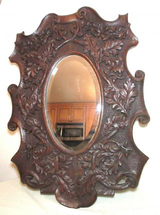
    Large Antique 1800 ' S Hand Carved German Black Forrest Wood Ornate Wall Mirror

  • Antique 1800

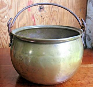
    Antique 1800 ' S Hand Forged Brass Kettle Blacksmith Dovetailed Seams Iron Handle

  • 13,  " Antique 1800

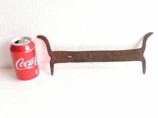
    13, " Antique 1800 ' S Hand Forged Massive Wrought Iron Primitive Boot Scraper

  • 15.  50 " Antique 1800

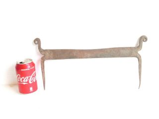
    15. 50 " Antique 1800 ' S Hand Forged Massive Wrought Iron Primitive Boot Scraper

  • Antique 1800

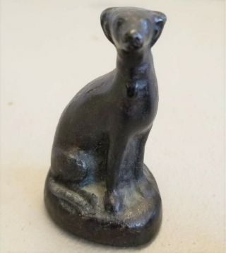
    Antique 1800 ' S Hand Forged Iron Gray Hound Sculpture Hunting Hound Virginia Made

  • Pair Antique 1800

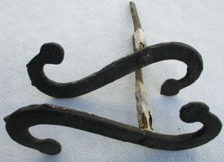
    Pair Antique 1800 ' S Hand Made Forged Shutter Dogs Hardware Scroll Style

  • Antique 1800

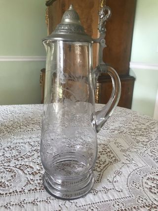
    Antique 1800 ' S Hand Blown And Etched 15” German Tankard


    • You might also like


    • 1860 Mitchell Hand Colored Map Colorado,  Nebraska & Kansas - Civil War Era

      1860 Mitchell Hand Colored Map Colorado, Nebraska & Kansas - Civil War Era

    • 18th Century French Map Of North America

      18th Century French Map Of North America

    • Las Vegas Nevada Vintage 1967 Us Geological Survey Quadrangle Map 4 Panels

      Las Vegas Nevada Vintage 1967 Us Geological Survey Quadrangle Map 4 Panels

    • Rare Antique 1845 Maps United States Exploring Expedition Book Antartica Hawaii

      Rare Antique 1845 Maps United States Exploring Expedition Book Antartica Hawaii

    • Vintage 1926 Map Hollywood From The Best Surveys Of The Time

      Vintage 1926 Map Hollywood From The Best Surveys Of The Time

    • American Continent (western Hemisphere) 1747 Bowen Antique Copper Engraved Map

      American Continent (western Hemisphere) 1747 Bowen Antique Copper Engraved Map

    • Gulf Coast Florida Texas United States 1705 De Fer Unusual Antique Engraved Map

      Gulf Coast Florida Texas United States 1705 De Fer Unusual Antique Engraved Map

    • California As Island United States 1700 De Fer Unusual First Edition Antique Map

      California As Island United States 1700 De Fer Unusual First Edition Antique Map

Avaluer          About Us          Privacy Policy          Contact Us          UP
© 2022, avaluer.net, Inc. or its affiliates