1863 US Coast Survey Map FLORIDA REEFS Key Largo Long Island Matecumbe
Item History & Price
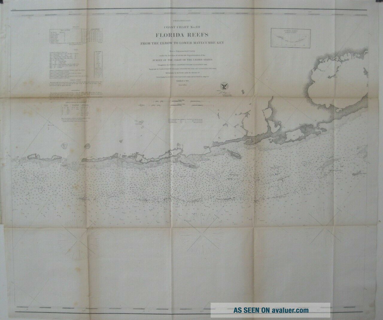
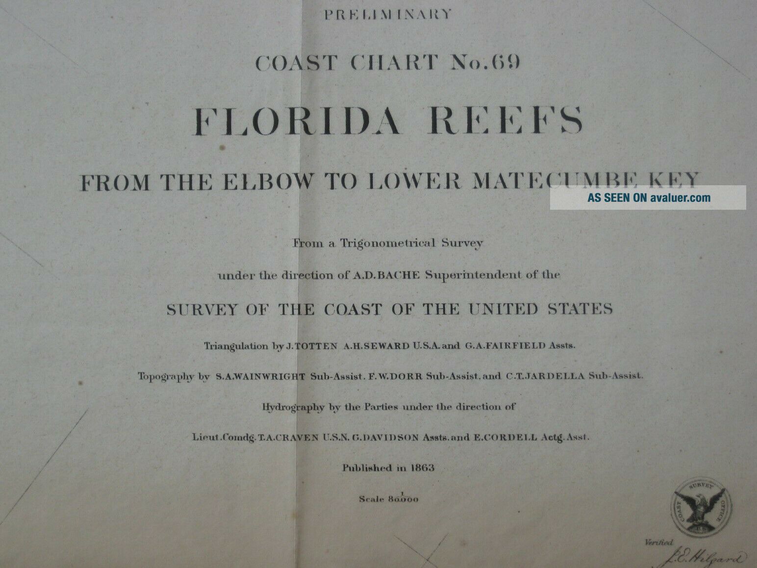
Original large-format fold-out 1863 antique lithographed survey chartof a section of the Florida Keys between the Elbowand Lower Matecumbe, printed more than 155 yearsago. The map is drawn on a scaleof 1:80, 000, and the image area measures agenerous 67 x 76.7 cm [26½" x 30¼"].
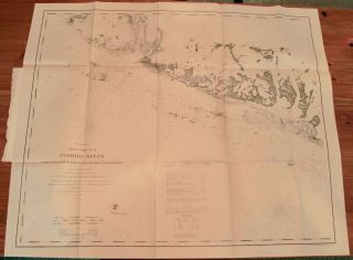
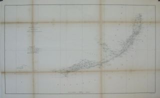
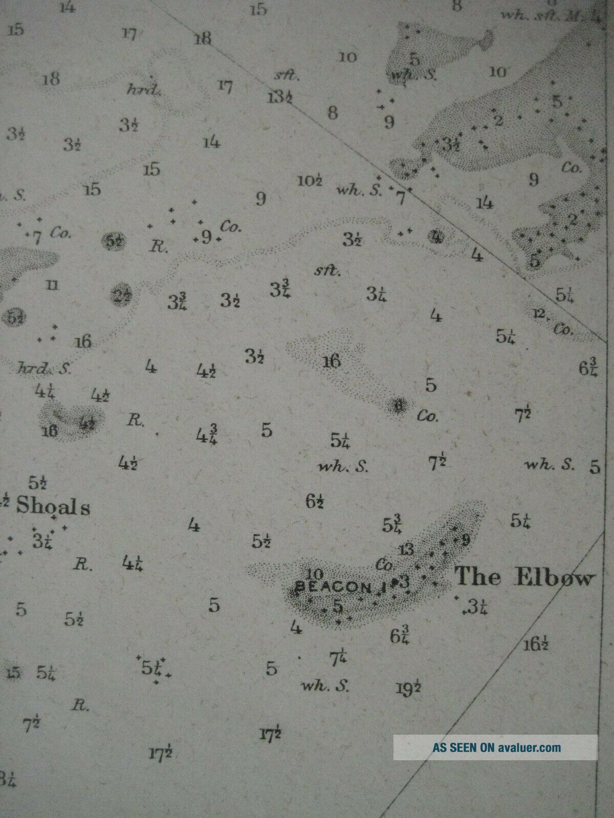
Details include soundings, bottom conditions, tidalinformation, and the location of beacons and other navigationalaids.
Among the specific named places and features are KeyLargo, Pickles Reef, Wi...ndley Key (labeled Windly's Island), Upper Matecumbe, Grecian Shoals, Tavernier (labeled Tavanier), Rodriguez Key, Alligator Reef, Long Island, Tea Table, Crocker's ReefBeacon, and LignumvitaeKey.
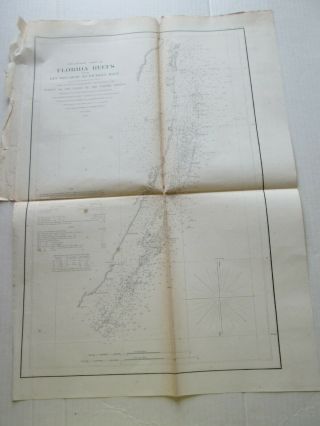
The map is titled Preliminary Coast Chart No.69: Florida Reefs from the Elbow to Lower Matecumbe Key.
Condition: Itis in very good condition, bright and clean, with faint browning on acouple of the folds, a couple of tiny breaks, mended on the verso with archival tape, and nomarks or writing. It is printed on a lightweight paper, typical ofmid-19th century government fold-outs. Please see the scans and feelfree to ask any questions.
This map was published by the United States Coast Surveyin 1863 and is an original, authentic antique map, fullyguaranteed to be genuine. It folds to approximately 8" x 6½".
Buy with confidence! We are always happy to combineshipping on thepurchase of multiple items — just make sure to pay for everythingat one time, not individually.
Powered by SixBit's eCommerce Solution
Details include soundings, bottom conditions, tidalinformation, and the location of beacons and other navigationalaids.
Among the specific named places and features are KeyLargo, Pickles Reef, Wi...ndley Key (labeled Windly's Island), Upper Matecumbe, Grecian Shoals, Tavernier (labeled Tavanier), Rodriguez Key, Alligator Reef, Long Island, Tea Table, Crocker's ReefBeacon, and LignumvitaeKey.
The map is titled Preliminary Coast Chart No.69: Florida Reefs from the Elbow to Lower Matecumbe Key.
Condition: Itis in very good condition, bright and clean, with faint browning on acouple of the folds, a couple of tiny breaks, mended on the verso with archival tape, and nomarks or writing. It is printed on a lightweight paper, typical ofmid-19th century government fold-outs. Please see the scans and feelfree to ask any questions.
This map was published by the United States Coast Surveyin 1863 and is an original, authentic antique map, fullyguaranteed to be genuine. It folds to approximately 8" x 6½".
Buy with confidence! We are always happy to combineshipping on thepurchase of multiple items — just make sure to pay for everythingat one time, not individually.
Powered by SixBit's eCommerce Solution